Category Archives: Photography

Seasons of Ice: Part 1 Spring

As Irish skiers go, I’m pretty average, which is to say, I’m a bad skier. I can survival ski down most things, but the grace and elegance that the residents of my current home display on the slopes still eludes me. The benefits of learning to ski before developing risk awareness is all too apparent.

This was on mind when talking over the phone with Ben Pelto (University of Northern British Columbia). Those of you who have read other posts on this blog will know that Ben and I regularly work together during our summer fieldwork campaigns on the glaciers of BC (see On Conrad Glacier: Part 1 and Part 2). It was January, and we were discussing plans for a spring trip to the mountains, specifically Conrad Glacier, to observe how the winter had treated the glacier, and to scout out locations for the coming summer’s deployment of my weather stations. We were also planning to perform scans of the glacier using a ground penetrating radar (GPR), which would provide us with information on how thick the ice is, and the general shape of the underlying bed. This would all require some serious skiing.

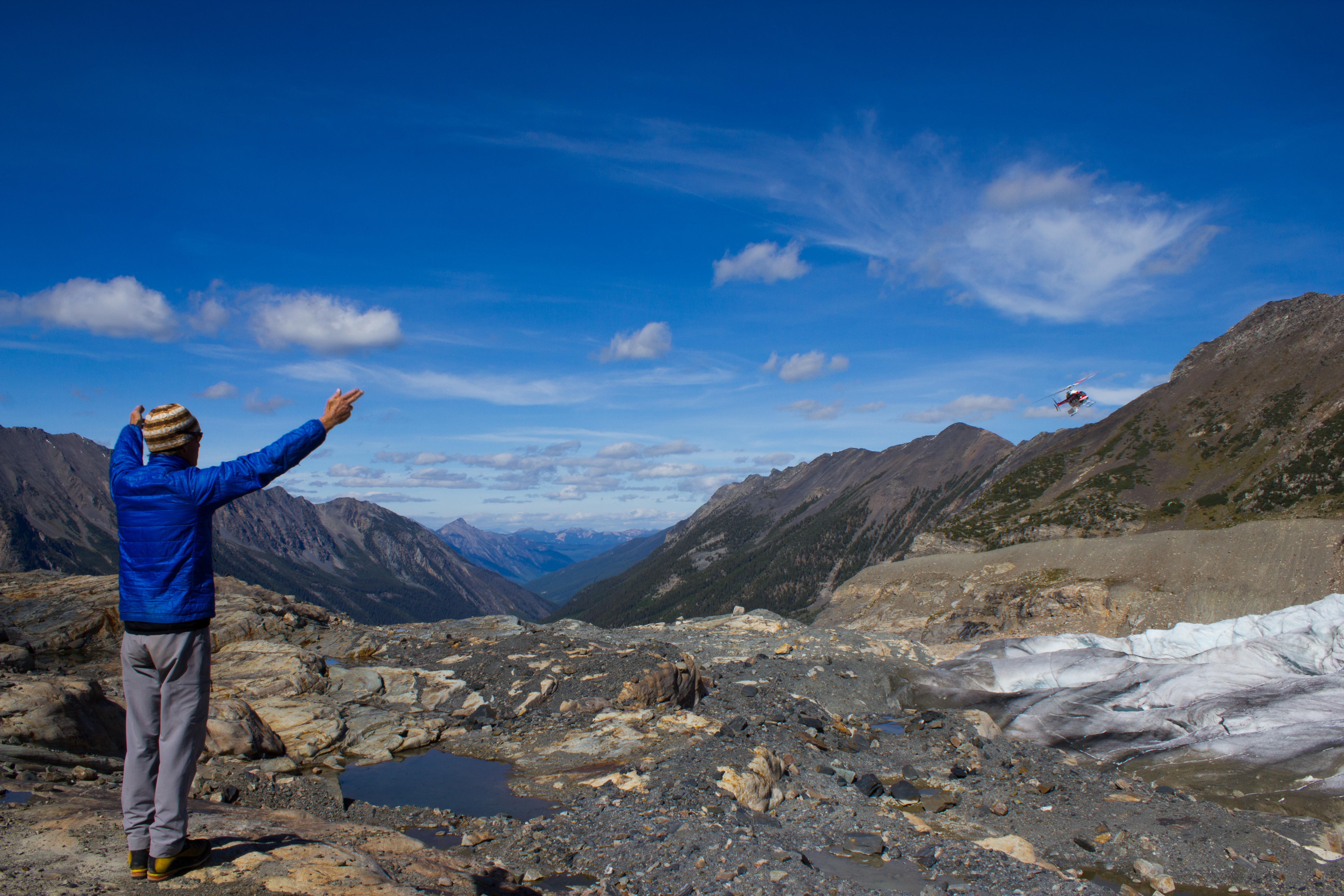
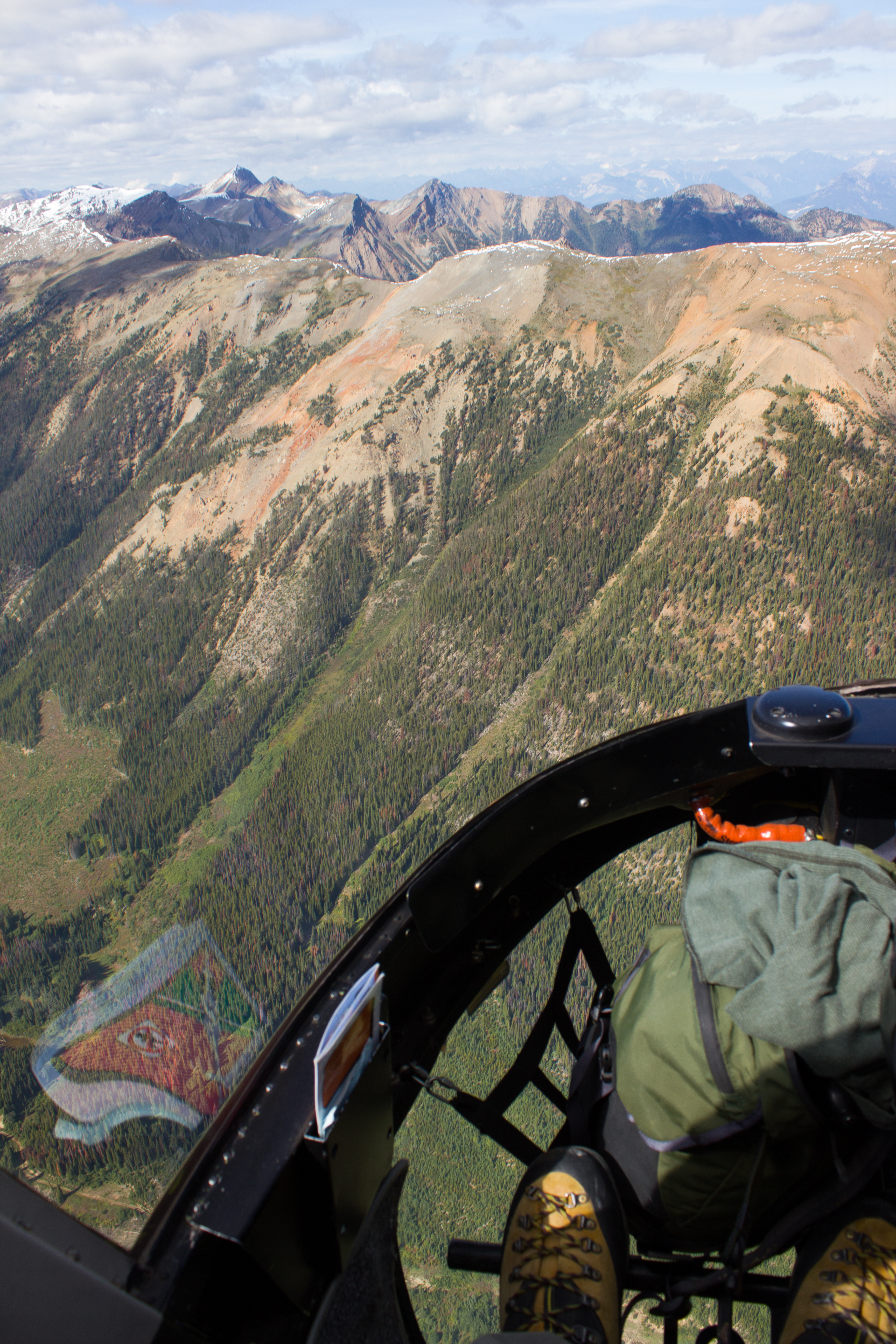
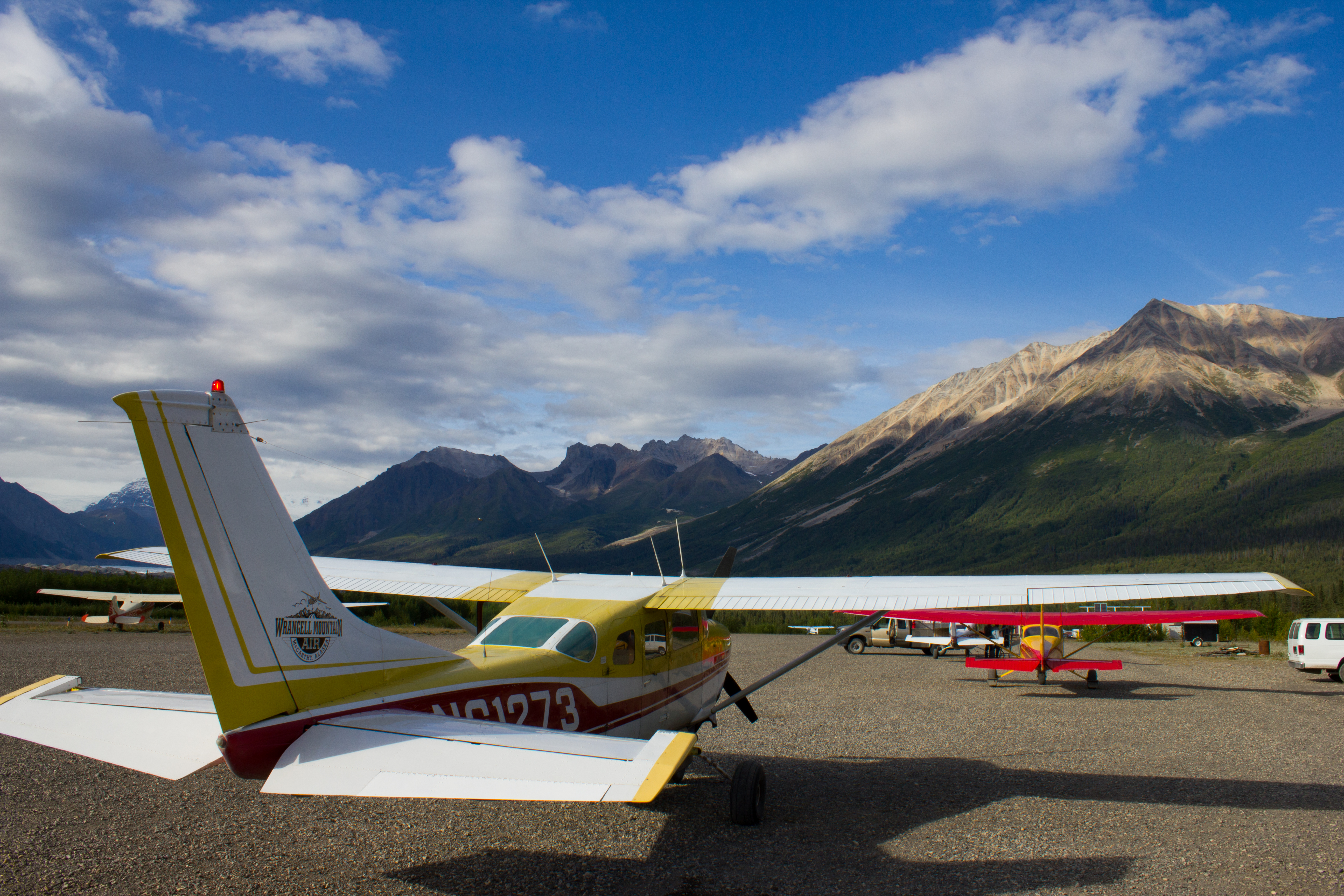
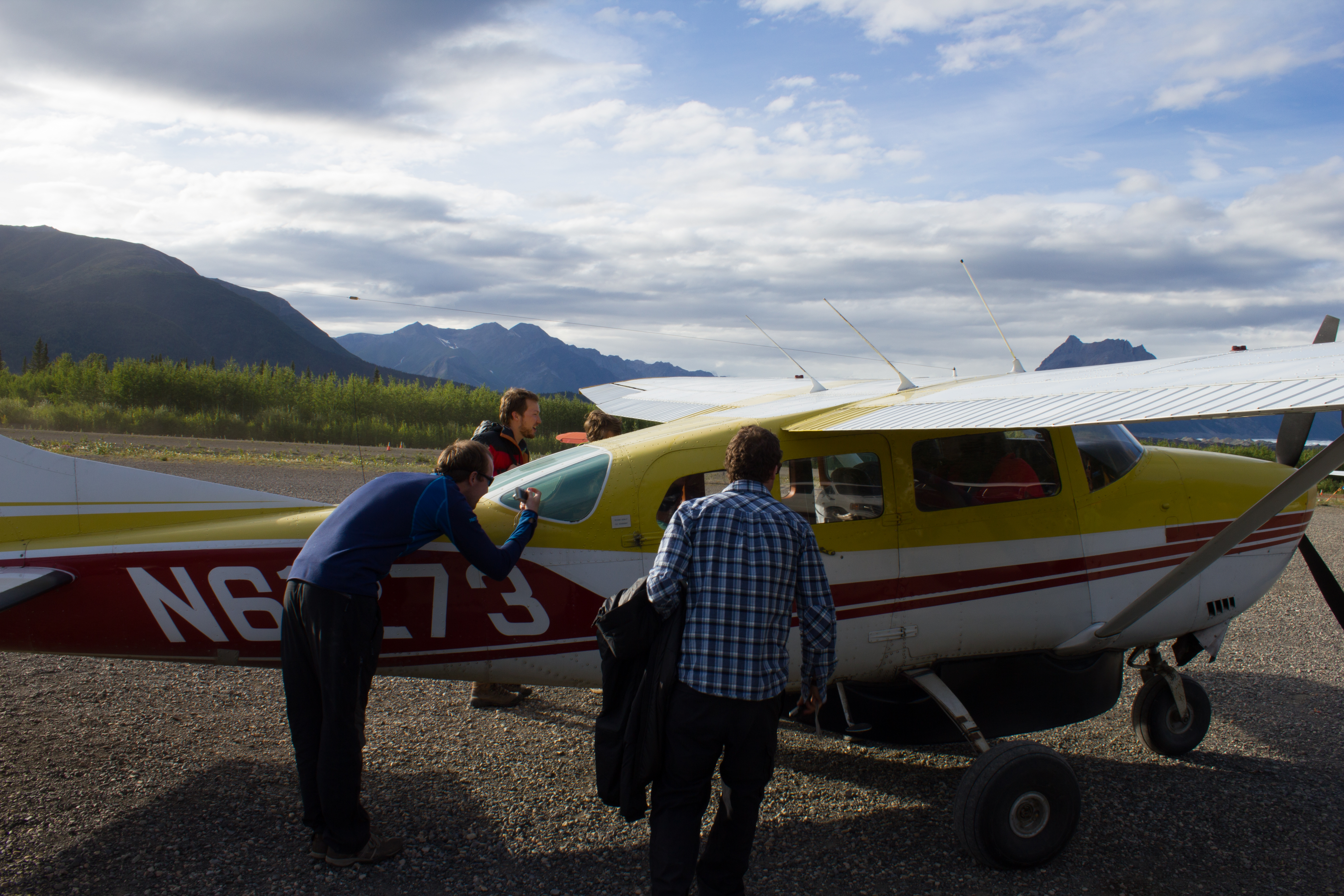
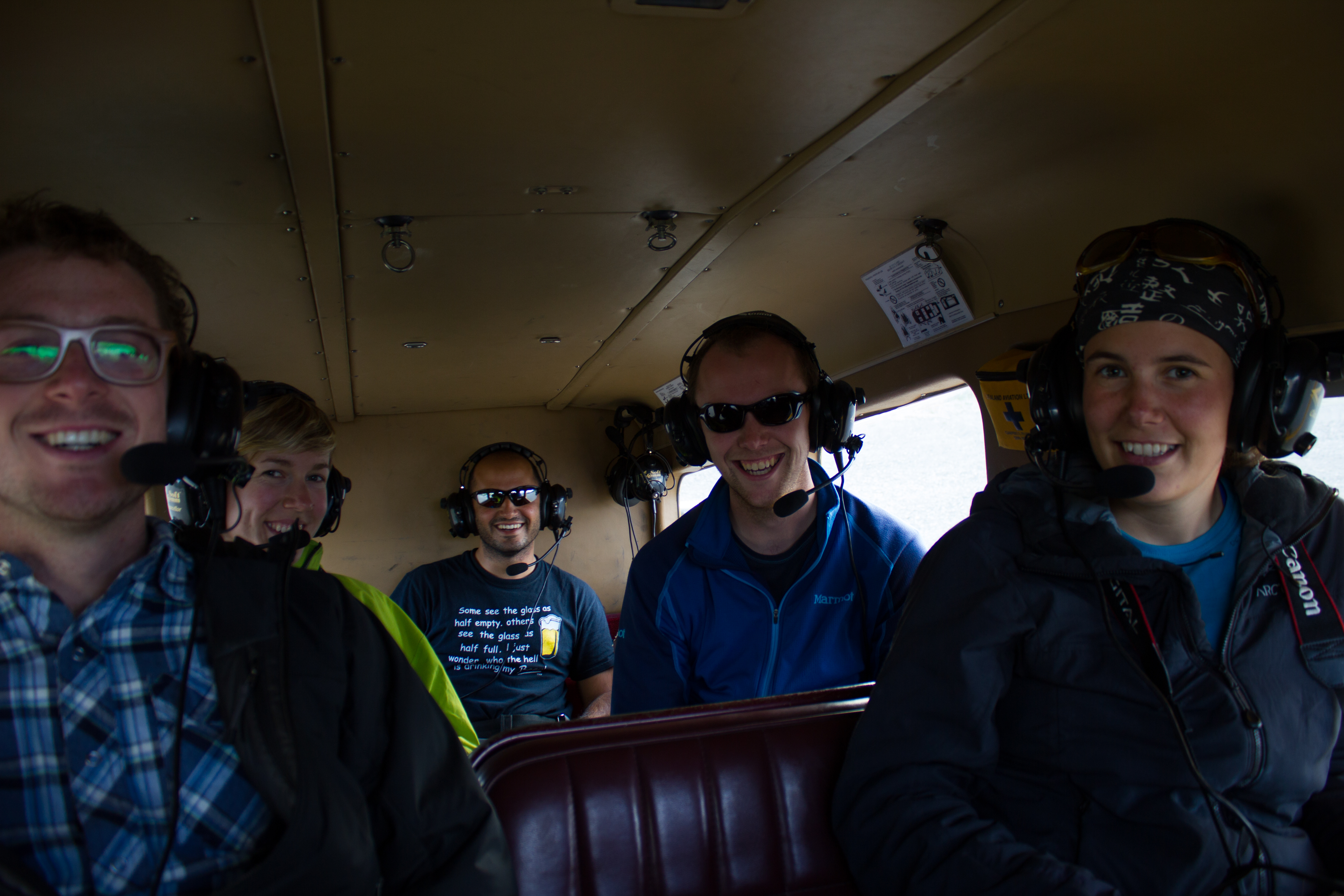
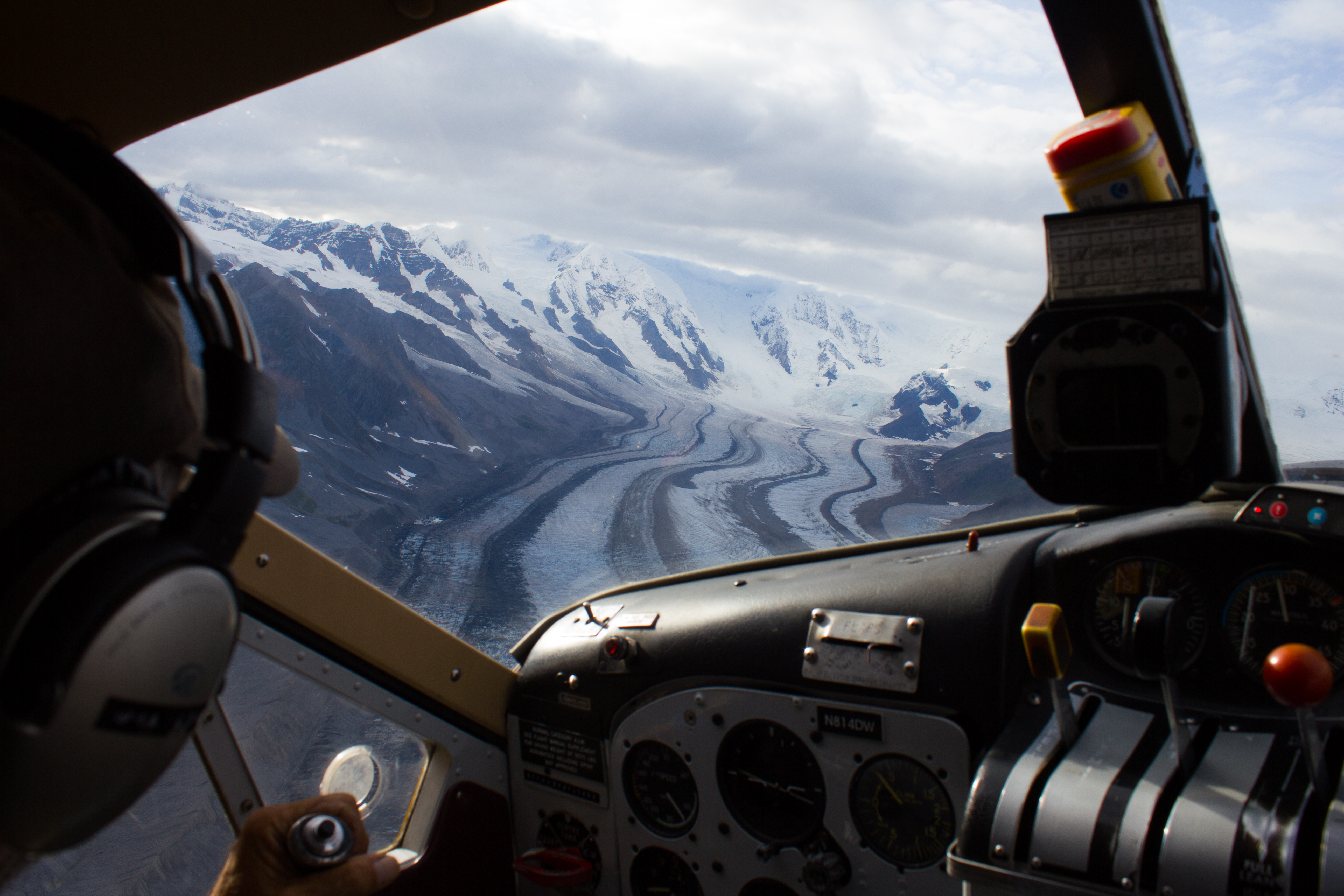
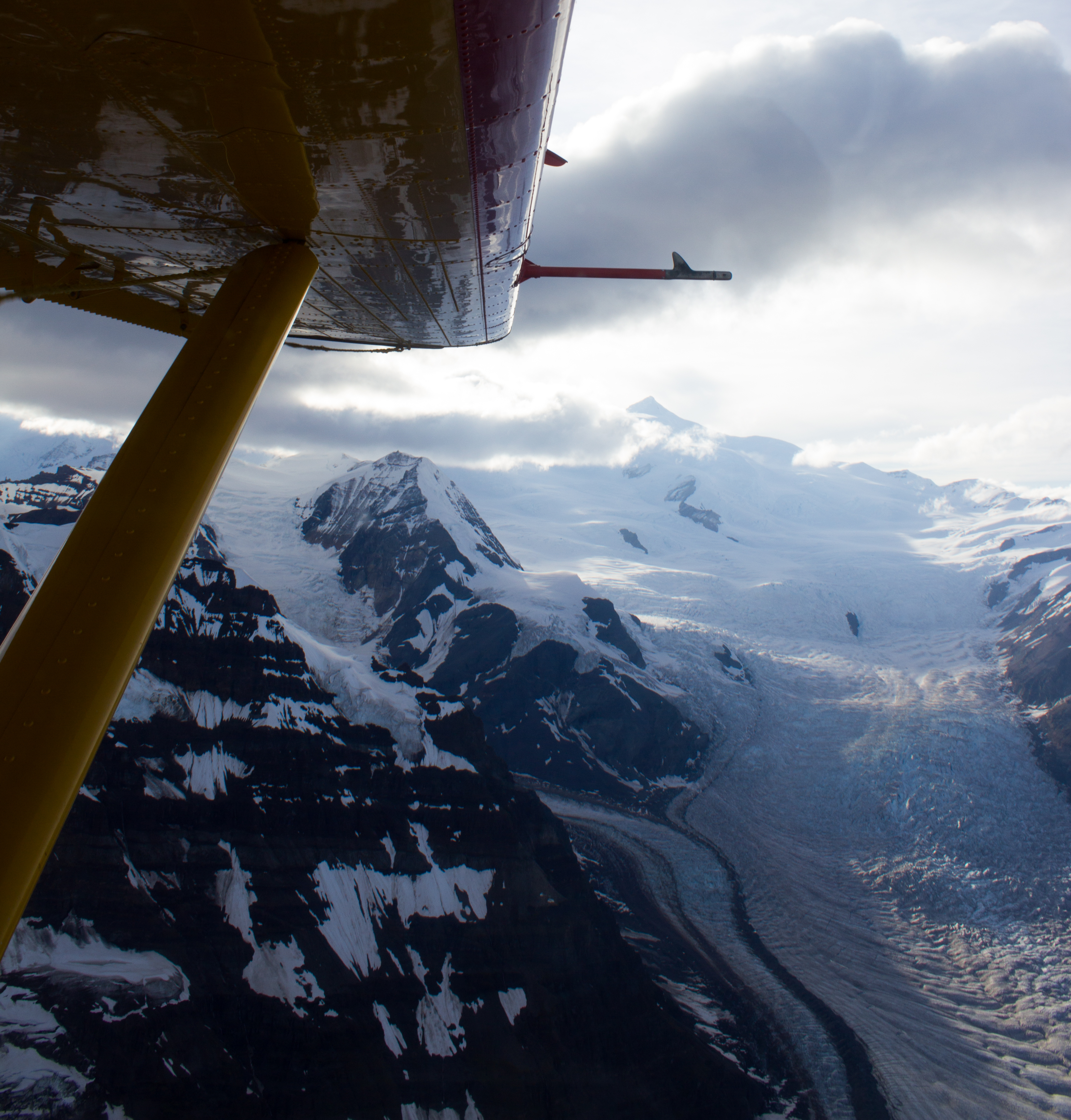
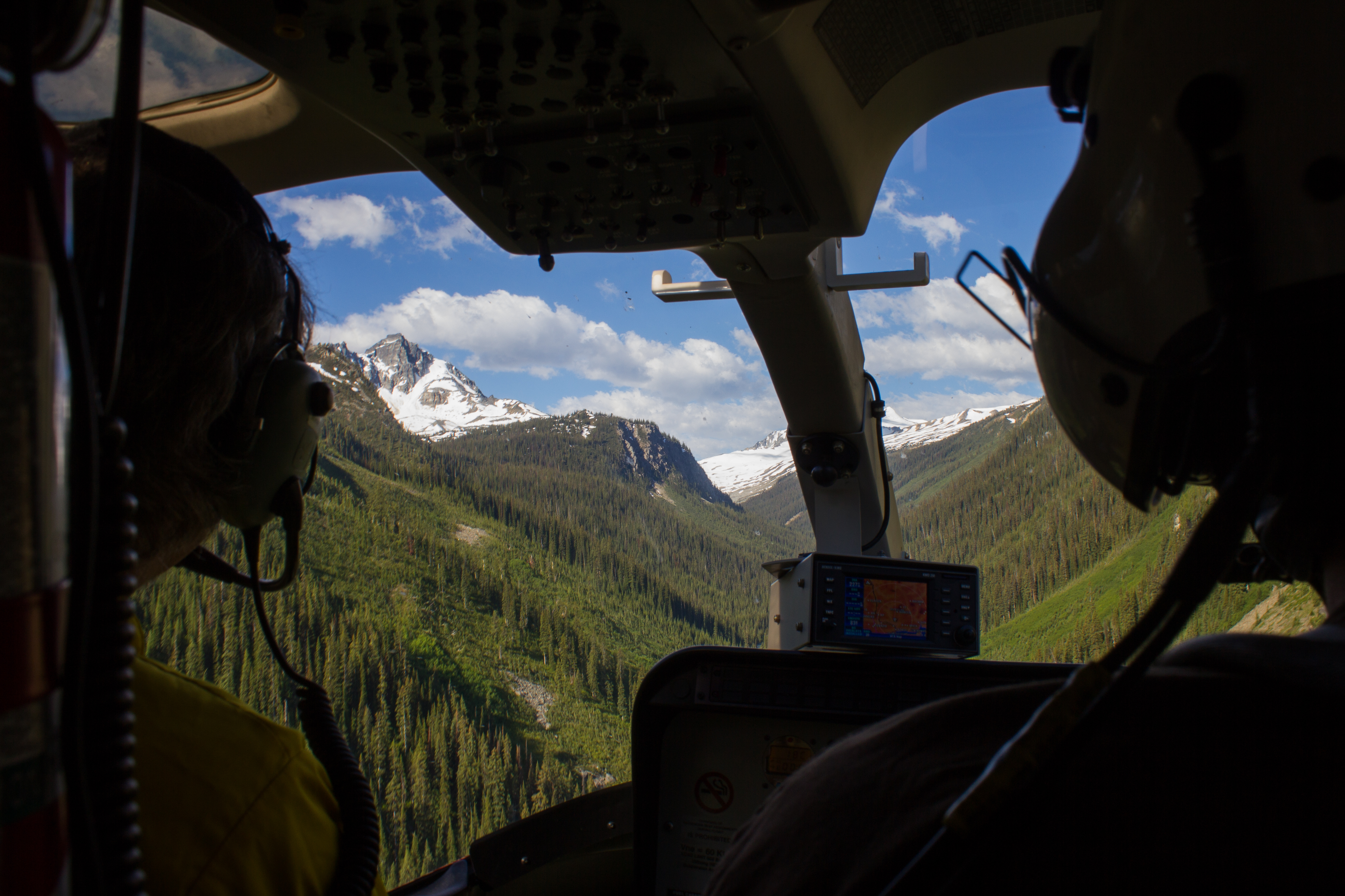
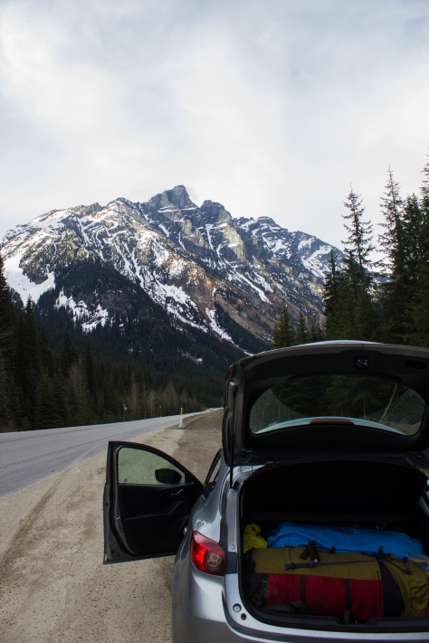
Three months later, I am on a familiar road. With skis and camping gear in the back, I’m winding my way along the 750 odd kilometers from Vancouver to Golden, in eastern BC. Tonight, I’m meeting Ben and his sister, Jill, before an early morning helicopter flight to the ice.


cg_spring_2016_packed_car_mountain
Stopping off at Roger’s Pass, en route to Golden.


cg_spring_2016_Jill_Ben_Helipad
Morning of departure at the Alpine Heli base, with Jill and Ben.


cg_spring_2016_Heli_mechanic
Happy for our mechanical problems to happen on the ground.


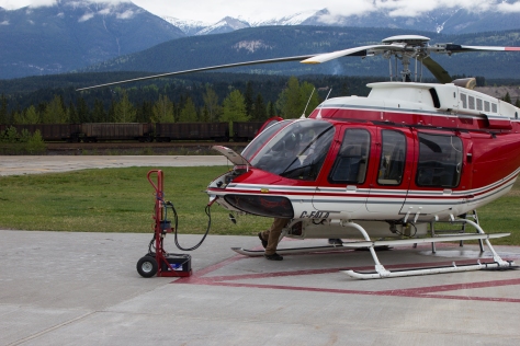
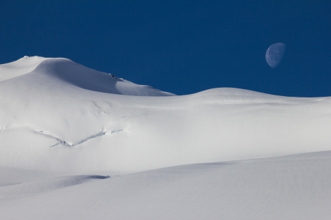
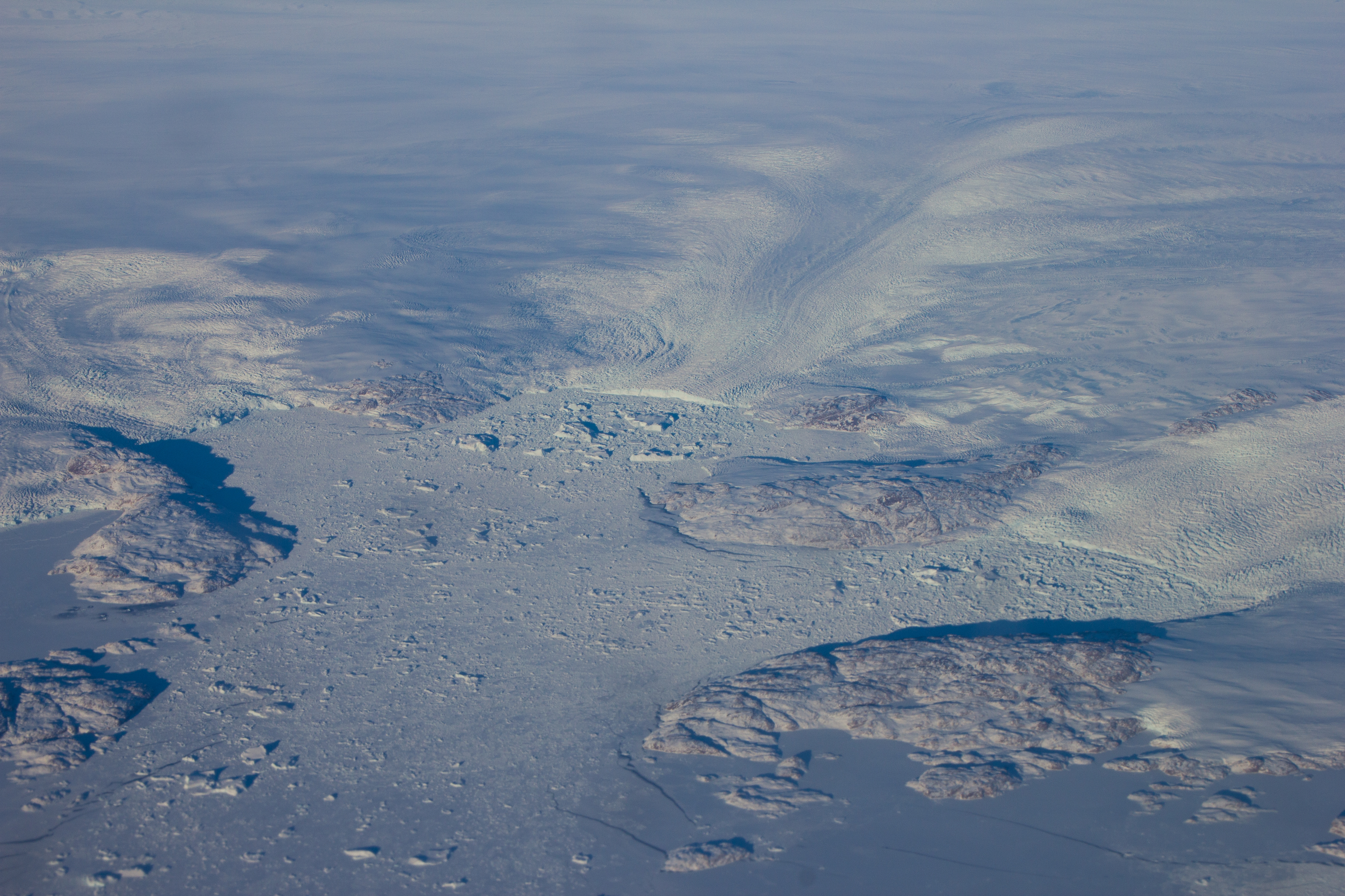
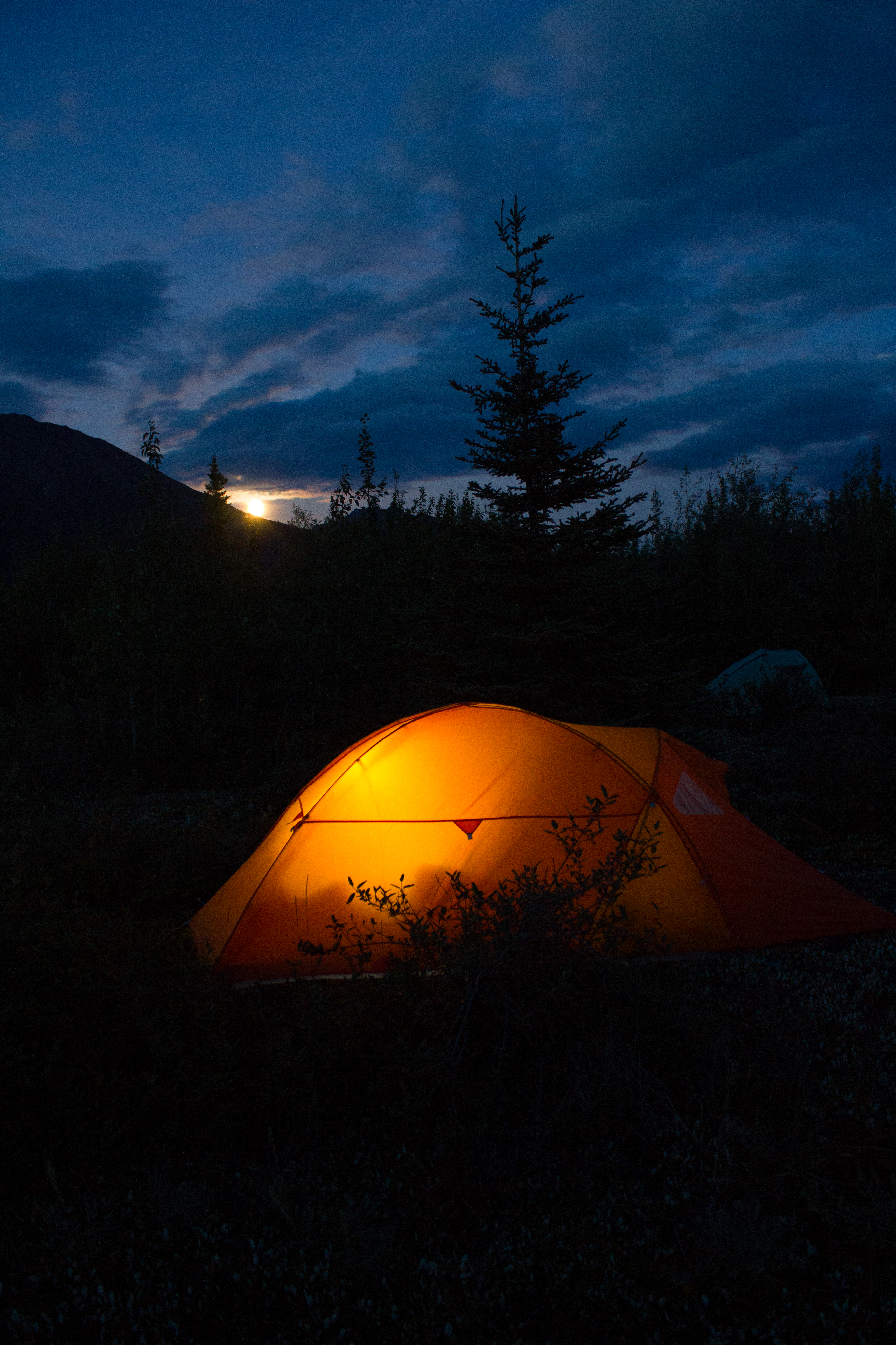
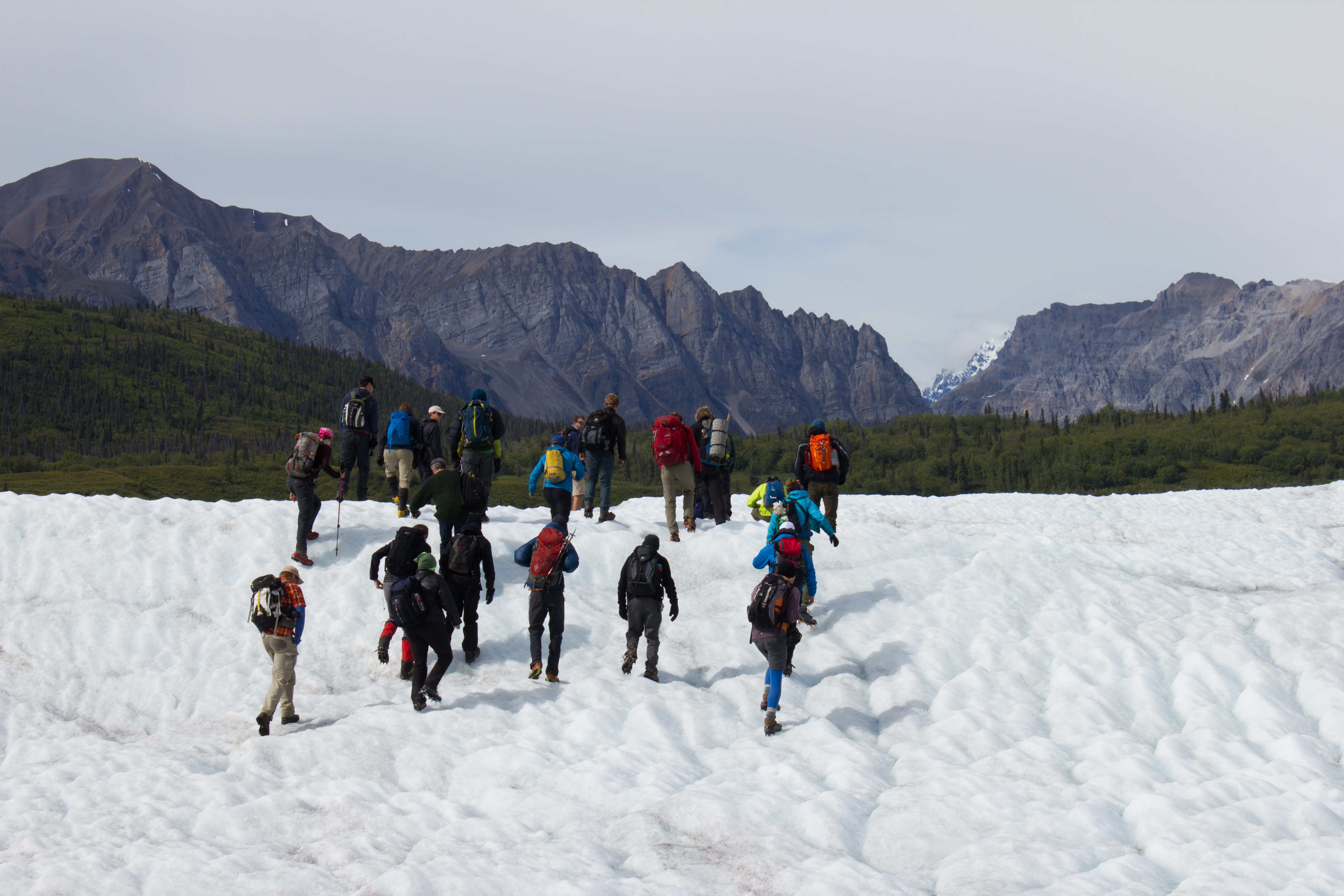
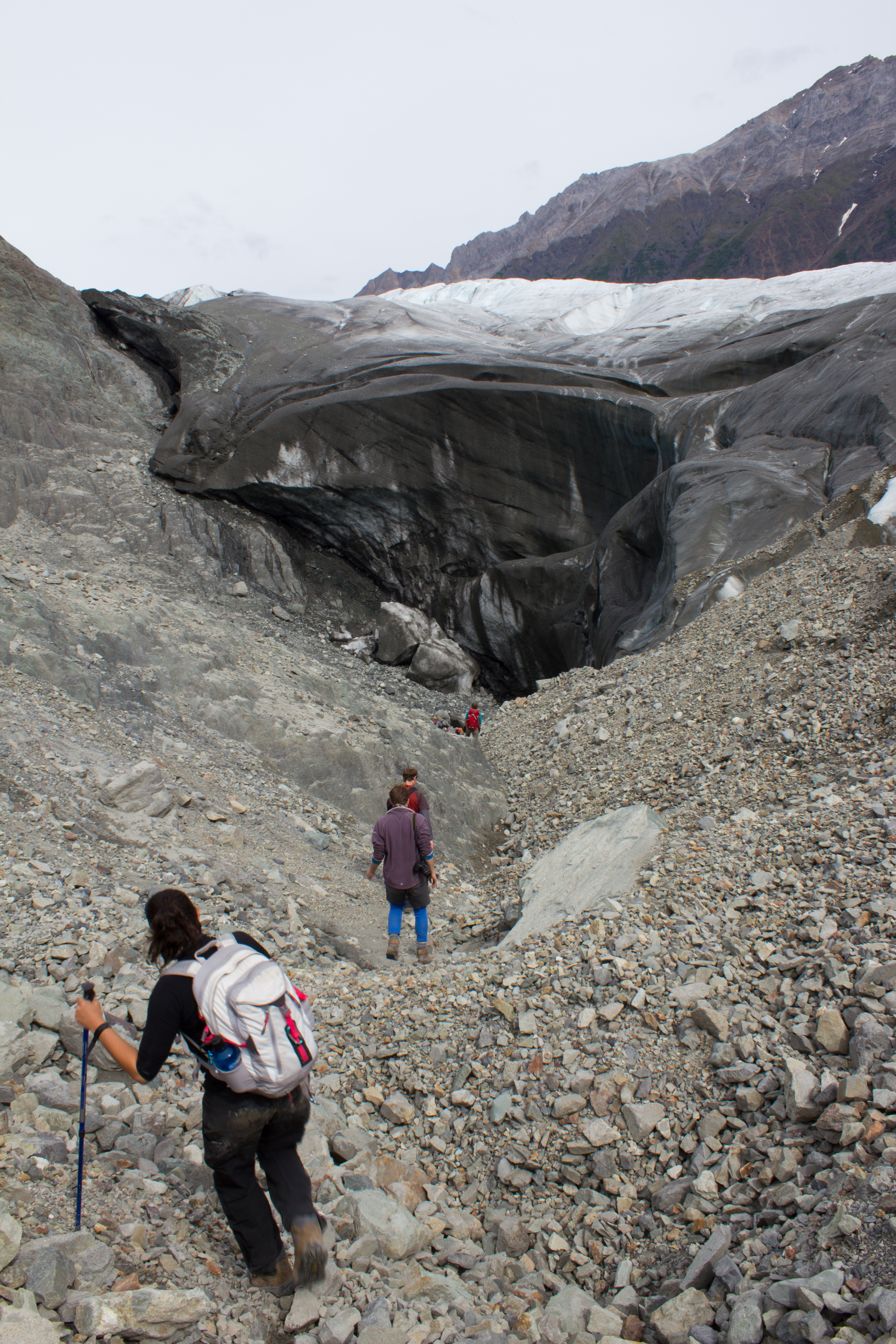
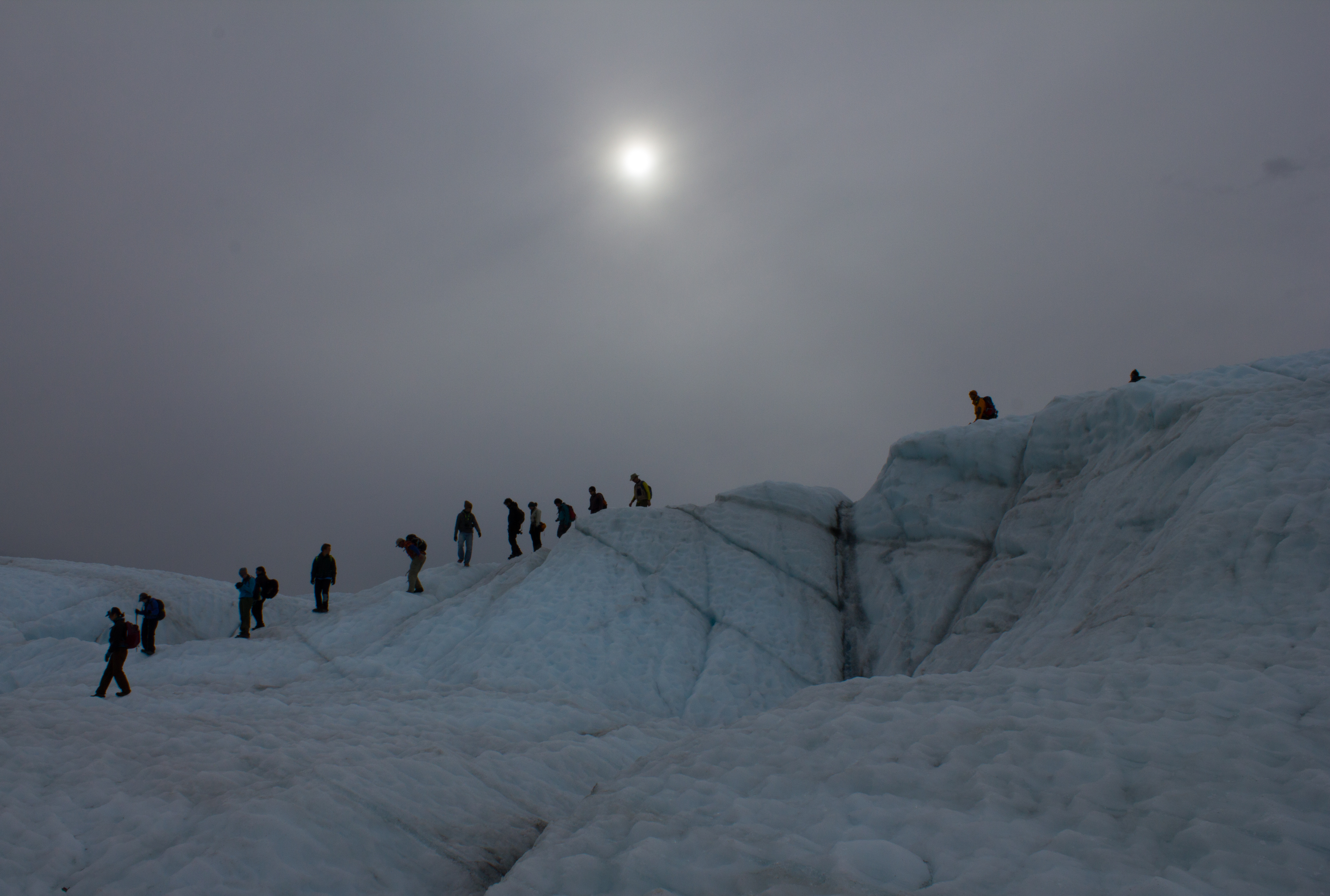
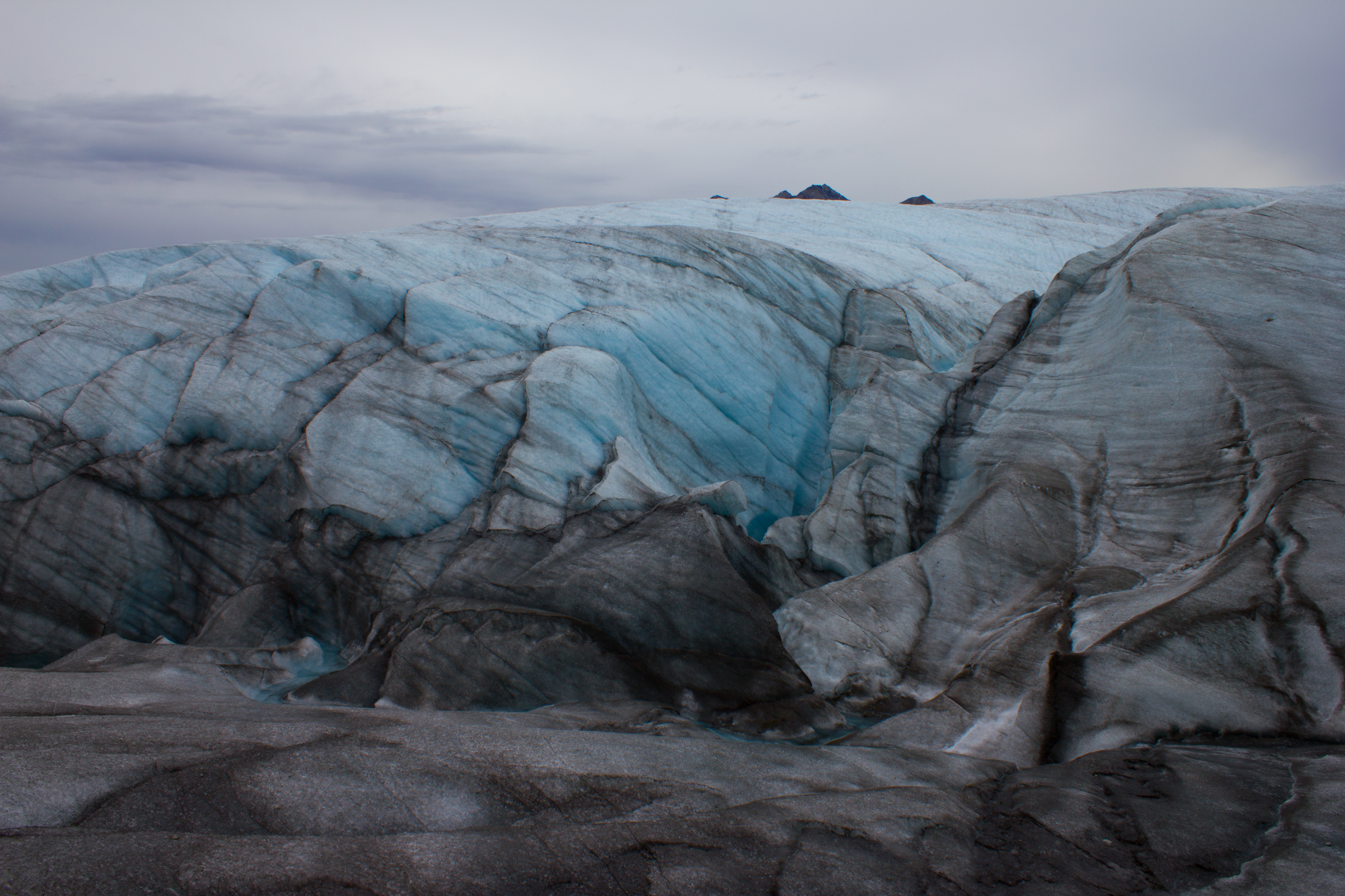
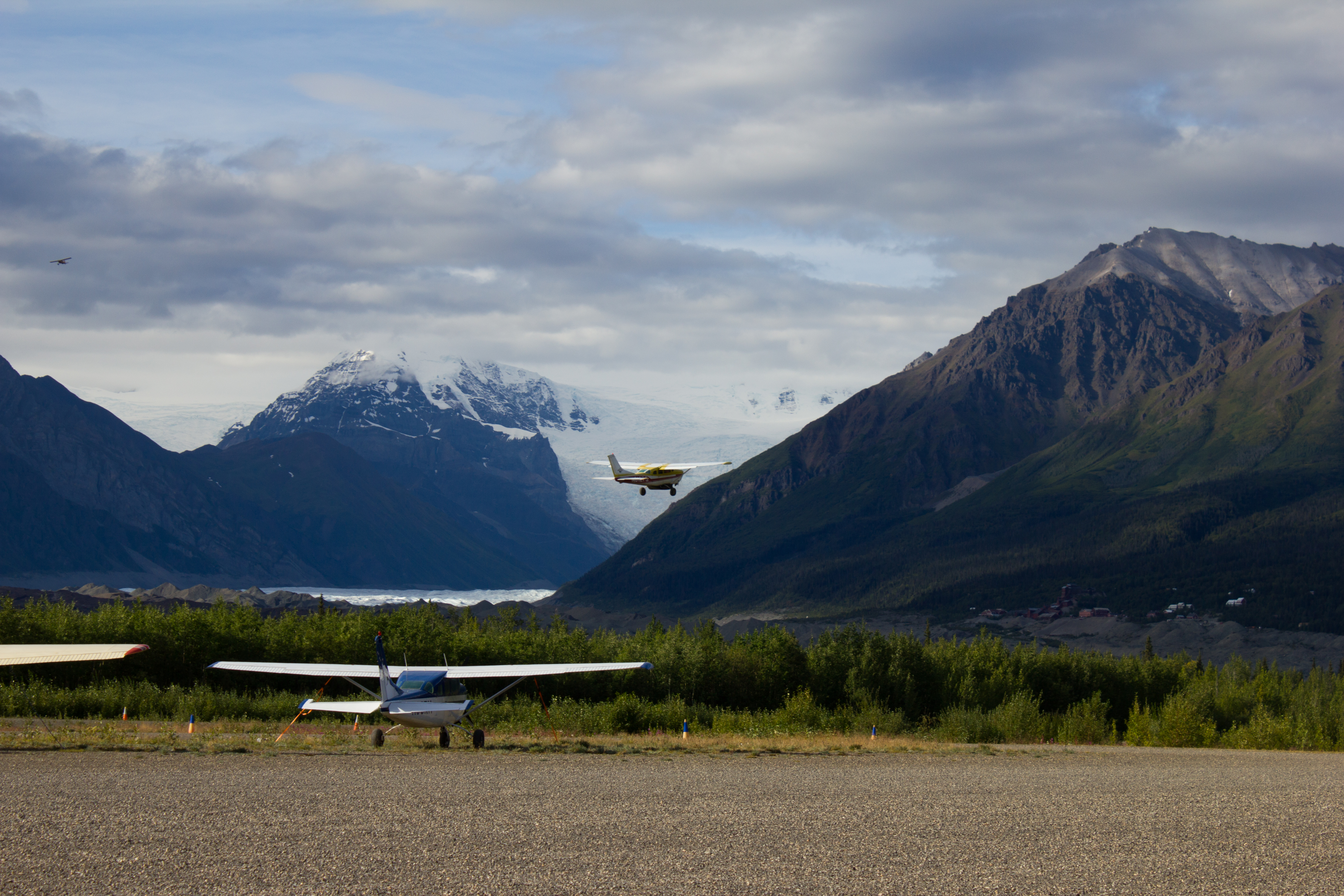
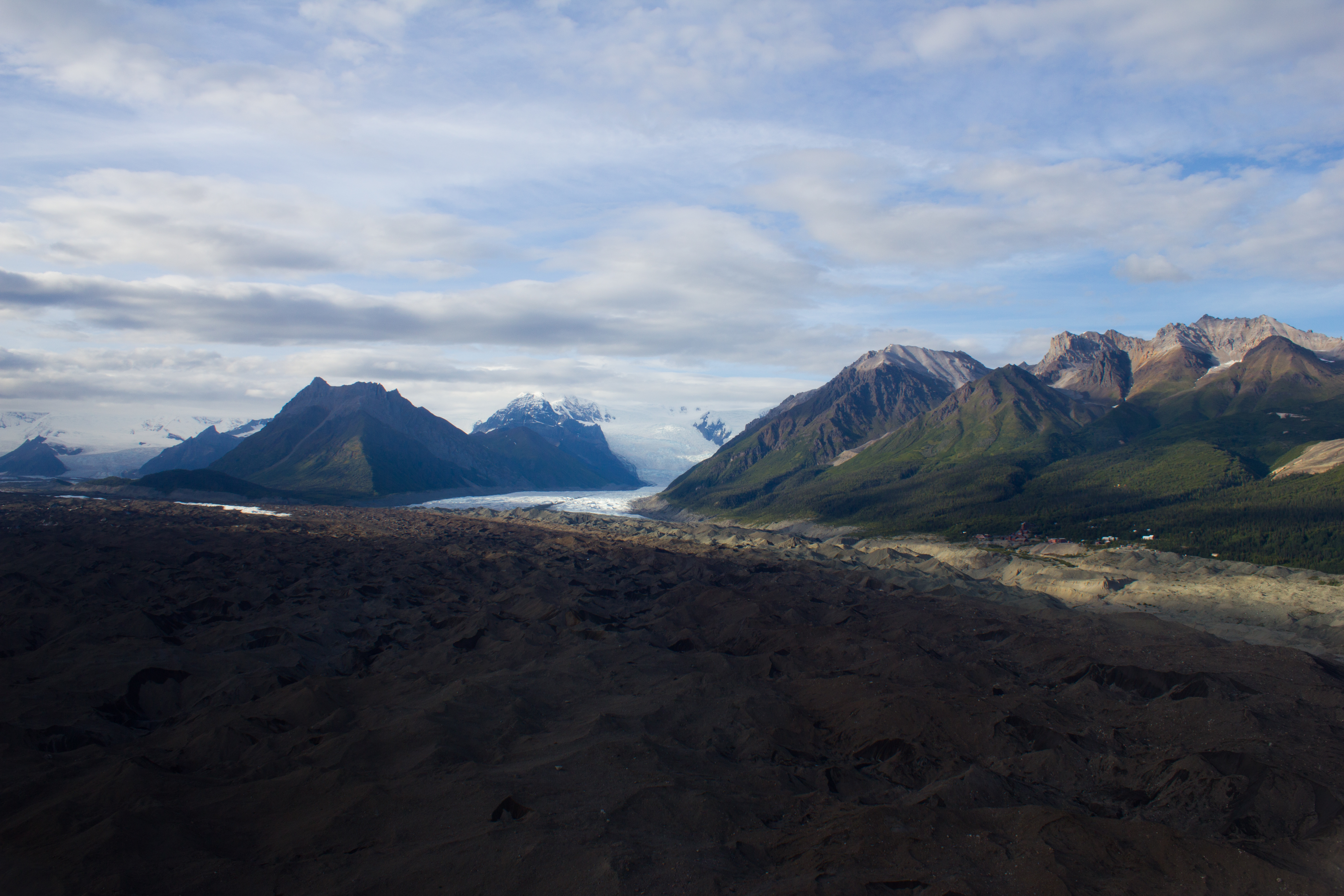
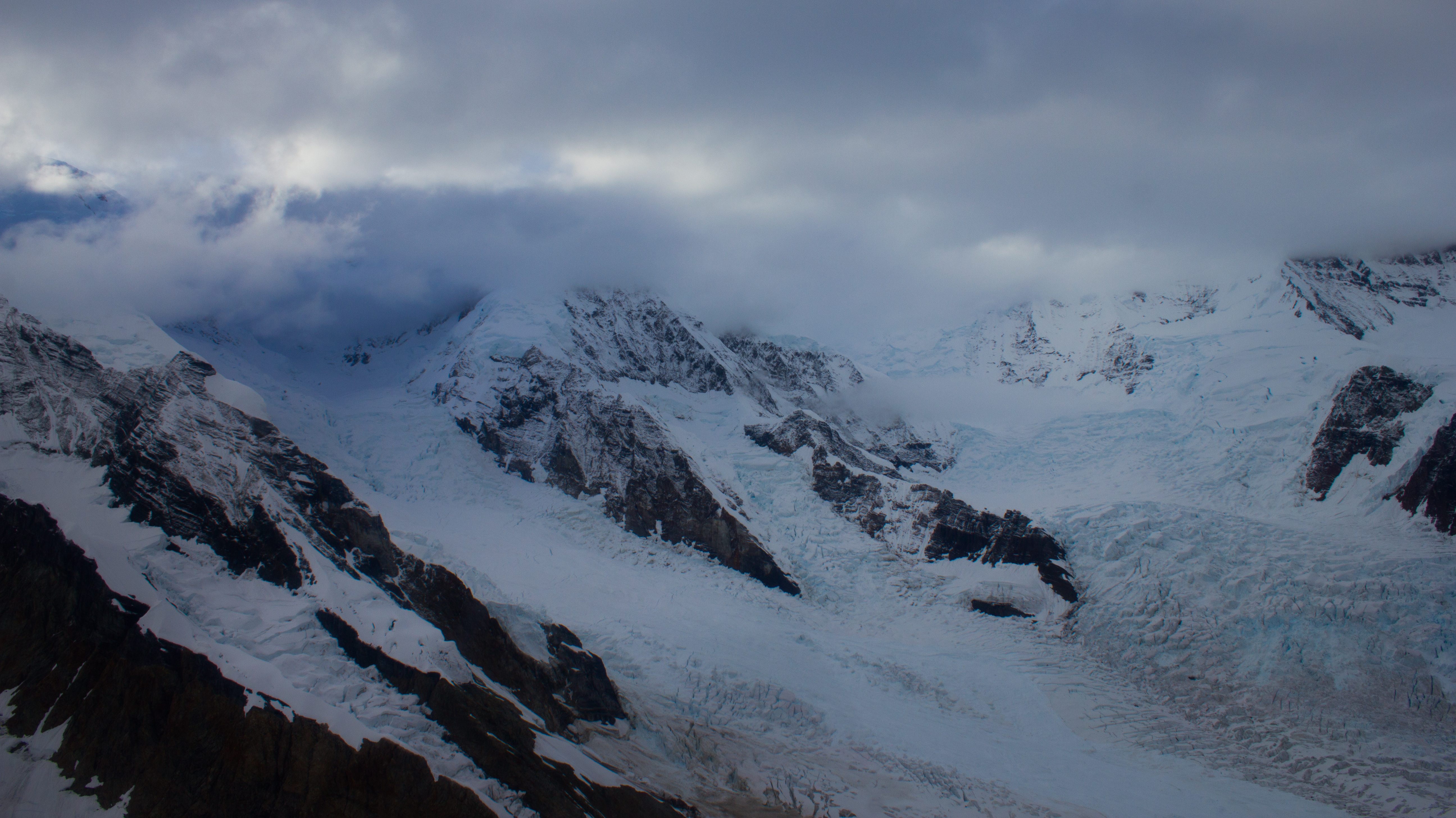
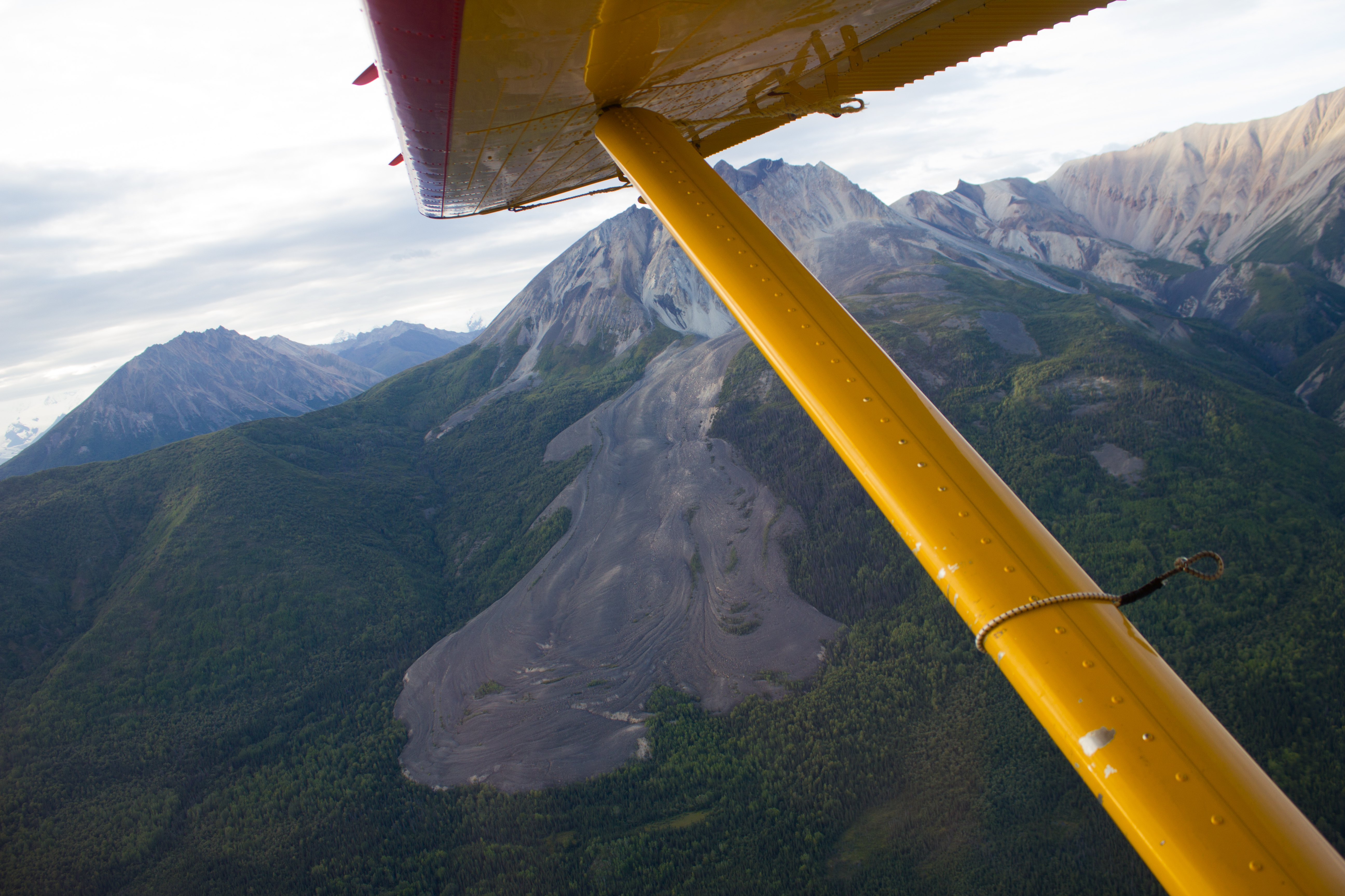
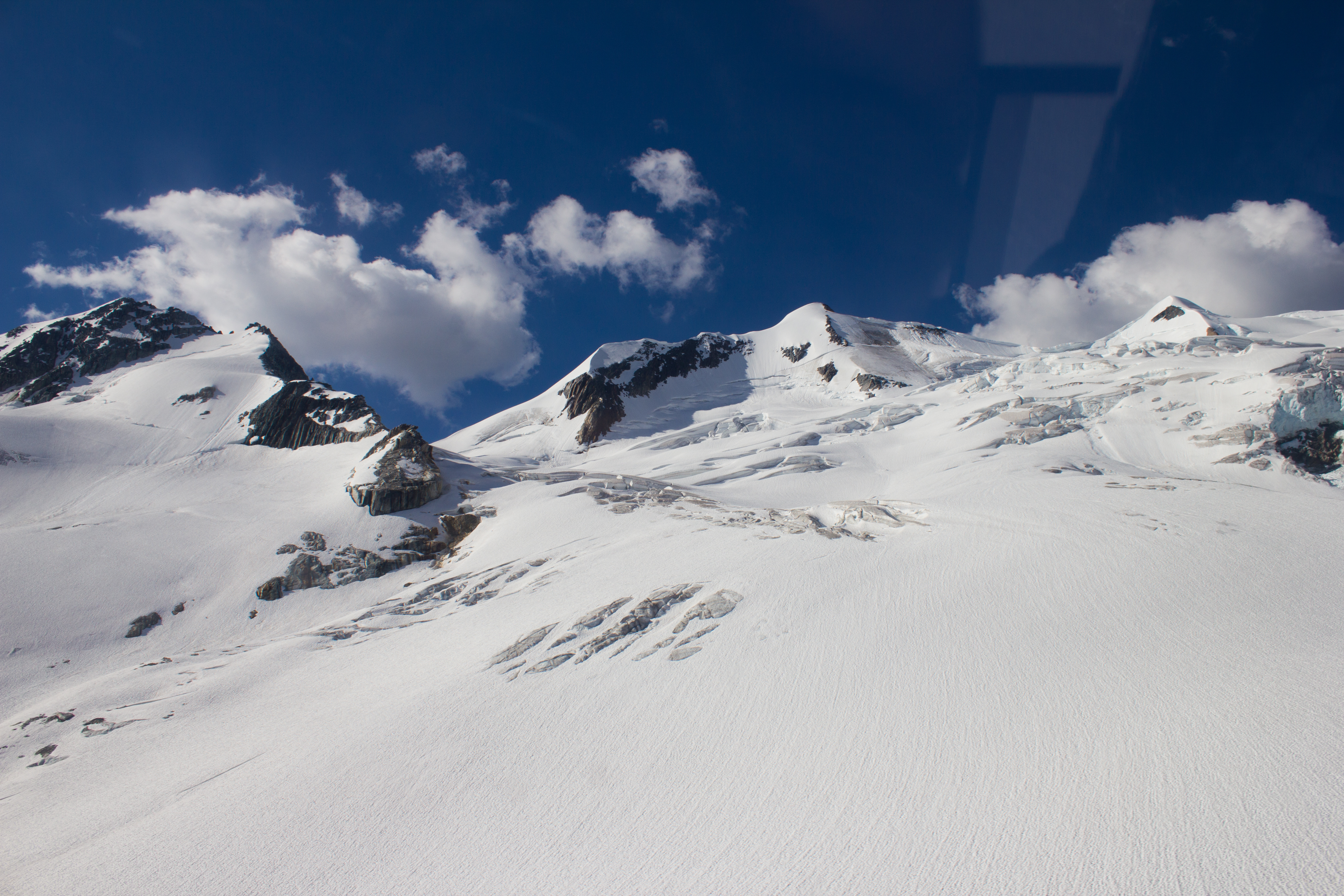
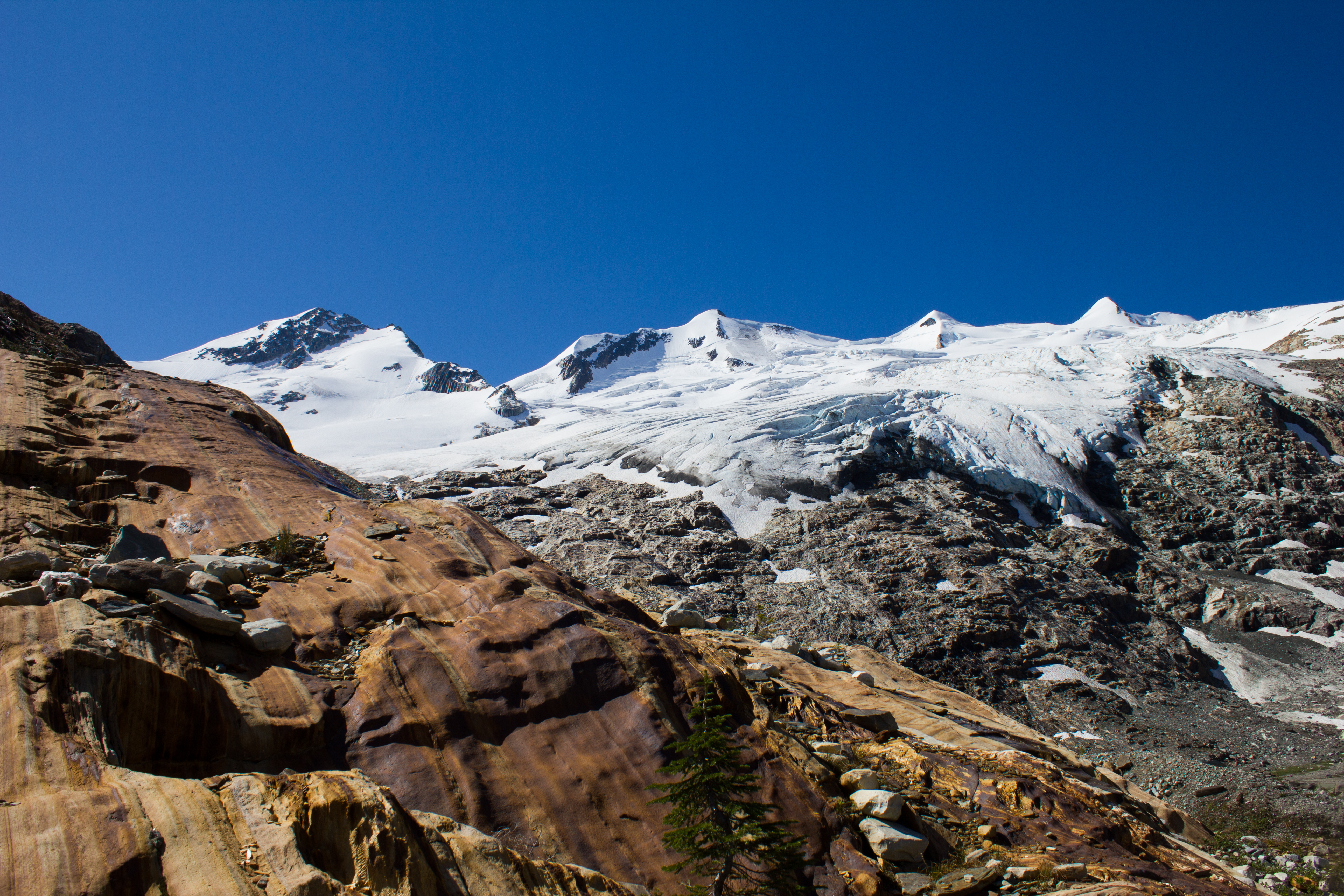
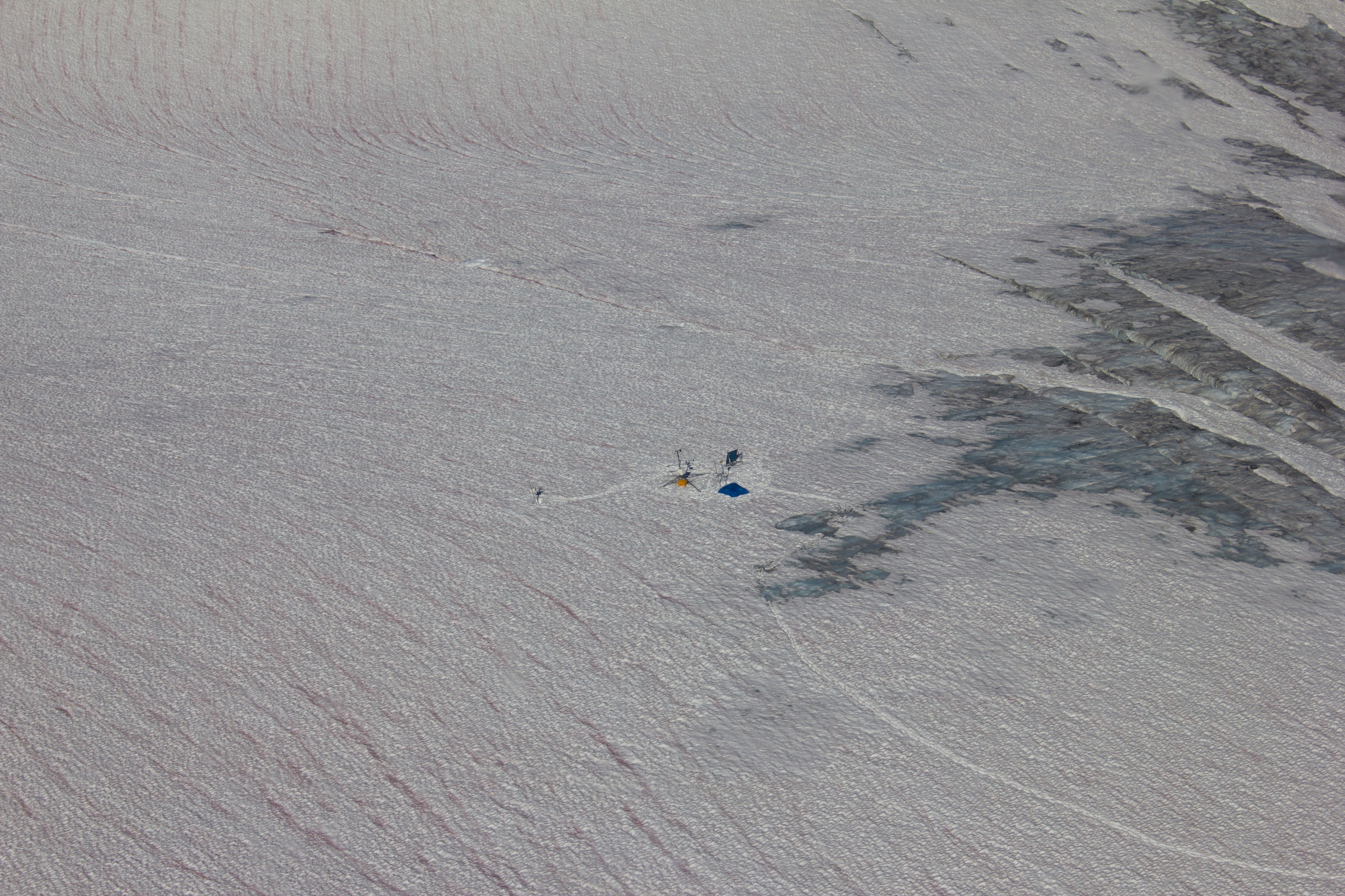
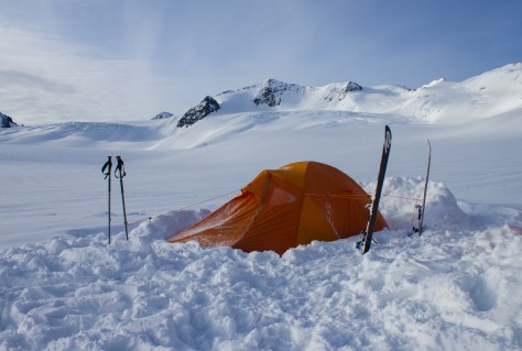
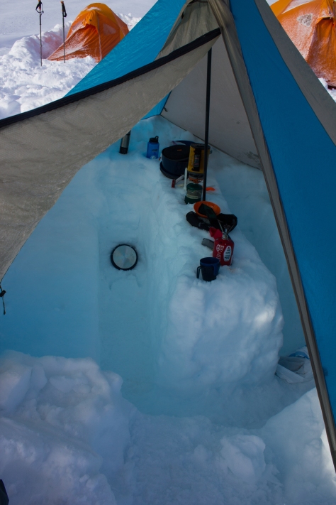
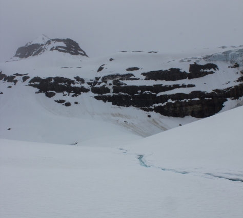
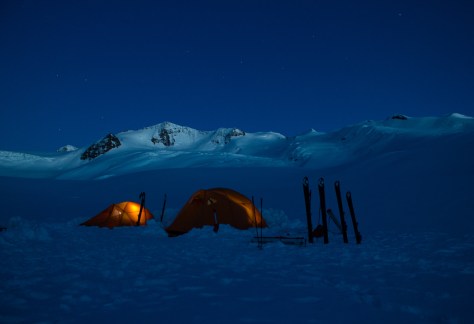
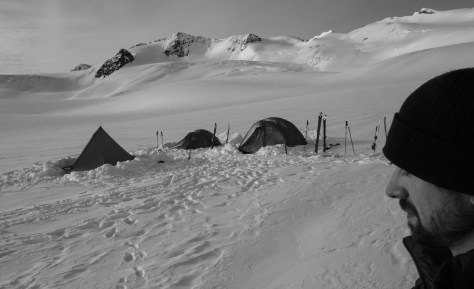
After a brief delay to fix a clogged spark plug, we were in the skies above the Purcell Mountains, in good flying weather. It was my first time taking this journey in what were essentially winter conditions, and I was glued to the window as we maneuvered between the snow-covered peaks. We landed on the west flank of Conrad Glacier at 2,300m. Our campsite overlooked the jagged crevasses of the icefall that lay above our summer field sites. We dug out level platforms in the snow for our tents, and built up walls on the upper side to keep out the cold, downhill ‘katabatic’ winds that can develop on glaciers at night. In the front vestibules, we dug out lower platforms for storing gear, and putting on our boots in the mornings. Finally, we dug out a table and benches, and pitched a tarp over it to serve as our kitchen.


cg_spring_2016_tent_morning
Home.


cg_spring_2016_mess_tent
Our mess tent. The option to get out of the elements for awhile to cook and eat can make all the difference.


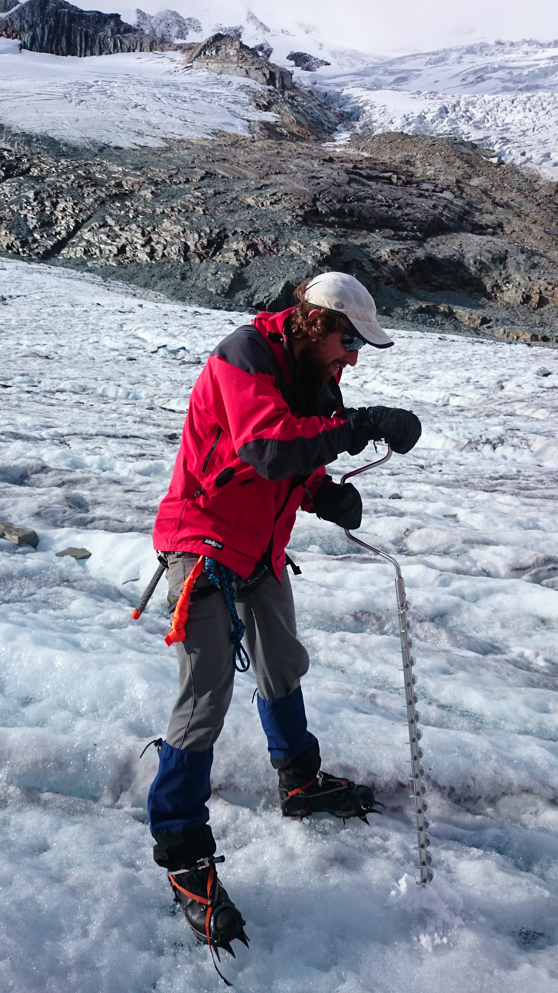
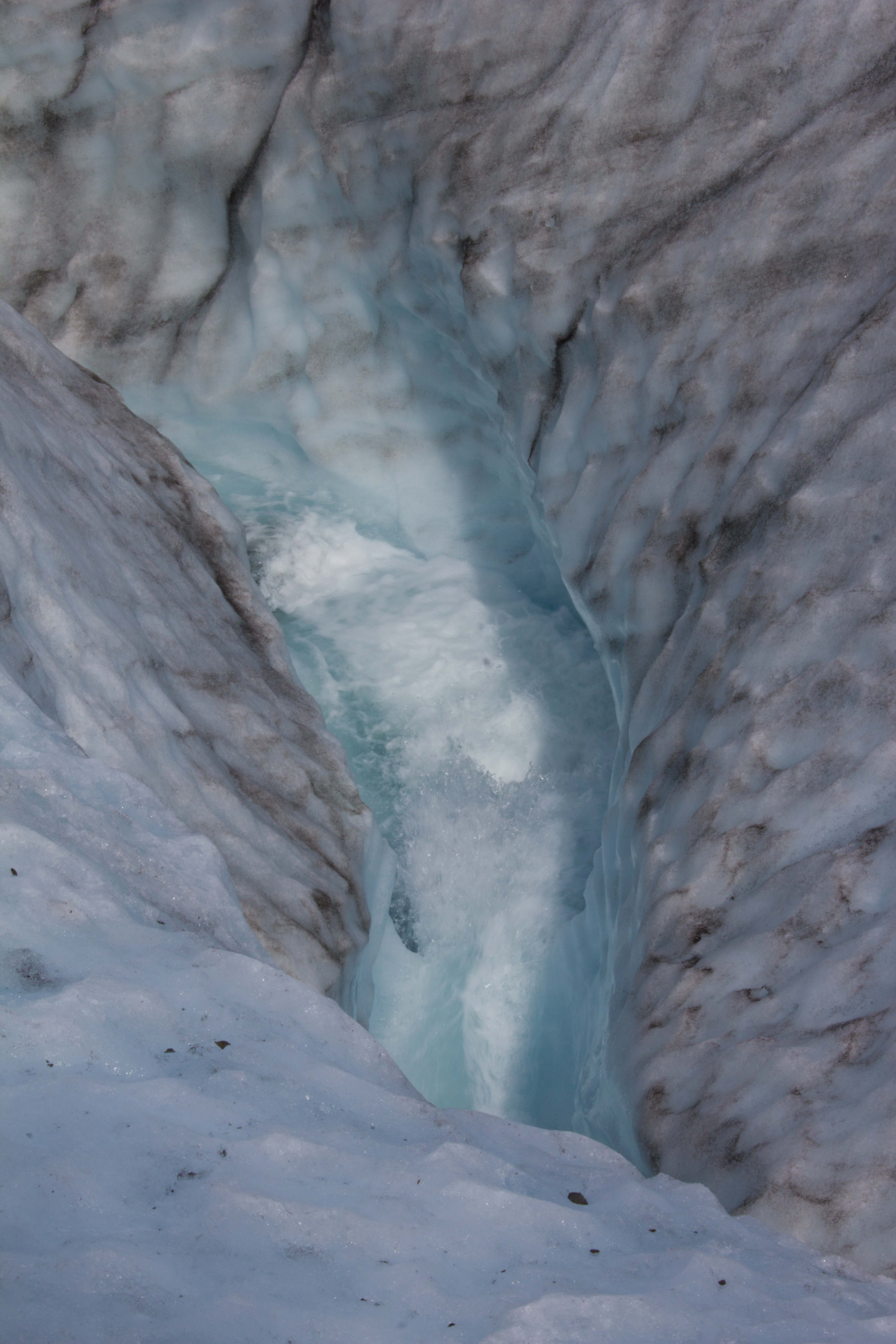
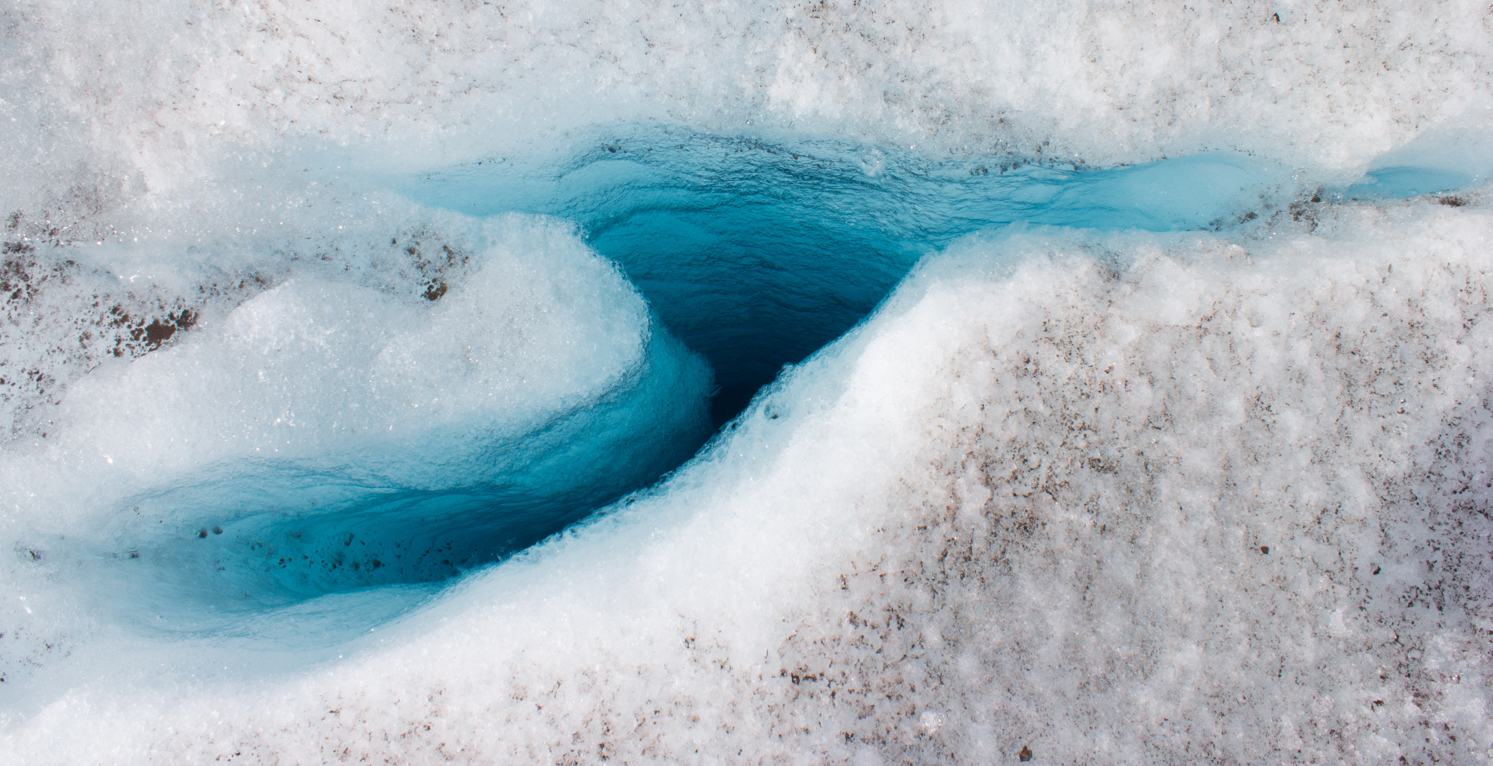
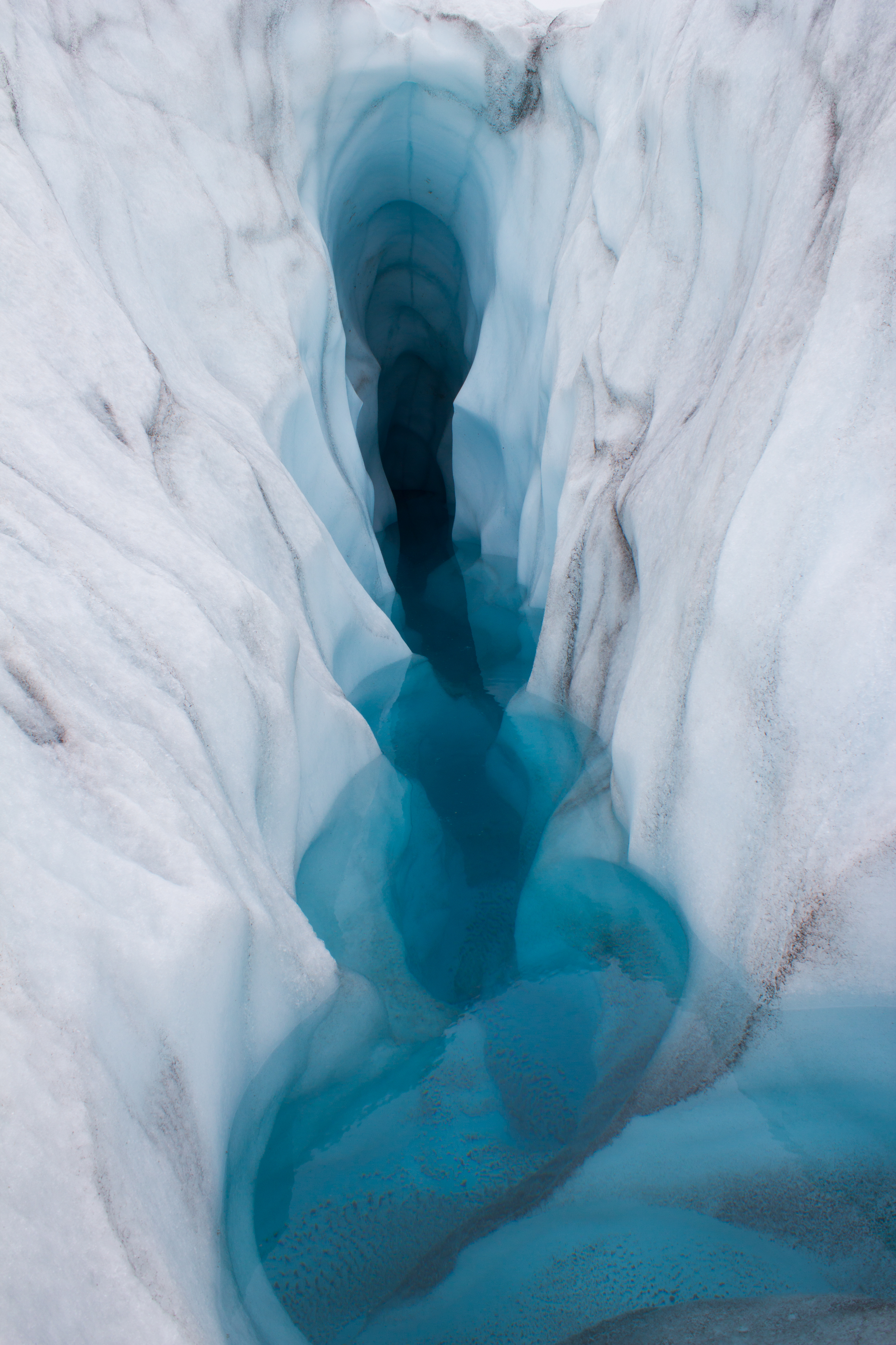
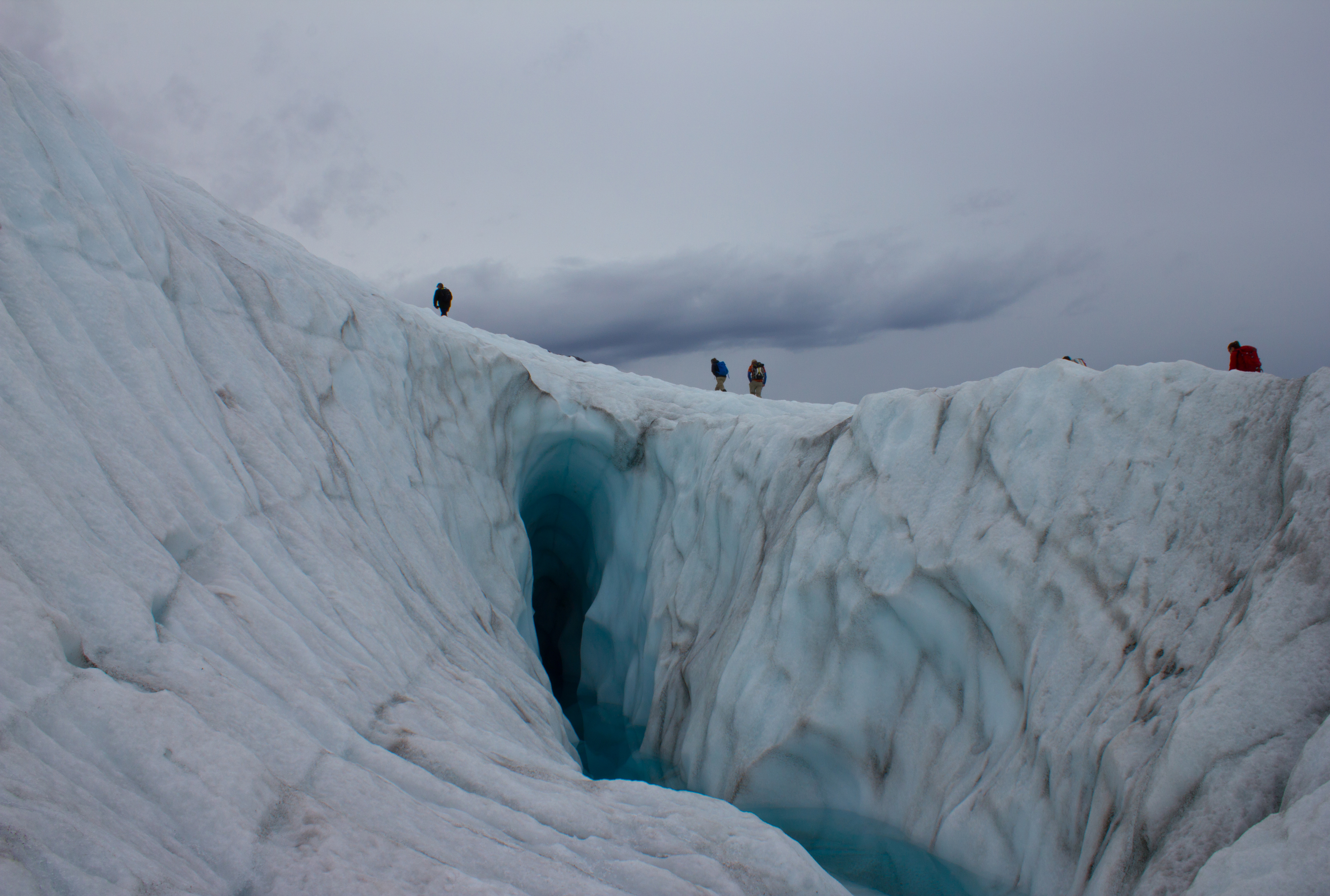
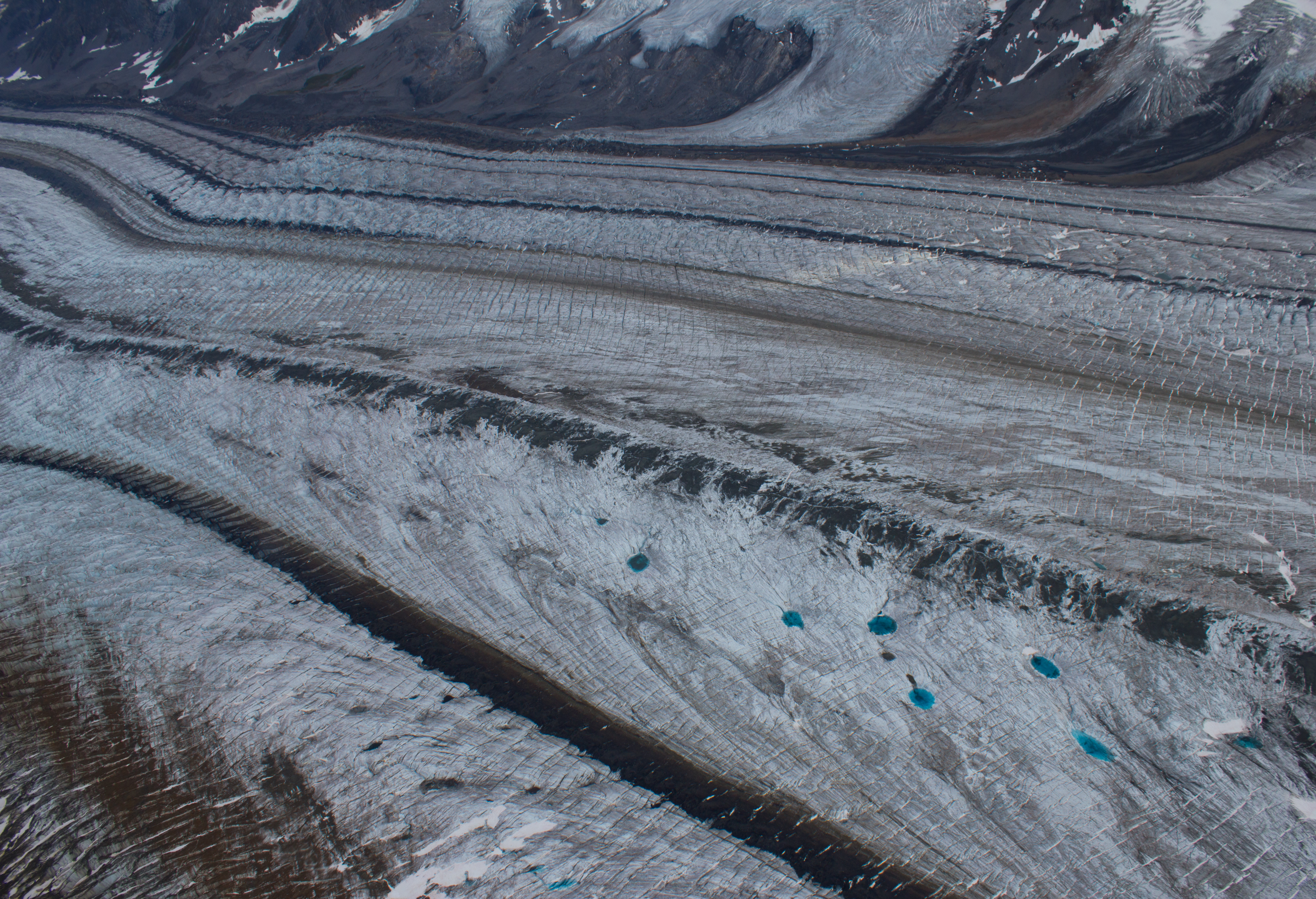
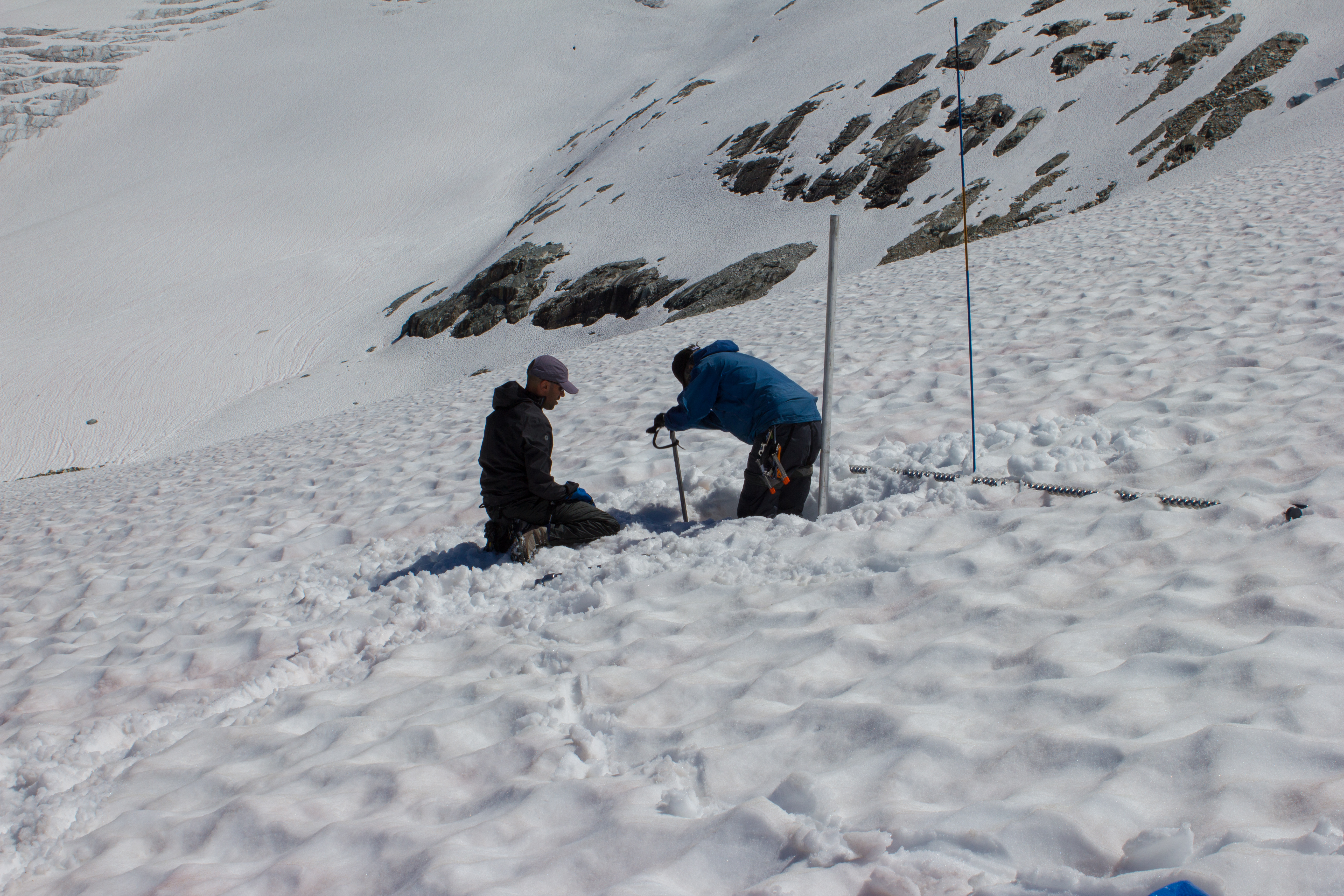
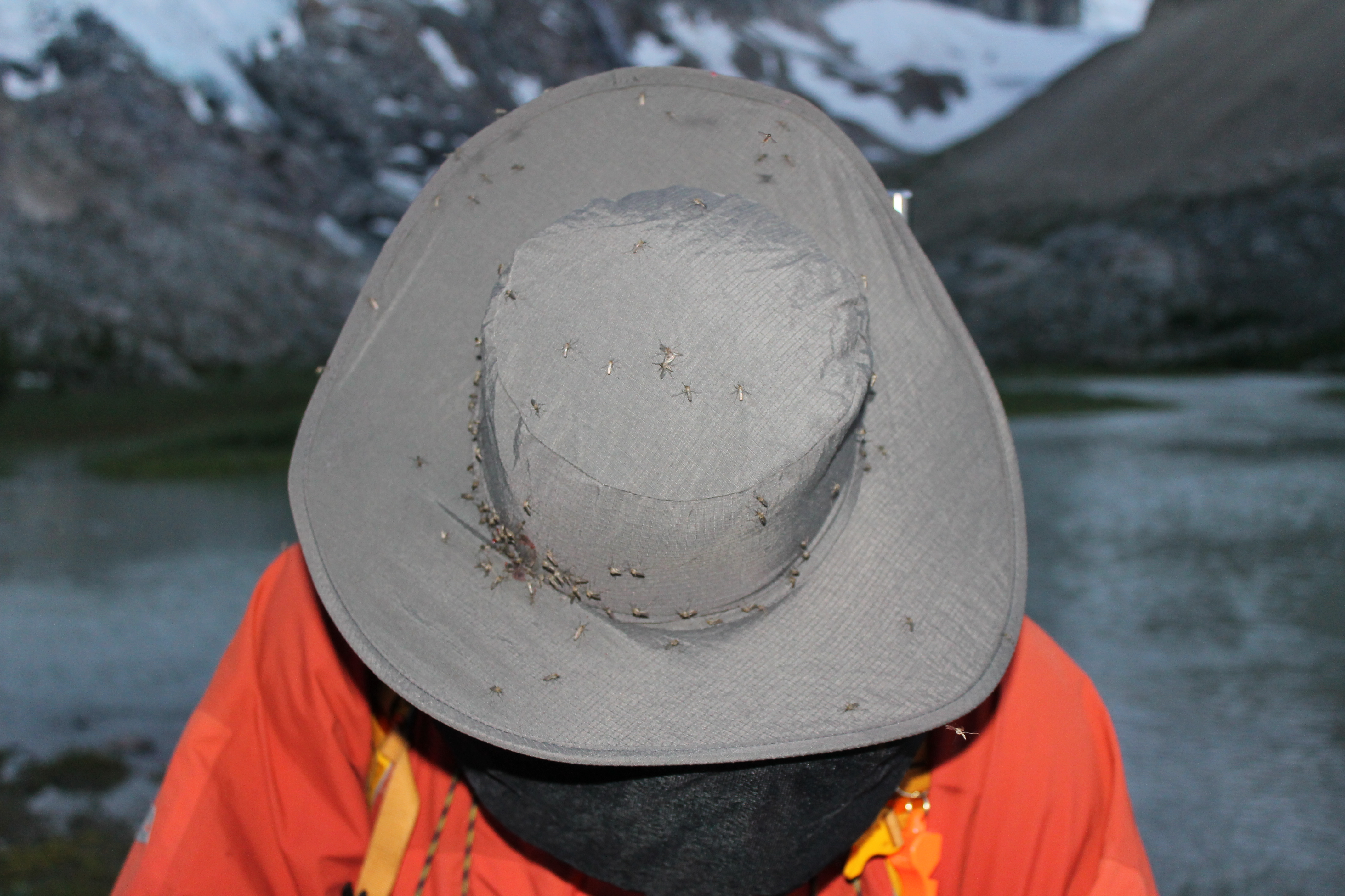
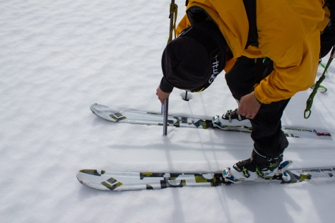
One of the main goals for this trip was to get an idea of how much snow the glacier had received over the winter, and how much water this snow will produce if it melts in the  summer. To this end, we needed to take regular measurements across the glacier of the depth of this season’s snow, and its density. After setting camp on the first day, we skied down to the terminus of the glacier, and took a series of these measurements as we moved back up the slope. The weather was mild, and we were surprised to find a well developed melt water stream this early in the season, carving a channel into the surface snow. In the weeks preceding our trip, we had been keeping an eye on data from snow sensors located on mountains in this region. The early onset of spring was resulting in some significant snow melt, and the question on our minds was whether 2016 would prove to be as detrimental to the glaciers in this region as the record losses of 2015.

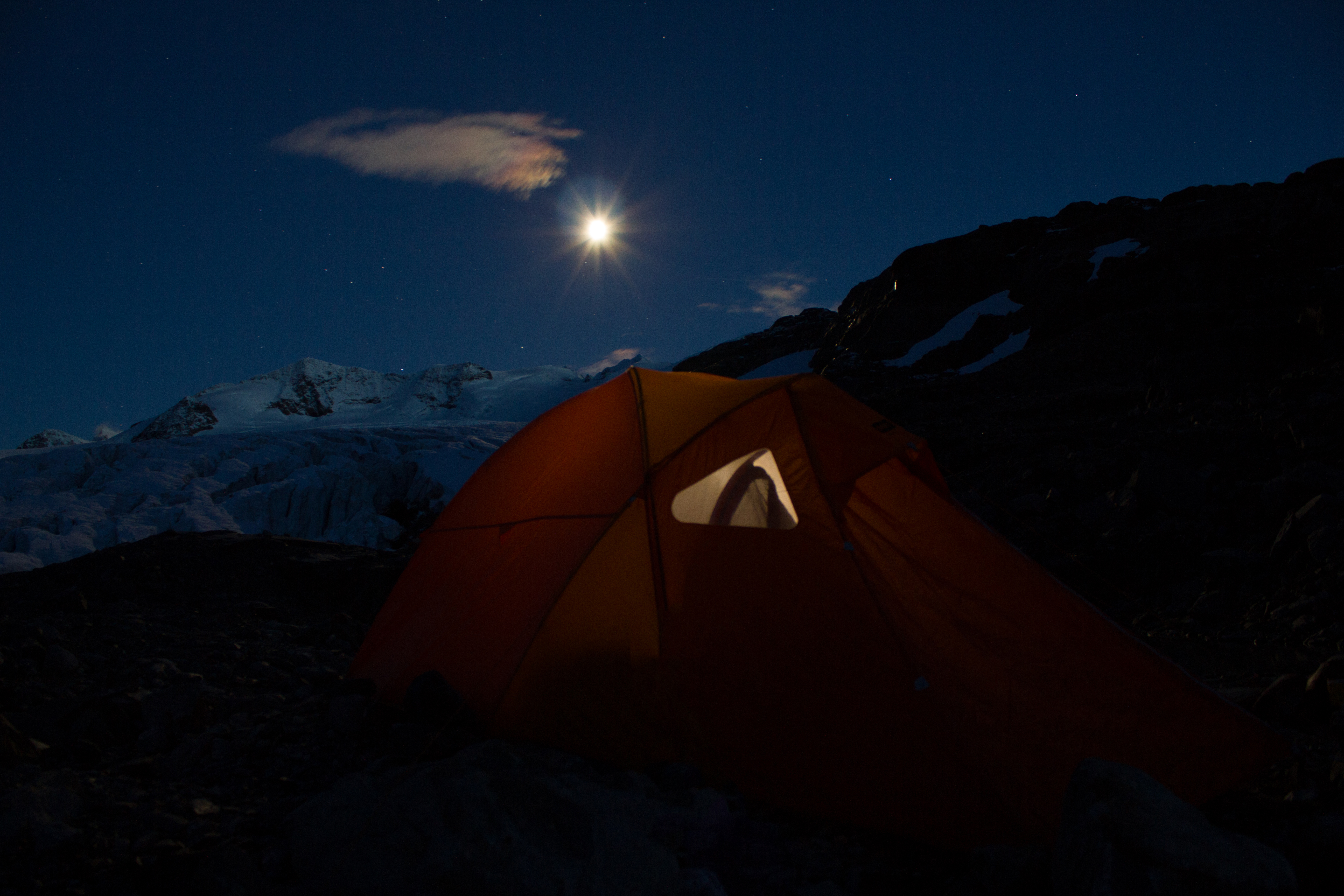
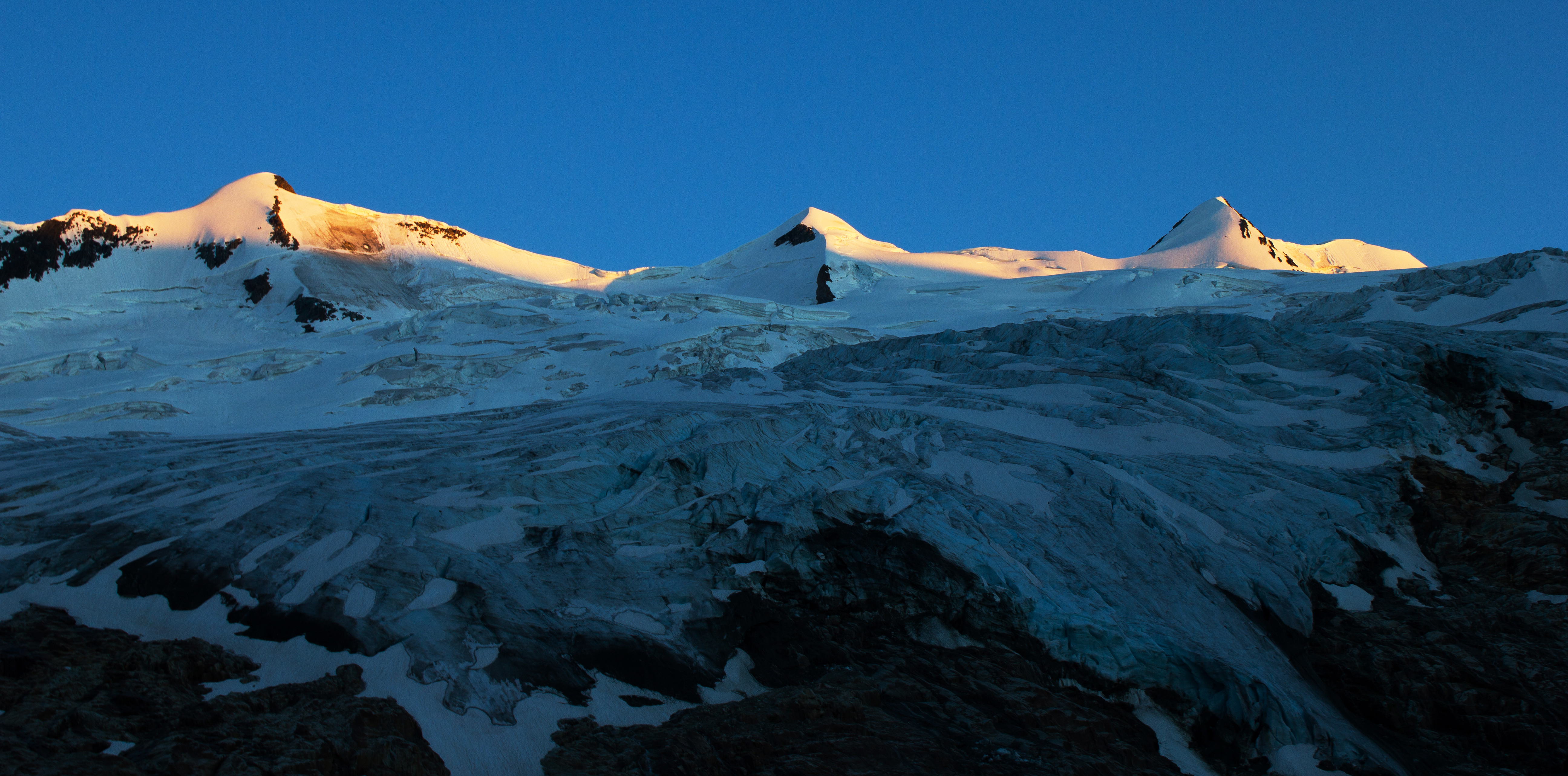
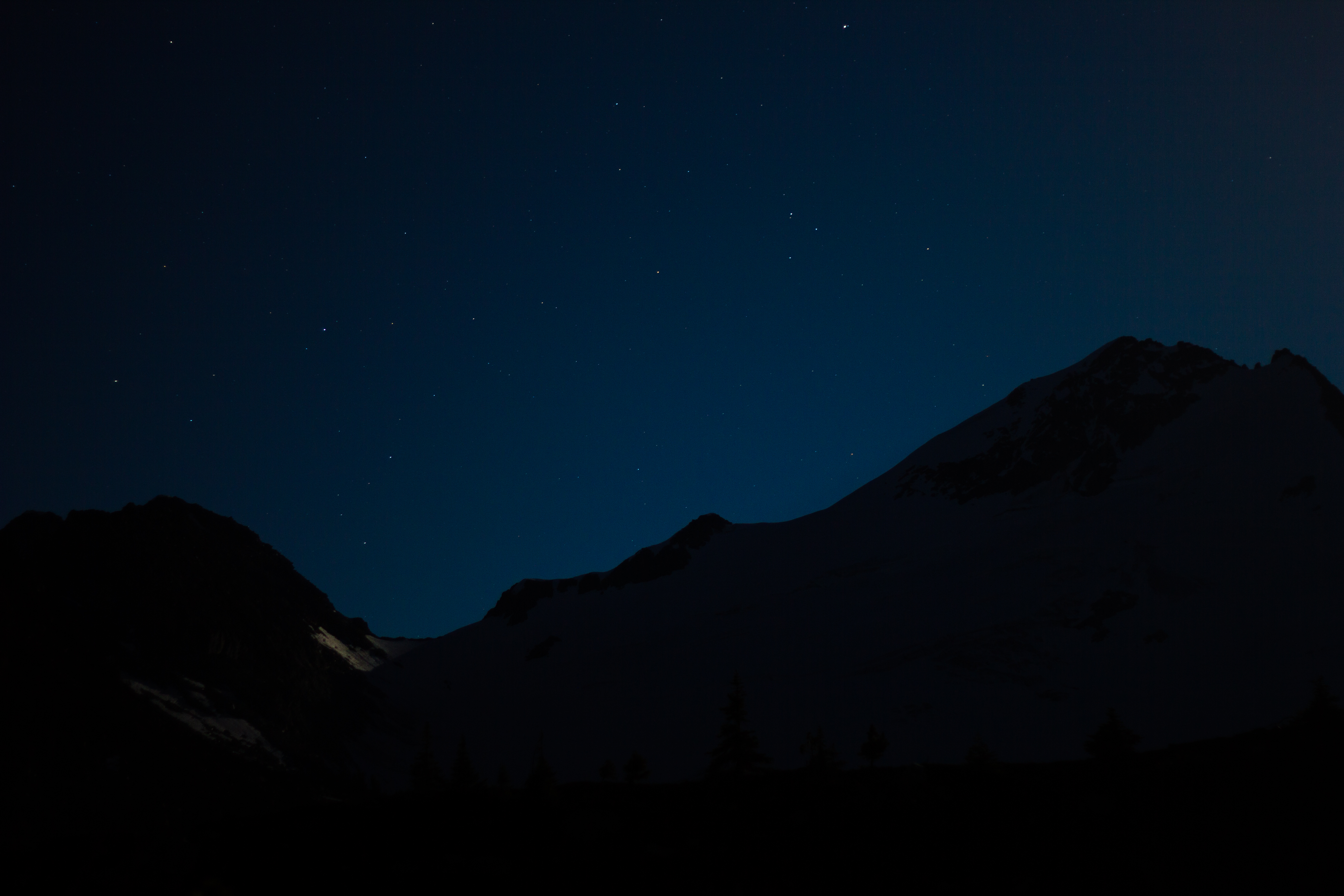
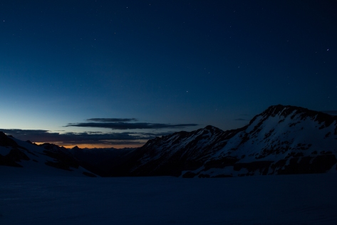
Late in the afternoon, with the weather beginning to turn, we pushed back to the shelter of our camp. After a warm meal, we watched the skies clear and felt the temperatures drop as the indigo twilight turned into a star filled mountain night.


cg_spring_2016_Ben_Jill_icefall_2
Ben and Jill, ascending past an icefall on the glacier.


cg_spring_2016_Ben_snow_depth_measure
Ben, probing the snow depth to determine how much the glacier had received over the winter.


cg_spring_2016_supraglacial
A well developed melt stream (supraglacial channel) was a surprise find this early in the year.


cg_spring_2016_Ben_Jill_return_to_camp
Returning to camp just as the weather began to close in.


cg_spring_2016_camp_at_night
Nights fall on our Conrad spring camp.


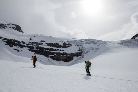
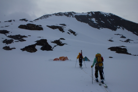
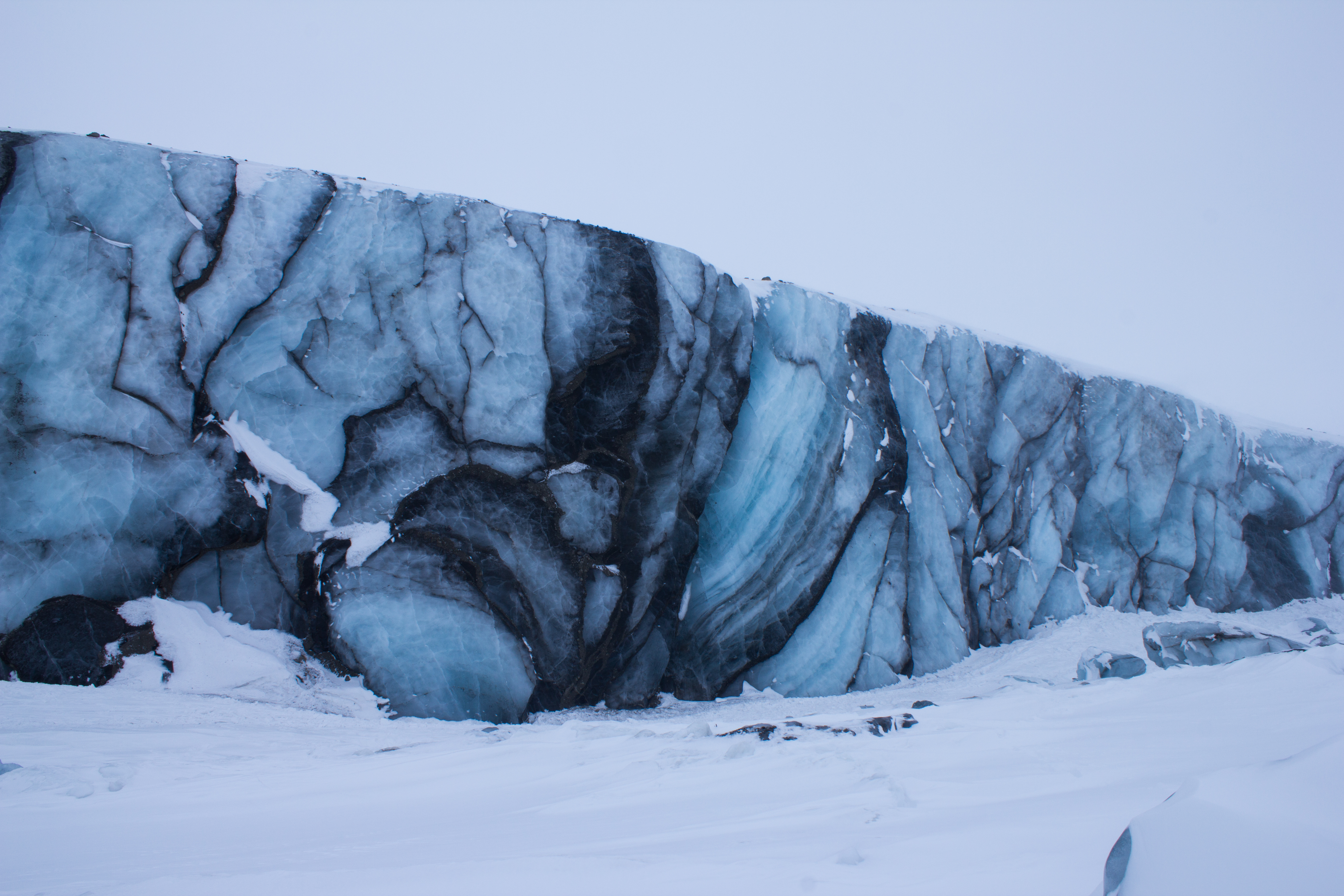
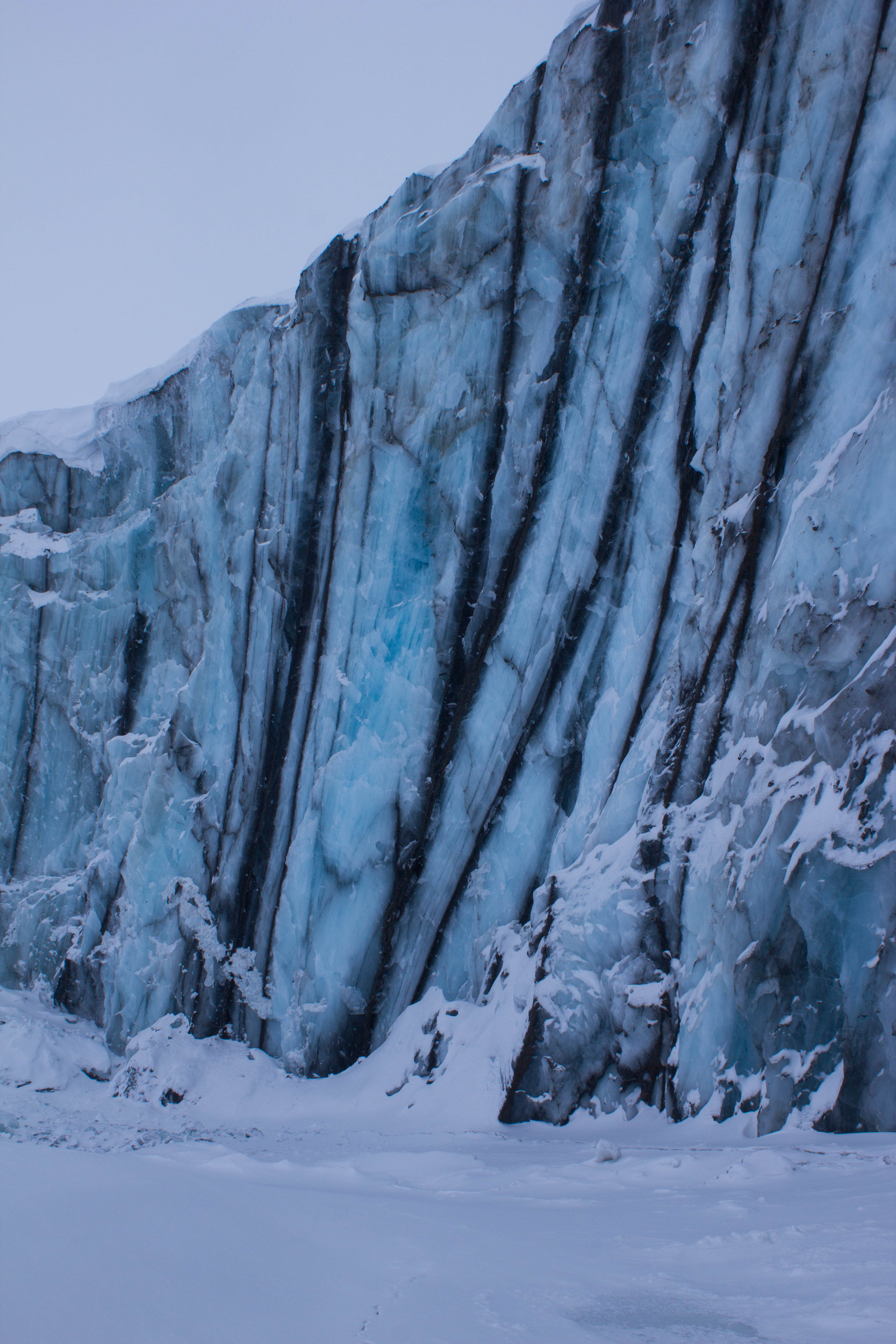
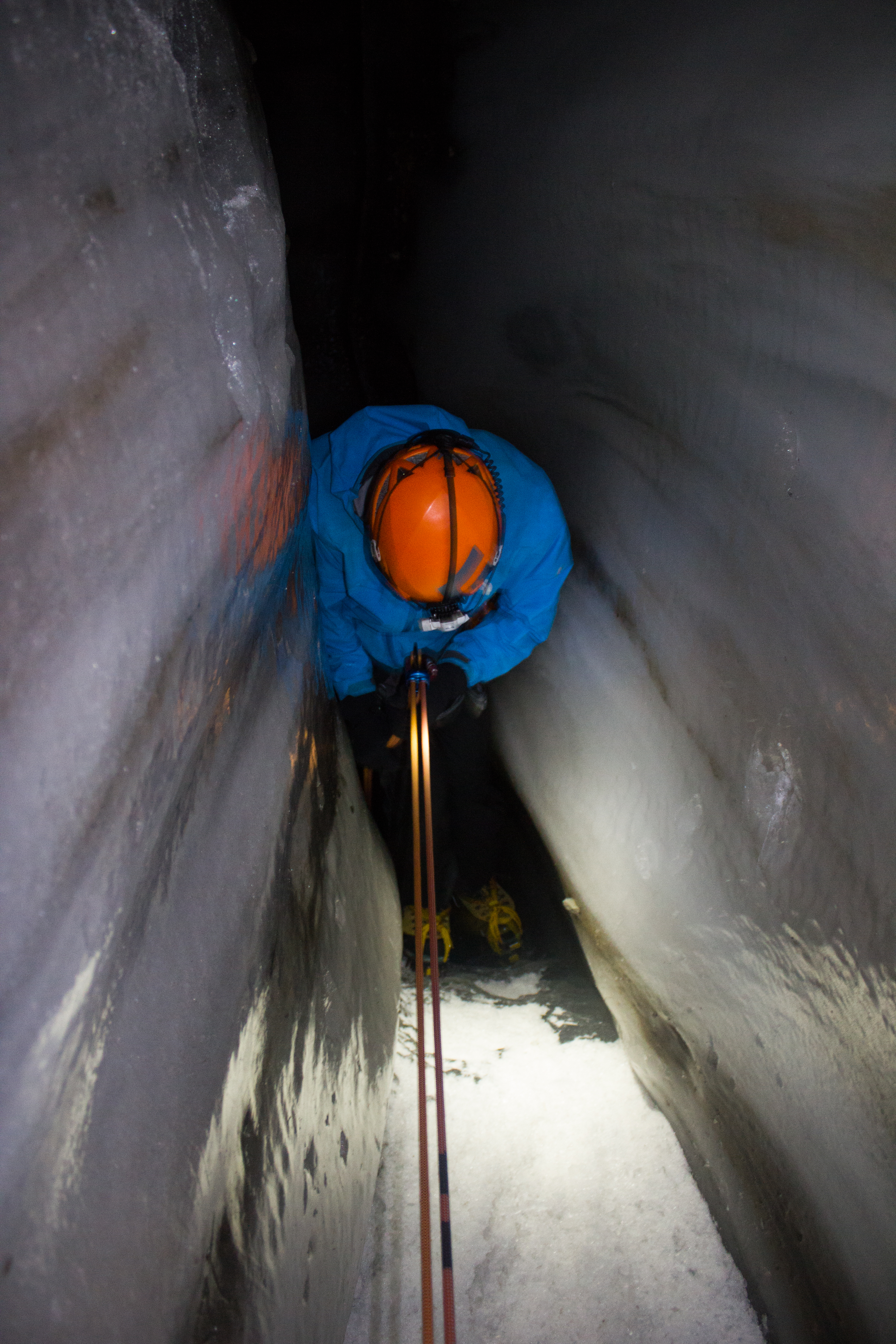
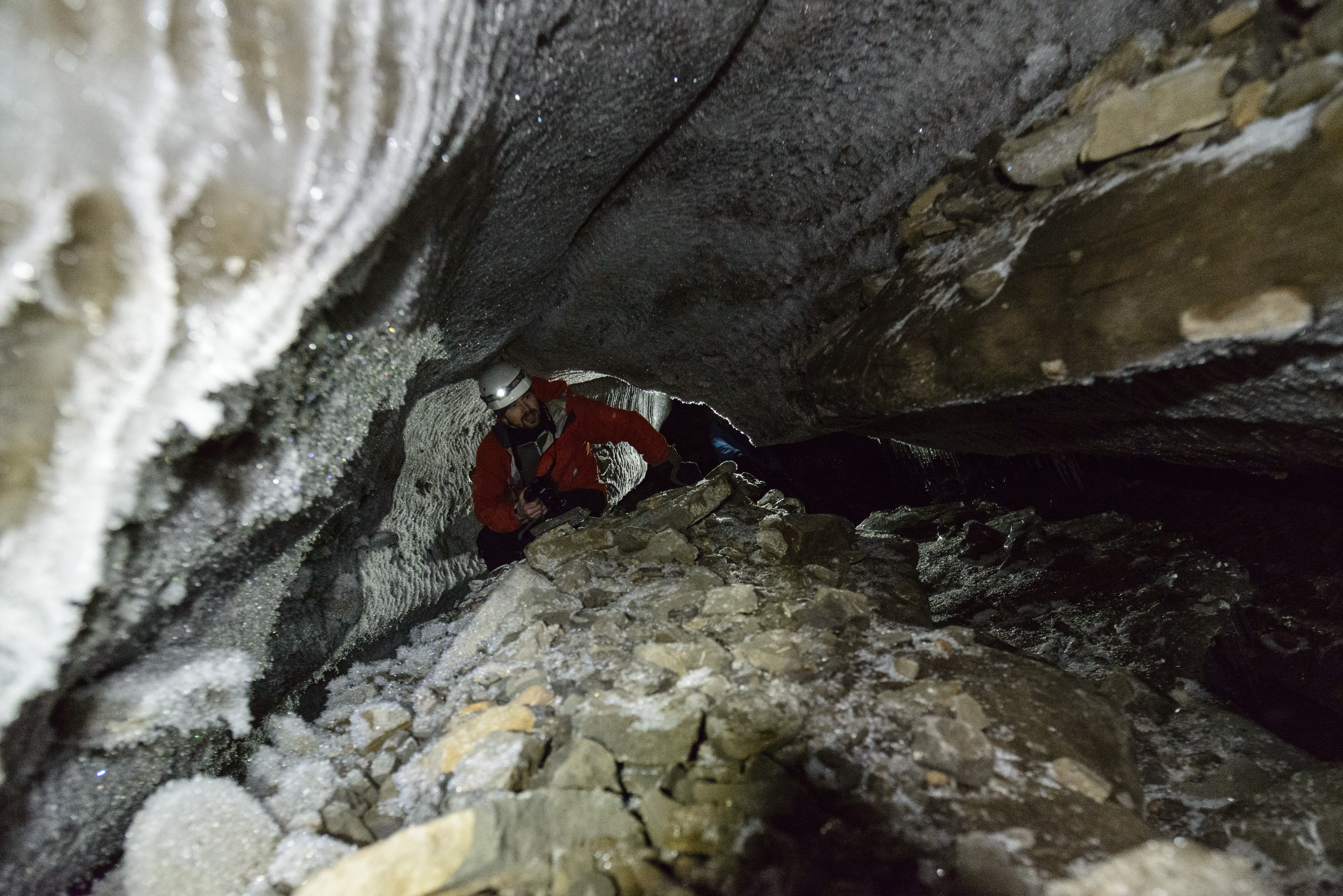
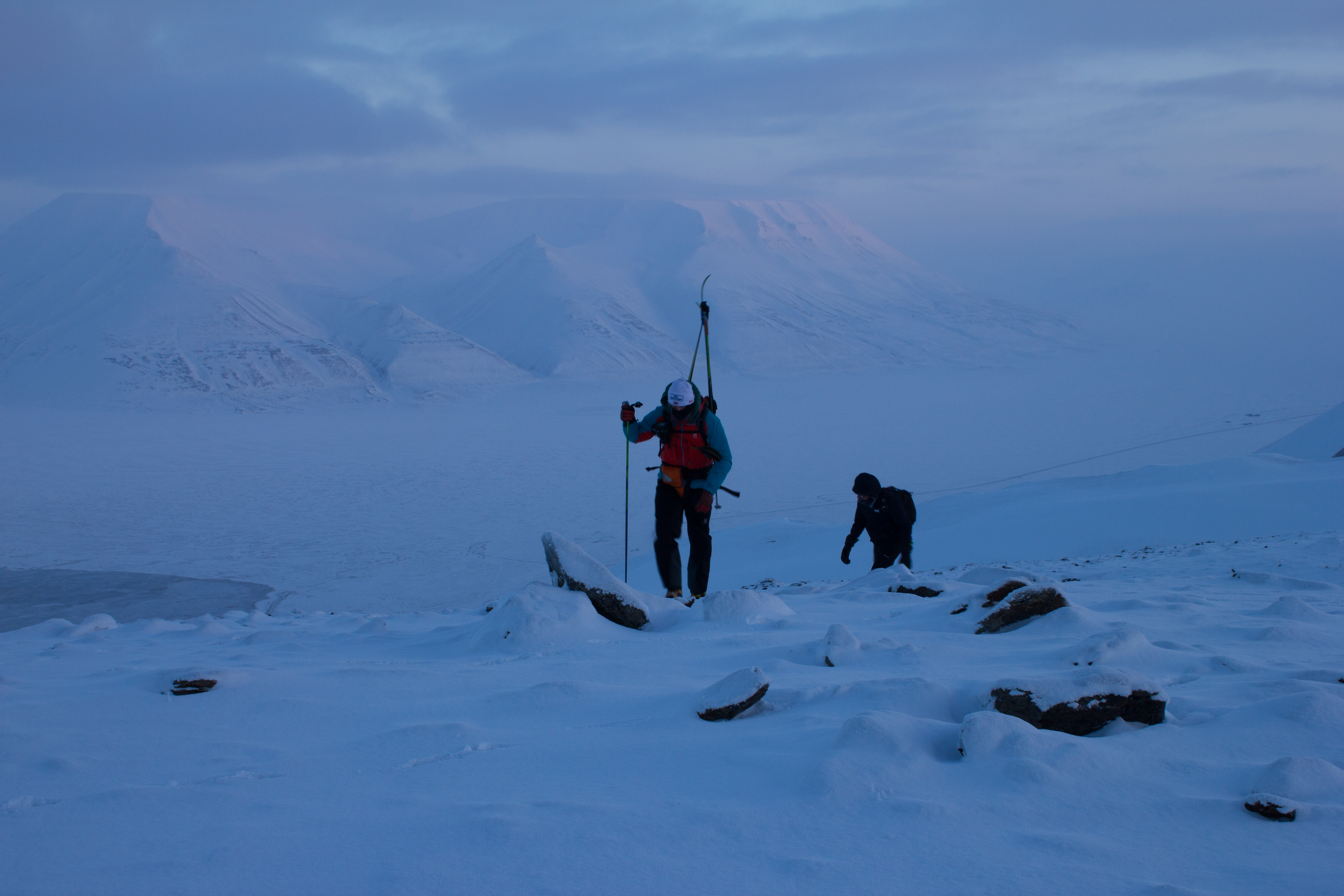
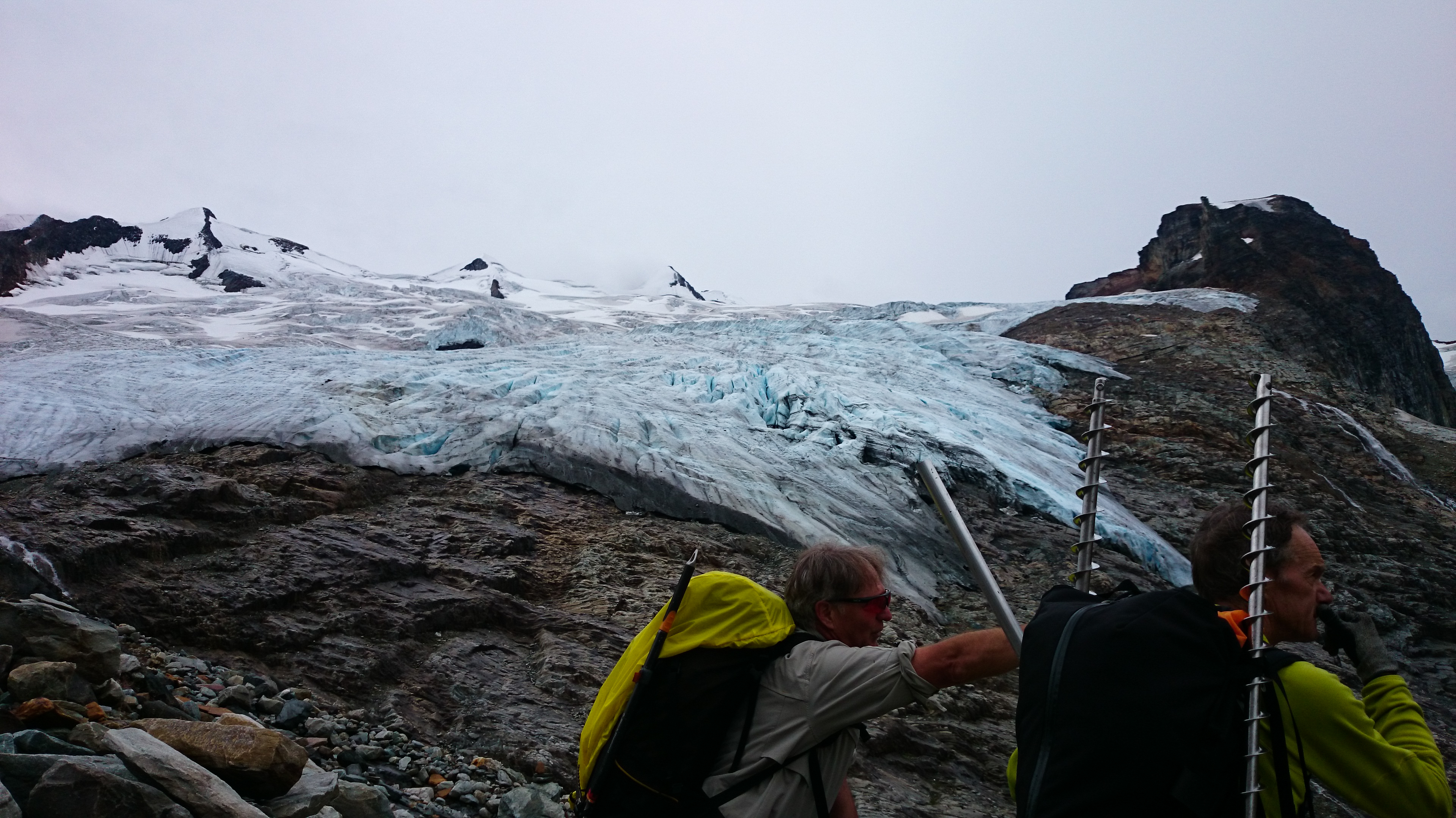
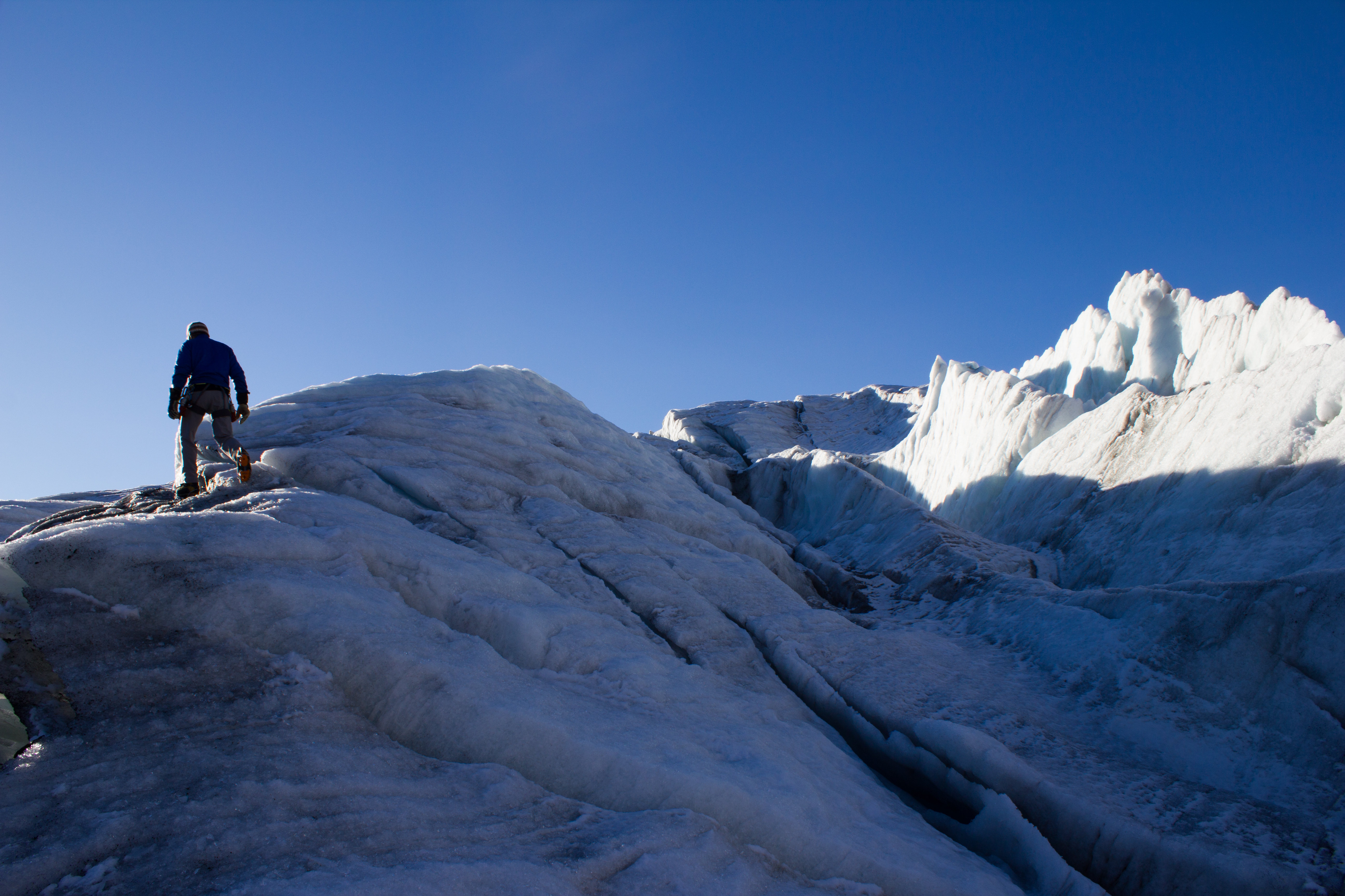
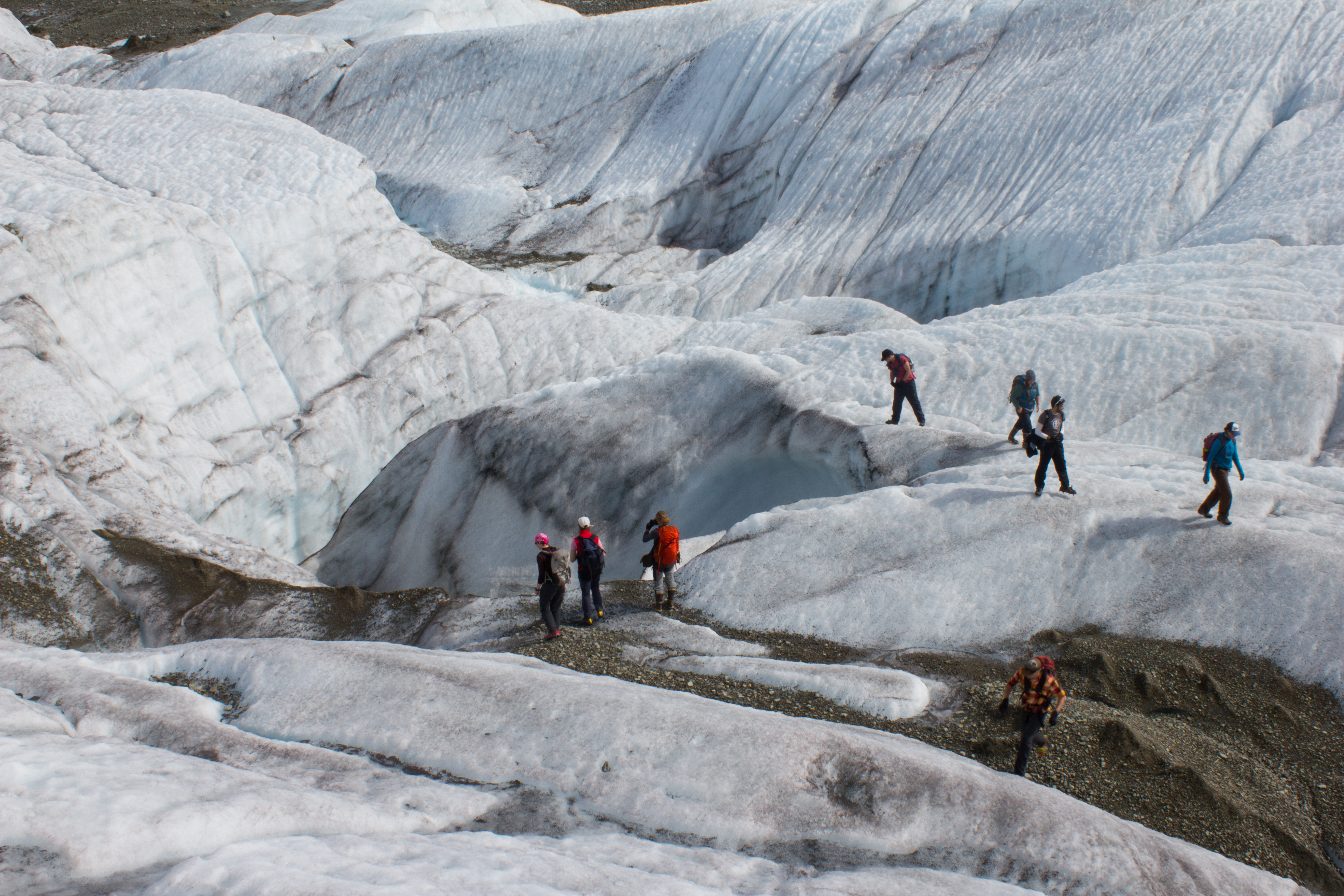
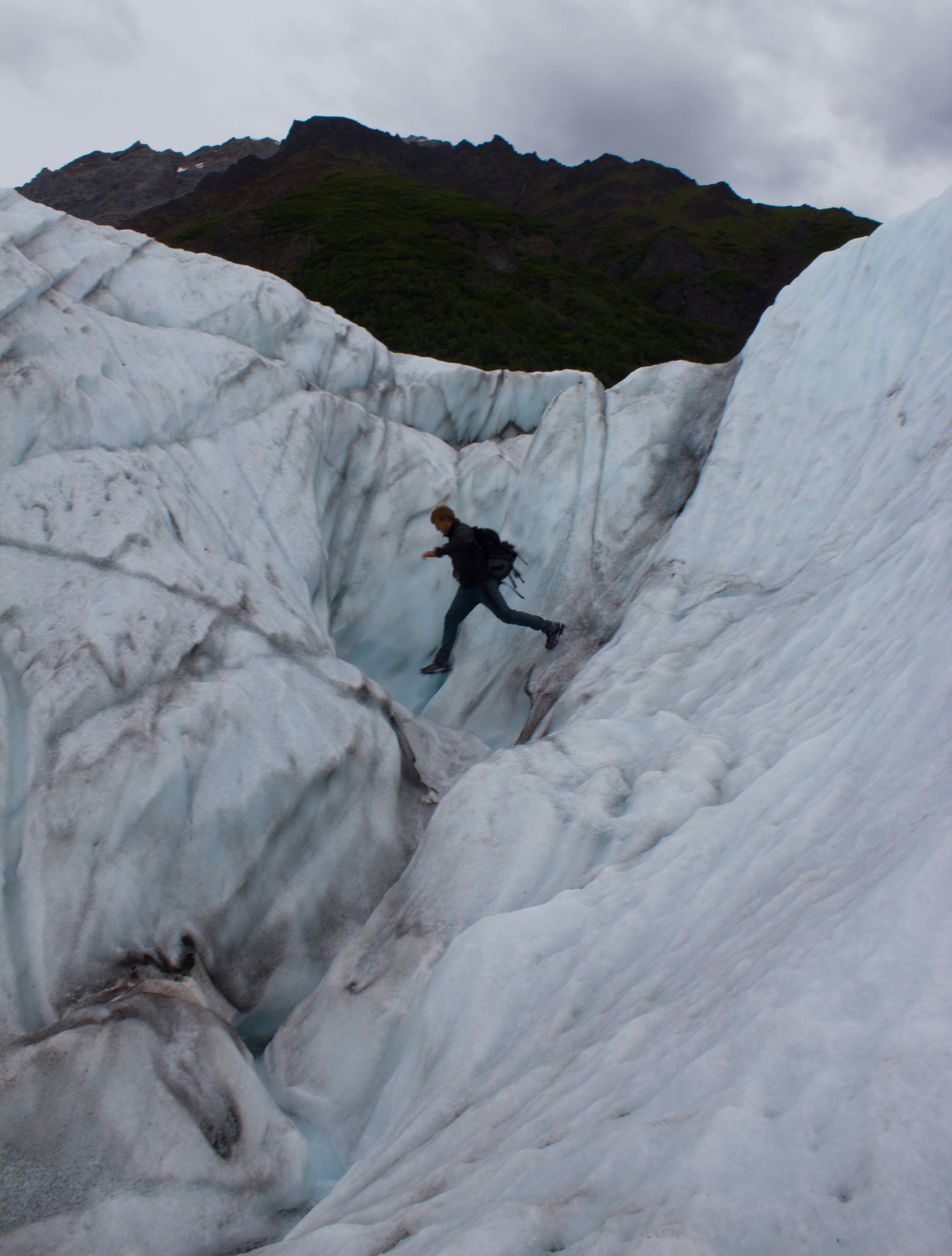
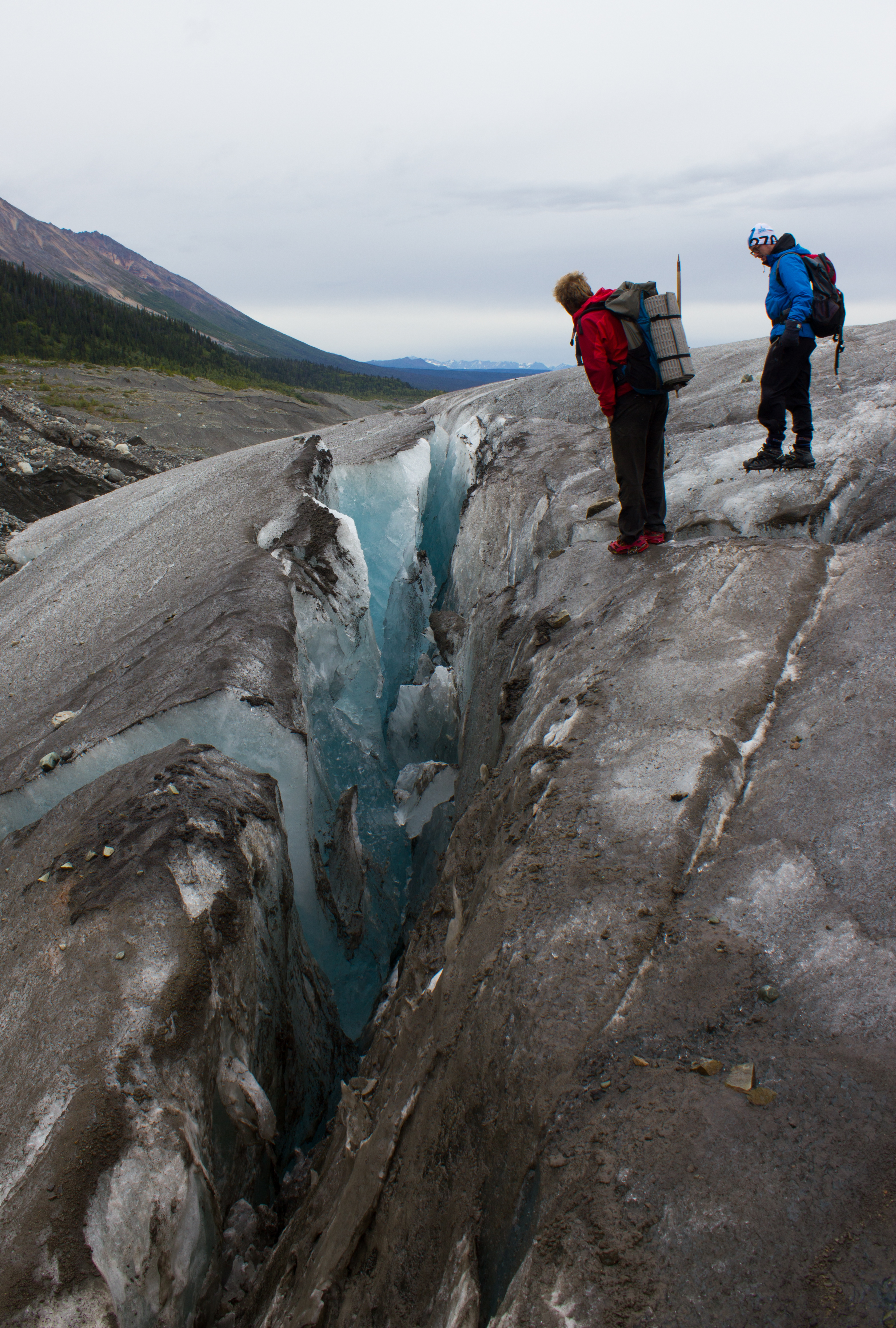
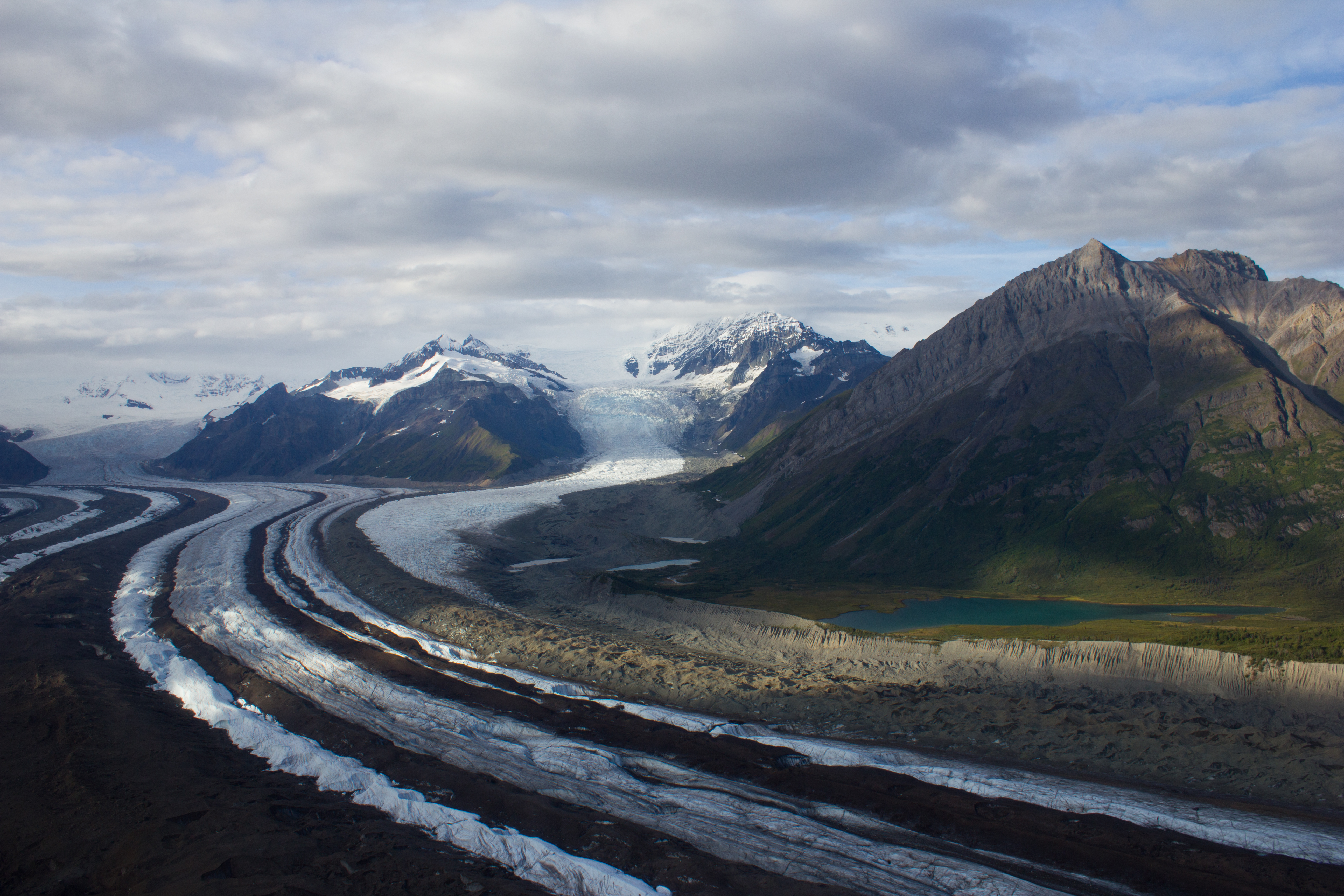
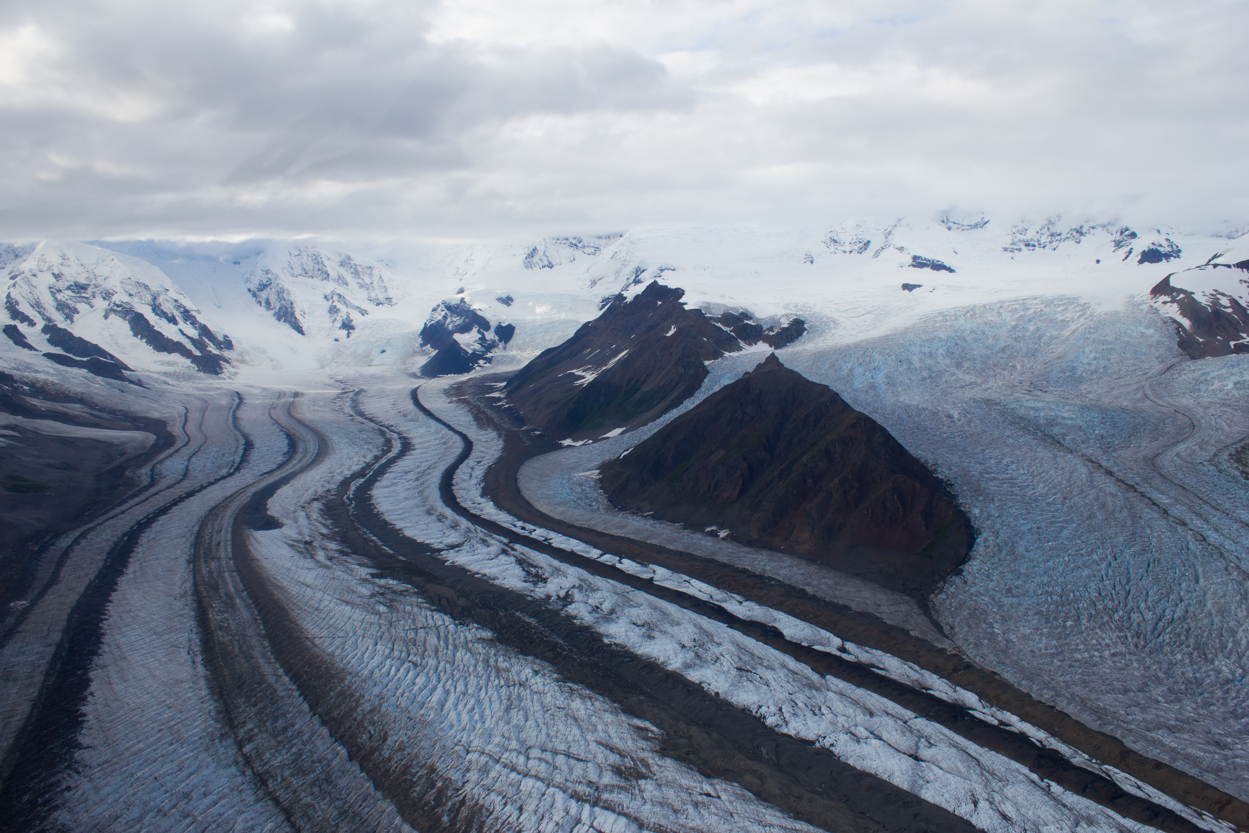
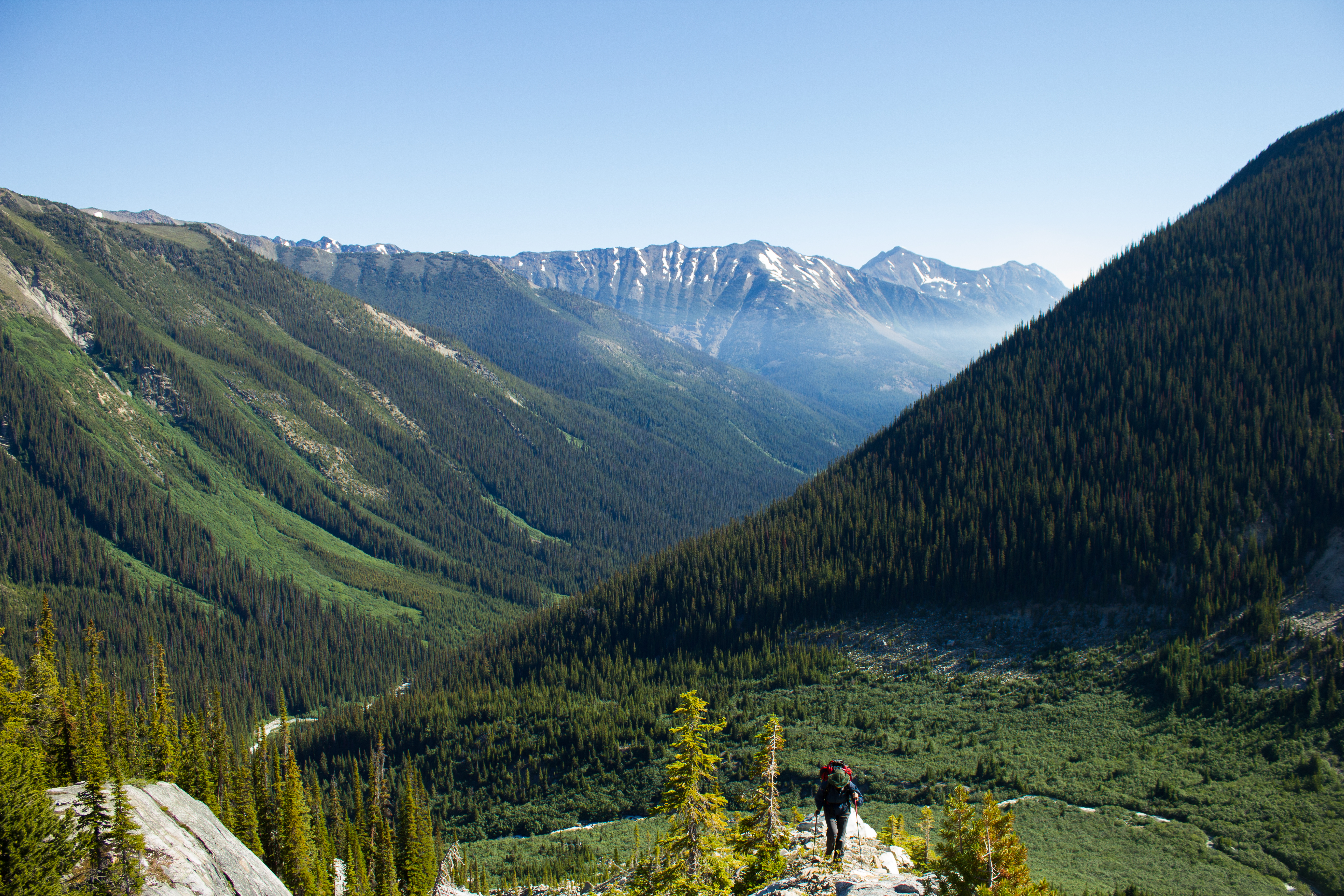
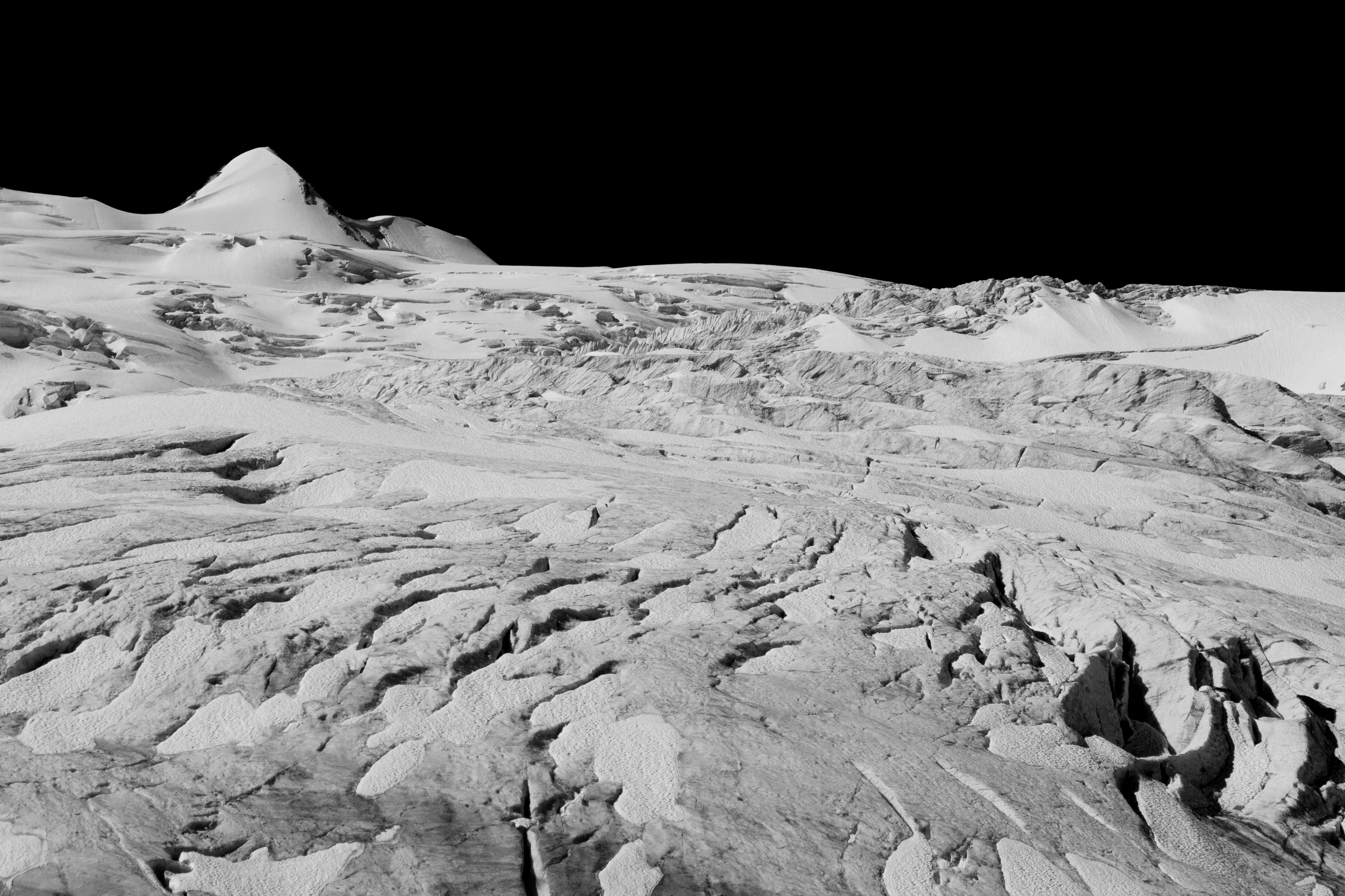
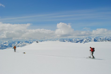
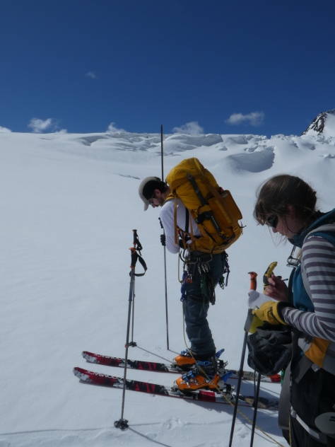
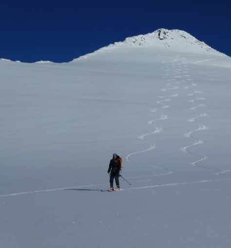
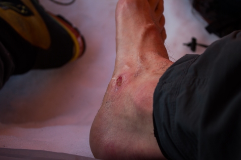
Day two saw the beginning of our radar campaign. Our objective was to ascend to the upper plateau of Conrad, taking measurements along the way. The GPR system consists of a transmitter, and a receiver, each mounted on skis, with antenna extending out in between. The transmitter sends out a pulse of energy that passes down through the ice, and reflects off the bedrock underneath. The reflected energy is detected by the receiver, and the time taken by the pulse to travel to the bed and back tells us how thick the ice is. That’s the theory. The practical involves hauling this system over large swaths of the glacier, up steep slopes and icefalls, and around crevasses, trying to keep the system in line as much as possible. The relatively mild temperatures and strong sunshine made the hauling difficult, with the sleds prone to digging into the soft snow and tipping over. Despite this, we managed to cover significant ground with the radar, completing day trips of over 20km in some cases. Descending with the GPR was always an interesting experience, generally completed at the end of the day when we were returning to camp with already tired legs. We needed to act as brakes to stop the system from torpedoing down the mountain, requiring us to snowplow in our skis for kilometers downhill at a time, quad muscles screaming.


cg_spring_2016_gpr_tow_1
Ascending Conrad towards the upper icefall, with the GPR in tow.


DSC_6249
Myself and Ben hauling the GPR across the stunning upper plateau of Conrad (Pic: Jill Pelto).


cg_spring_2016_Wolverine_tracks
Shared slopes. We came across these wolverine tracks in the snow at 2,900m.


cg_spring_2016_mountain_cloud_ski_tracks
Cloud streams across the faces of the surrounding peaks.


P1000503
Probing the snow depth as we moved up the glacier (Pic: Ben Pelto).


cg_spring_2016_ben_jill_gpr_distant
Completing a GPR survey on the glacier close to camp.


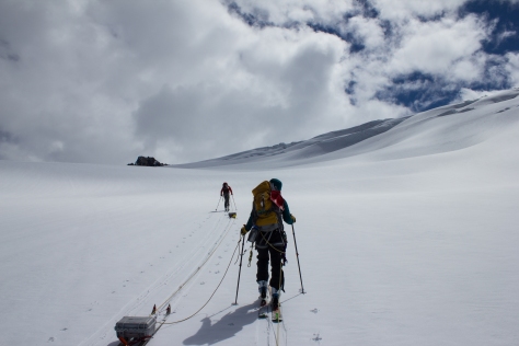
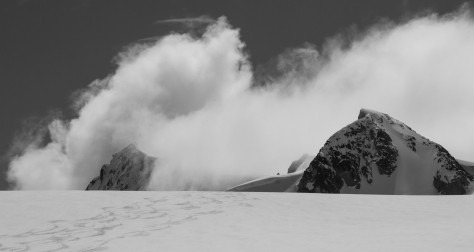
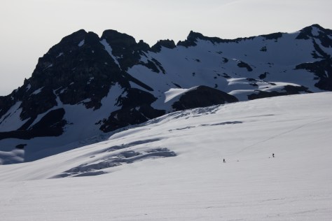
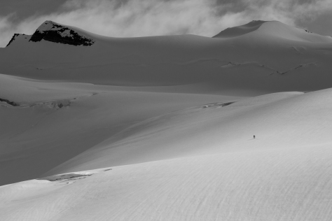
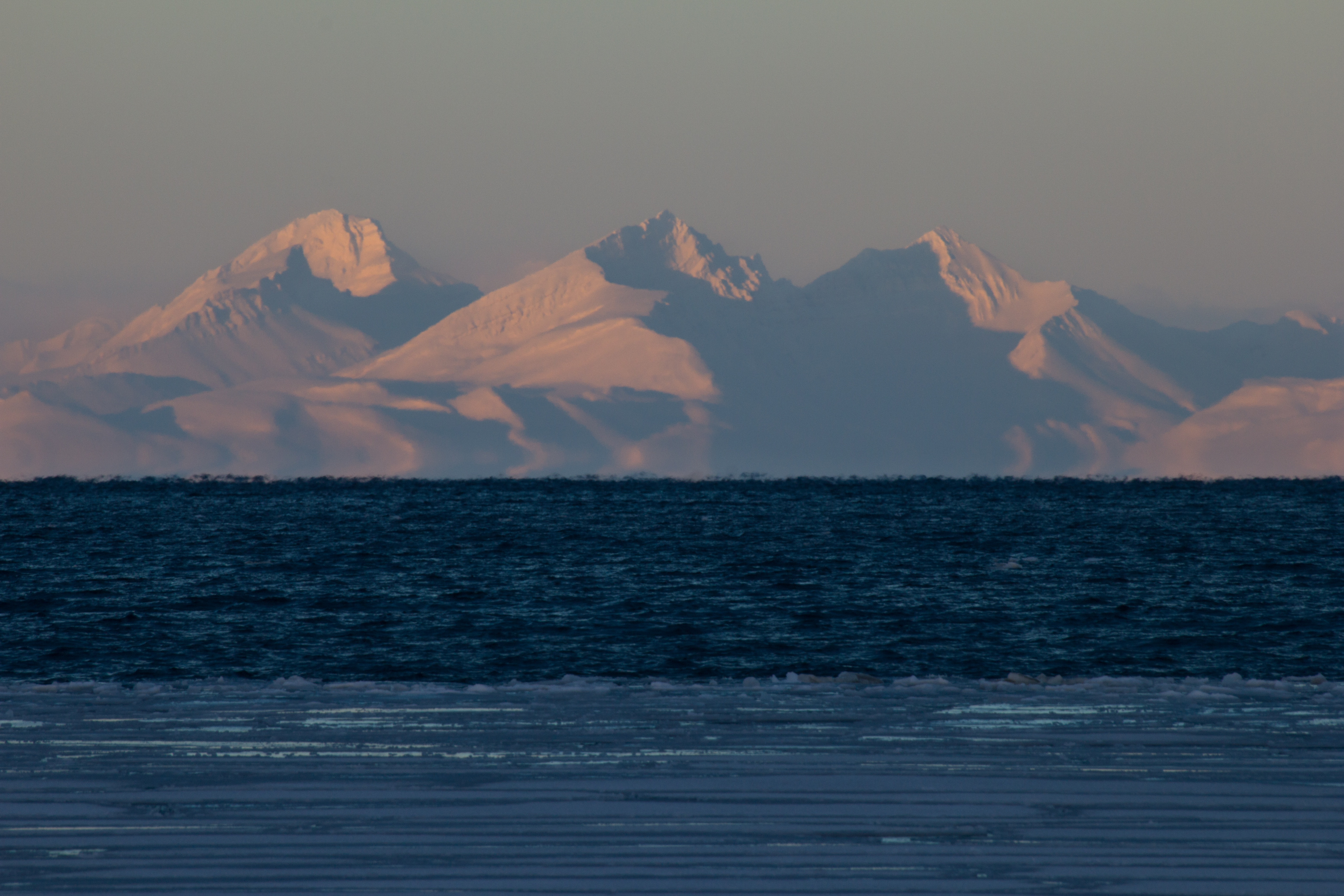
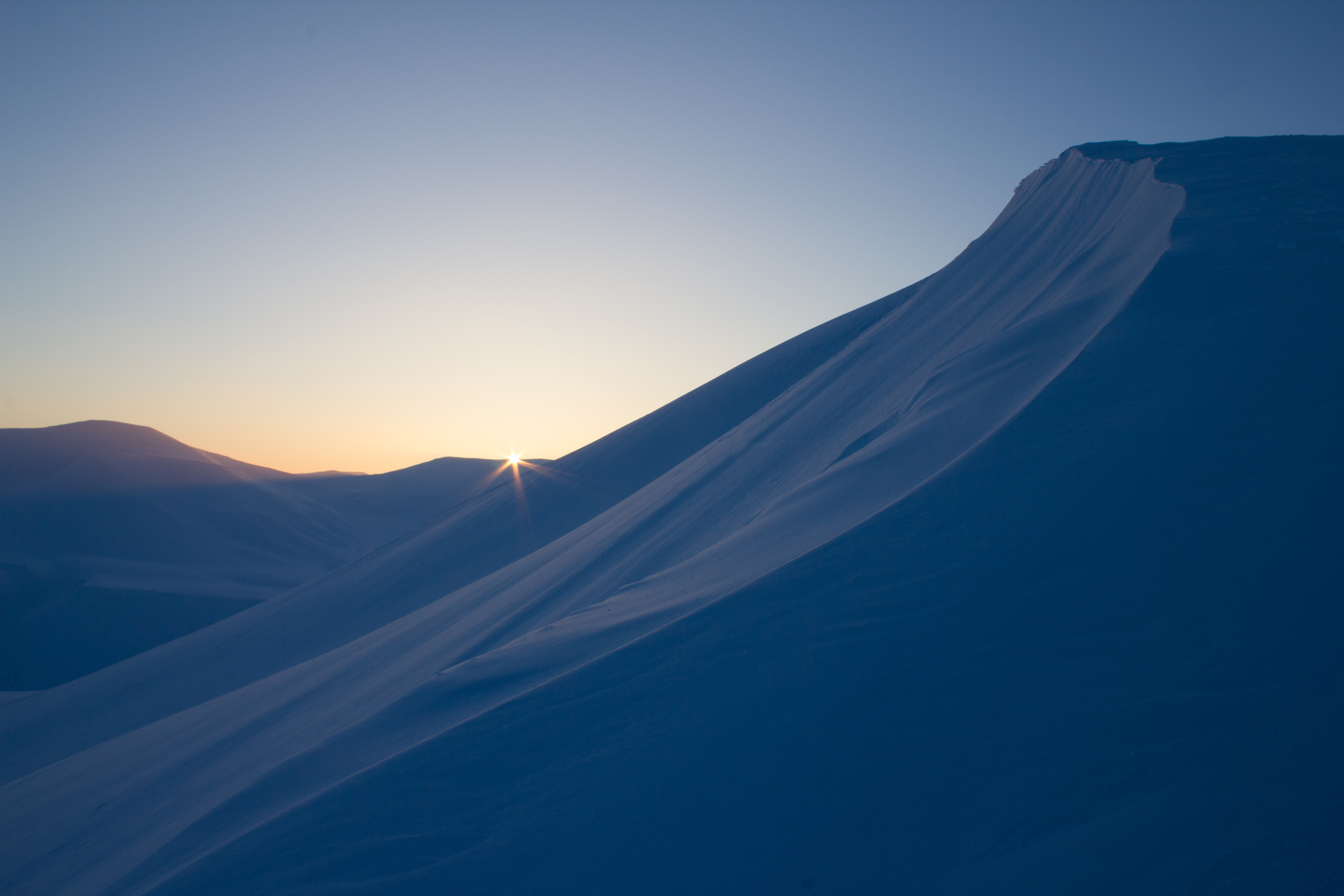
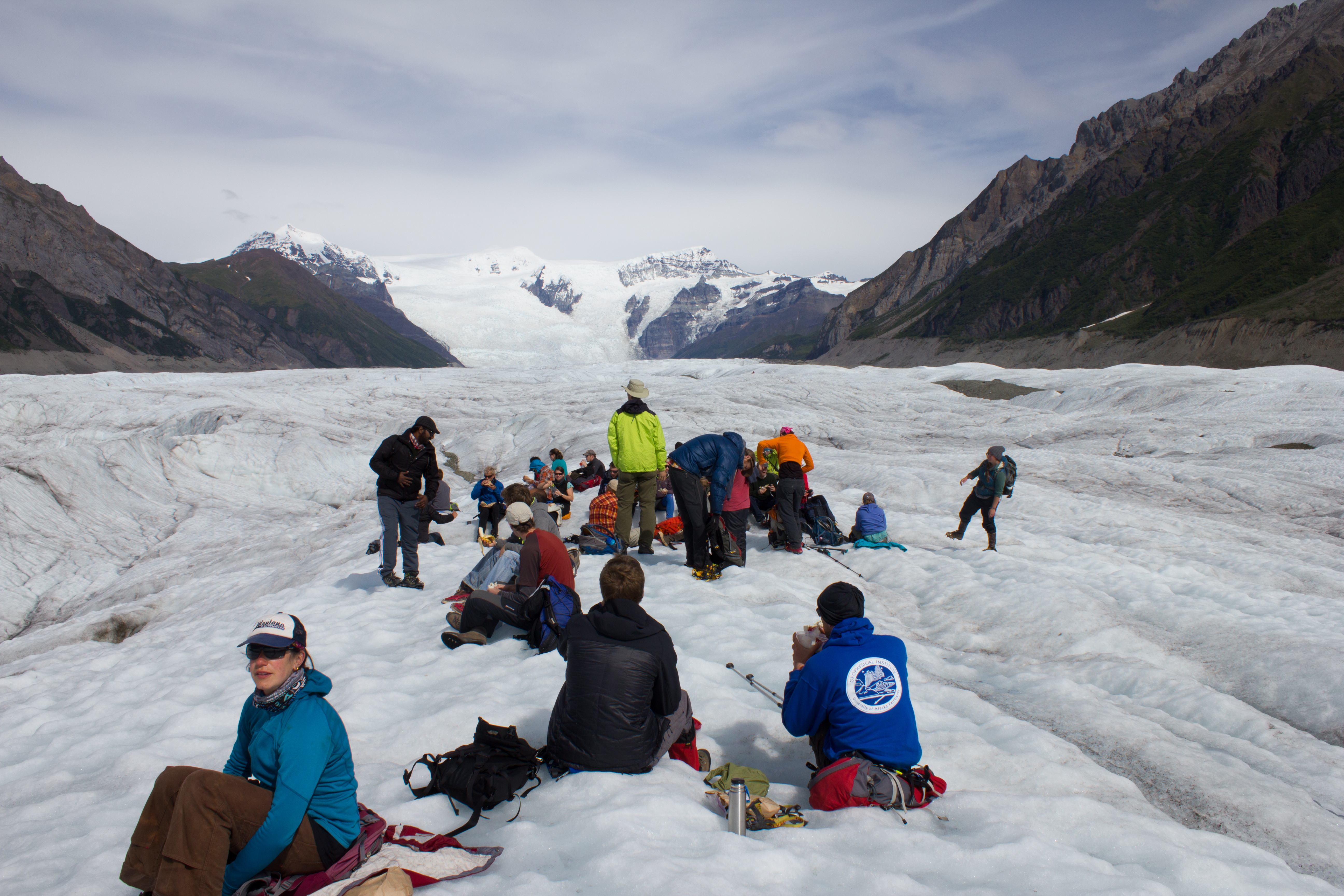
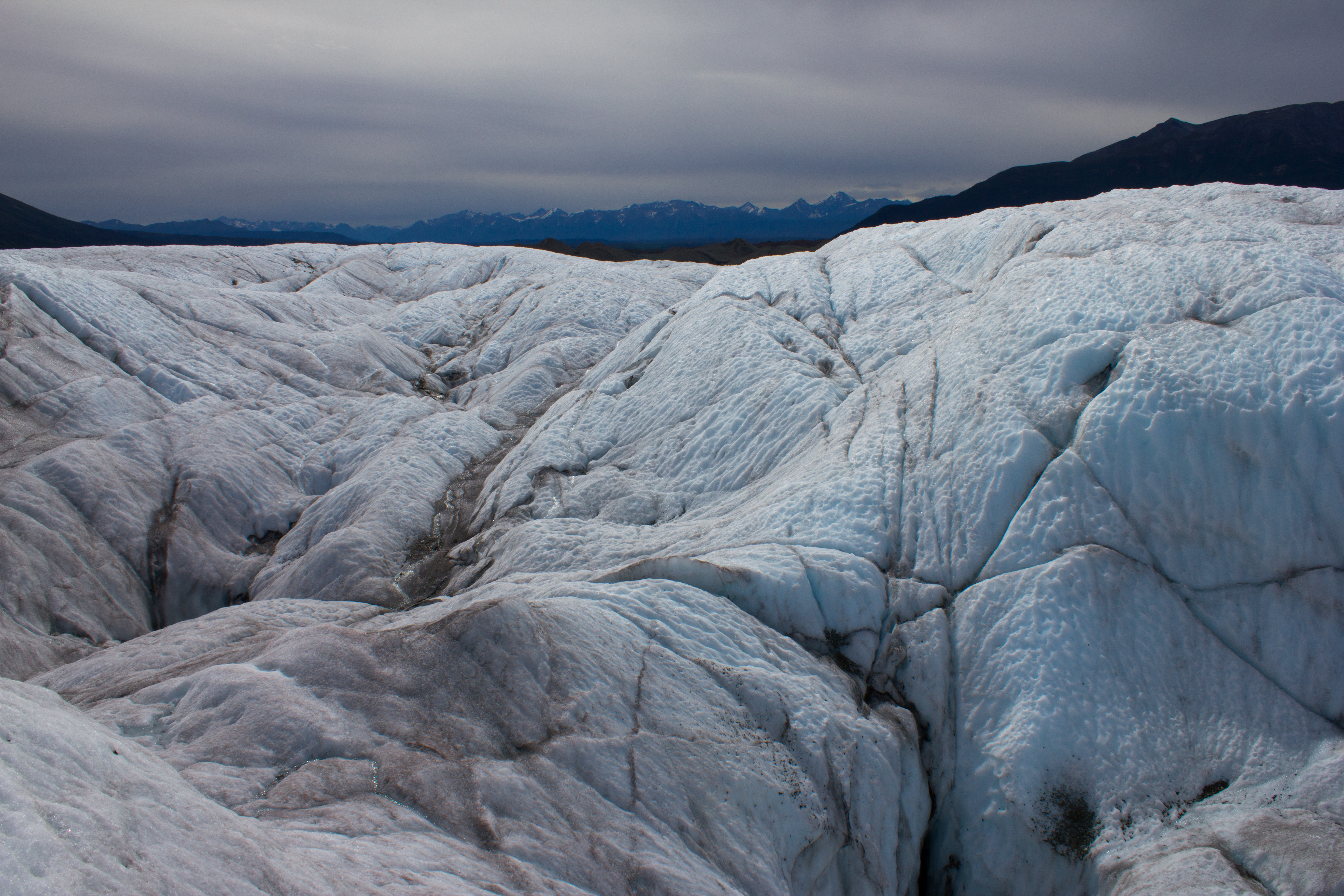
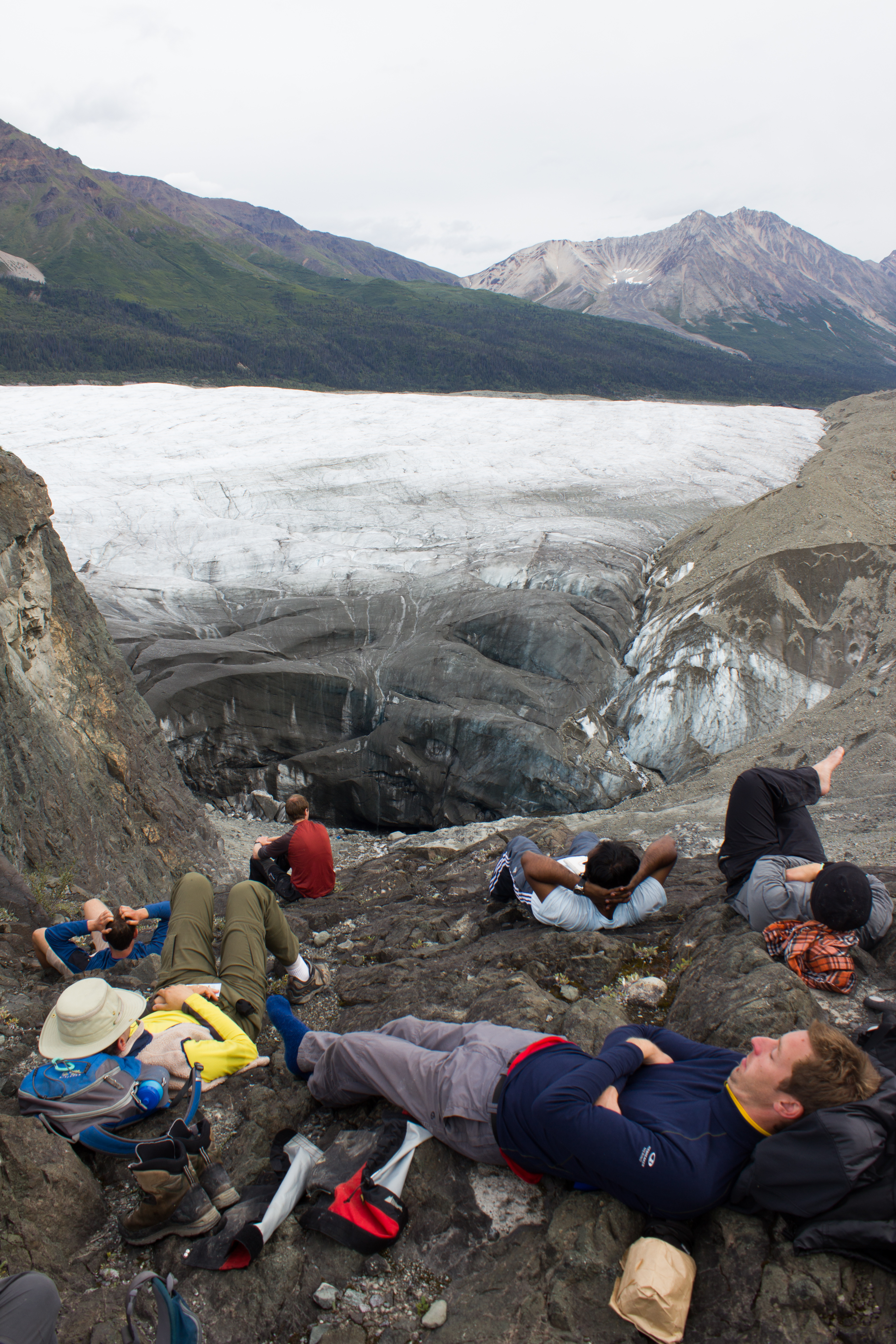
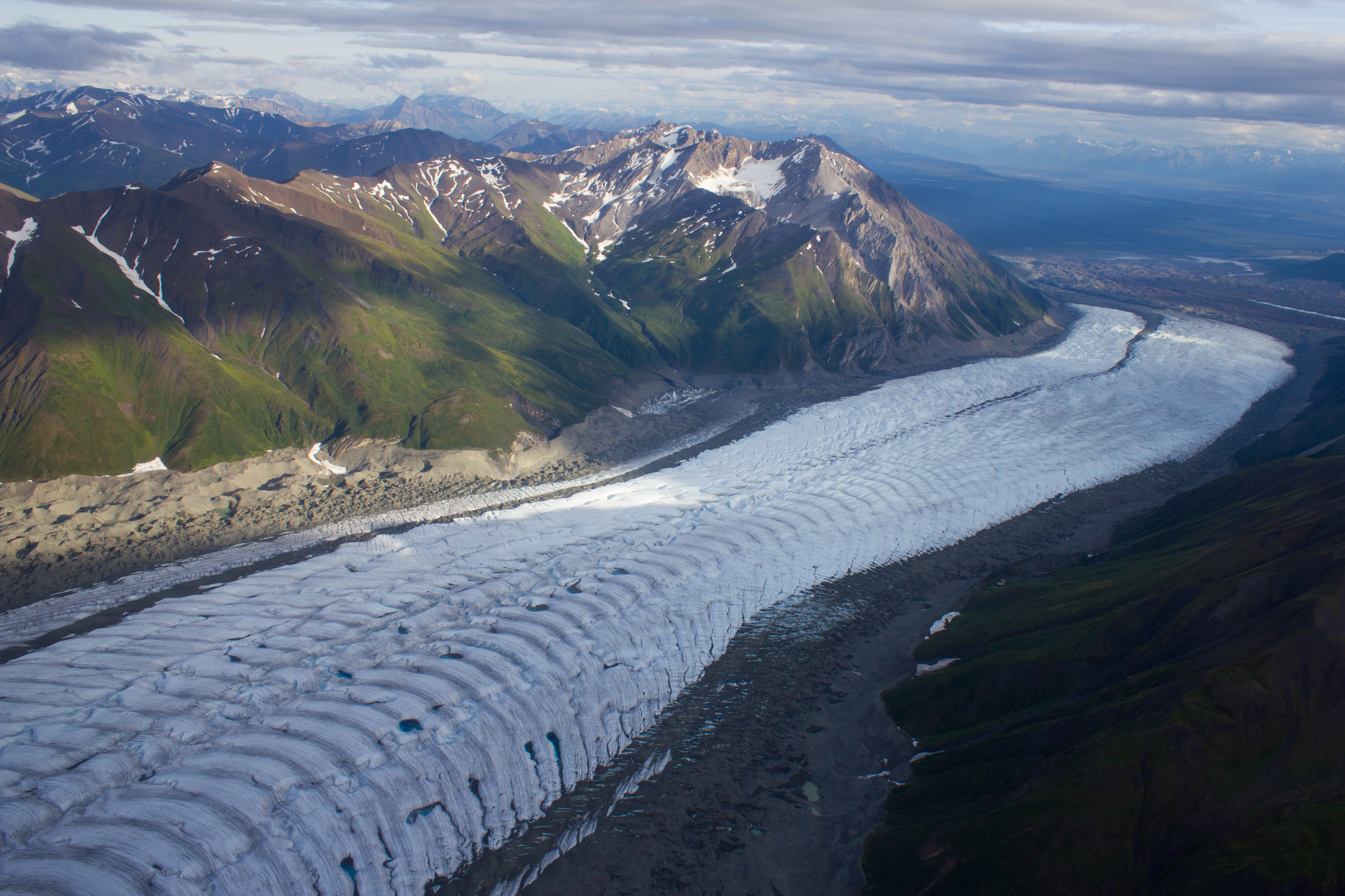
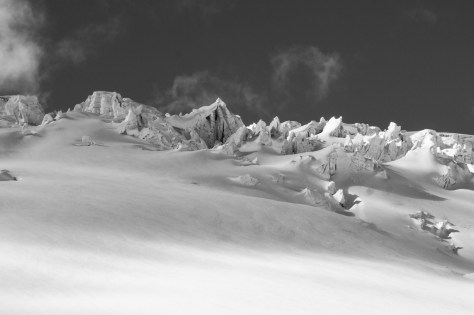
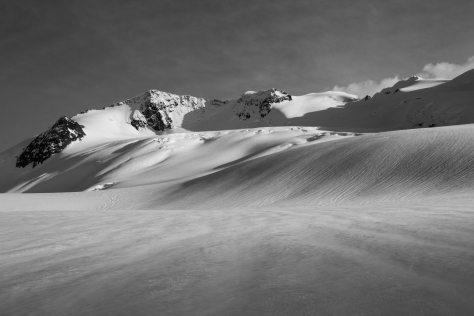
Our days on the glacier continued with combined snow depth/density measurements and GPR surveys. Working on the upper plateau of Conrad, the expanse of mountainous terrain around us was astounding. On every degree of the compass, snow covered peaks jostled for space on the horizon, like some jagged, storm blown ocean. A thought that keeps returning to me when working in these places, is what a privilege it is to be afforded such isolation and space in what is an increasingly crowded world. No traffic, sirens, voices, bleeping phones, or engines (apart from the occasional helicopter). To have access to the culture and community that living in a society provides is a great thing, but I am grateful for these opportunities to exist in solitude with nothing but survival and science to drive us on.

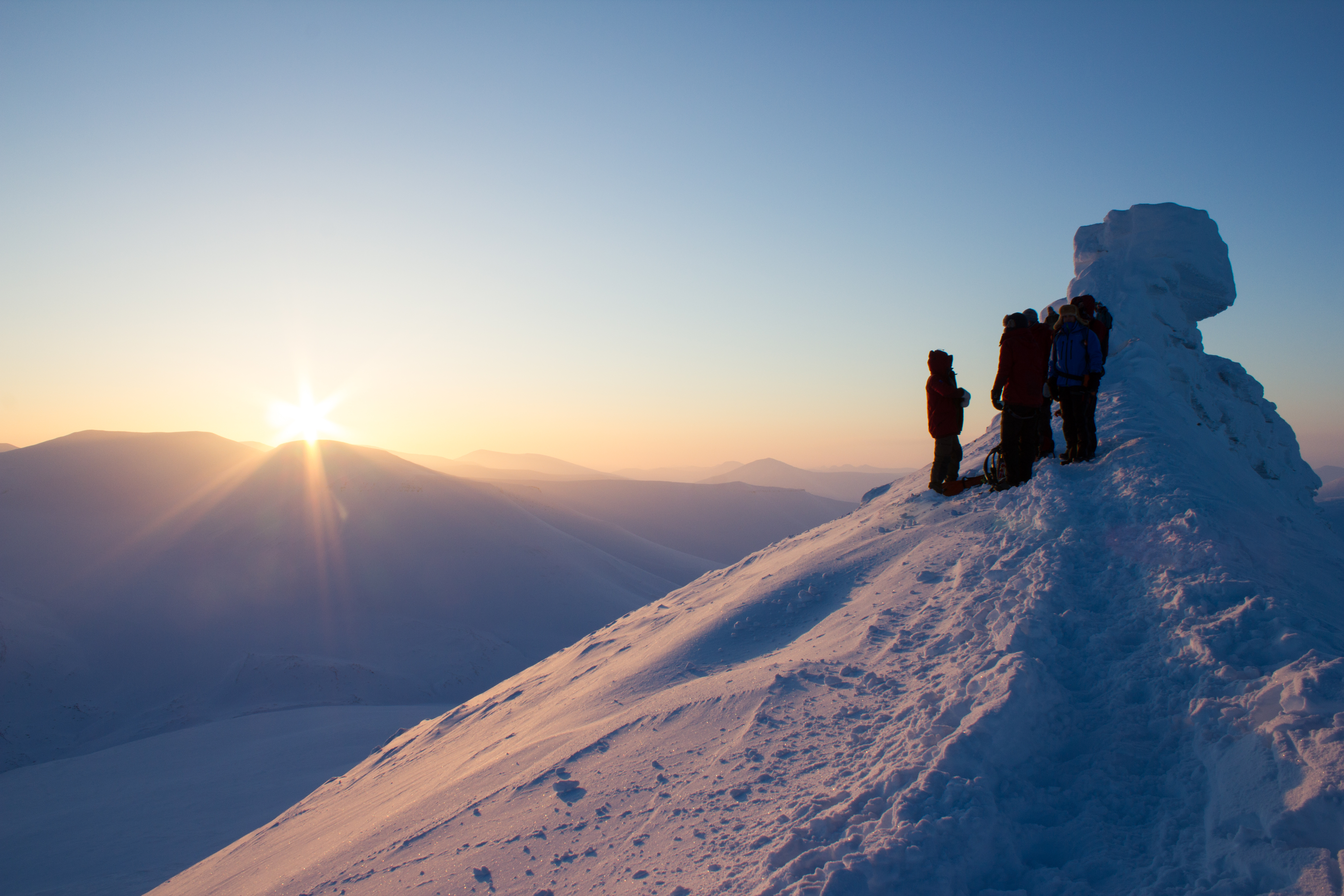
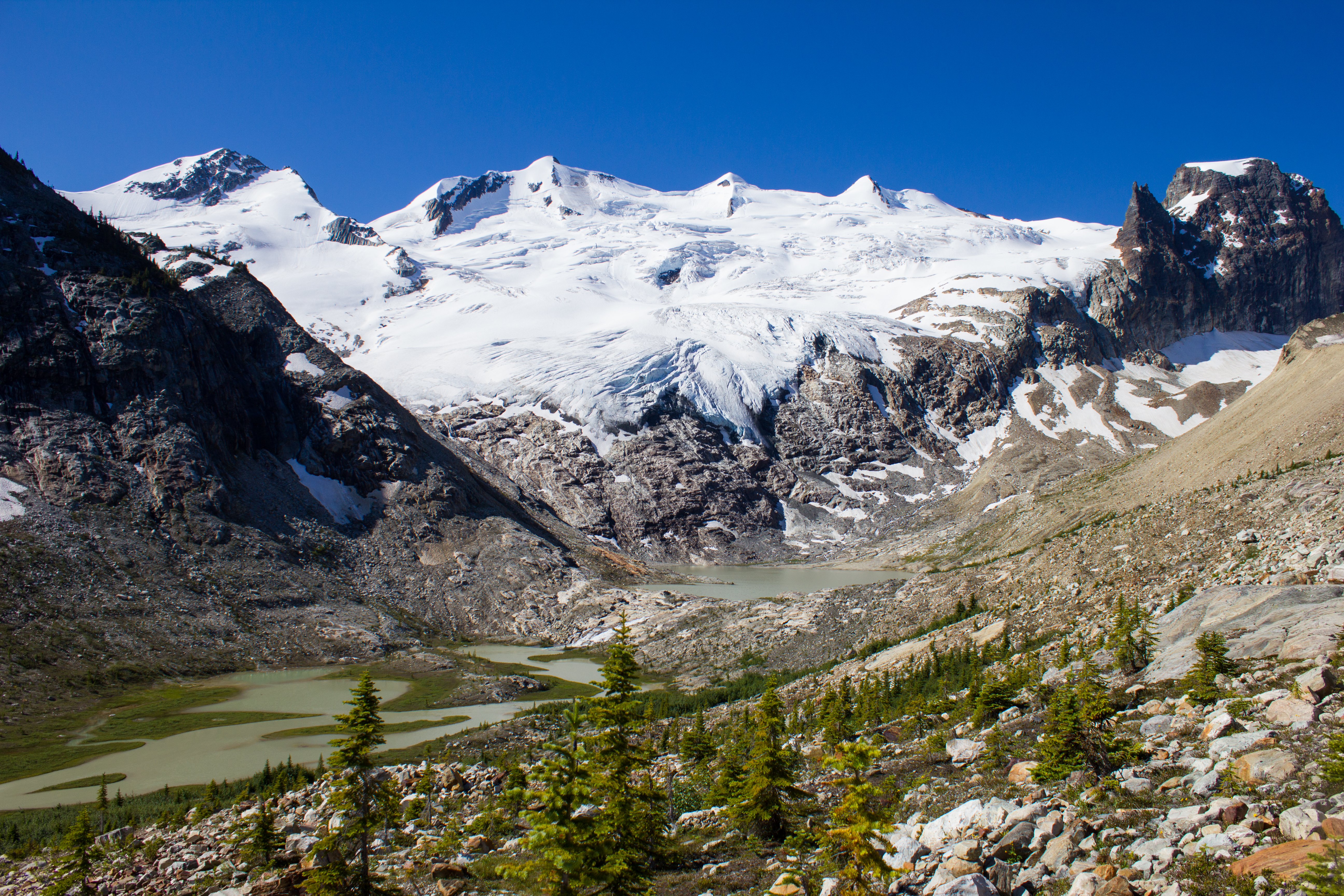
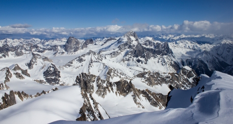
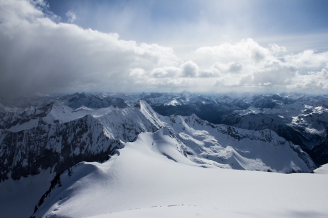
On one of our last days on the upper section of the glacier, we continued to record snow depth values to well over 3,000m elevation, and decided to push on  to climb the summit of Mount Conrad; the peak which had loomed over us as we worked. We ascended on skies to within 50m or so of the 3,290 summit, before shedding our gear and scrambling the rock and snow of the final section. We climbed in beautiful weather (as had been the case for most of the trip; very unusual for Conrad), and our view from the summit was unimpeded in all directions. Turning from the summit, my thoughts were now fully occupied by the ski descent necessary to get off the mountain. The conversation I had had with Ben in January regarding my ski experience was echoing in my head as I clipped into my skis, and double checked my bindings. This was steep for me, but hesitating or leaning back would be the wrong option. I watched Ben and Jill drop in, took a solid breath, and followed.


cg_spring_2016_Mt_Conrad_summit_Ben_skis
Ben, checking some gear, on the ascent of Mount Conrad.


cg_spring_2016_Mt_Conrad_summit_view_bugs
On the summit, looking south into Bugaboo Provincial Park; a climbing mecca I had visited a year previously.


cg_spring_2016_conrad_summit_1
My view from the top, prior to our ski descent.


noel_conrad_ski_descent
On a very fun section of the descent back to camp. The beautifully symmetrical ski tracks are not mine (Pic: Ben Pelto).


cg_spring_2016_Icefall_bw
Below the tumbled walls of one of the icefalls we passed through on the return to camp.


cg_spring_2016_peak_long_shadows_1_bw
Light from a low sun highlights the textures of the glacier.


cg_spring_2016_tent_morning_noel
Back at camp after another rewarding day.


cg_spring_2016_blister
Ski boots that aren’t your own can be unforgiving on long touring days, but it was little to complain about.


cg_spring_2016_night_looking_north
Looking north down the valley as the day ends.


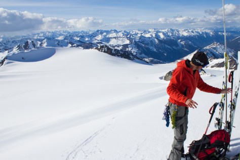
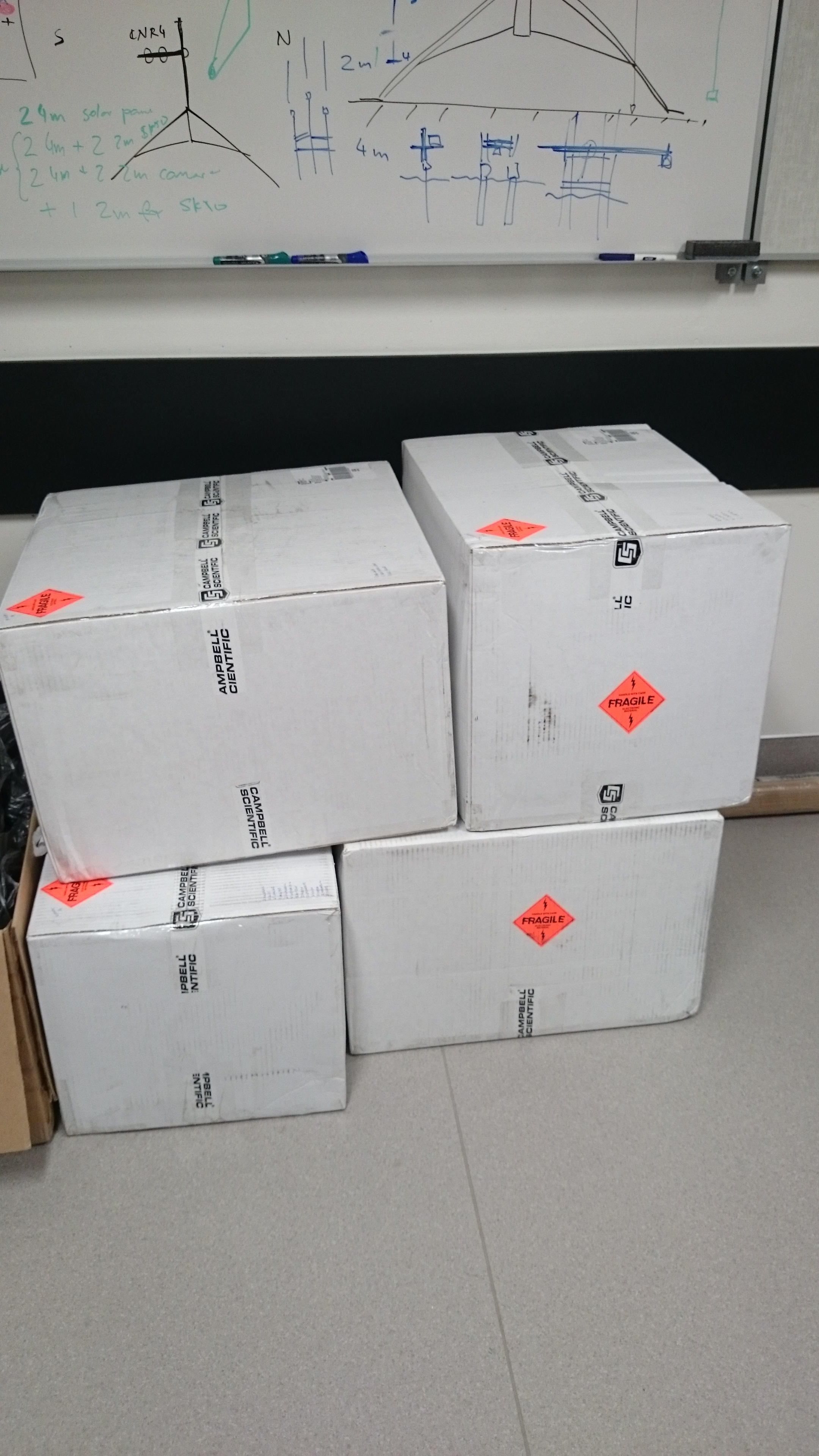
Our spring visit to Conrad had been very successful, with a wealth of snow and ice thickness data recorded over much of the glacier. Throughout our travels , I had been scouting for potential sites for installing the weather stations in the summer; just two short months away. One would be deployed in a similar location to last year; lower on the glacier in the ablation zone (the area on a glacier where more ice/snow is lost than gained from year to year). The other would be a more ambitious venture. The upper plateau at 3,000m would provide a unique and intriguing location to gain information on the glacier’s weather and melt relationships. It would also present a much harsher environment to operate in. Would we get a decent enough weather window to allow us to install the equipment (several days work), and if so, could the system withstand a season in tough and, as of yet, untested conditions? We would find out soon enough.


cg_spring_2016_mountain_moon
The moon sets behind Conrad as another day begins.


cg_spring_2016_Ben_distant_2
‘What are men to rocks and mountains’? Ascending a western branch of the glacier.


Svalbard Part 6: Stories in the Ice

“There is no such thing as ‘just’ ice.” Not to a glaciologist anyway.

Professor Doug Benn is recounting to us his reply to a reviewer who questioned his use of the term ‘refrozen water ice’. While this may sound superfluous, the many variations in density, temperature, content, layering, and colour of glacier ice can tell us a lot about its history, and potentially, about it’s future.


Svalbard_gpr_3
Prepping the Ground penetrating radar (GPR) on Longyearbreen. GPR is used in glaciology to look at the thickness and structure of a glacier. The GPR is towed across the surface, emitting pulses of energy which pass through the ice. These pulses bounce of the rock underneath the glacier, and are reflected back to the GPR, like an echo when you shout in a valley. The time it takes for this echo to travel back to the GPR tells us how far it has travelled, and hence, how thick the ice is. GPR can also be used to see if there are regions in the glacier that are ‘warm’ i.e. at its melting point, by reflecting off liquid water. The presence of these warm sections in a glacier can tell us about the glacier’s present and past; how it moves, how it used to move, and how its behaviour has changed with time.


Svalbard_larsbreen_exposures_5
Examining the internal layering and structure of the ice on Larsbreen.

Svalbard_larsbreen_exposures_6

Svalbard_larsbreen_exposures_2


Svalbard_larsbreen_exposures_3
The network of tunnels visible here are formed by the movement of air bubbles in between ice crystals as freezing takes place.


Svalbard_Tunabreen_ship_bw
A ship frozen in the sea ice, on the way to Tunabreen


Svalbard_Tunabreen_11
Arriving at the calving front of Tunabreen. Calving is the processes by which chunks of ice break off at the end or ‘terminus’ of a glacier, forming icebergs. We were there during winter, when the sea was frozen. The sea ice acts as a temporary barrier to the glacier, slowing its forward movement, and preventing calving.


Svalbard_Tunabreen_Calving_front_Nick
Tunabreen is a surge type glacier, meaning that its rate of flow or speed is not constant. Instead, the glacier may move very slowly or remain still for several years, before going through a period of faster flow, known as a surge.


Svalbard_Tunabreen_Glacier_Prayer
A glacier prayer


Svalbard_Tunabreen_27

Svalbard_Tunabreen_34
Departing Tunabreen


Svalbard_Paulabreen_13
Surge front of Paulabreen


Svalbard_Paulabreen_12
The dark banding visible at the front of Paulabreen is evidence of its surging past. When the glacier was flowing more rapidly, large crevasses (cracks) opened up at the surface and spread downwards. Debris and dust fell into these cracks, and when the crevasses closed again as the glacier flow changed, dark vertical bands of debris mark their former location.


Svalbard_Paulabreen_Aurora


Svalbard_Paulabreen_24

Svalbard_Paulabreen_25

DSC_1255
Better to light a candle: an arctic storm led to a power cut on the night before the final exam, leading to some creative lighting.


Svalbard_snowy_window
Morning view after an overnight snow storm


Svalbard_Trollsteinen2_Conrad
One last venture into the mountains before leaving the Arctic.


Svalbard_Trollsteinen2_Tom_ridge_ascent
Summit ridge of Trollsteinen


Svalbard_Trollsteinen2_TJ_summit_descent


Svalbard_Departure_flight_aurora2
Parting gift from Svalbard: dancing aurora on the flight south to Oslo


Svalbard_Departure_flight_Tom_sleep
Glaciology PhDs: amazing experiences, zero glamour. Overnighting at Oslo Airport.


Svalbard_Departure_flight_Greenland_west1
Flying over the enormous glaciers on the west coast of Greenland on my way back to Vancouver, and getting re-inspired for the next adventure.

Svalbard_Departure_flight_Greenland_iceberg

Svalbard Part 5: The beauty of the North

Some shots from a landscape that I hope we can continue to be inspired by. Click on the images to see them in high resolution. They still won’t do the place justice, but it’s a start.


Svalbard_hut_mountains_sunlight
.


Svalbard_Triple_Point
Triple point


Svalbard_larsbreen_exposures_10
Frozen air


Svalbard_larsbreen_ice_exposure_1


Svalbard_Tunabreen_hut_c2


Svalbard_Tunabreen_polar_bear_tracks-2
Polar bear tracks


Svalbard_Tunabreen_12


Svalbard_Tunabreen_29


Svalbard_Paulabreen_9


Svalbard_Paulabreen_10


Svalbard_Tunabreen_30


Svalbard_Tunabreen_21


Svalbard_Paulabreen_8


Svalbard_Paulabreen_18


Svalbard_March7_nightshots_mountains_sea_Aurora


Svalbard_March7_nightshots_mountains_sea

Svalbard Part 4: To the icy core

A glacier is more than an ice cube. Rather than being solid, uniform blocks, glaciers can have incredible variations throughout in terms of structure, temperature, and movement. The surface and the base of a glacier can communicate with each other, and the language of this communication is water.

When ice and snow on the surface of a glacier melts, it can produce a lot of water. Streams of this meltwater flow over the surface of a glacier during the warmer months of the year. These streams can cut or ‘erode’ into the glacier, creating paths or channels which the water flows through. Over time, these channels can cut deeper and deeper into the glacier, their roofs closing over to create tunnels through the ice which can bring the meltwater from the surface all the way down to the bottom of the glacier. This is important because increasing the amount of water underneath a glacier can encourage it to slide faster.

During the cold winter months, melt channels are generally dry. We had explored one of these channels previously on Scott Turnerbreen (see Svalbard Part 2: Balancing Act), and decided that some more time under the ice was needed. There had been reports of an excellent ice cave on Larsbreen, a glacier within an hour’s hike of Longyearbyen. So one Tuesday evening, with duties at UNIS finished for the day, Tom, Ellie, Jelte, and myself met on the outskirts of the village, and began the trek to the glacier. Our plan was to explore the cave for a few hours, and then being a bunch of idiots, to stay overnight inside the ice.

(A note on the images: the caves in the glacier were entirely dark, with our headlamps being the only source of light. Therefore, for me, much of the photography was experimental; playing around with shutter speeds, iso settings, and flashes, while avoiding damaging my camera too much when climbing and crawling. As always, click on images to see them in full resolution)

Svalbard_Larsbreen_caves_part_1_Longyearbyen_at_night
Nighttime in the mountains above Longyearbyen.


Svalbard_Larsbreen_caves_part_1_group_outside2
At the cave entrance, on Larsbreen.


Svalbard_Larsbreen_caves_part_1_Tom_Jelte_ice_ribs
The walls of the channel were lined with a huge variety of beautiful and delicate ice structures.


Svalbard_Larsbreen_caves_part_1_Tom_icicle_light

Svalbard_Larsbreen_caves_part_1_Tom_Jelte_distant

Svalbard_Larsbreen_caves_part_1_Ellie_in_ice
Glaciologist: defrosting.


Svalbard_Larsbreen_caves_part_1_Tom_Jelte_icicle2

By the light of the moon, we found the entrance to the cave; first squeezing into a tunnel down through the overlying snow to get into the glacier itself. The passage through the ice twisted, widened, and narrowed, like a desert rock canyon; in sections coated in fragile crystal structures, then changing  to smooth, swirled patterned walls like polished marble. We followed the channel as far as we could go, descending through a series of levels and passages until we were forced to stop at a major drop; the location of what would have been a waterfall during the melt season. We picked a spot where we could roll out our bags for a few hours, and returned to the surface for some frigid air before sleep. On the way to the surface, I had a ‘how did I get here’ moment; crawling out of a glacier through a snow tunnel in the middle of the night, with a rifle on my back to watch out for polar bears, and being greeted by the northern lights.

Svalbard_Larsbreen_caves_part_1_Jelte_Ellie_sleeping_bag
Our home for the night: a cosy ice chamber inside the glacier.


Svalbard_Larsbreen_caves_part_1_Tom_Ellie_sleeping_bag
Student accommodation in the Arctic can be grim


Svalbard_Larsbreen_caves_part_1_ice_mri
My choice of sleeping spot, or as it became know as, the ‘MRI machine’.


Our night in the glacier was a memorable experience, but it felt like the caves had a lot more to show us had we been willing to push a little further. A few days later, we returned to Larsbreen.  Armed with ice climbing gear, Tom, Andi, and myself  would attempt to work our way down some of the larger drops that had stalled us on the previous visit, and see how deep we could get.

Svalbard_Larsbreen_caves_part_2_Andi_Start

Svalbard_Larsbreen_caves_part_2_Andi_wooden_ladder
Descent was carried out through the use of ladders, fixed ropes, and rappels for the longer drops.


Svalbard_Larsbreen_caves_part_2_Andi_crystal_entrance

Svalbard_Larsbreen_caves_part_2_Group_upladder

Svalbard_Larsbreen_caves_part_2_Andi_chimney
Climbing up


Svalbard_Larsbreen_caves_part_2_Frank_descending
Climbing down


Svalbard_Larsbreen_caves_part_2_Frank_ice_eye

Svalbard_Larsbreen_caves_part_2_chimney_looking_down
Climbing my way up through an ice chimney.


Svalbard_Larsbreen_caves_part_2_Tom_beginning_rappel
Tom, about to drop over the edge of the first rappel section, which was extremely narrow.


Svalbard_Larsbreen_caves_part_2_roof_wave
Close to the base of the glacier, looking upwards through the section we had just rappelled down. The dark bands in the ice are layers of debris and sediment (rock and soil) that has been picked up by the glacier as it moved along the valley floor.


Svalbard_Larsbreen_caves_part_2_Tom_tightspot
Getting narrow…


Svalbard_Larsbreen_caves_part_2_Tom_tightspot2
Narrower…


Svalbard_Larsbreen_caves_part_2_base_cavern_roof1
Wide. We reached the base of the glacier to find a cathedral of ice.


Svalbard_Larsbreen_caves_part_2_Andi_Rchannel
Crawling through an R channel (a tunnel cut into the bottom of the ice by a stream running along the bed), with the entire glacier above our heads.


_DSC1229
(photo: Andi Alex)


Svalbard_Larsbreen_caves_part_2_Andi_base_1

Svalbard_Larsbreen_caves_part_2_Andi_end2
End of the line. The channel eventually became too narrow for us to proceed further.


_DSC1281
Belaying Tom up the last pitch of ice climbing (photo: Andi Alex).


_DSC1290
Back on the surface, and being watched by a distant reindeer (photo: Andi Alex).


We found the bed of the glacier, and it was an awe inspiring experience to have this entire mass of ice lying above us. My thanks to my like-minded companions on both trips for their company; the highlight of being in such incredible places is to share it with great people.

Svalbard Part 3: In search of Sun

The Sun has been absent since I’ve arrived here in Longyearbyen. The islands are deep inside the Arctic Circle; the line of latitude north of which it is possible to have 24 hour nights in winter. But Spring is fast approaching.

When a ray of sunlight was spotted hitting the mountain tops on the other side of the fjord, it was decided that a group of us would aim to get as much elevation as possible over the weekend, and try to catch some elusive light. Temperatures would remain well below -20°C over the two days, so warm clothes and moving fast would be essential.

Saturday morning saw us hiking up to Sverdruphamaren; an elevated plateau to the west of Longyearbyen. There is a real sense of wilderness here, and the view is an expanse of white peaks, sea ice, and reindeer. The sun however, remained just below the higher mountains to the south.

Svalbard_smoke_stack
Setting out from Longyearbyen on Saturday morning


Svalbard_starting_uphill

Svalbard_longyearbyen_above-2

Svalbard_Anna_peak

Svalbard_Jelte_Vikram

Svalbard_Jessica_lashes
Ice mascara


Svalbard_cold_feet_dance
The Svalbard Cold Feet Dance


Svalbard_Jessica_handstand
Some opted just to get their feet off the ground altogether.


Svalbard_reindeer_sunset_Jelte3
Chasing the sun across Svalbard’s wilderness


Svalbard_three_silhouette
Returning back across the plateau after a cold but beautiful day


On Sunday morning, we aimed higher, and set out for Trollsteinen; the peak behind which the Sun had hidden from us the previous day. With temperatures at sea level forecast to be around -30°C, we knew we were in for a cold summit. Our route would bring us south of Longyearbyen, up the glacier of Larsbreen, before ascending onto the main ridge of the mountain. The winds were calm, and the skies were perfectly clear, promising excellent views, and potentially some vitamin D.

Svalbard_trollsteinen_setting_out
Heading south, with Longyearbyen in the distance


Svalbard_Trollsteinen_lone_hiker
Lone hiker on Larsbreen


Svalbard_trollsteinen_ascending
Beginning to ascend towards the ridge


Svalbard_Trollsteinen_sunrise
The Sun! The end of polar night, as viewed from the main ridge of Trollsteinen


Svalbard_trollsteinen_ridge_Steffi_Jelte

Svalbard_trollsteinen_summit_ridge

Svalbard_trollsteinen_summit_Ollie

Svalbard_Trollsteinen_Summit_sun


The Sun is literally days away from reappearing here in the valley, and the community of Longyearbyen will mark its return this weekend with a festival in its honour. It’s certainly something worth celebrating, but I’ll still be happy to experience a few more Svalbard nights.

Svalbard_aurora_27feb_1
The Aurora over Longyearbyen


Svalbard Part 1: Arrival in the Arctic

It’s a matter of latitude. 78° 13′ N; approximately twelve degrees, or 1,334 kilometers north of the Arctic circle. This is the realm of twenty four hour nights and days, of the Aurora Borealis, of polar bears, of windswept landscapes of snow, sea ice, mountains, and glaciers. It’s a part of the world I’ve wanted to experience since I was a kid, and it’s the place I’m going to for the next six weeks.

My destination is Svalbard; an archipelago of islands in the Arctic Ocean. I’m taking part in a glaciology program run by the University Centre in Svalbard (UNIS), which is located in the regional capital of Longyearbyen. Sixty percent of Svalbard’s surface is covered by glaciers, making it an ideal location to study their processes.

The first leg of my journey takes me from Vancouver to Oslo, where I have an overnight stay before my flight to Longyearbyen. The stopover gives me a chance to join up with a friend who is also taking part in the glaciology program. I met the aptly named Aurora last summer in Alaska (see North to Alaska), and catching up over some much need food that night, we’re both equally excited about the trip ahead. The next morning, we soak up the last sunrise we’ll see for a few weeks, and board our flight to the Arctic.

Svalbard_Touch_Down
Touchdown at Longyearbyen Airport, Svalbard.


Arriving in Longyearbyen just after 1pm, the usual bustle for hand luggage when the plane stops takes on a more practical air. Down jackets, balaclavas, and mittens are being pulled on before the exit door is opened. Stepping out into the blue semi-darkness, we are greeted by a biting wind that draws streams of fine snow across the tarmac. It’s already below -20°C, and I couldn’t be happier.

The following are just some initial shots from my first few days here, including some from the training we underwent. As always, images can be clicked on to view in full size. More updates coming soon.

Svalbard_Range_lineup
Protect our glaciers. Rifle handling is an important component of the safety training at UNIS, but is very rarely drawn upon. Temperatures on this evening were around -25°C, adding the additional challenges to target practice of bulky gloves and shivering.


Svalbard_range_guns


Svalbard_Flare_test
Flare testing


DSC_1158
Snowmobile training


Svalbard_scene_snowmobiles_heli
Longyearbyen


Svalbard_dog_sled
Dog team


Svalbard_reindeer_calf_brighter
Reindeer calf


Svalbard_reindeer_calf_mountains_brighter


Svalbard_sea_ice_mountains
Mountains and sea ice


Svalbard_tepee


Svalbard_sea_ice_mountains_me


DCIM100GOPRO
A wild day


Svalbard_storm_building
Shelter in a storm

Return to the Field

Waiting at the gate at Anchorage Airport, my phone beeps to life. I had spent the last two weeks in Alaska, without phone or internet coverage, and was looking forward to having a little time off back in Vancouver before the end of the summer. My phone disagrees.

A few short days later, I’m sitting behind the wheel of a pick up truck on the road to Golden, and Nordic glacier (see Notes from Nordic). 740km of driving solo in one afternoon was certainly a first for me. This isn’t surprising when you consider that  I come from a country that can be crossed three and a half times in that distance. It is quite a road though; the landscape constantly evolving between mountains, forests, and arid plains. Back at the airport, I had received a backlog of emails advising me that a research team from the University of Northern British Columbia (UNBC) were planning to travel to Nordic earlier than expected. Before leaving for Alaska, the plan had been to return to the glacier in mid September in order to dismantle and collect my equipment. Now, if I wanted to get back to my station this season, I needed to be on the helicopter flight tomorrow morning.

I made it into Golden after dark, with the silent flashes of distant thunderstorms hinting at what the weather would have in store for us. Once again, I was being hosted by Tannis and Steve (of Sorcerer Lodge), and was grateful for a place to sleep that night. A short drive to the helicopter early the next morning, and we were on our way back into the mountains.  We were a group of five; Rob Vogt and Ben Pelto from UNBC, Bob Sawyer, Steve, and myself.

Aug_field-4
Click on images to enlarge. Due to a technical issue, the images in the first half of this article (from Nordic) were not taken with my usual camera, and are of a lower quality.
Aug_field-14
Autumn had arrived in the mountains, and we experienced some significant snow showers.

The last I had seen of my station had been in early July as we were flying out after installing the equipment. Thoughts of failed power systems, wiring mistakes, and  crevasses opening underneath had been frequently on my mind in the intervening period. They were certainly on my mind that morning as Steve and I hiked up to the glacier. Ascending a ridge of ice, I could see emerging above me the rotating propeller of the wind sensor on the top of the station. So, it was still standing at least. As we approached closer, I could hear the low hum of one of the sensors, meaning power was still being supplied. So far so good. A quick check of the data logger (device for storing the measurements from the sensors) showed no obvious gaps in the data. More serious investigation would be left for the lab back in Vancouver, but I was delighted with that much.

When designing each aspect of the station (see The Project), the fact that the glacier surface would be constantly melting and changing was always kept in mind. Seeing the change in reality, however, after such a short period of time was still a shock. Equipment that I had installed while crouched on my knees was now towering above me, stranded high on 4 meter poles that had been fully submerged in the ice 48 days previously.

Nordic_camera
An example of the changes observed on the surface. The above image shows the camera mount on the day it was installed (July 11th). The mounting poles were drilled 4 meters into the ice. The image below shows the camera mount on returning to the glacier on August 28th. (This image is taken from a different angle and from further away).

Aug_field-6

It took a day and a half to dismantle the station, and to pack everything up for transport out by helicopter. It would have taken significantly longer without Steve’s assistance throughout. With the last minute nature of this trip, I had thought that I would be tackling the station on my own, and I would probably be still up there trying to extract frozen pipes had that been the case.

Aug_field-9
Preparing the sling load for transporting the equipment out by helicopter.

I had been really curious (and nervous) to see how the camera had performed over the summer (see A Camera for all Seasons). For one reason, it would be a really useful source of information when it came to examining the data. Also, as I had built it, I would have no one to blame but myself if it hadn’t worked. Opening the case back in the lodge that night, the camera passed the first test; it switched on. Quickly checking through the pictures, the most recent image had been taken just a few minutes earlier as I was taking off my boots. Overall, the camera performed well, with just one day where it failed to shoot (looking into that). I’ve stitched the images together into the short timelapse video below, to give an idea of the changes taking place.

Aug_field-8
The camera box, just prior to me opening it to see if it had worked.


(Best viewed in full screen and HD)


On the third day, I joined Rob, Bob, and Ben (seriously), and assisted with their work on the glacier. In order to monitor the loss or gain of ice over the glacier surface (known as it’s mass balance), a common method is to drill a series of stakes along the central line of the glacier (usually every 100 meters of elevation).  These ‘ablation’ stakes are inserted deep into the snow or ice, with just their tops emerging. The stakes are visited at the same time the following year, and the change in the level of the glacier surface relative to the stake is measured. We spent most of the day installing stakes, and also a sensor in one of the streams emerging from the base of the glacier, to monitor temperature changes of the melt water.

Aug_field-13
Rob, using an ice auger to drill a hole for an ablation stake. Depending on elevation and the expected amount of melt, holes were drilled between 3 and 7 meters deep.


Aug_field-11
A temperature sensor was installed in this melt water stream, emerging from the base of the glacier.


Aug_field-15
All about the angles. This huge crevasse and snow bridge were only visible when we came around the far side. During the winter, it is concealed by snow.

I had agreed to stay on after the work on Nordic, and to assist Ben and Bob with an ablation stake campaign on Conrad Glacier. I was also interested in assessing Conrad (also in the Selkirk mountains) as a potential location for installing a station next summer. Between flying down from Nordic and setting out for Conrad, we had a couple of enforced rest days. Low cloud meant that visibility was too poor for the helicopter, so we hung out in Golden, and Steve took us around some of the local mountain bike trails.

Aug_field-19
Rain delayed. Waiting at the airport for a break in the weather. Cloud in the valleys was preventing us from taking a helicopter to Conrad glacier.


A window of clear skies two days later gave us a few hours to fly to Conrad, and set up camp. The following are some images from our time there, and of the work we were involved in.

Aug_field-46
Conrad glacier, as seen from our camp. Although heavily crevassed along its margins, once this section was navigated, the main truck was relatively solid.


Aug_field-23
Preparing dinner as the sun sets.


Aug_field-1
Home in the mountains.


Aug_field-44
Morning reflection.


Aug_field-47
Ben, preparing the GPS locator, which would facilitate the airborne LiDAR scanner in producing a digital map of the glacier.


Aug_field-48
Gaining access onto the glacier.


Aug_field-50
Navigating bands of lateral crevasses.


Aug_field-26
Drilling boreholes into the ice, with depths of up to 6 meters, for installation of ablation stakes. On Conrad, we installed stakes every 100 meters or so of elevation.


Aug_field-34
Ice falls of a tributary glacier.


Aug_field-36_bw


Aug_field-37_c


Aug_field-30
The skull of a mountain goat at the base of Conrad glacier.


Aug_field-38
Returning back after a day on the ice, we found one of the tents flipped by the wind, and only moments away from being blown off the cliff on to the glacier below.


Aug_field-2
Come to carry us home. Bob signaling the location of the landing spot to the approaching pilot.


Aug_field-54
Boots off the ground

I really enjoyed my time on Conrad. With my own project wrapped up on Nordic, I was better able to connect with the landscapes around me. This was wilderness;  rock, ice, water, and weather, with little to distract from it. With night temperatures below zero, and winds that spoke of snow, it was clear that the summer was ending, and it was a beautiful location to bid it farewell for this year. The last day was an epic. We rose at 6 to piercing blue skies, and spent the morning installing the remaining stakes higher up on the glacier. We returned to break up camp, and were picked up by helicopter at 3. It was 5:30 before I was pulling out of Golden, with the drive back to Vancouver ahead of me. Arriving at the University shortly after 3am, I unloaded the equipment as quickly as possible, and was thankful that my running in and out of the building with expensive equipment did not alert the suspicions of security.

Aug_field-55
Night shift. The truck, finally unloaded, after an epic day.

The main purpose of the field work was to obtain data. So in some ways, the work is really only beginning, and will continue throughout the winter, in the office and the lab. This summer’s campaign was just the first of several before the research questions of my PhD can, hopefully, be answered. However, a PhD can be filled with lots of missteps and wrong turns, so it’s important to recognise and appreciate when things go well. A solid first step. One down.

North to Alaska

At the beginning of August, I was fortunate enough to take part in the International Glaciology Summer School, in beautiful Alaska. The school is run every two years,  directed by Regine Hock of the University of Alaska Fairbanks, and brings together students and instructors from all over the world. Based in the Wrangell mountains, in the old mining village of McCarthy, the school provides an opportunity to learn from experts in  a range of fields within glaciology, and perhaps more importantly, provides a platform to engage with and get to know others embarking on research in the science.  The 10 days of the course were some of the most enjoyable of my academic career, and I left inspired by the enthusiasm and curiosity of my peers.

Below are images from some of the activities that took place outside of the classroom (click on images to enlarge).

Alaska_IGSS-1
Hitting the road from Fairbanks to McCarthy, and aiming for the mountains.


Alaska_IGSS-2
The drive to McCarthy took 11 hours, but it was broken up with regular stops.


Alaska_IGSS-4

Alaska_IGSS-5

Alaska_IGSS-6
The Trans-Alaska pipeline crosses the entire state, north to south, from Prudhoe Bay to Valdez, stretching over 1,200km.


Alaska_IGSS-7
Not a popular decision. In reality, the salmon at this point have traveled so far inland from the sea (to reach spawning grounds) that they have lost much of their mass, and are not suitable for consumption.


Alaska_IGSS-8

Alaska_IGSS-9

Alaska_IGSS-10
Hanging out under bridges.


Alaska_IGSS-11

Alaska_IGSS-13

Alaska_IGSS-14
Home for the next 10 days


Alaska_IGSS-92
Moonrise


Alaska_IGSS-15

Alaska_IGSS-18
McCarthy’s old hardware store, now operated as the Wrangle Mountain Center, was our base for the summer school.


Alaska_IGSS-19

Alaska_IGSS-17
Tools of the trade. An unconventional poster session.


Alaska_IGSS-16

Alaska_IGSS-20
Friday night softball in McCarthy.


Alaska_IGSS-22
Passing Kennicott mill, where ore from the surrounding copper mines was processed in the early 1900s.


Alaska_IGSS-21
Mike in action. The expanse of what looks like gravel in the background is actually the lower reaches of the Kennicott glacier; the ridges are composed predominately of ice, coated with a thin layer of debris. The material comes from the lateral moraines of numerous tributary glaciers that have merged with the main trunk of the Kennicott, higher up the valley.


Alaska_IGSS-23

Alaska_IGSS-25

Alaska_IGSS-29
Footprint of a moulin. Debris carried downwards by water is deposited at the bottom of the moulin. When the overlying snow and ice melts (and the moulin collapses), the ice covered by this material melts slower than the surrounding exposed ice, resulting in these ridges.


Alaska_IGSS-31

Alaska_IGSS-32

Alaska_IGSS-33
Glaciologists in their natural environment.


Alaska_IGSS-34
Lunch time


Alaska_IGSS-36

Alaska_IGSS-37

Alaska_IGSS-38

Alaska_IGSS-42

Alaska_IGSS-43
Holding court


Alaska_IGSS-46
Descending into a temporarily empty lake basin. This lake, along the margin of the Root glacier, can fill or drain in a day; the water flowing through subglacial channels.


Alaska_IGSS-48

Alaska_IGSS-49

Alaska_IGSS-50

Alaska_IGSS-52
What lies beneath a glacier?


Alaska_IGSS-54

Alaska_IGSS-53
The blue room. I spent longer crouched in a subglacial river than is probably recommended, but it was a hard place to leave.


Alaska_IGSS-55

Alaska_IGSS-56

Alaska_IGSS-58

Having seen all there is to see on the surface of a glacier, Colin decides to check out a moulin (not really; don’t do this).


Alaska_IGSS-62

Alaska_IGSS-63

Alaska_IGSS-90

Alaska_IGSS-89
Outlets were a commodity when power was available.


Alaska_IGSS-65
A group of us took advantage of the landing strip in McCarthy, and arranged a flight over the surrounding glaciers and mountains.


Alaska_IGSS-66

Alaska_IGSS-67

Alaska_IGSS-68

Alaska_IGSS-69
The debris covered terminus of the Kennicott glacier. The village of Kennicott can be seen along the right margin.


Alaska_IGSS-70
Further up the Kennicott, medial moraines are visible as dark bands on the surface, and are formed by the merging of several tributary glaciers (and their lateral moraines).


Alaska_IGSS-72

Alaska_IGSS-73

Alaska_IGSS-75

Alaska_IGSS-78
Medial moraines and incredibly blue melt water pools.


Alaska_IGSS-79
Glacial ogives.


Alaska_IGSS-81

Alaska_IGSS-85

Alaska_IGSS-86
Rock glacier.


Alaska_IGSS_phone-2
Trail run up to the old Bonanza copper mine, in the mountains above McCarthy (phone pictures).


Alaska_IGSS_phone-4


Alaska_IGSS_phone-1
A very fuzzy picture of a black bear encountered during the run.


Alaska_IGSS-87
Fire and ice.


Alaska_IGSS-88

Alaska_IGSS-94
Obligatory moose, with calf (I was driving at the time).

Notes from Nordic

The winter snowpack was still hiding crevasses. Where it had melted, large swaths of cracked and yawning ice had been exposed, hinting at what may lie beneath the snow cover.

One day earlier, July  8th, Valentina Radic and I had left Vancouver, aiming for the town of Golden, near British Columbia’s eastern border. Our route brought us on a nine hour drive, passing from the Coastal Mountains, through the vast Interior Plateau, and into the Selkirk range near the edge of the Rockies.

Golden was to be the staging point for this summer’s field campaign. The plan was to install a weather and glacier monitoring station on Nordic Glacier.  The station was to observe the melt rate of the surface of the glacier, and to record any meteorological varibles that may affect melting (see The Project).

Nordic was selected as its meltwater drains into the Columbia river. This is the largest river in the the Pacific Northwest, and the forth largest in the United States. It stretches for 2,000km, through BC and seven US states, with a drainage basin the size of France.  Its waters are used for irrigation and hydroelectric power production, with 14 dams on the main stem, and more on its tributaries.  I had encountered the Columbia before, but much further downstream in the state of Washington, while rock climbing (see Vantage Point).

On arriving in Golden, we drove straight to the home of our hosts for the night, Tannis and Steve. When initially planning this trip, we had intended to camp once we got into the mountains, but Tannis and Steve kindly offered us the use of their backcounty ski lodge (Sorcerer Lodge) which is located in the same valley as Nordic.  Operating in the area for over twenty years, they have seen firsthand the changes undergone by the glacier. It was inspiring to see the interest and enthusiasm (and knowledge) that they showed for the project, and was a reminder that this research wasn’t just an academic exercise. Joining us in Golden were Brian Menounus and Federico Ponce, two researchers from the University of Northern British Columbia. With our team of four assembled, we stocked up on some soon to be burned calories (with excellent burgers in Golden), and bedded down for an early departure.

Steve_Heli
Line of action. Morning of departure for the mountains, with Steve (pictured) assisting with the logistics of the helicopter transport. (Click on images to expand)


Nordic_Article-1
Loading the helicopter.


Nordic_Article-2
Ascending the valley towards the mountains.

Our flight to the glacier the following morning went smoothly, with Steve lending us his experience with helicopter transports. Valentina and I went in on the first run to scan for a suitable site for the station, and to get dropped off on the glacier with the main equipment for the station. Brian and Federico were to travel in on the second run to bring equipment to the lodge.

After several months of looking at Nordic in photographs and maps, seeing it grow larger through the window of the helicopter, I felt excited and nervous. As we drew closer however, I was concerned to see the extent of the snow cover in the area we had been planning to deploy. Working on a ‘dry’ section of a glacier (where there is no snow) has the major advantage  of being able to see the location of the crevasses. Not only is this much safer, it allows you to move and work more efficiently, as precautions such as being roped together are not necessary. We had hoped that the winter snow pack would have melted from our site by the time we arrived, but it appeared that, for this season, we were a little early.

Nordic_Article-3
Initial fly over of the glacier to select a suitable site. It became apparent at this point that there was still significant snow cover.

We landed on the glacier, and unloaded our equipment with the engines still running. As soon as we were clear of the downwash from the departing helicopter, we roped up and started surveying the area for the flattest spot for our station, probing the snow as we moved to check for crevasses. After the helicopter returned to deposit the larger pieces of equipment, we flew down as far as the lodge to  meet with Brian and Federico. With conditions the way they were, we decided we would hike up to the glacier together, and find the safest route to the site.

Nordic_Article-8
Traversing the moraine at the beginning of the hike to the glacier. Smoke from forest fires further down the valley can be seen hanging in the background.


Nordic_Article-9
Nordic Glacier. After descending the moraine, our route crossed the river, and followed the base of the mountain on the left side of the image as far as the patch of rust coloured rock to the left of the upper lake. This marks the beginning of the ‘Wedding Band’, which we ascended up to the left to gain access on to the glacier.

Each day, our hike to the glacier would begin with crossing the lateral moraine that separated the lodge from the main valley. From there, we would descend and traverse the valley to the other side, crossing the river to do so. The river crossing was a glacier monitoring exercise in itself. As the river’s source is the melt water draining from the glacier, there was a distinct daily pattern in the strength and level of the flow. In the morning, when there had been little melting during the colder night temperatures, the water level would be well below my knee. Returning in the evening, after a day of warm temperatures and sunshine, the flow would be much stronger, pulling at already tired legs. As you’d imagine, the water was pretty cold, and it was incredible to feel how quickly your heat could be drained away.

Nordic_Article-10
Approaching the crossing. The river is fed directly by melt water from the glacier, meaning its temperature is very cold, and its flow varies greatly with the time of day.


Nordic_Article-11


Nordic_Article-12_c
Rock Ptarmigan. I came across quite a few of these, usually only noticing them when I was within a couple of meters, and they would burst from behind a rock , freaking me and themselves out.


Nordic_Article-13
The Wedding Band.


Nordic_Article-14

Nordic_Article-16_BW
Ascending alongside the glacier, significant crevasses were visible in the ice where the snow cover had melted.


Nordic_Article-4_BW
Setting out on the glacier towards the site where we had deposited our equipment by helicopter.


DSC_0080
Probing for crevasses on the snow covered sections of the glacier (Photo by Valentina Radic).


Installing the station came together relatively quickly. Although the glacier is a very different working environment to the lab or test field, I really felt the benefit of all the trial runs and lab assemblies. The station was constructed, wired, and operating after one, albeit long day, and it was fantastic to have the additional manpower of Brian and Federico, who obliged me with some serious ice drilling. A second day was spent testing to see how the data and power system was performing, and also securing the various components of the station in preparation for two months on the side of a mountain.

Nordic_Article-6
A combination of steam drilling (above) and augering (below) was used to bore holes into the ice for mounting some of the sensors.

Nordic_Article-7

IMG_8438
Mounting and wiring the sensors on the main ‘quadpod’ (Photo by Federico Ponce).


Nordic_station
The completed station, looking northwest. The solar panel can be seen in the left background, which recharges the batteries housed in the yellow case.  The rain gauge and the snow/ice level monitor mast is behind the main station. The blue tarp contains the tools and equipment used for the installation, and will be left secured on the glacier until the station is dismantled.


Nordic_camera
A camera for monitoring the glacier and the station over the season (see A Camera For all Seasons) was installed to the south, with its view similar to the previous image.


Nordic_Article-18
The weather during our field work was relatively warm and sunny, and we would notice a significant difference in the surface of the glacier between ascending in the morning and descending in the evening. Crevasses and meltwater streams were appearing as the summer melt season kicked in.

Nordic_Article-19


Mohammed Ali once said, ‘it isn’t the mountains ahead to climb that wear you out; it’s the pebble in your shoe.’ In this case, it was the mosquito inside your mosquito net. We carried out our field work during the buggiest few days of a particularly buggy season, and these mosquitoes couldn’t believe their luck when they saw us coming. I’ve spent time in the Amazon jungle, and this was comparable. Once on the ice however, the buzzing clouds would disappear, and we could work in peace.

IMG_8442
My buzzing hat. The locals were out in force to welcome us (Photo by Federico Ponce).


Each evening, with duties on the glacier finished, we would begin our return hike back to the lodge. Despite being tired, this was always my favourite part of the day.  No longer focusing on tasks that needed to be done, I could better appreciate the surroundings, particularly in the hour around sunset when everything would be painted gold and blue. To work in such an environment is a privilege, and time needed to be taken to set aside concerns and stresses, and simply take note of where we were.

Nordic_sunset_3
Sunset on Nordic mountain.


Nordic_Article-23
Emerging stars.


On the morning of departure, we flew over the glacier to get our last view of the station for the next two months. I will return at the beginning of September to see how well it survived, to dismantle and transport it back to Vancouver, and to start working on what its data can tell us.

Nordic_Article-24
The station through a telephoto lens, as seen from the lodge on the morning of departure.
Nordic_Article-25
Flying over the moraine.
Nordic_Article-26
Station from above as we flew out.


Nordic_Article-28_c
Passing through the Selkirk range (images above and below) on the flight back to golden.

Nordic_Article-29

Nordic_Article-30
Returning to base.


We tackled the drive back to Vancouver on the day we flew down, utilising several food/coffee/ice cream stops to keep sleep and the 35°C of the Interior Plateau at bay. Arriving back to the city, I was tired but content that the work had gone well, and looking forward to taking it easy for a few days before preparing for my next trip (Alaska). Calling into the lab to drop off a couple of items before going home, I was greeted by a delivery of 4 large boxes; the starting components for next year’s stations. It was time to get some sleep.


DSC_0667
The beginnings of next year’s field campaign.


Up Next: I’ve just returned from a glaciology summer school in Alaska; photo-journal coming in the next couple of days.