“There is no such thing as ‘just’ ice.” Not to a glaciologist anyway.
Professor Doug Benn is recounting to us his reply to a reviewer who questioned his use of the term ‘refrozen water ice’. While this may sound superfluous, the many variations in density, temperature, content, layering, and colour of glacier ice can tell us a lot about its history, and potentially, about it’s future.
Prepping the Ground penetrating radar (GPR) on Longyearbreen. GPR is used in glaciology to look at the thickness and structure of a glacier. The GPR is towed across the surface, emitting pulses of energy which pass through the ice. These pulses bounce of the rock underneath the glacier, and are reflected back to the GPR, like an echo when you shout in a valley. The time it takes for this echo to travel back to the GPR tells us how far it has travelled, and hence, how thick the ice is. GPR can also be used to see if there are regions in the glacier that are ‘warm’ i.e. at its melting point, by reflecting off liquid water. The presence of these warm sections in a glacier can tell us about the glacier’s present and past; how it moves, how it used to move, and how its behaviour has changed with time.
Examining the internal layering and structure of the ice on Larsbreen.
The network of tunnels visible here are formed by the movement of air bubbles in between ice crystals as freezing takes place.
A ship frozen in the sea ice, on the way to Tunabreen
Arriving at the calving front of Tunabreen. Calving is the processes by which chunks of ice break off at the end or ‘terminus’ of a glacier, forming icebergs. We were there during winter, when the sea was frozen. The sea ice acts as a temporary barrier to the glacier, slowing its forward movement, and preventing calving.
Tunabreen is a surge type glacier, meaning that its rate of flow or speed is not constant. Instead, the glacier may move very slowly or remain still for several years, before going through a period of faster flow, known as a surge.
A glacier prayer
Departing Tunabreen
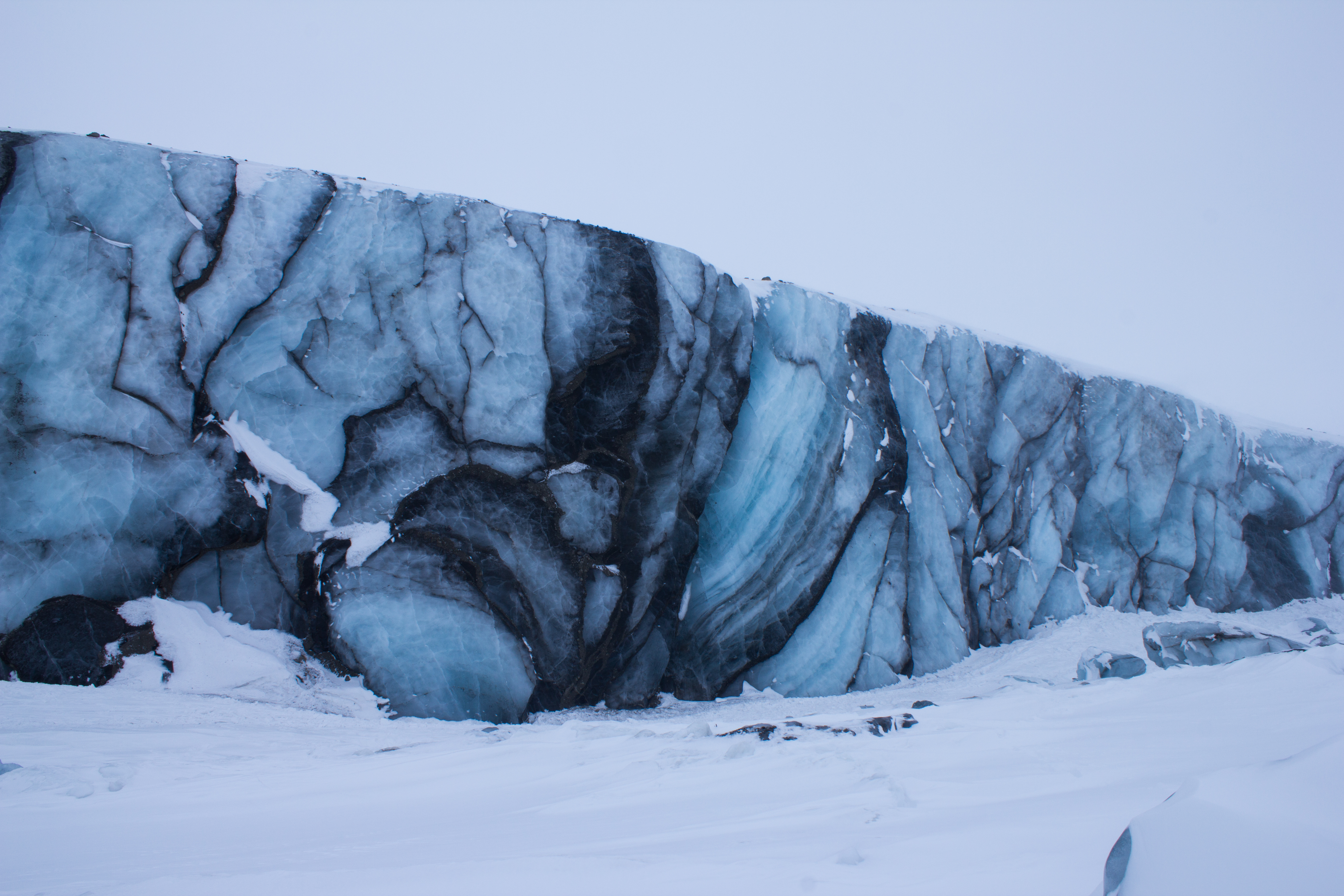
Surge front of Paulabreen
The dark banding visible at the front of Paulabreen is evidence of its surging past. When the glacier was flowing more rapidly, large crevasses (cracks) opened up at the surface and spread downwards. Debris and dust fell into these cracks, and when the crevasses closed again as the glacier flow changed, dark vertical bands of debris mark their former location.
Better to light a candle: an arctic storm led to a power cut on the night before the final exam, leading to some creative lighting.
Morning view after an overnight snow storm
One last venture into the mountains before leaving the Arctic.
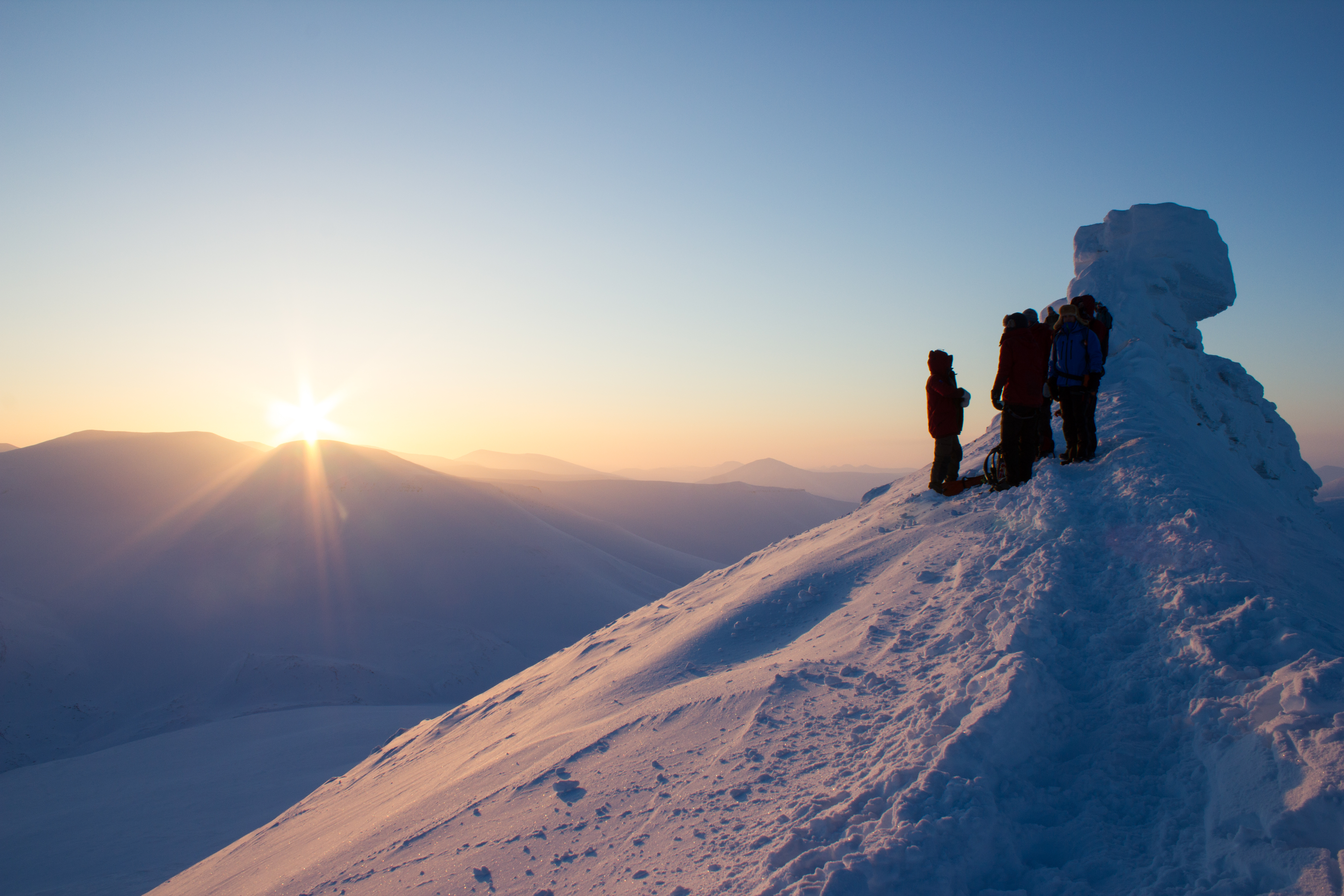
Summit ridge of Trollsteinen
Parting gift from Svalbard: dancing aurora on the flight south to Oslo
Glaciology PhDs: amazing experiences, zero glamour. Overnighting at Oslo Airport.
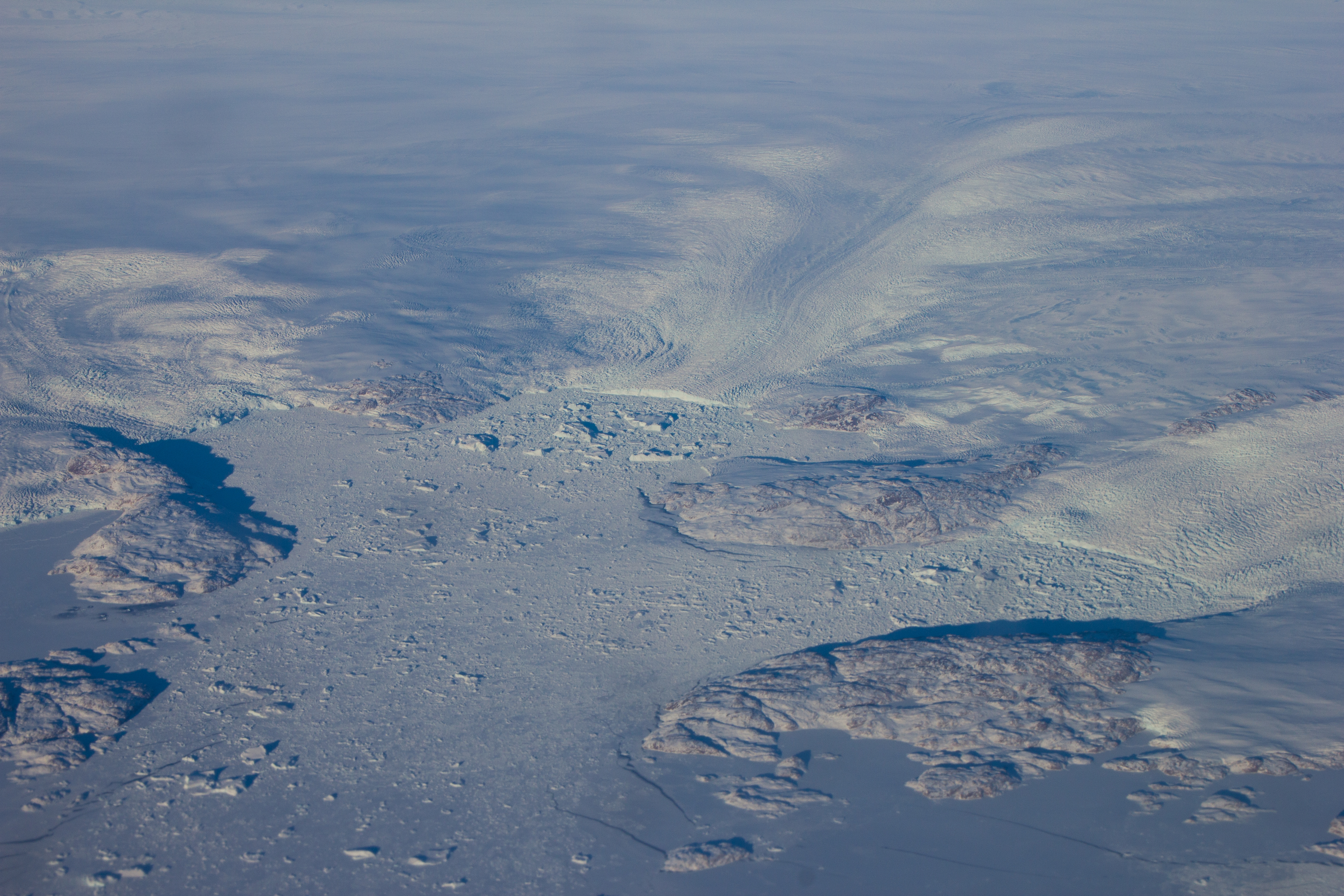
Flying over the enormous glaciers on the west coast of Greenland on my way back to Vancouver, and getting re-inspired for the next adventure.
A glacier is more than an ice cube. Rather than being solid, uniform blocks, glaciers can have incredible variations throughout in terms of structure, temperature, and movement. The surface and the base of a glacier can communicate with each other, and the language of this communication is water.
When ice and snow on the surface of a glacier melts, it can produce a lot of water. Streams of this meltwater flow over the surface of a glacier during the warmer months of the year. These streams can cut or ‘erode’ into the glacier, creating paths or channels which the water flows through. Over time, these channels can cut deeper and deeper into the glacier, their roofs closing over to create tunnels through the ice which can bring the meltwater from the surface all the way down to the bottom of the glacier. This is important because increasing the amount of water underneath a glacier can encourage it to slide faster.
During the cold winter months, melt channels are generally dry. We had explored one of these channels previously on Scott Turnerbreen (see Svalbard Part 2: Balancing Act), and decided that some more time under the ice was needed. There had been reports of an excellent ice cave on Larsbreen, a glacier within an hour’s hike of Longyearbyen. So one Tuesday evening, with duties at UNIS finished for the day, Tom, Ellie, Jelte, and myself met on the outskirts of the village, and began the trek to the glacier. Our plan was to explore the cave for a few hours, and then being a bunch of idiots, to stay overnight inside the ice.
(A note on the images: the caves in the glacier were entirely dark, with our headlamps being the only source of light. Therefore, for me, much of the photography was experimental; playing around with shutter speeds, iso settings, and flashes, while avoiding damaging my camera too much when climbing and crawling. As always, click on images to see them in full resolution)
Nighttime in the mountains above Longyearbyen.
At the cave entrance, on Larsbreen.
The walls of the channel were lined with a huge variety of beautiful and delicate ice structures.
Glaciologist: defrosting.
By the light of the moon, we found the entrance to the cave; first squeezing into a tunnel down through the overlying snow to get into the glacier itself. The passage through the ice twisted, widened, and narrowed, like a desert rock canyon; in sections coated in fragile crystal structures, then changing to smooth, swirled patterned walls like polished marble. We followed the channel as far as we could go, descending through a series of levels and passages until we were forced to stop at a major drop; the location of what would have been a waterfall during the melt season. We picked a spot where we could roll out our bags for a few hours, and returned to the surface for some frigid air before sleep. On the way to the surface, I had a ‘how did I get here’ moment; crawling out of a glacier through a snow tunnel in the middle of the night, with a rifle on my back to watch out for polar bears, and being greeted by the northern lights.
Our home for the night: a cosy ice chamber inside the glacier.
Student accommodation in the Arctic can be grim
My choice of sleeping spot, or as it became know as, the ‘MRI machine’.
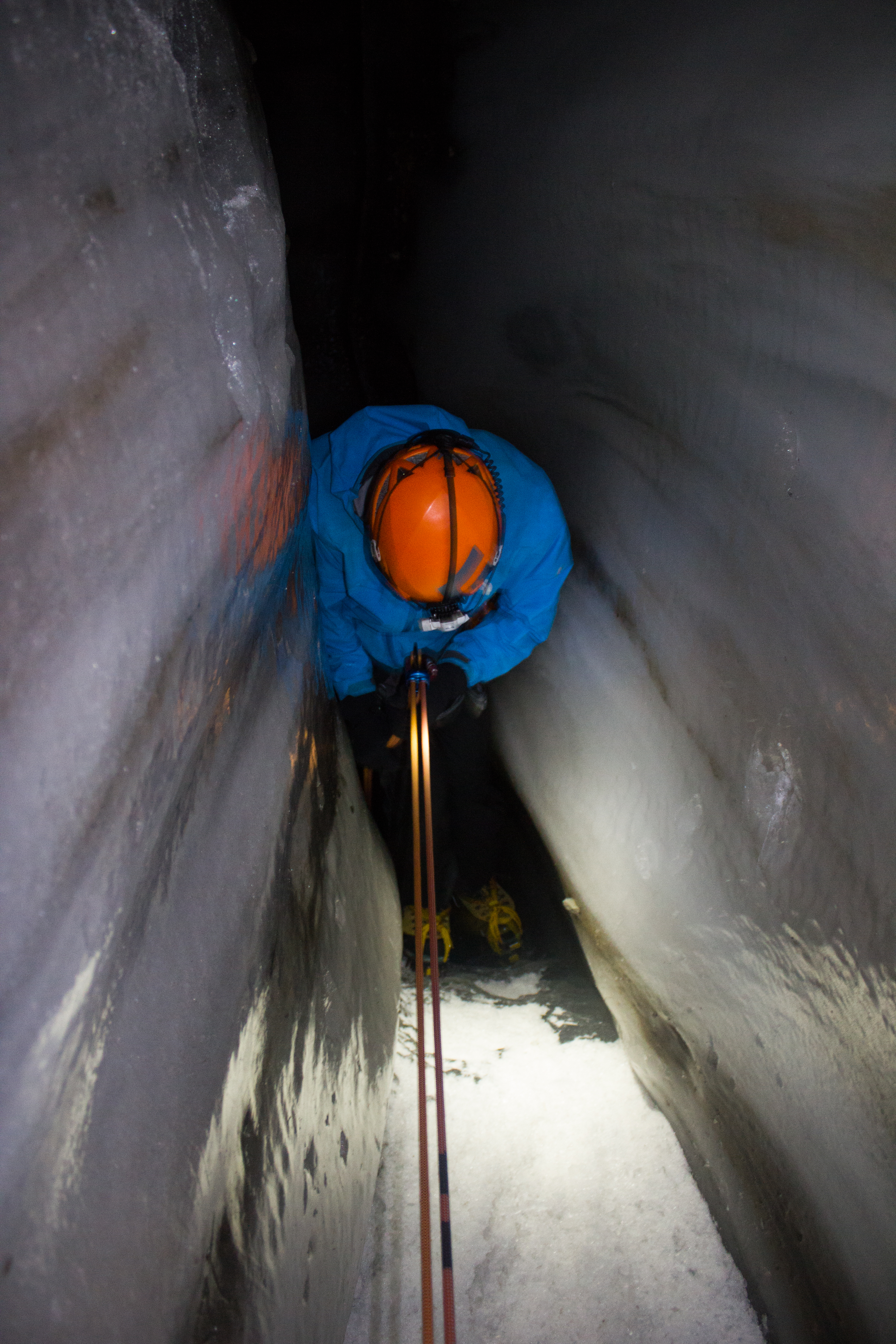
Our night in the glacier was a memorable experience, but it felt like the caves had a lot more to show us had we been willing to push a little further. A few days later, we returned to Larsbreen. Armed with ice climbing gear, Tom, Andi, and myself would attempt to work our way down some of the larger drops that had stalled us on the previous visit, and see how deep we could get.
Descent was carried out through the use of ladders, fixed ropes, and rappels for the longer drops.
Climbing up
Climbing down
Climbing my way up through an ice chimney.
Tom, about to drop over the edge of the first rappel section, which was extremely narrow.
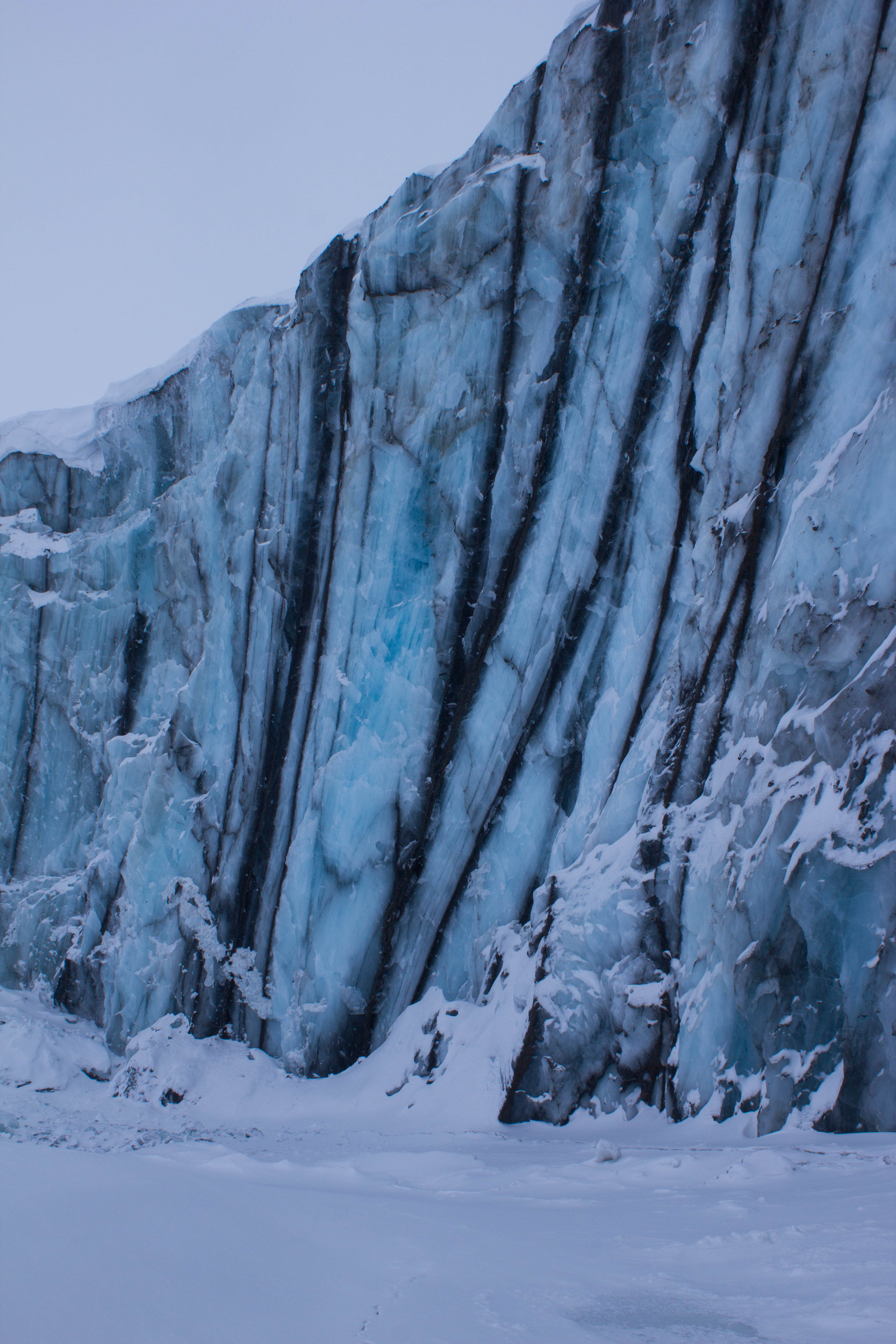
Close to the base of the glacier, looking upwards through the section we had just rappelled down. The dark bands in the ice are layers of debris and sediment (rock and soil) that has been picked up by the glacier as it moved along the valley floor.
Getting narrow…
Narrower…
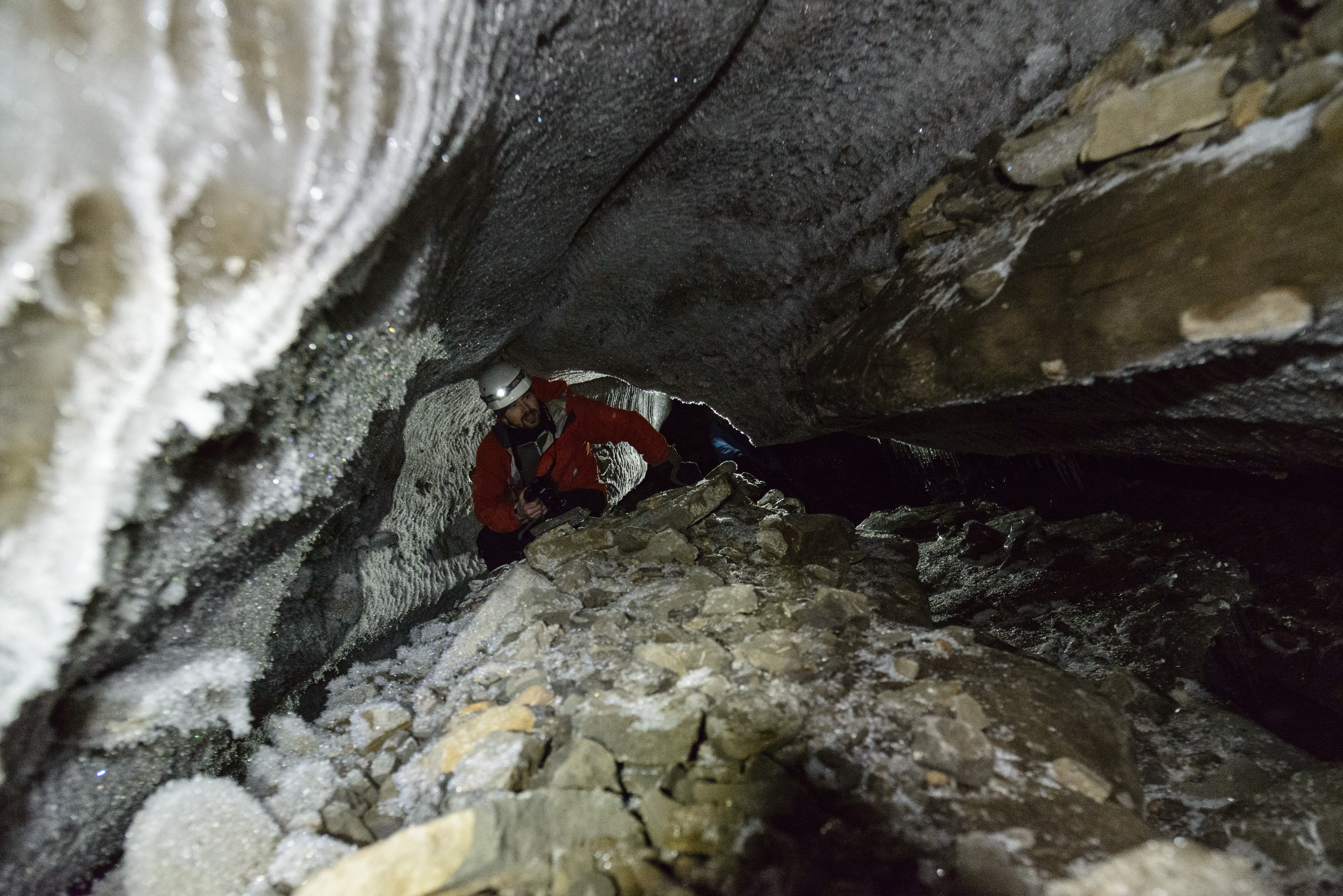
Wide. We reached the base of the glacier to find a cathedral of ice.
Crawling through an R channel (a tunnel cut into the bottom of the ice by a stream running along the bed), with the entire glacier above our heads.
(photo: Andi Alex)
End of the line. The channel eventually became too narrow for us to proceed further.
Belaying Tom up the last pitch of ice climbing (photo: Andi Alex).
Back on the surface, and being watched by a distant reindeer (photo: Andi Alex).
We found the bed of the glacier, and it was an awe inspiring experience to have this entire mass of ice lying above us. My thanks to my like-minded companions on both trips for their company; the highlight of being in such incredible places is to share it with great people.
The Sun has been absent since I’ve arrived here in Longyearbyen. The islands are deep inside the Arctic Circle; the line of latitude north of which it is possible to have 24 hour nights in winter. But Spring is fast approaching.
When a ray of sunlight was spotted hitting the mountain tops on the other side of the fjord, it was decided that a group of us would aim to get as much elevation as possible over the weekend, and try to catch some elusive light. Temperatures would remain well below -20°C over the two days, so warm clothes and moving fast would be essential.
Saturday morning saw us hiking up to Sverdruphamaren; an elevated plateau to the west of Longyearbyen. There is a real sense of wilderness here, and the view is an expanse of white peaks, sea ice, and reindeer. The sun however, remained just below the higher mountains to the south.
Setting out from Longyearbyen on Saturday morning
Ice mascara
The Svalbard Cold Feet Dance
Some opted just to get their feet off the ground altogether.
Chasing the sun across Svalbard’s wilderness
Returning back across the plateau after a cold but beautiful day
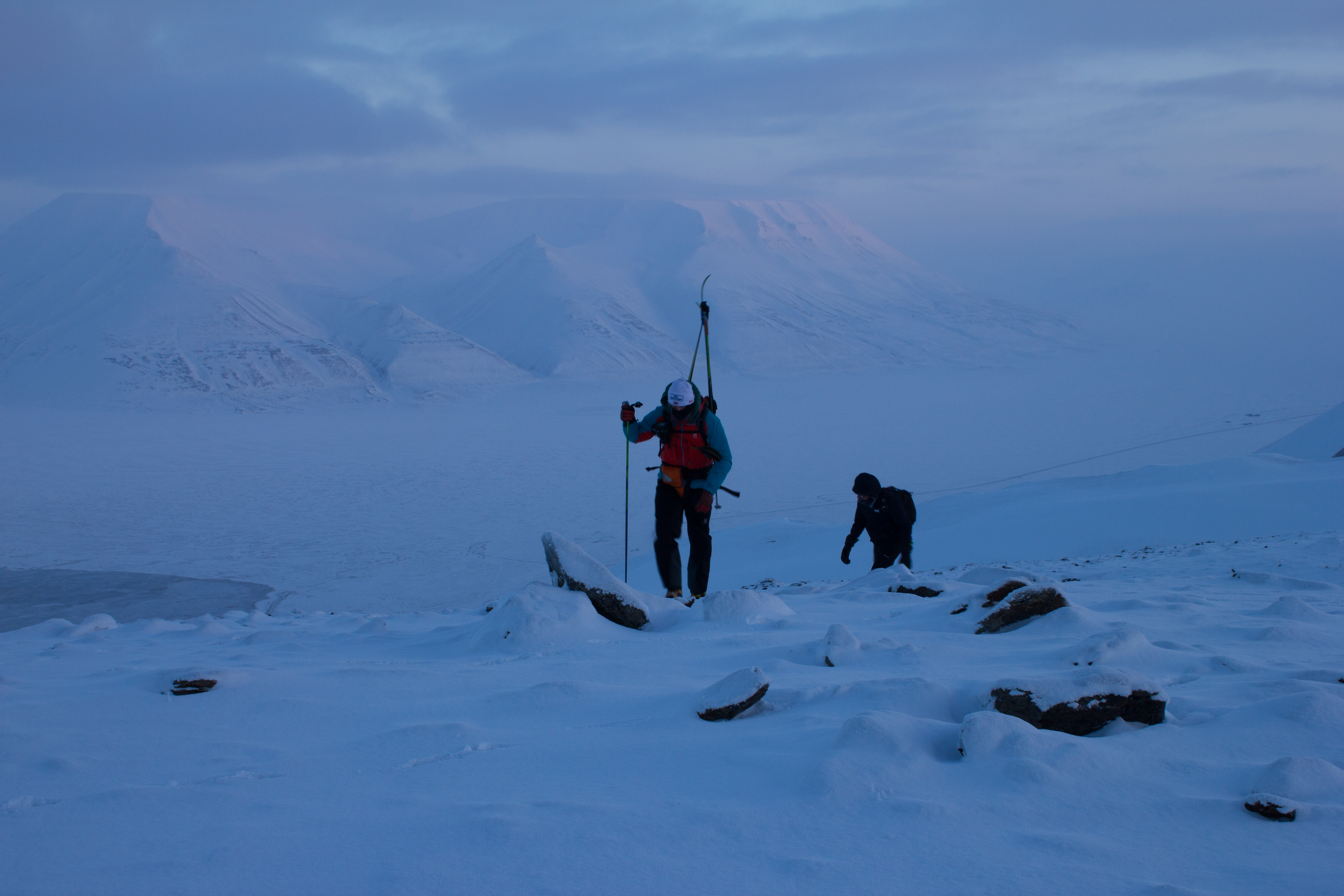
On Sunday morning, we aimed higher, and set out for Trollsteinen; the peak behind which the Sun had hidden from us the previous day. With temperatures at sea level forecast to be around -30°C, we knew we were in for a cold summit. Our route would bring us south of Longyearbyen, up the glacier of Larsbreen, before ascending onto the main ridge of the mountain. The winds were calm, and the skies were perfectly clear, promising excellent views, and potentially some vitamin D.
Heading south, with Longyearbyen in the distance
Lone hiker on Larsbreen
Beginning to ascend towards the ridge
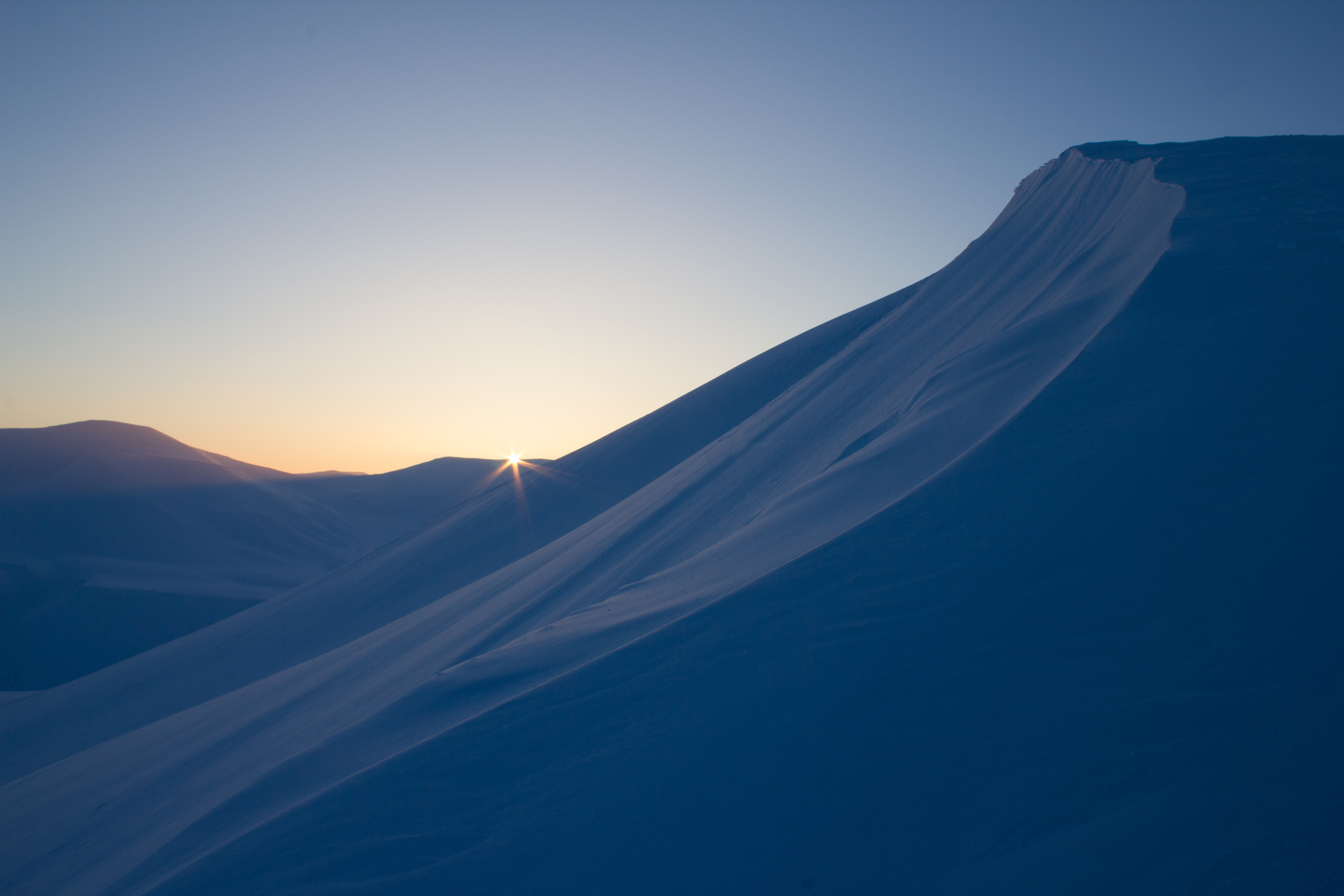
The Sun! The end of polar night, as viewed from the main ridge of Trollsteinen
The Sun is literally days away from reappearing here in the valley, and the community of Longyearbyen will mark its return this weekend with a festival in its honour. It’s certainly something worth celebrating, but I’ll still be happy to experience a few more Svalbard nights.
The Earth has approximately 170,000 glaciers, located in a range of environments from Alaska to Argentina, Nepal to New Zealand. Almost all of them are shrinking.
The measure of the growth or shrinkage of a glacier is known as its mass balance, and this was the area of focus during my first week here in Svalbard. As part of the glaciology program I’m involved in, we traveled to one of the local glaciers to examine the layers of snow on its surface, and to hopefully explore some of its inner workings. Named (somewhat ironically) after a local coal mining manager in the early 1900’s, Scott Turnerbreen is located in a valley to the south east of Longyearbyen.
En route to the Scott Turnerbreen glacier
Glaciers are formed where snow is able to build up over time, and gradually get squeezed or compressed into ice by the weight of the snow on top. The growth of a glacier is essentially a balance between how much goes in i.e. snow, and how much goes out i.e. melting. If more snow and ice is added to a glacier than is melted, the glacier grows; if more ice melts than is replaced by snow, the glacier shrinks. Think of it as a bank account; lodge more money than you withdraw, and your account grows, and vice versa. Warmer climate conditions have increased melt rates on glaciers, removing ice faster than it can be replaced by snowfall.
Digging a snowpit to examine the layers of snow
Measuring the density of the snowpack
We built the deluxe snowpit model, including a lunch seat.
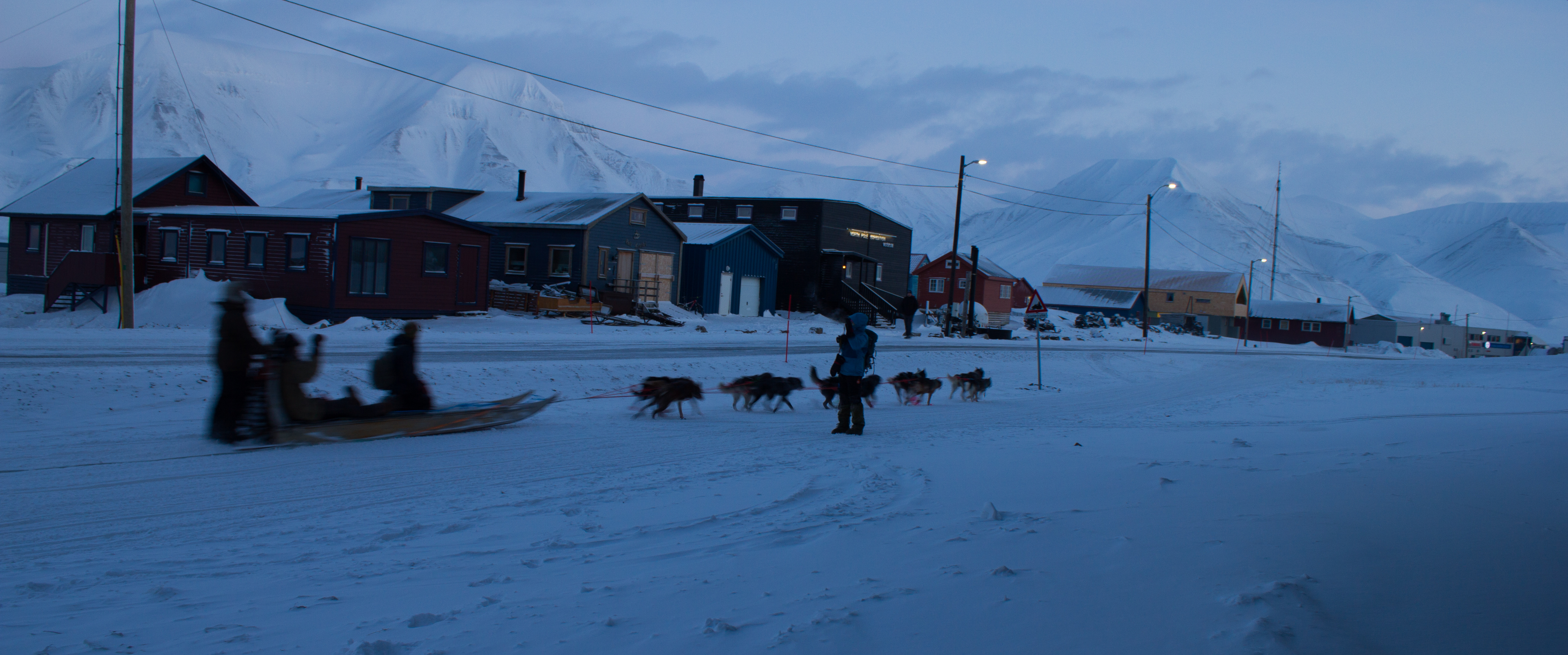
On Scott Turnerbreen, we carried out a number of surveys of the snowpack. Firstly, we used snow probes (basically long tubular measuring sticks) to determine the depth and pattern of snow accumulation over the surface. We then dug a series of snowpits to examine the thickness and density of layers in the snow, and to look for evidence of a recent ‘warm’ weather spell. That was, of course, until getting completely distracted by a passing group of dog sleds. When in the Arctic.
Approaching dog teams
Our attention then turned from the surface of the glacier to deeper into its core. In order to gain access to the inner glacier, we descended down through a presently dry meltwater channel. Like a scene from a Jules Verne novel, we traveled through a subsurface tunnel of ice with incredible formations and patterns. This was a brief visit, but I’m hoping to return to these passages while I’m here, and spend a little time to get some images that do them justice.
Tunnel to the inside of a glacier
Traveling through a meltwater channel inside the glacier
Crevasses or cracks on the glacier surface can collect dust or sediment. The dark coloured bands in this image may represent old crevasses which have closed and been buried deeper into the glacier, leaving behind a layer of dust in the ice.
In the heart of a glacier
Up next: Exploring the surrounding mountains in the search for sun.
It’s a matter of latitude. 78° 13′ N; approximately twelve degrees, or 1,334 kilometers north of the Arctic circle. This is the realm of twenty four hour nights and days, of the Aurora Borealis, of polar bears, of windswept landscapes of snow, sea ice, mountains, and glaciers. It’s a part of the world I’ve wanted to experience since I was a kid, and it’s the place I’m going to for the next six weeks.
My destination is Svalbard; an archipelago of islands in the Arctic Ocean. I’m taking part in a glaciology program run by the University Centre in Svalbard (UNIS), which is located in the regional capital of Longyearbyen. Sixty percent of Svalbard’s surface is covered by glaciers, making it an ideal location to study their processes.
The first leg of my journey takes me from Vancouver to Oslo, where I have an overnight stay before my flight to Longyearbyen. The stopover gives me a chance to join up with a friend who is also taking part in the glaciology program. I met the aptly named Aurora last summer in Alaska (see North to Alaska), and catching up over some much need food that night, we’re both equally excited about the trip ahead. The next morning, we soak up the last sunrise we’ll see for a few weeks, and board our flight to the Arctic.
Touchdown at Longyearbyen Airport, Svalbard.
Arriving in Longyearbyen just after 1pm, the usual bustle for hand luggage when the plane stops takes on a more practical air. Down jackets, balaclavas, and mittens are being pulled on before the exit door is opened. Stepping out into the blue semi-darkness, we are greeted by a biting wind that draws streams of fine snow across the tarmac. It’s already below -20°C, and I couldn’t be happier.
The following are just some initial shots from my first few days here, including some from the training we underwent. As always, images can be clicked on to view in full size. More updates coming soon.
Protect our glaciers. Rifle handling is an important component of the safety training at UNIS, but is very rarely drawn upon. Temperatures on this evening were around -25°C, adding the additional challenges to target practice of bulky gloves and shivering.