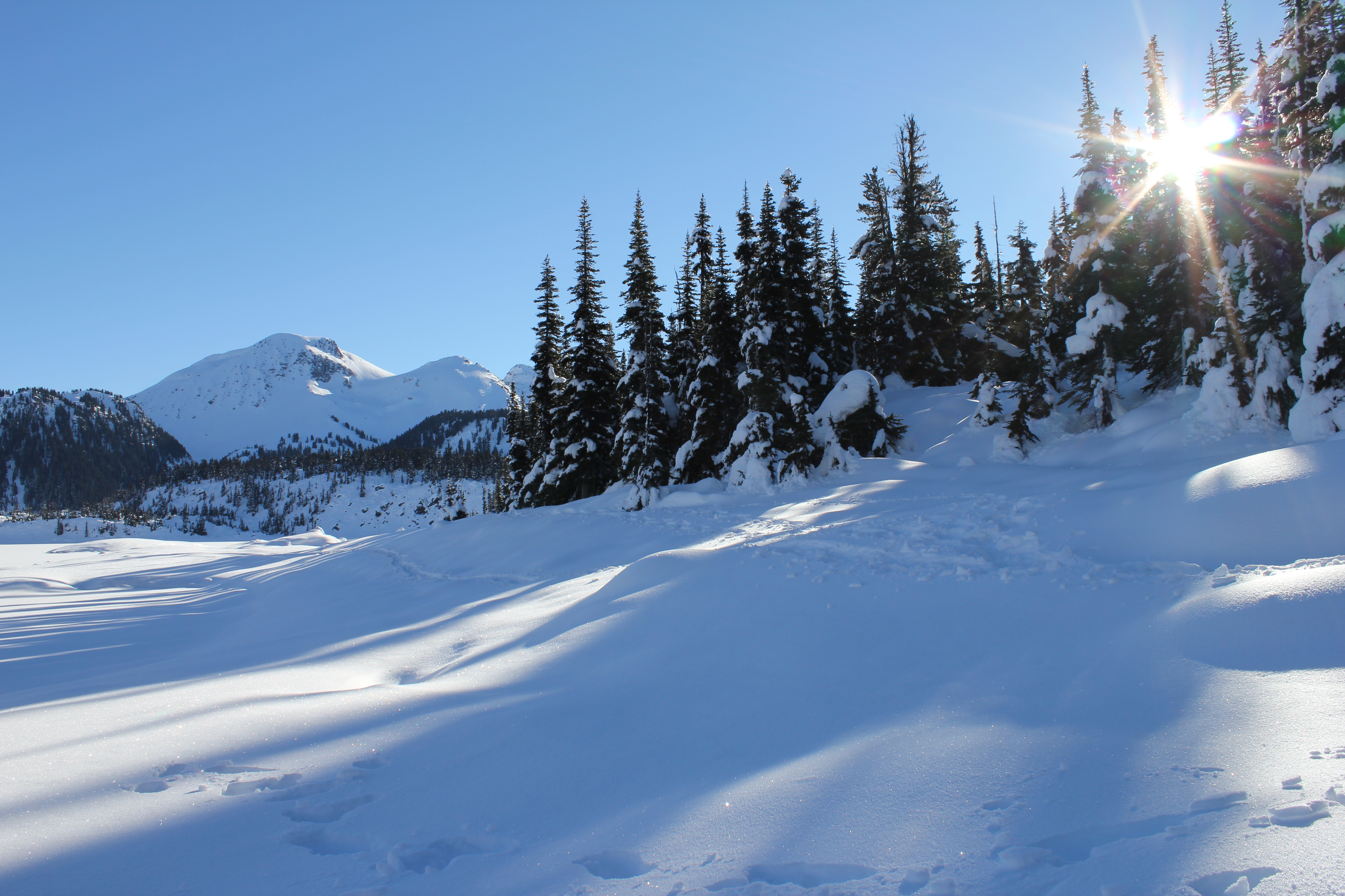
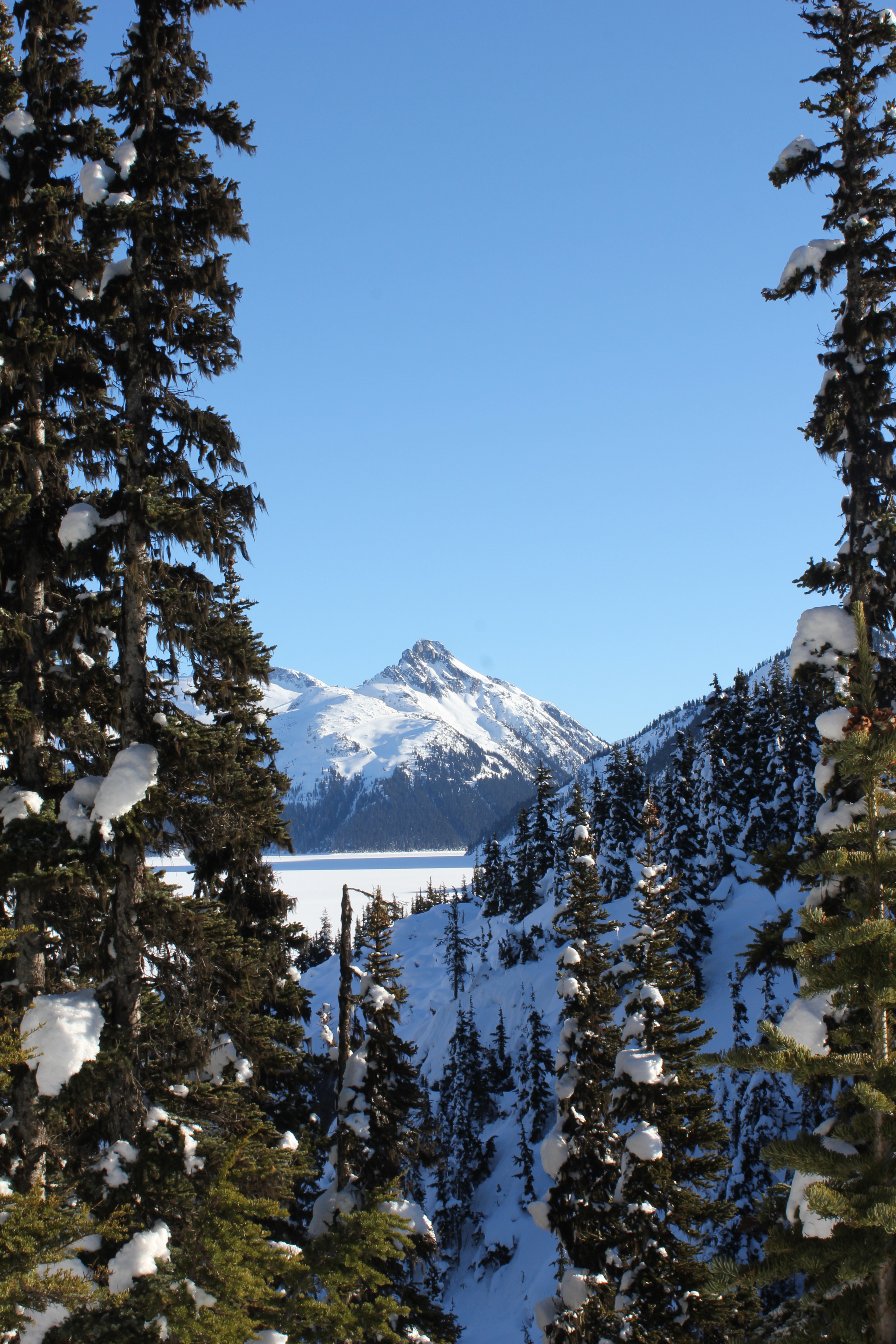
Some shots from a recent drive along the Icefields Parkway, a 230km stretch of road through the center of the Canadian Rockies.

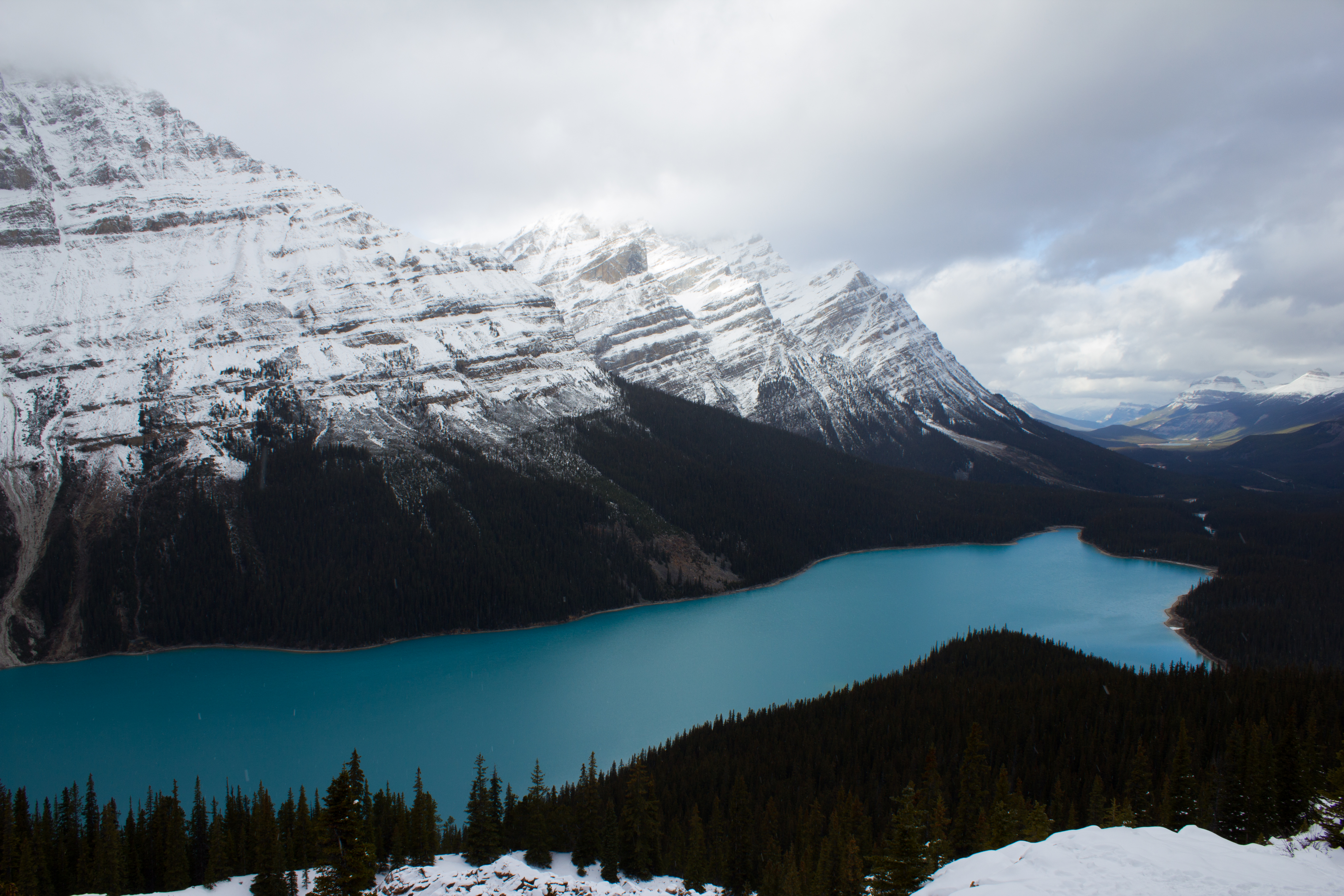


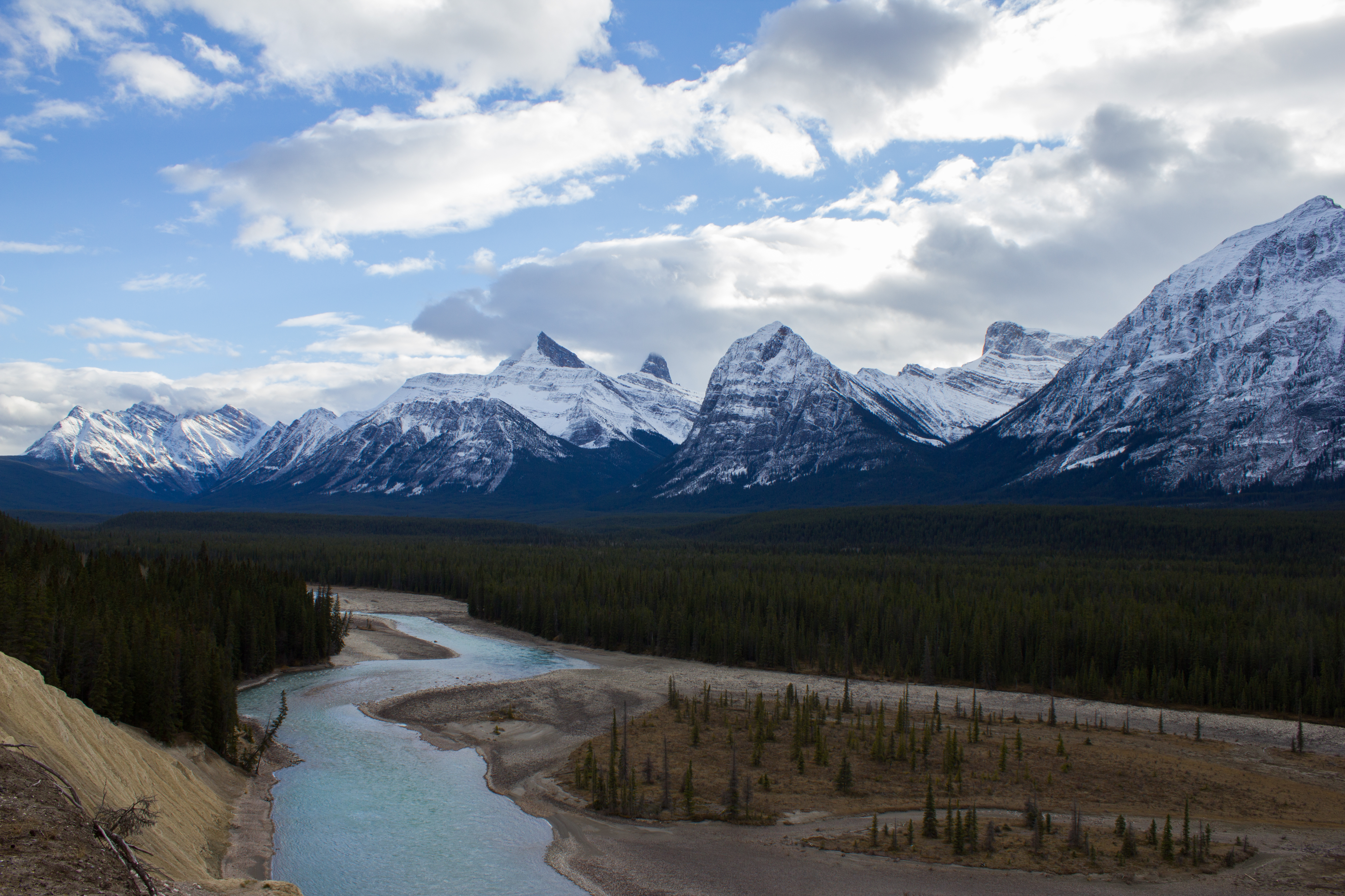

Some shots from a recent drive along the Icefields Parkway, a 230km stretch of road through the center of the Canadian Rockies.
Waiting at the gate at Anchorage Airport, my phone beeps to life. I had spent the last two weeks in Alaska, without phone or internet coverage, and was looking forward to having a little time off back in Vancouver before the end of the summer. My phone disagrees.
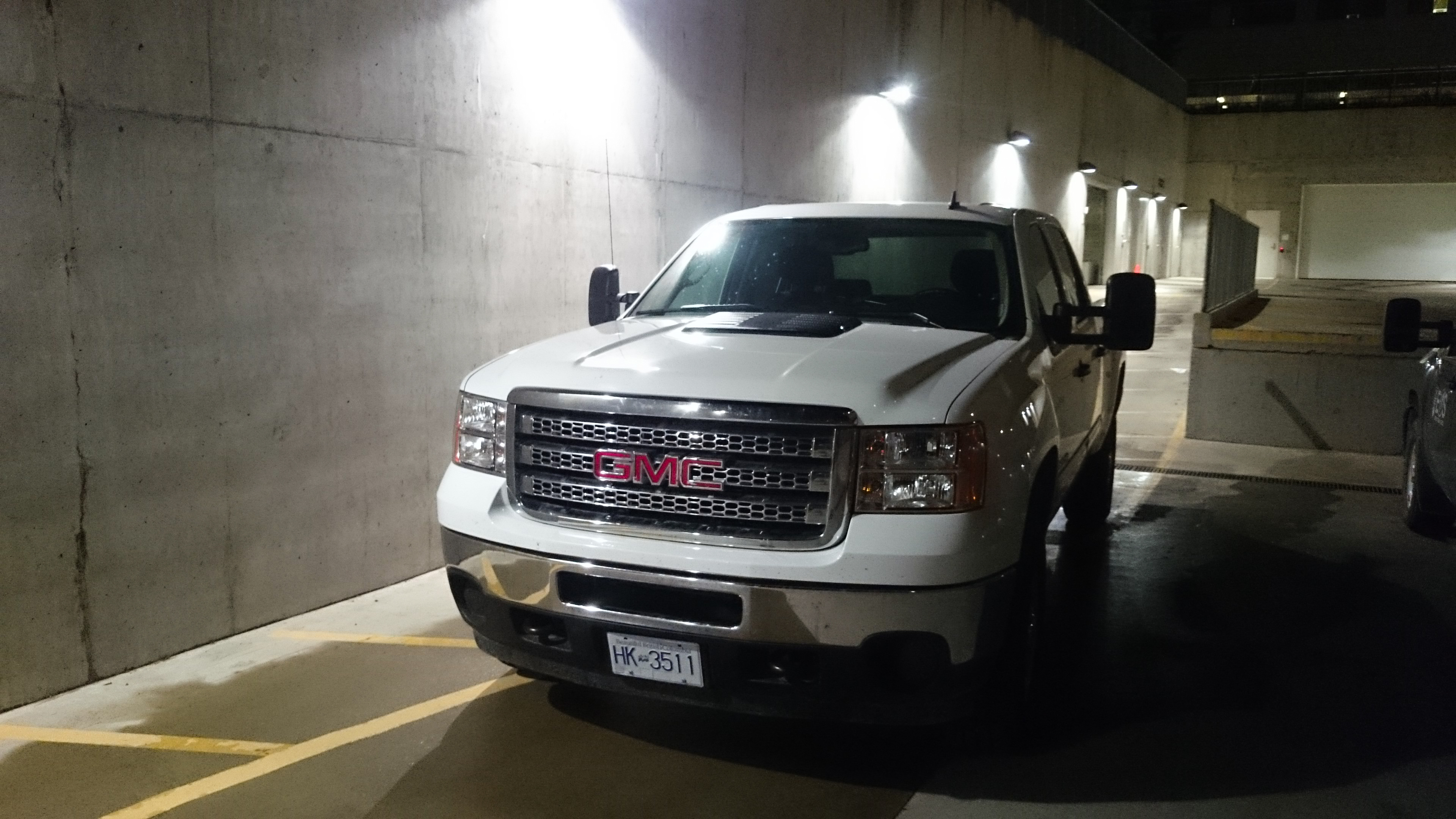
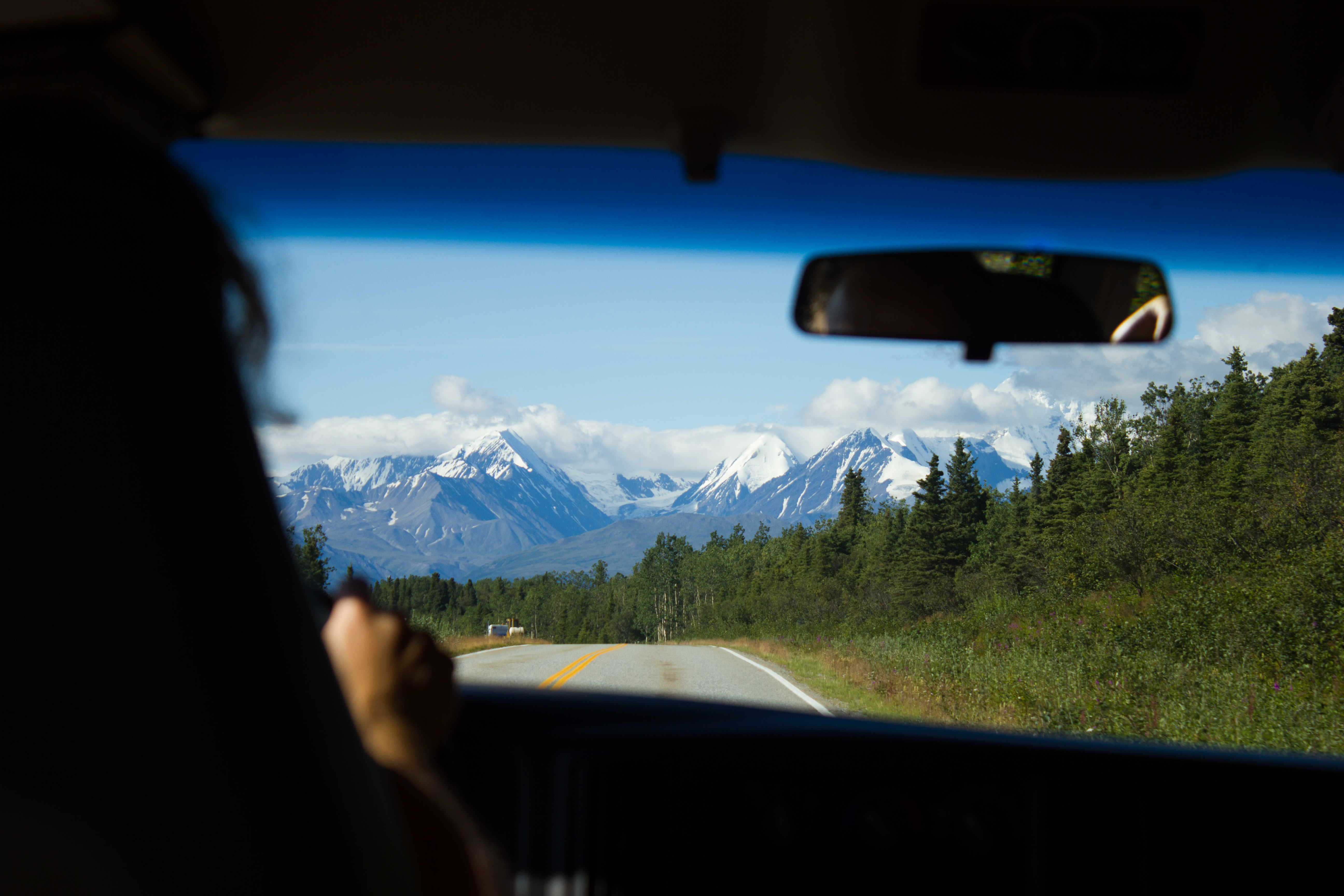
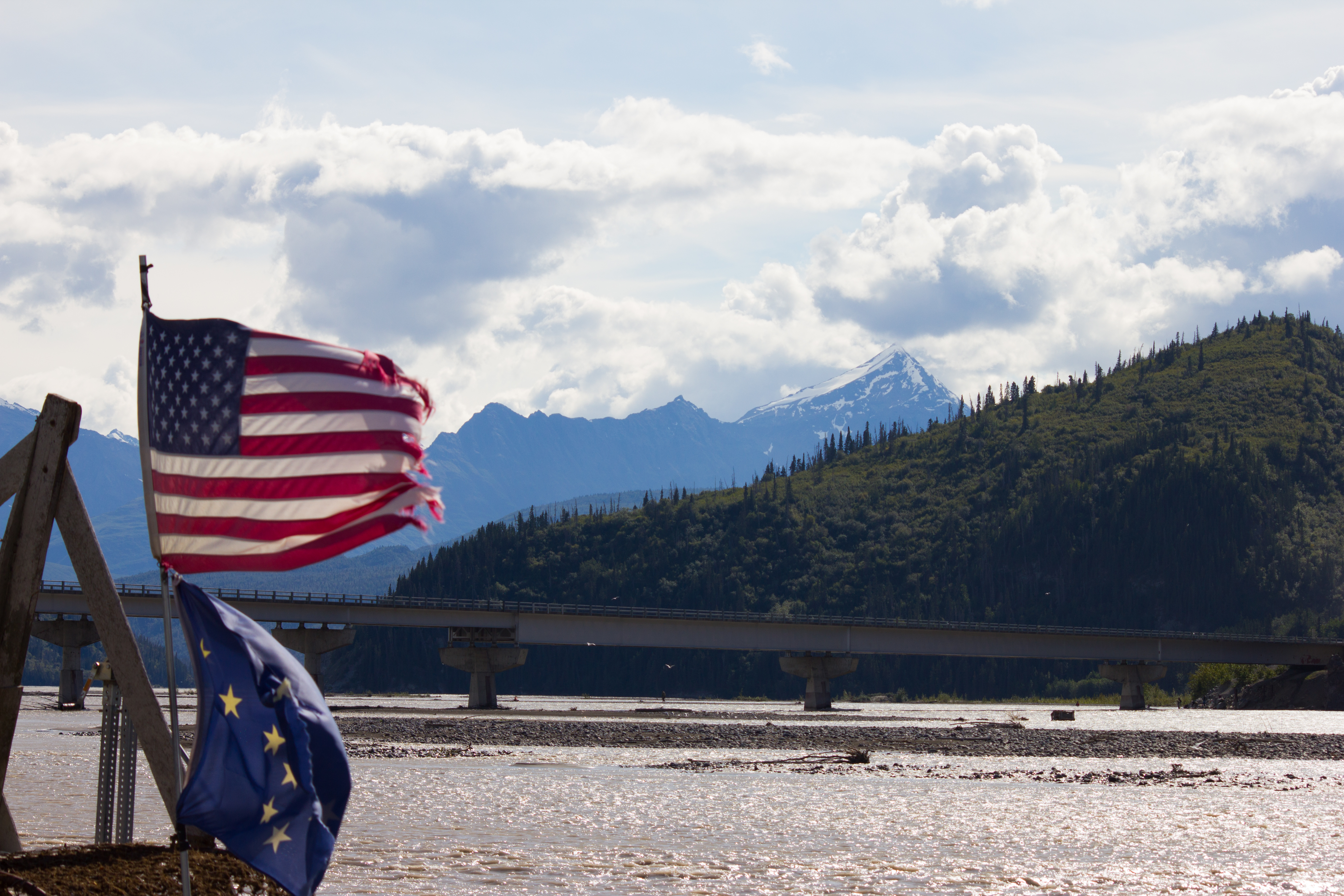
A few short days later, I’m sitting behind the wheel of a pick up truck on the road to Golden, and Nordic glacier (see Notes from Nordic). 740km of driving solo in one afternoon was certainly a first for me. This isn’t surprising when you consider that I come from a country that can be crossed three and a half times in that distance. It is quite a road though; the landscape constantly evolving between mountains, forests, and arid plains. Back at the airport, I had received a backlog of emails advising me that a research team from the University of Northern British Columbia (UNBC) were planning to travel to Nordic earlier than expected. Before leaving for Alaska, the plan had been to return to the glacier in mid September in order to dismantle and collect my equipment. Now, if I wanted to get back to my station this season, I needed to be on the helicopter flight tomorrow morning.
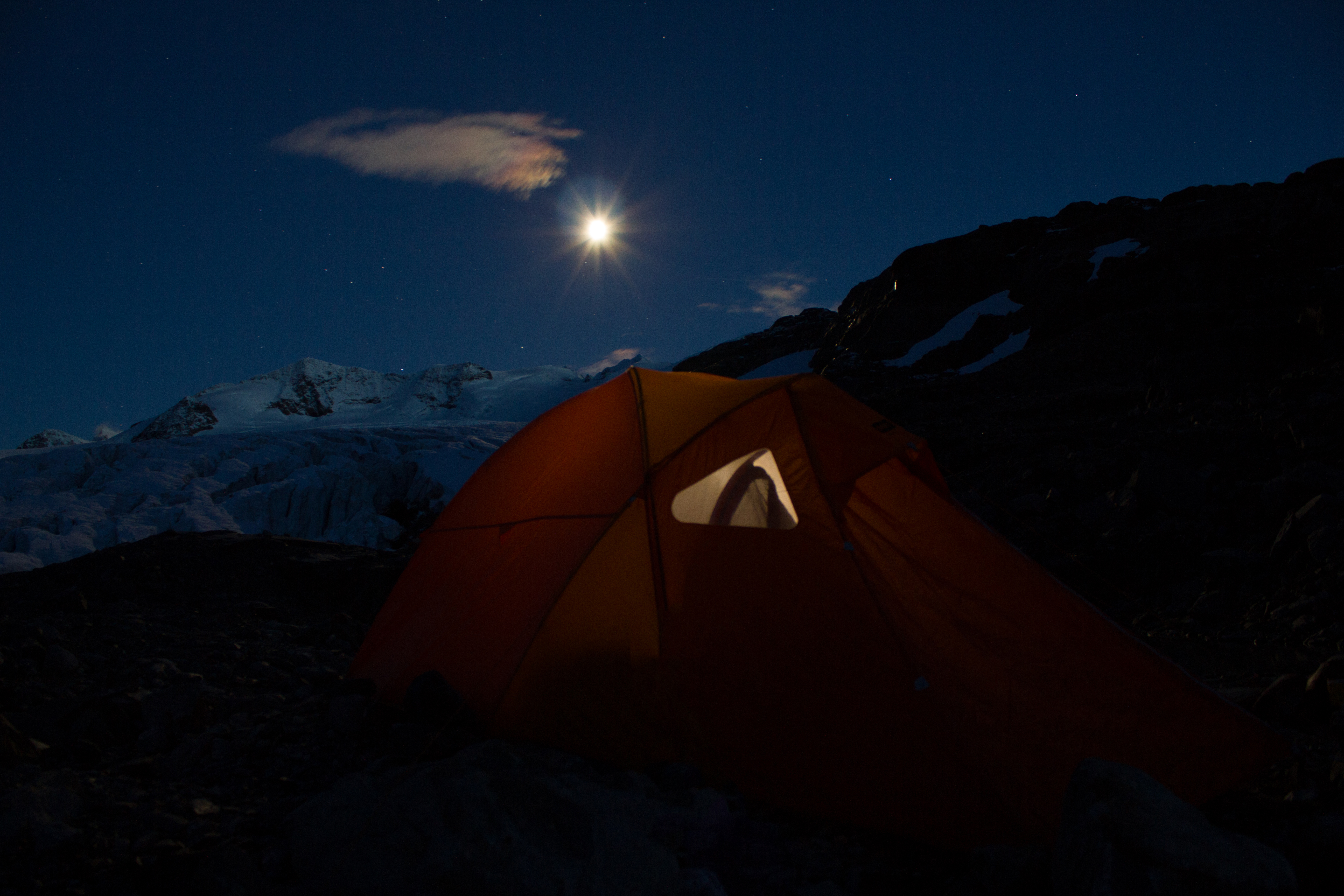
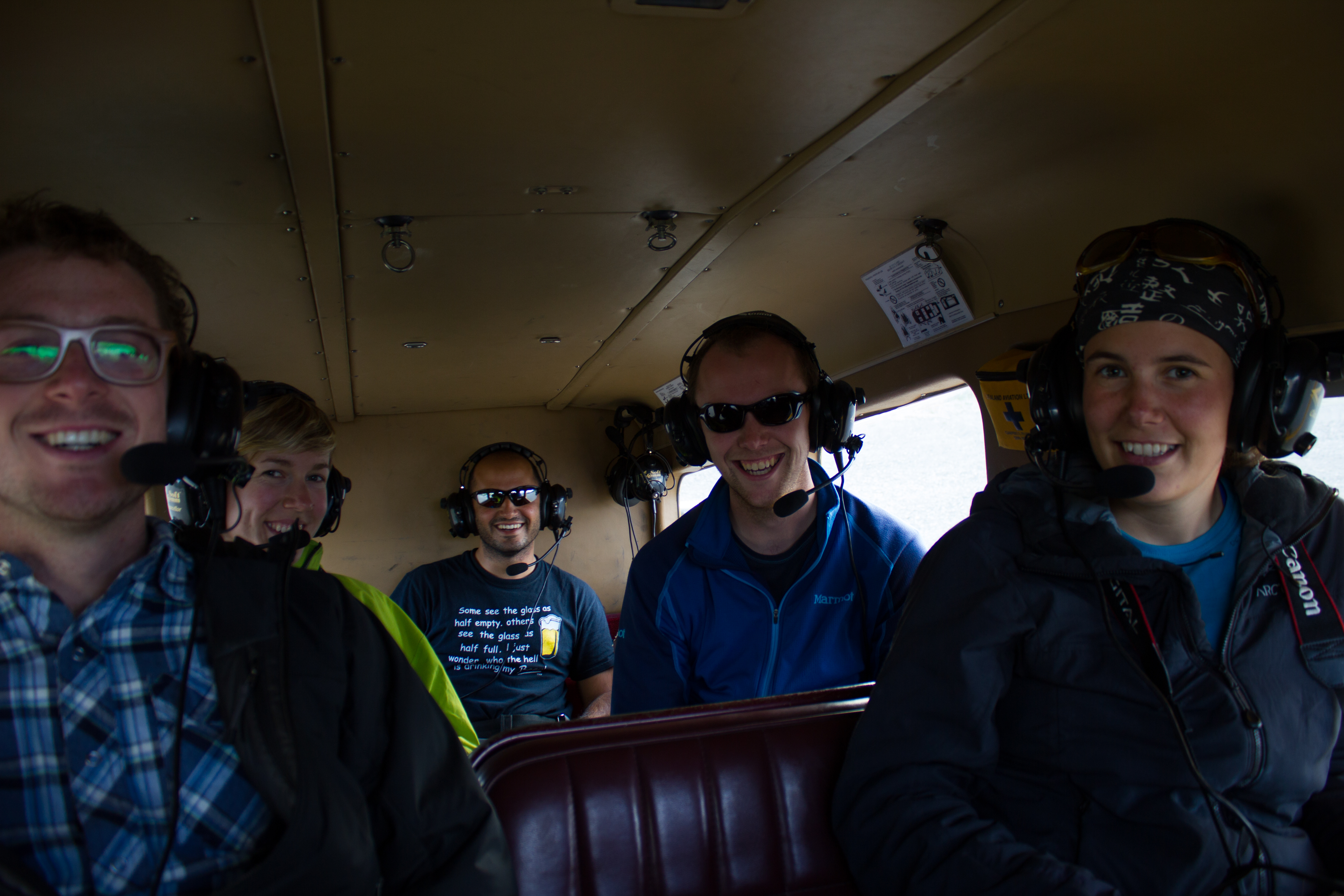
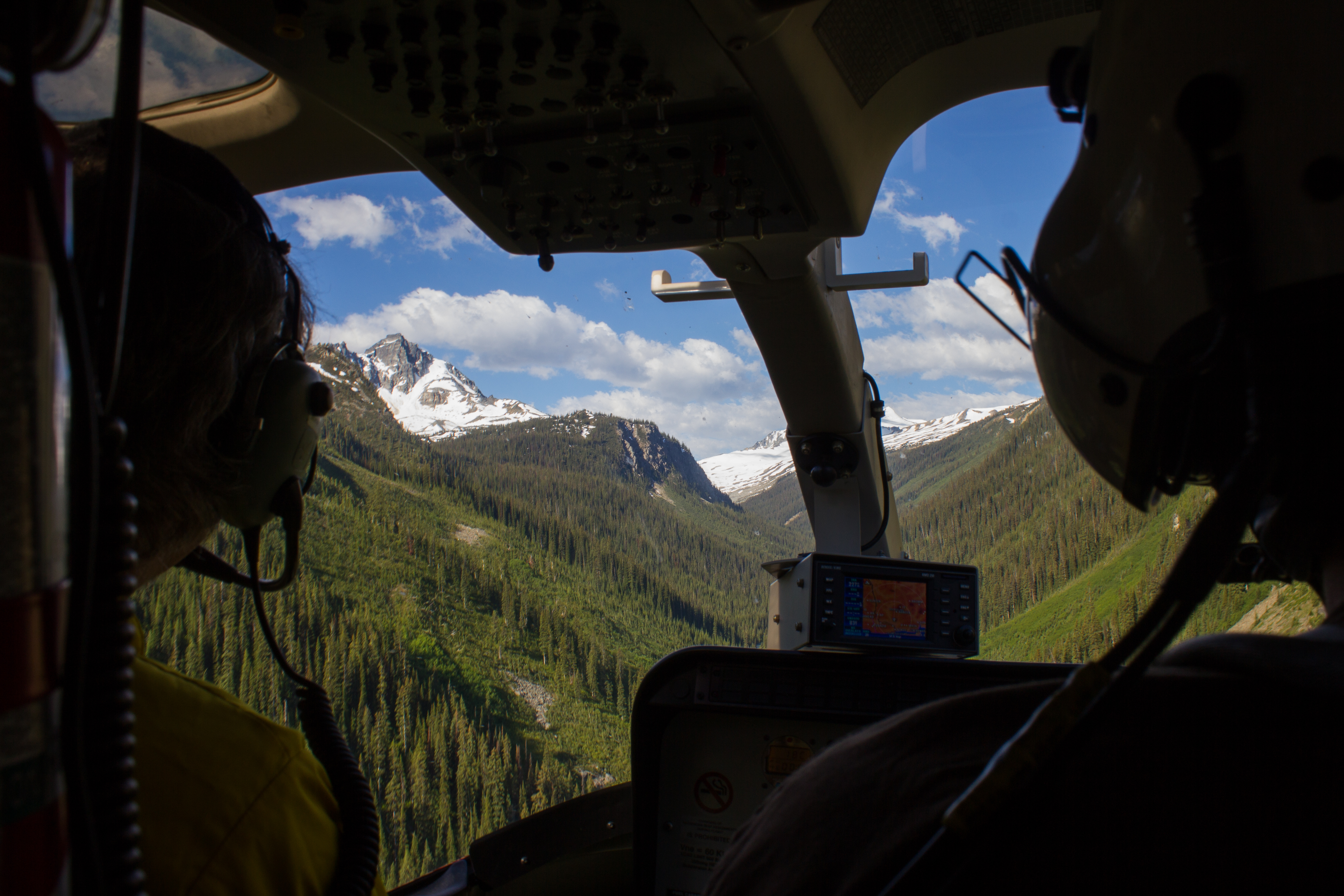
I made it into Golden after dark, with the silent flashes of distant thunderstorms hinting at what the weather would have in store for us. Once again, I was being hosted by Tannis and Steve (of Sorcerer Lodge), and was grateful for a place to sleep that night. A short drive to the helicopter early the next morning, and we were on our way back into the mountains. We were a group of five; Rob Vogt and Ben Pelto from UNBC, Bob Sawyer, Steve, and myself.

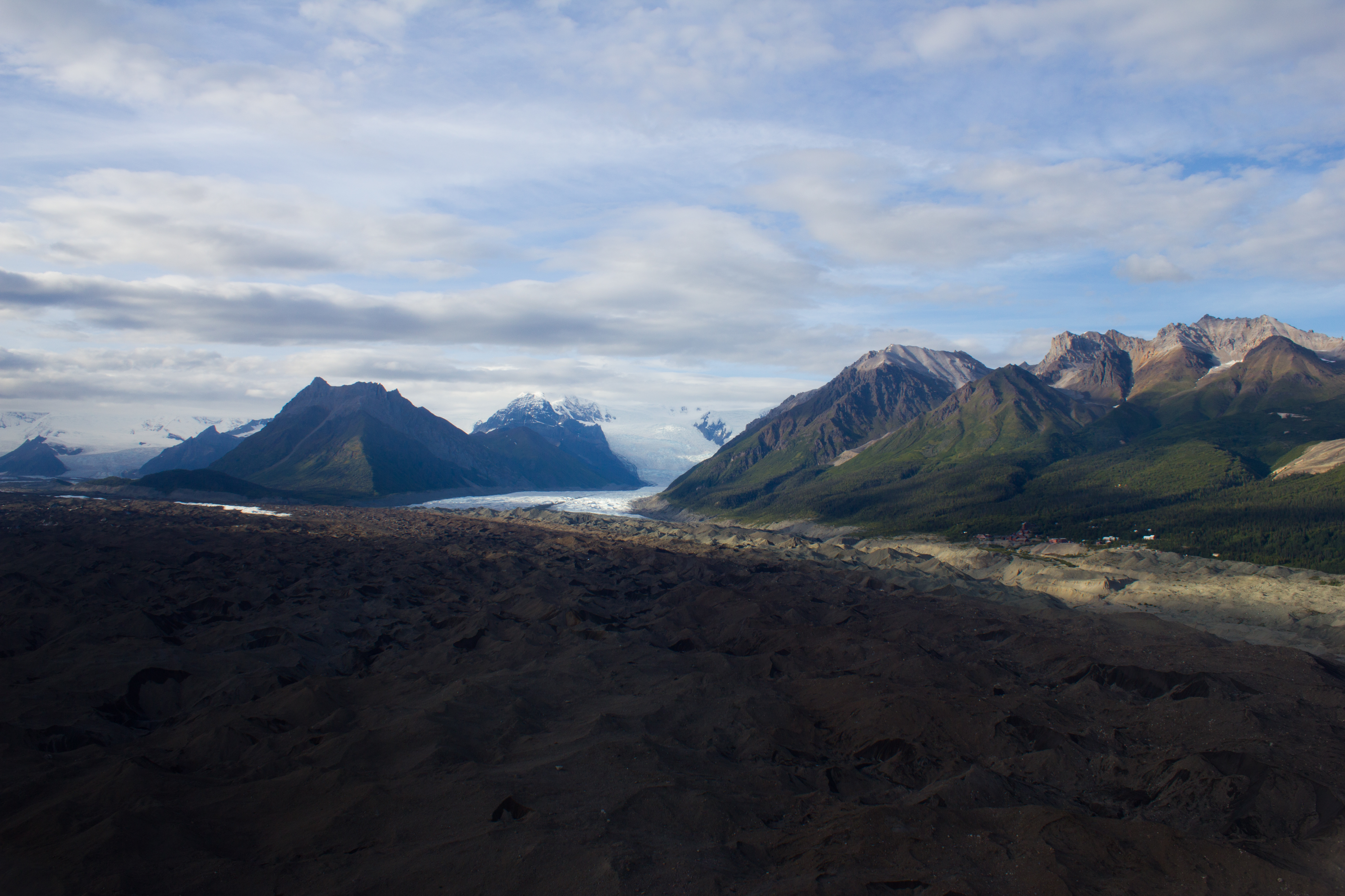
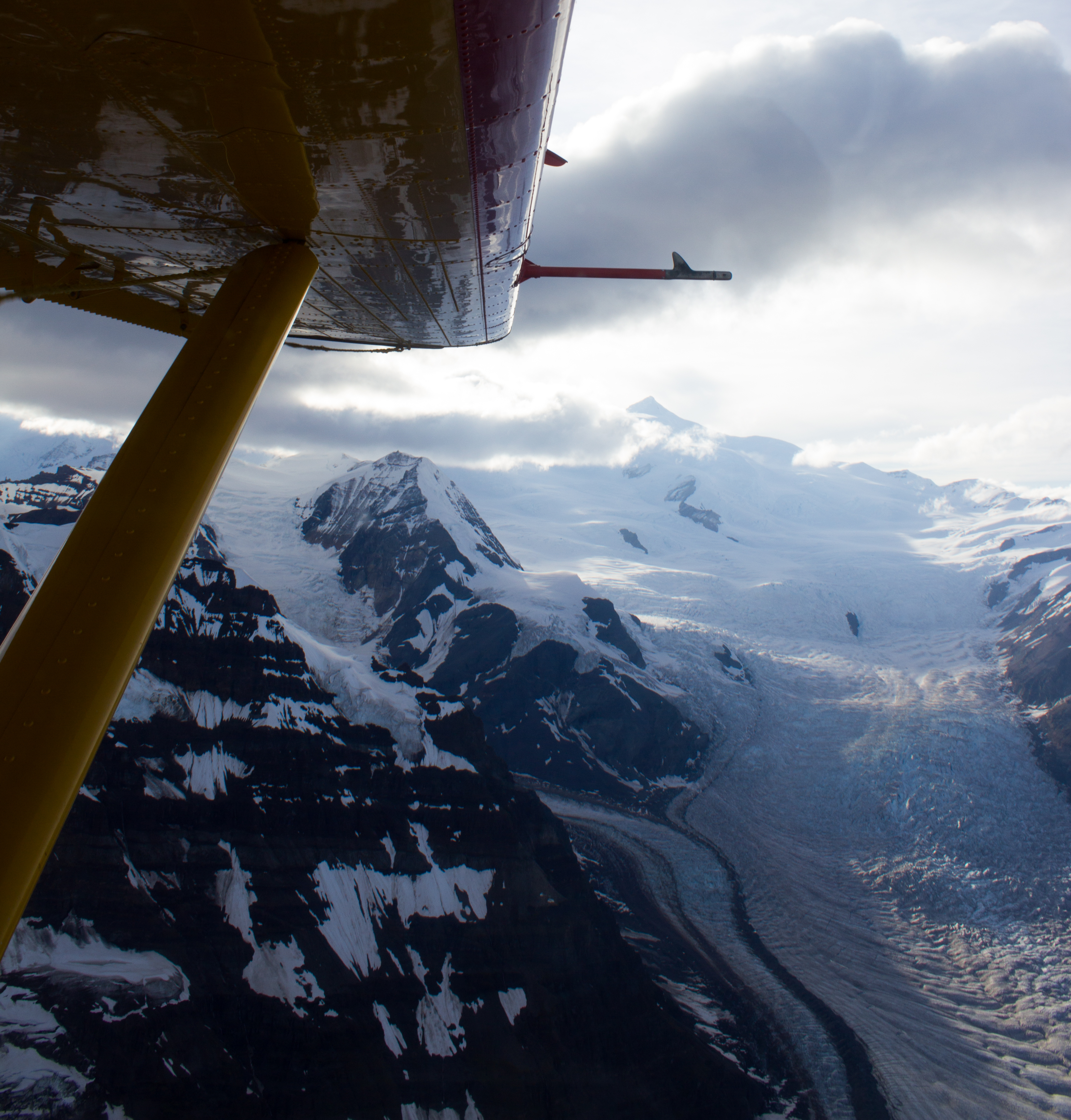
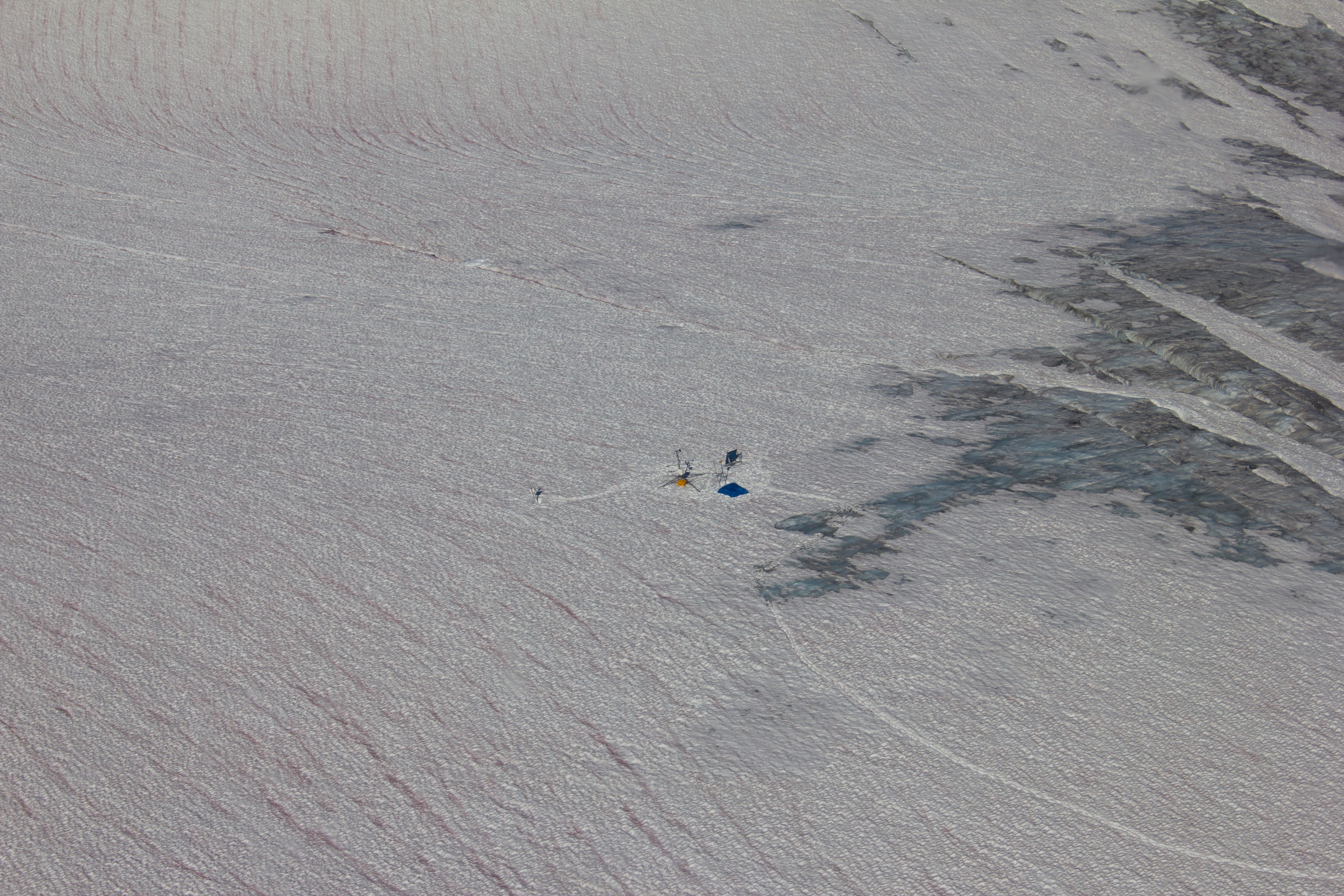
The last I had seen of my station had been in early July as we were flying out after installing the equipment. Thoughts of failed power systems, wiring mistakes, and crevasses opening underneath had been frequently on my mind in the intervening period. They were certainly on my mind that morning as Steve and I hiked up to the glacier. Ascending a ridge of ice, I could see emerging above me the rotating propeller of the wind sensor on the top of the station. So, it was still standing at least. As we approached closer, I could hear the low hum of one of the sensors, meaning power was still being supplied. So far so good. A quick check of the data logger (device for storing the measurements from the sensors) showed no obvious gaps in the data. More serious investigation would be left for the lab back in Vancouver, but I was delighted with that much.
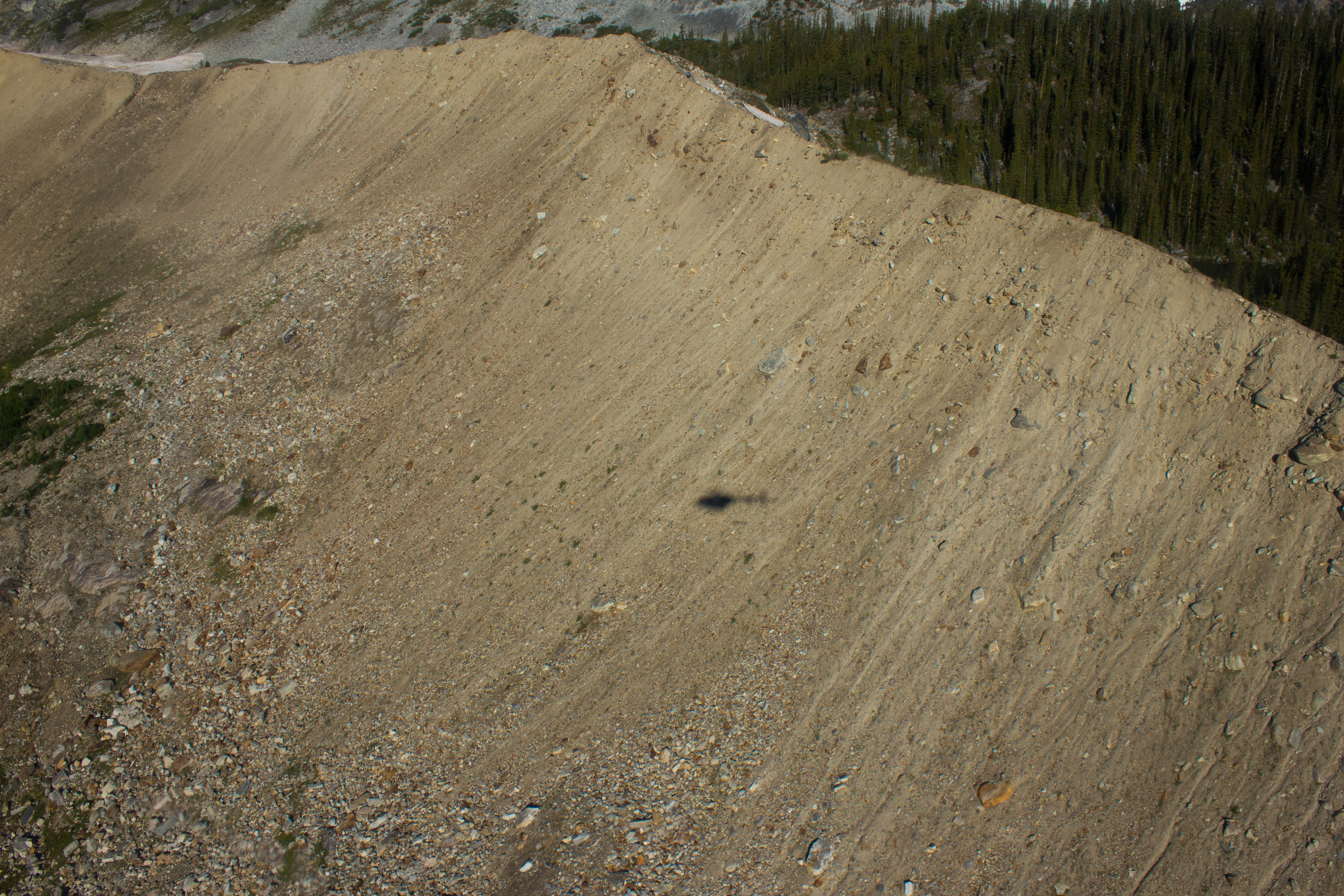
When designing each aspect of the station (see The Project), the fact that the glacier surface would be constantly melting and changing was always kept in mind. Seeing the change in reality, however, after such a short period of time was still a shock. Equipment that I had installed while crouched on my knees was now towering above me, stranded high on 4 meter poles that had been fully submerged in the ice 48 days previously.


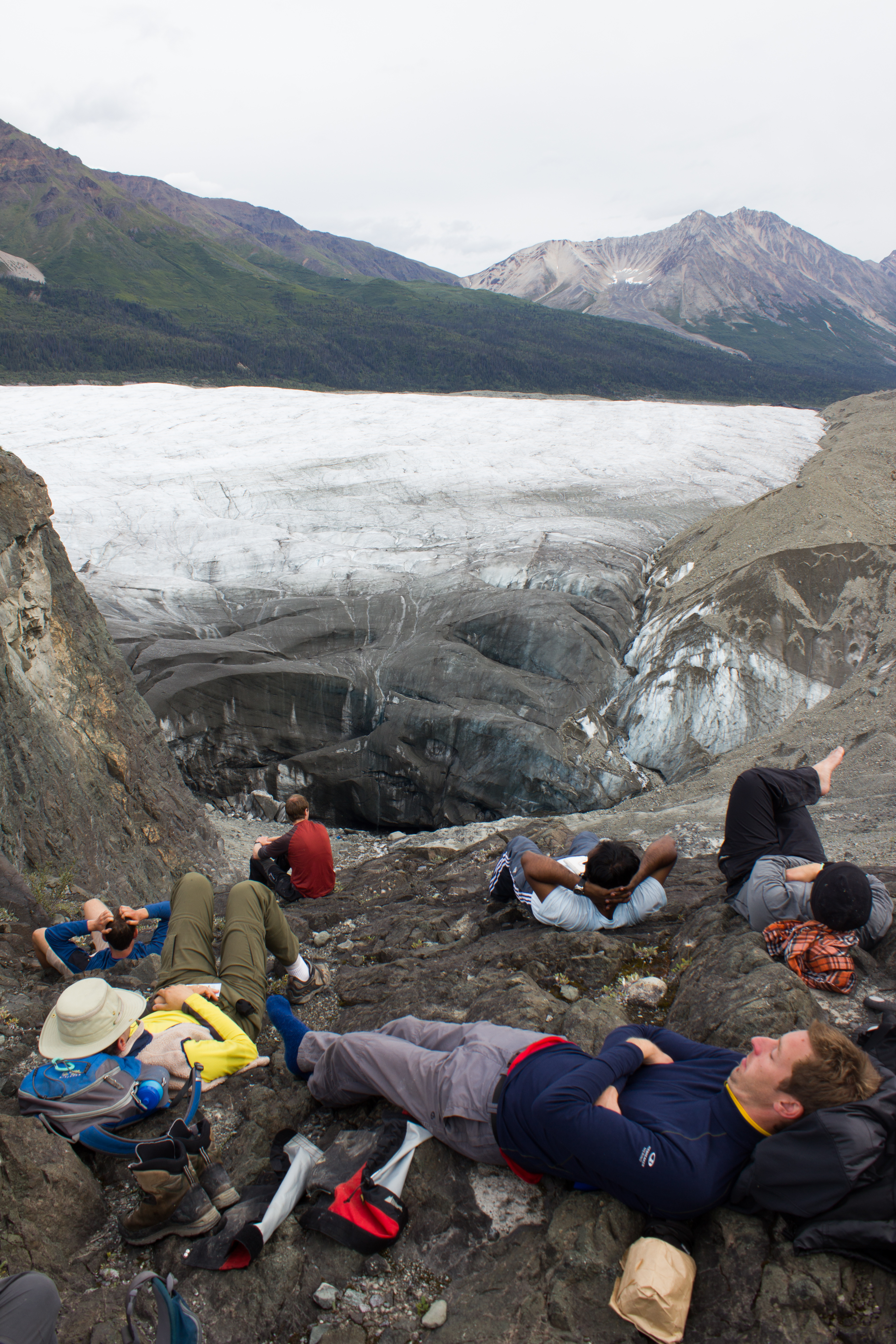
It took a day and a half to dismantle the station, and to pack everything up for transport out by helicopter. It would have taken significantly longer without Steve’s assistance throughout. With the last minute nature of this trip, I had thought that I would be tackling the station on my own, and I would probably be still up there trying to extract frozen pipes had that been the case.

I had been really curious (and nervous) to see how the camera had performed over the summer (see A Camera for all Seasons). For one reason, it would be a really useful source of information when it came to examining the data. Also, as I had built it, I would have no one to blame but myself if it hadn’t worked. Opening the case back in the lodge that night, the camera passed the first test; it switched on. Quickly checking through the pictures, the most recent image had been taken just a few minutes earlier as I was taking off my boots. Overall, the camera performed well, with just one day where it failed to shoot (looking into that). I’ve stitched the images together into the short timelapse video below, to give an idea of the changes taking place.

(Best viewed in full screen and HD)
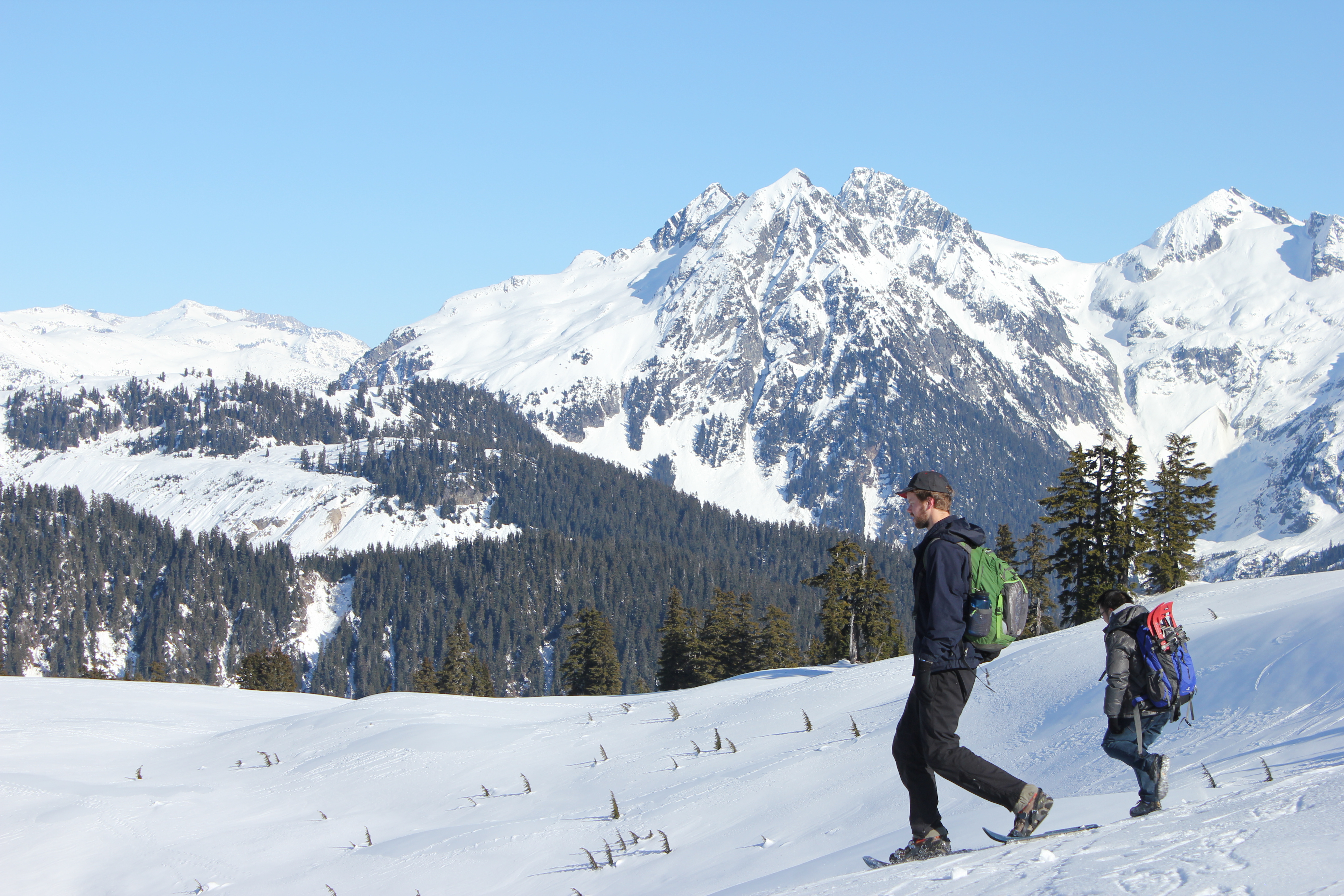
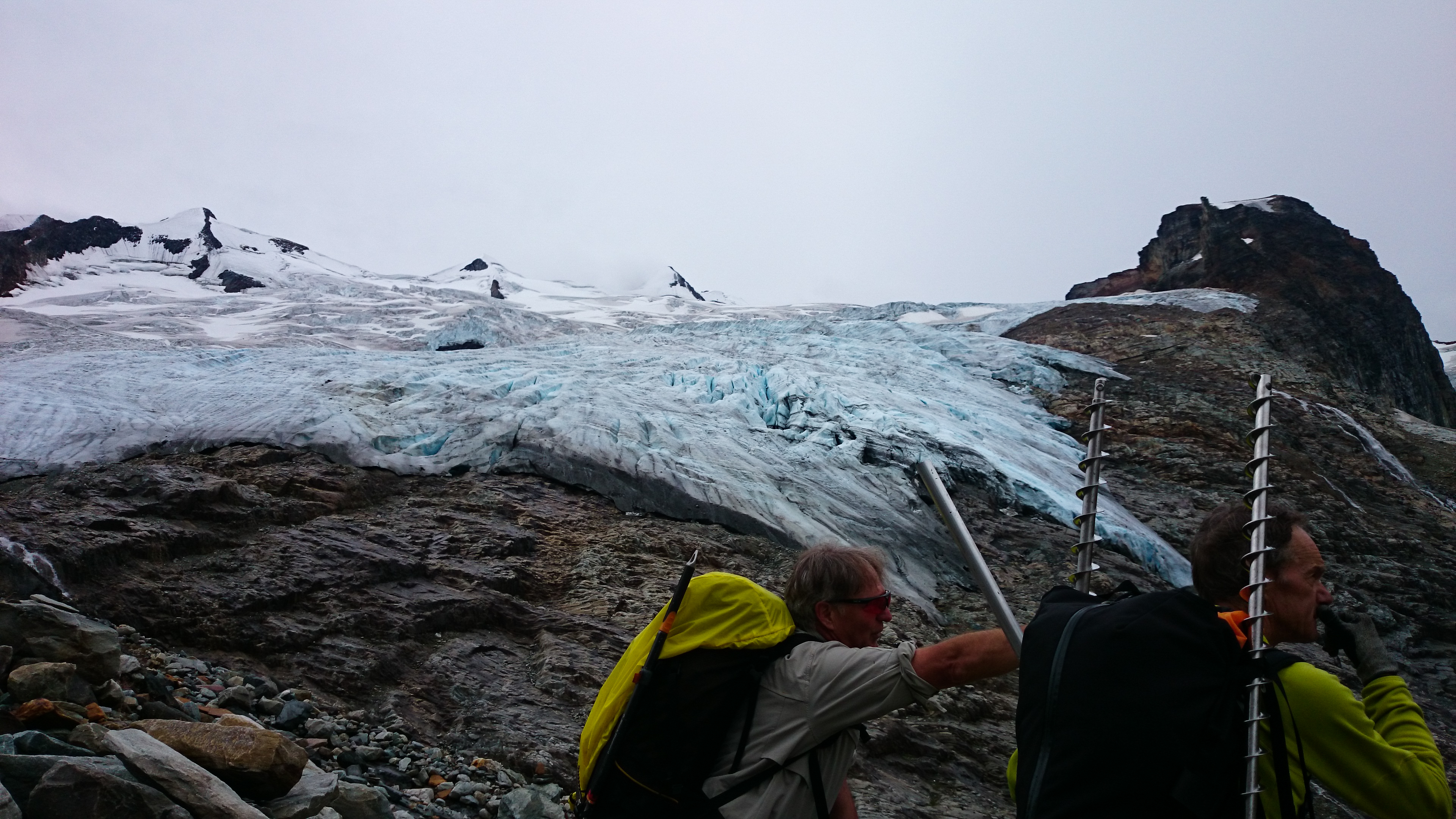
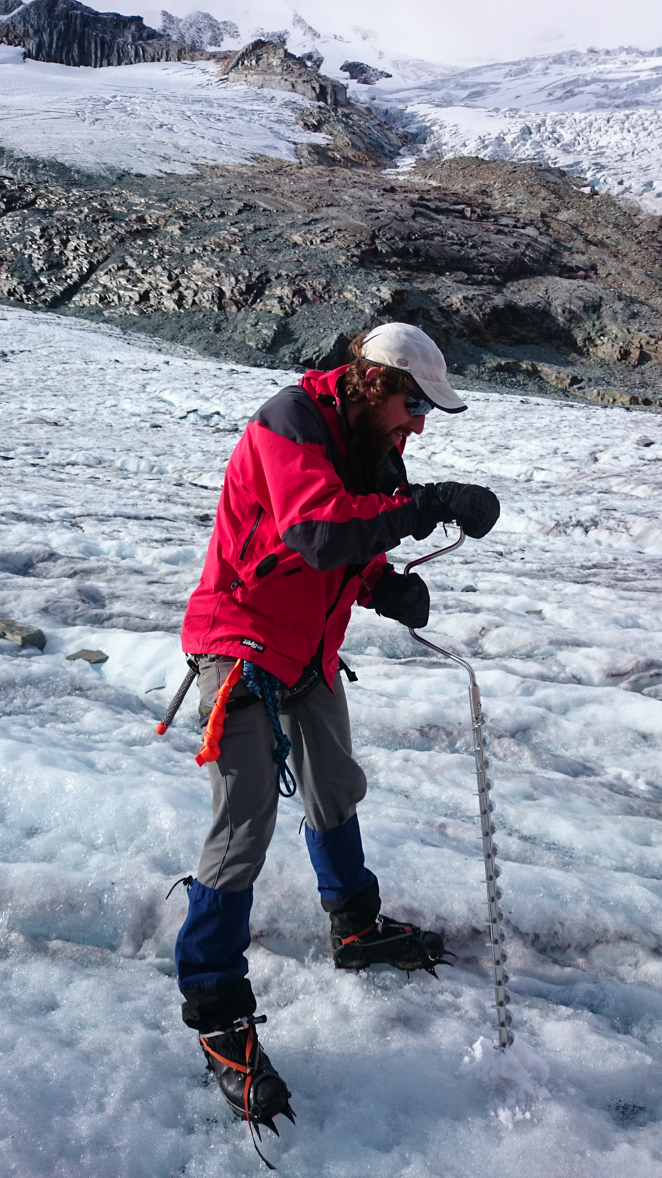
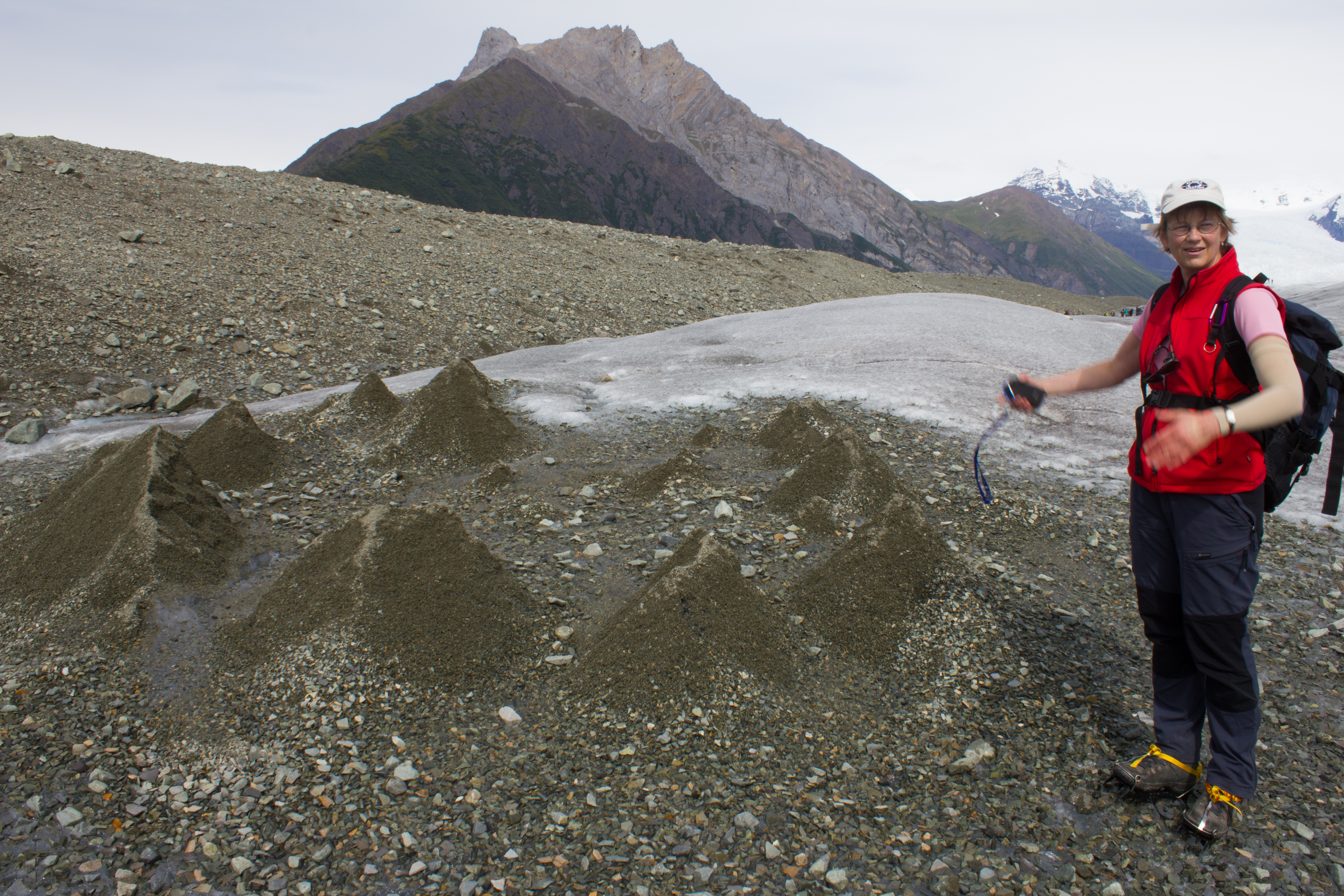
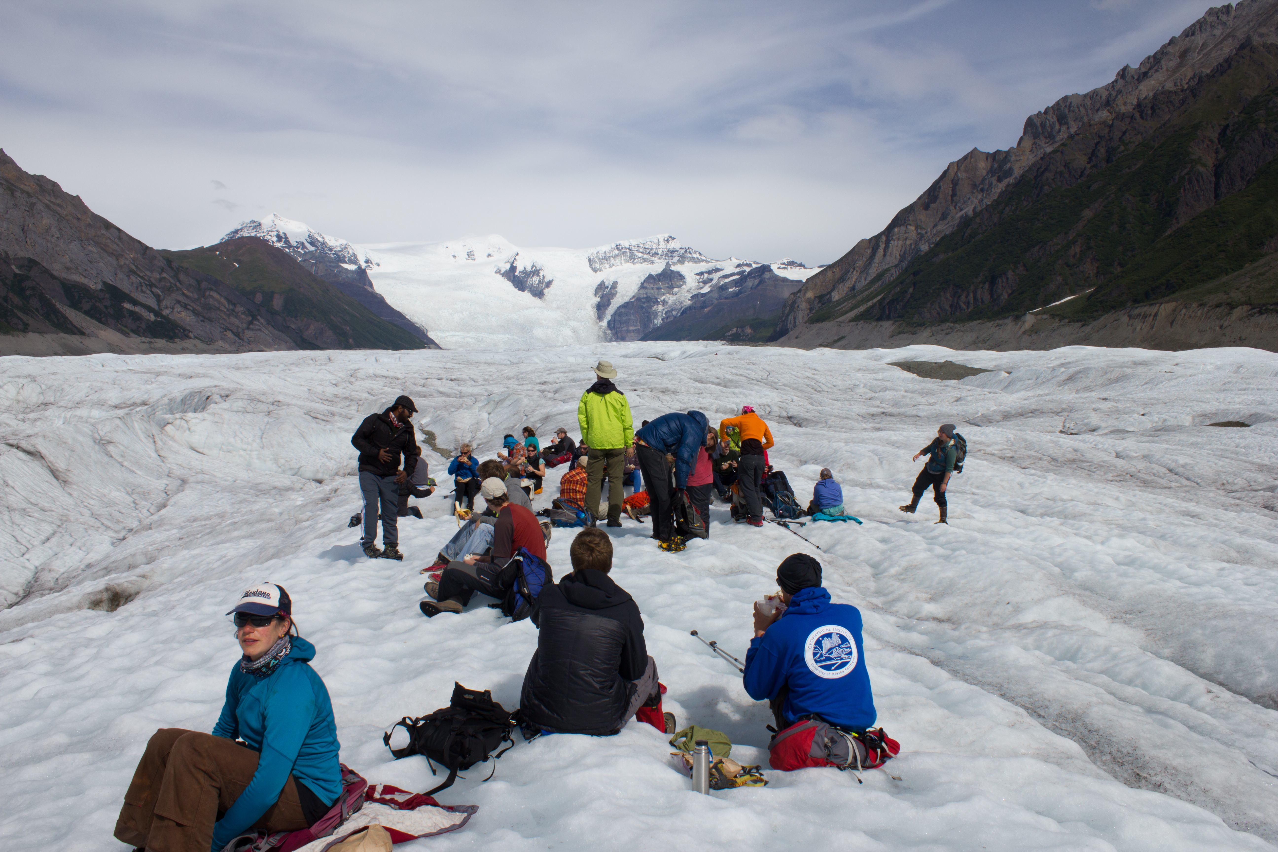
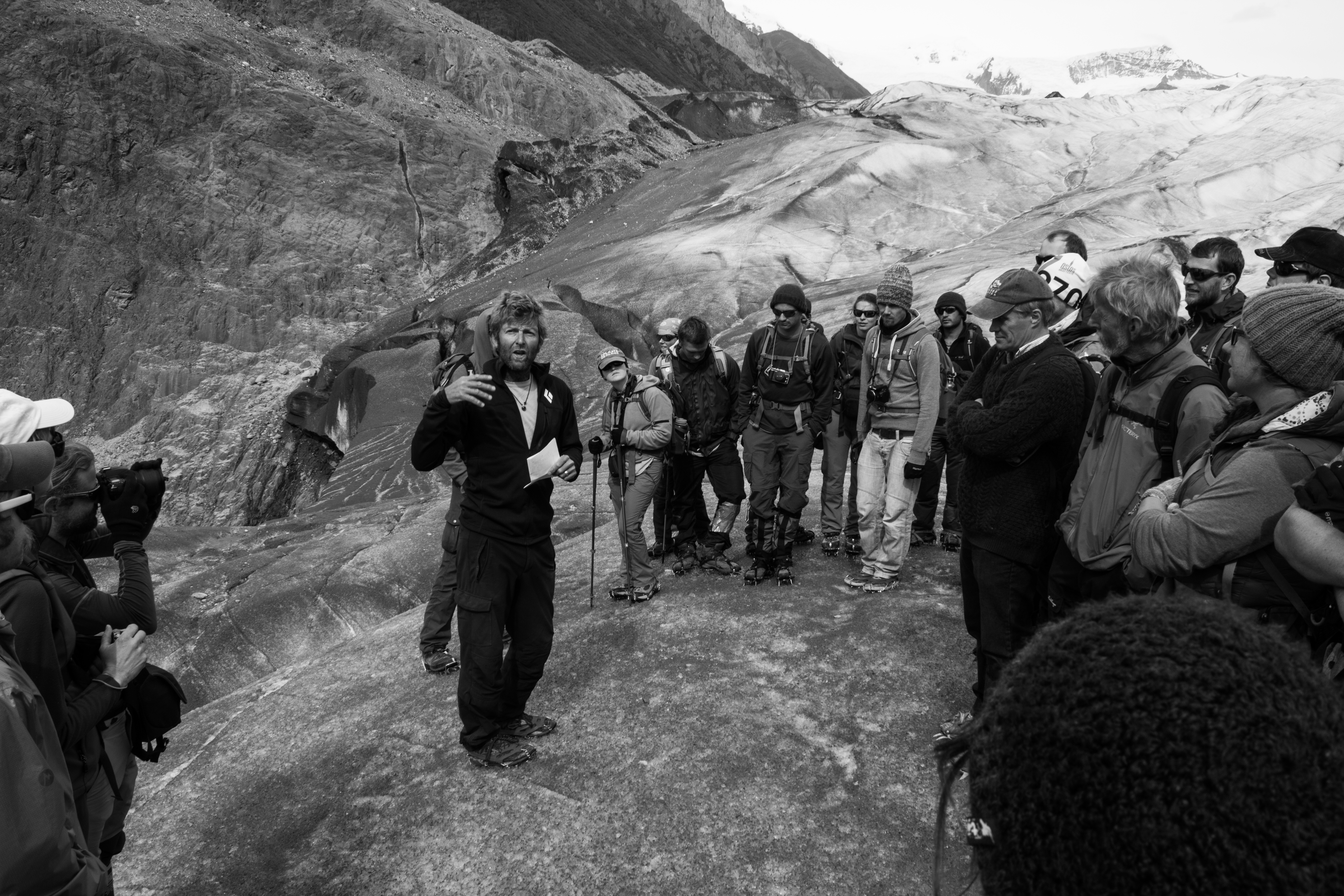
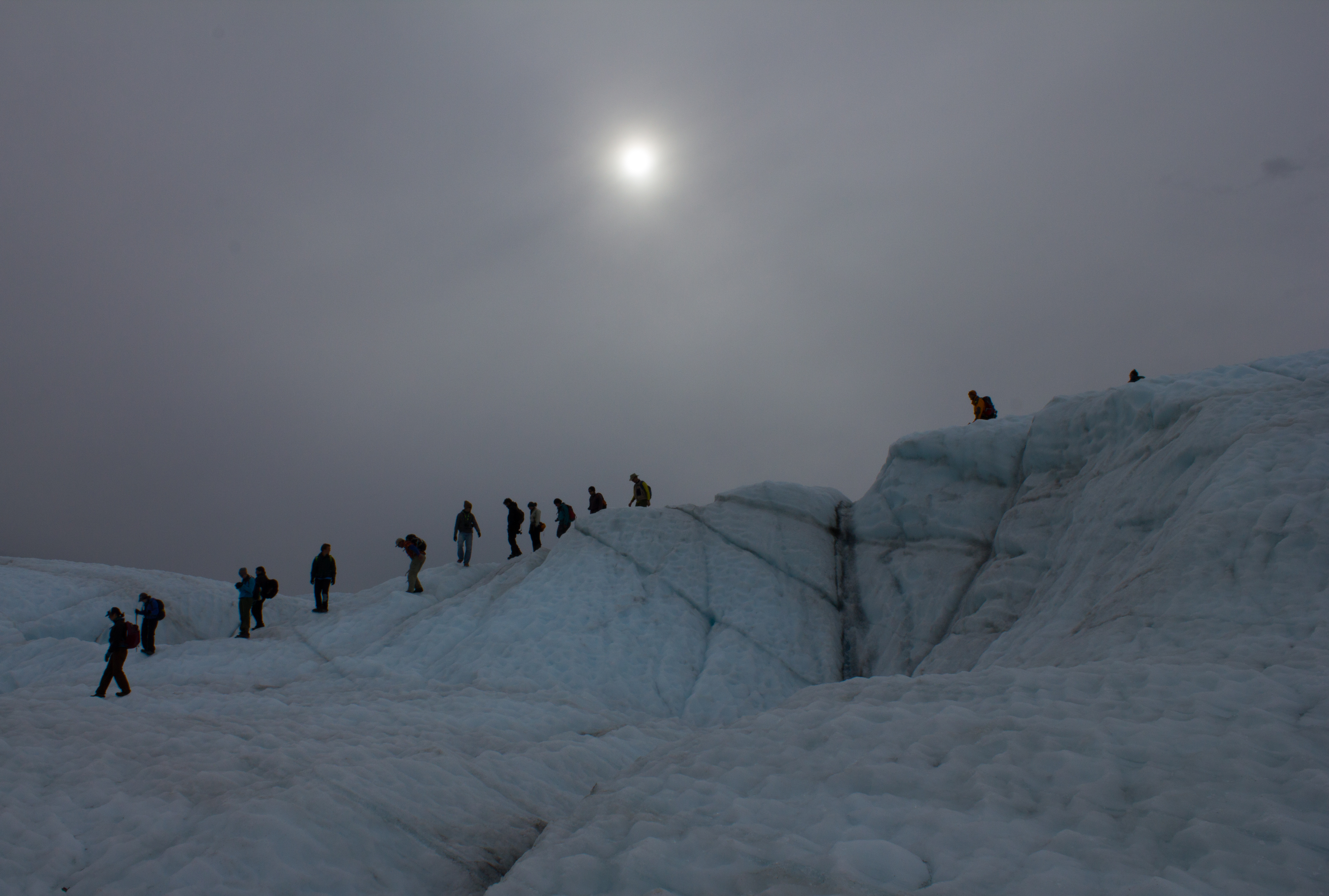
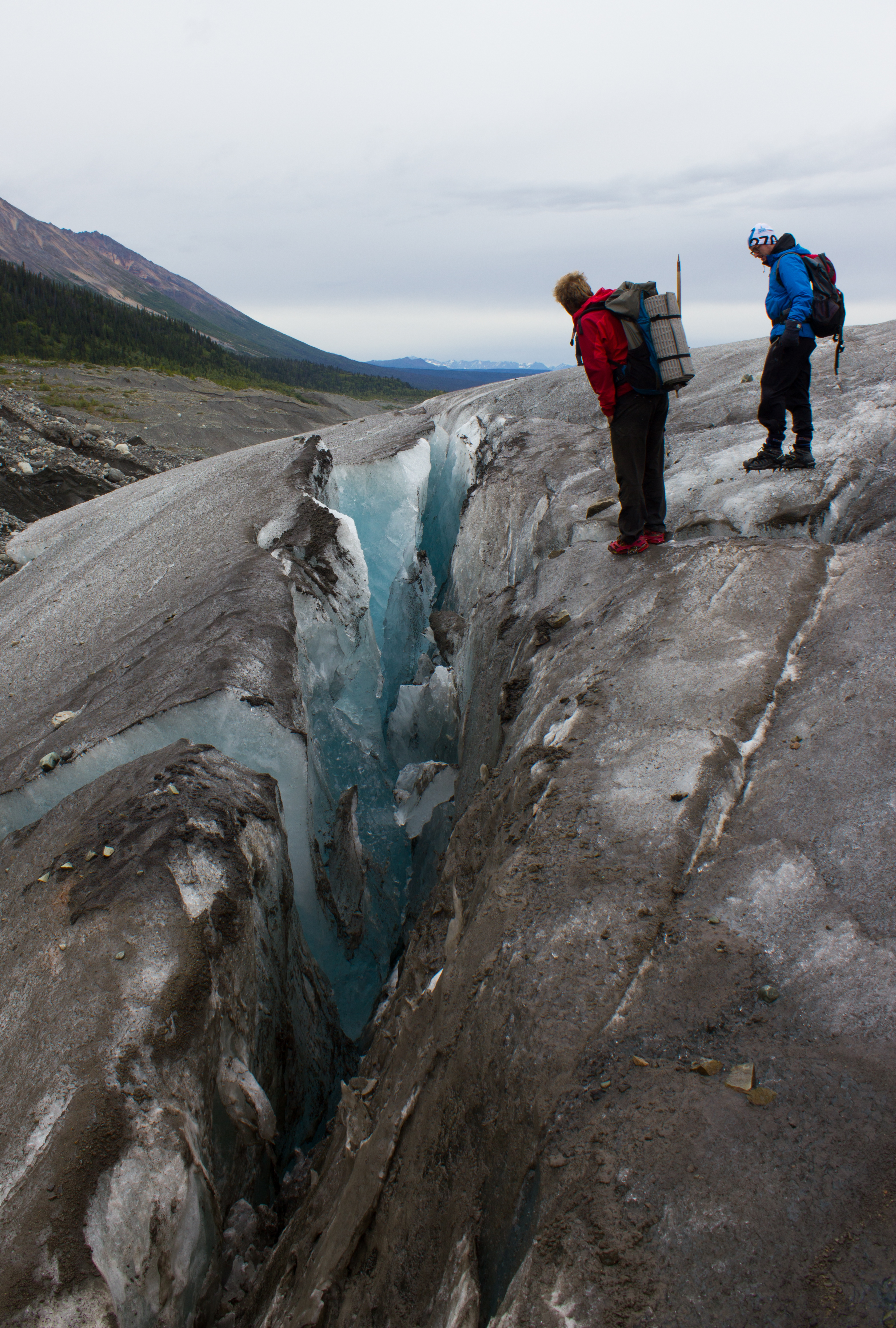
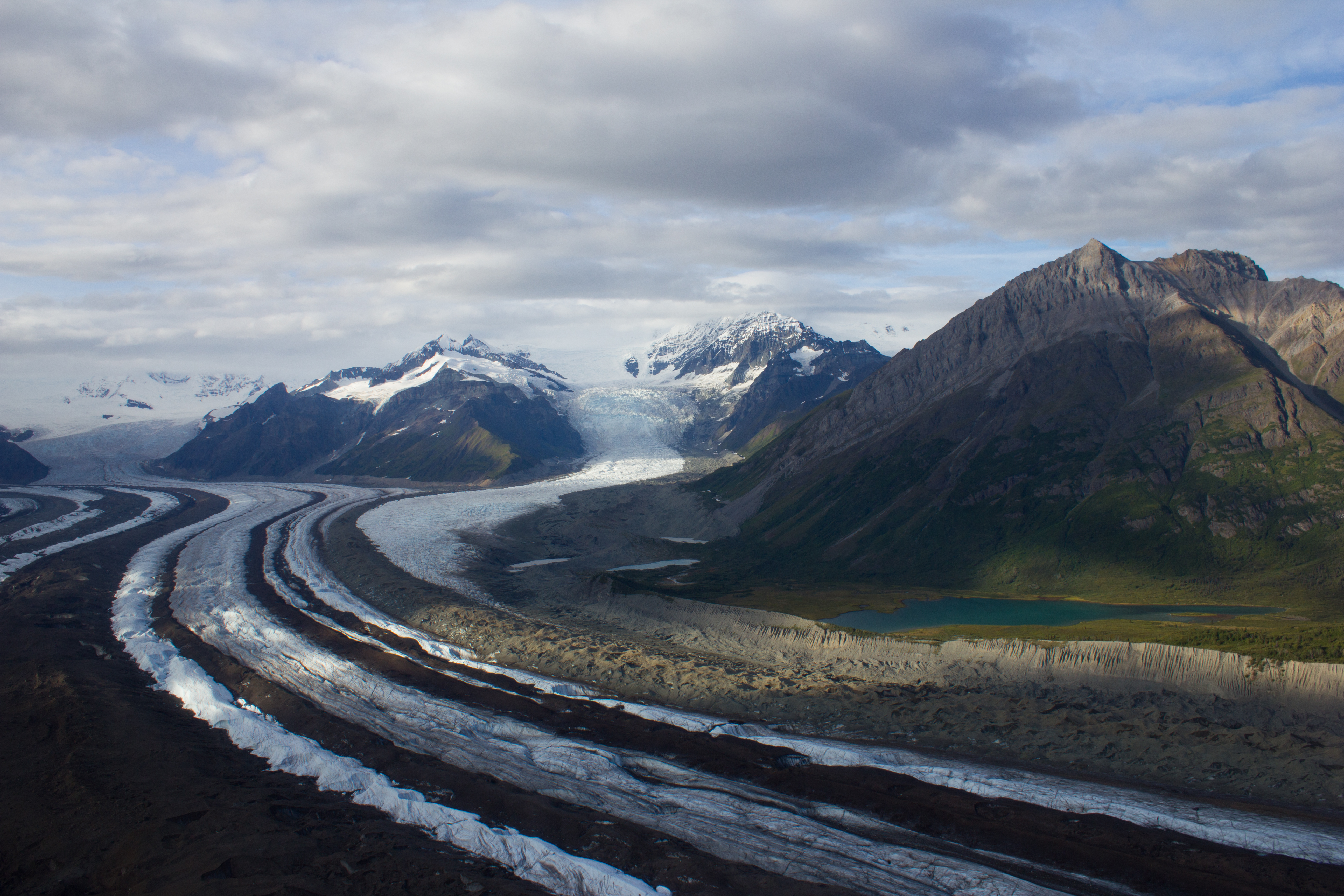
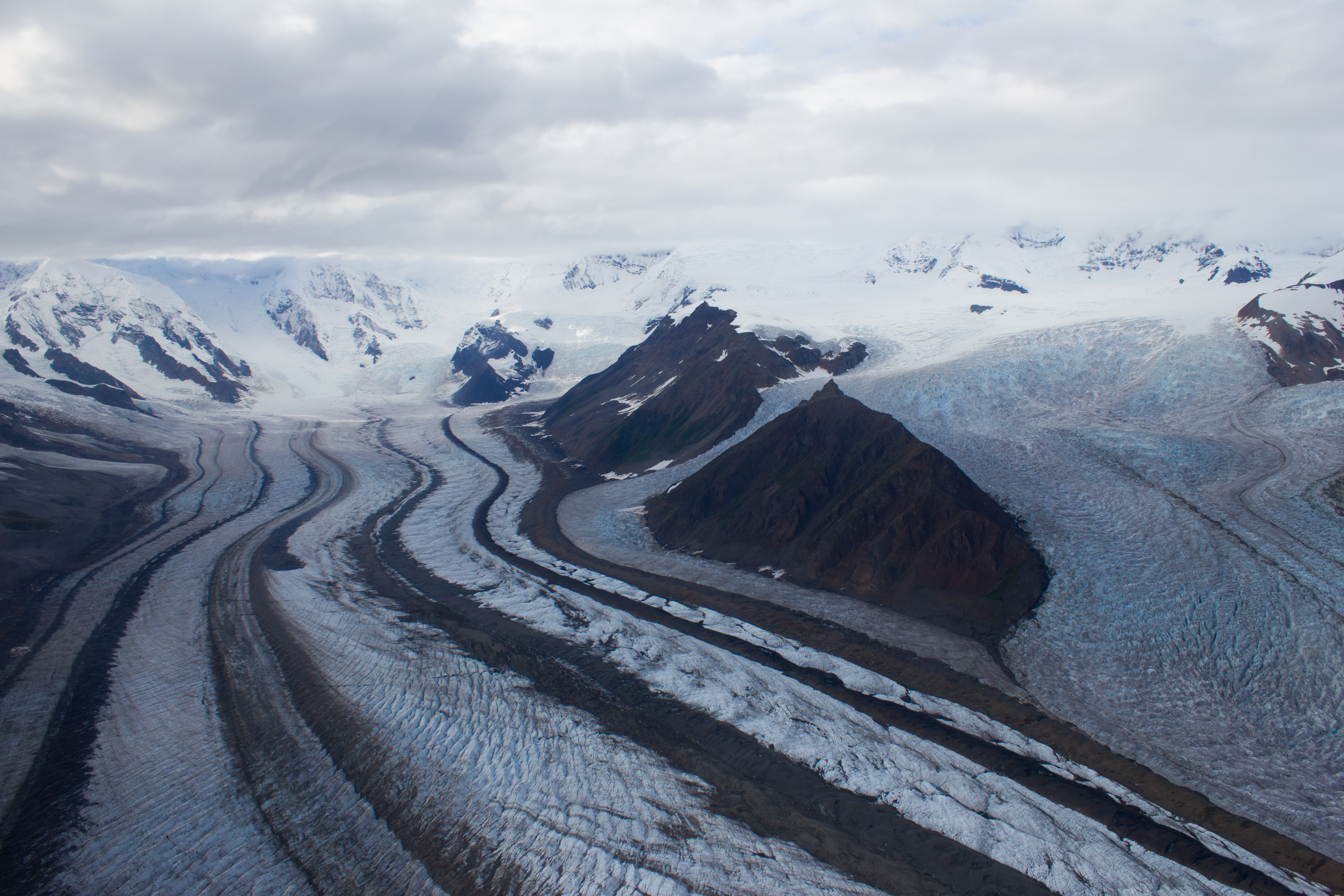
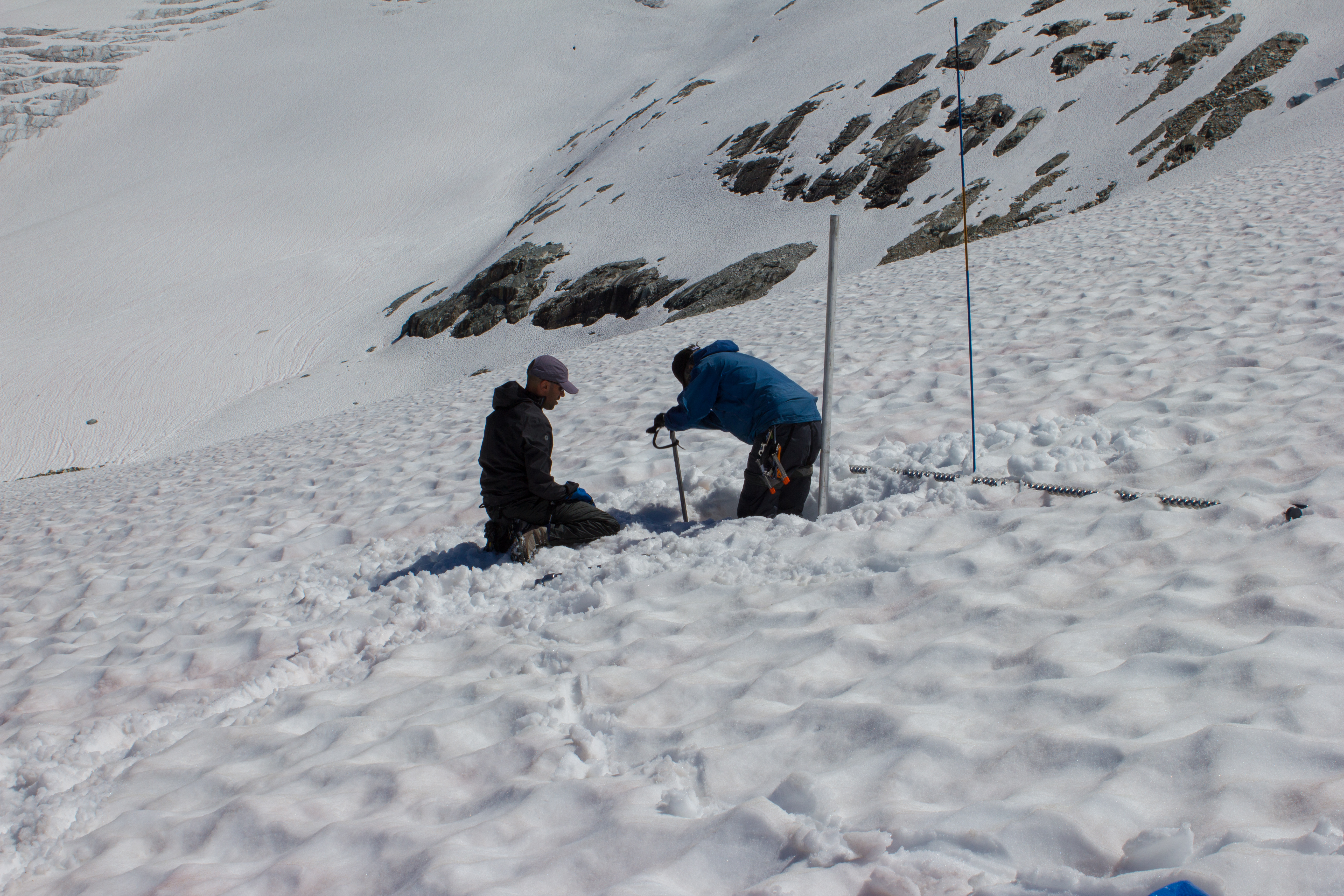
On the third day, I joined Rob, Bob, and Ben (seriously), and assisted with their work on the glacier. In order to monitor the loss or gain of ice over the glacier surface (known as it’s mass balance), a common method is to drill a series of stakes along the central line of the glacier (usually every 100 meters of elevation). These ‘ablation’ stakes are inserted deep into the snow or ice, with just their tops emerging. The stakes are visited at the same time the following year, and the change in the level of the glacier surface relative to the stake is measured. We spent most of the day installing stakes, and also a sensor in one of the streams emerging from the base of the glacier, to monitor temperature changes of the melt water.


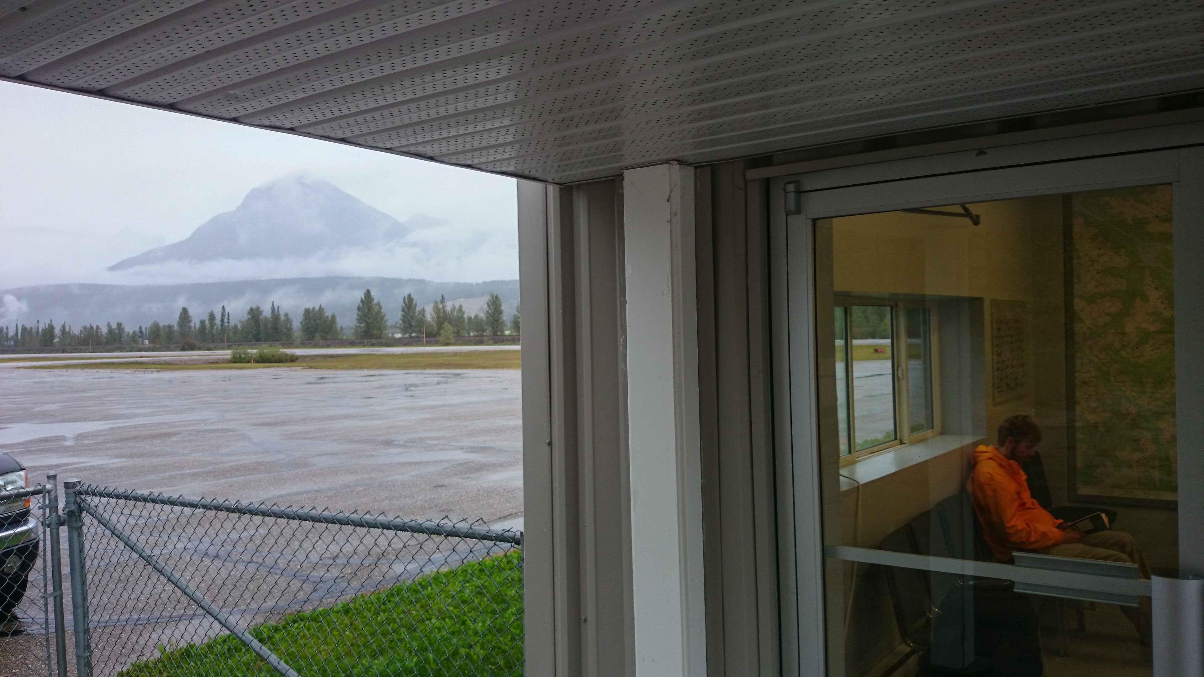
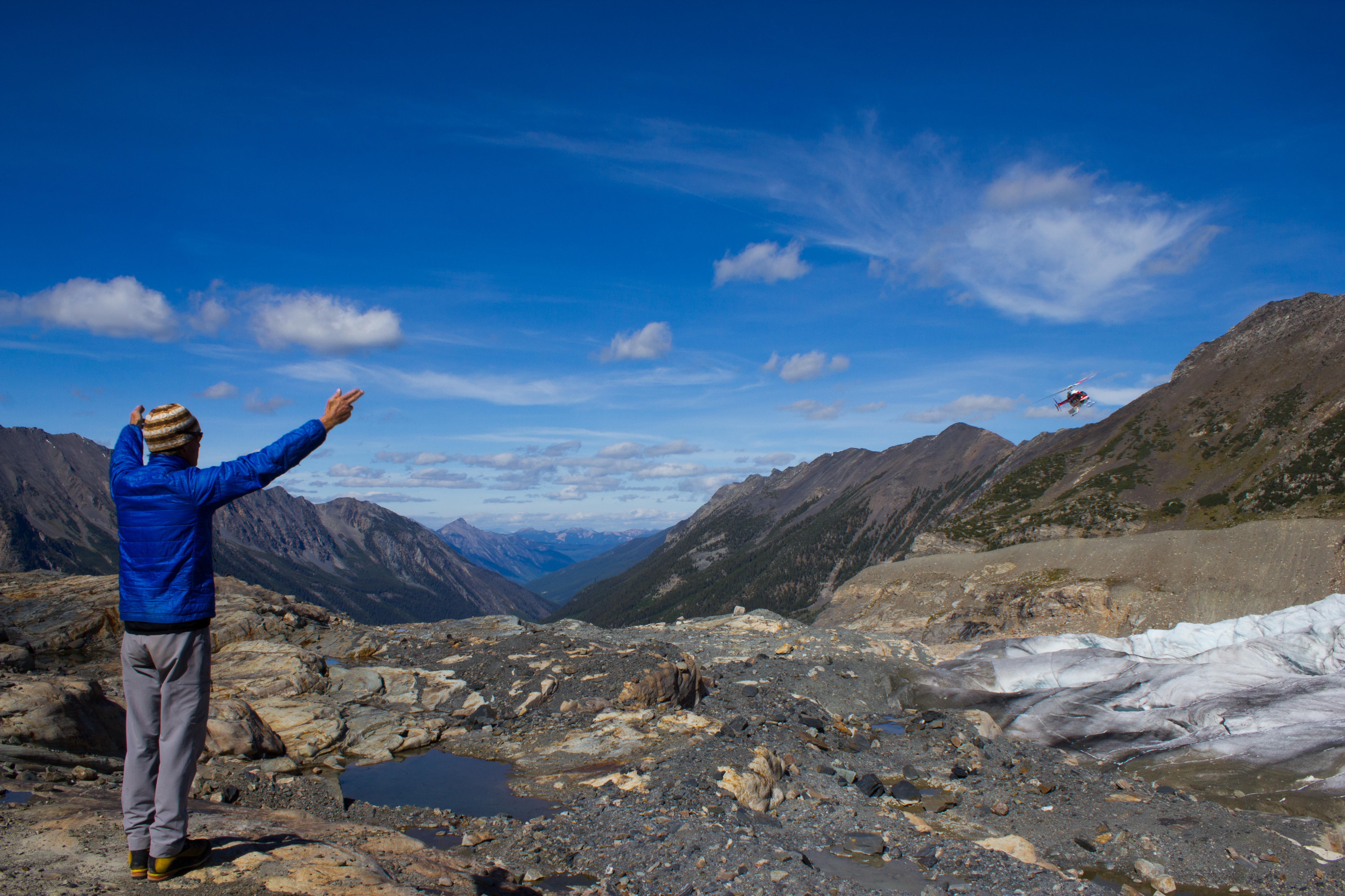
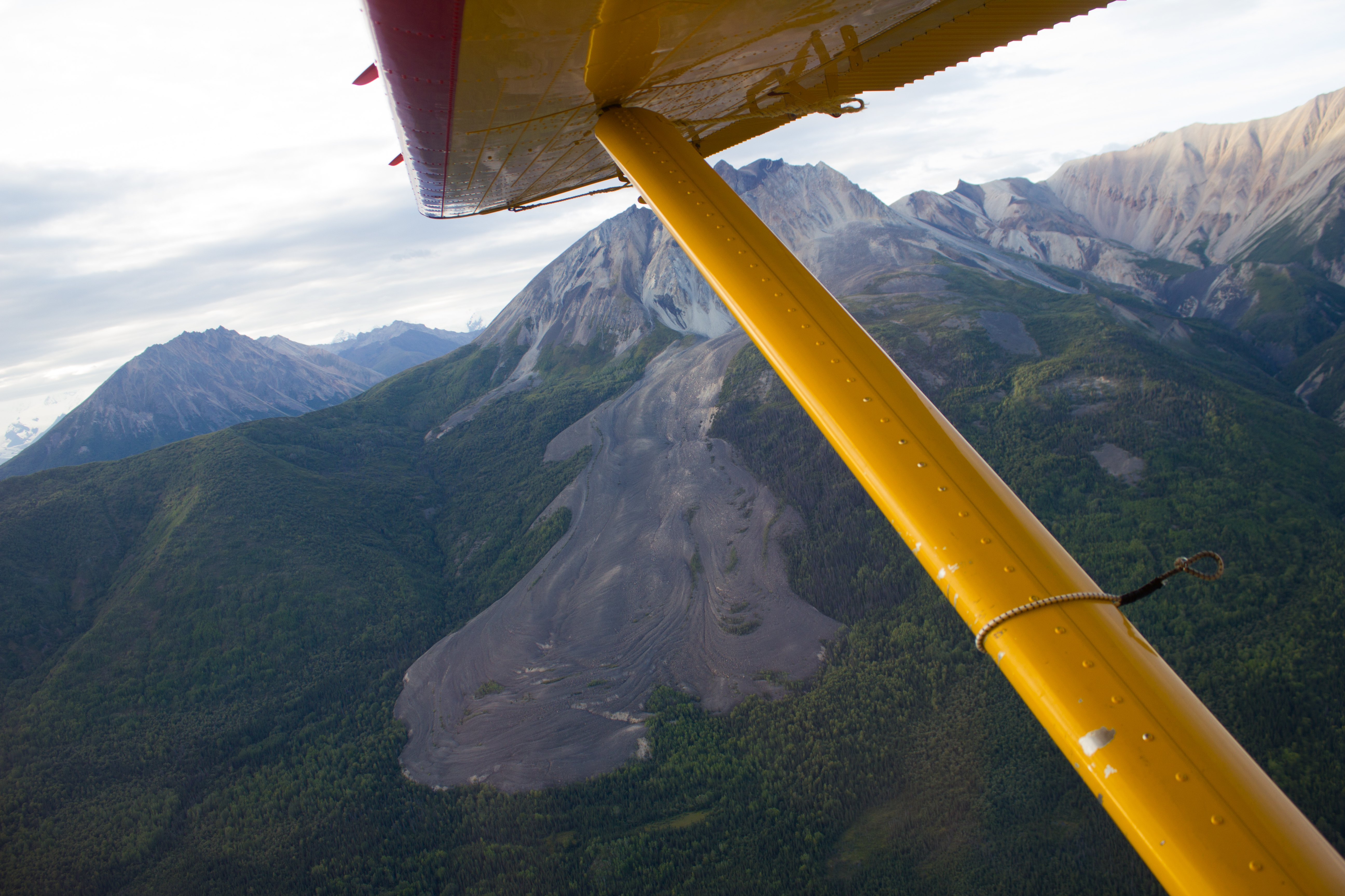
I had agreed to stay on after the work on Nordic, and to assist Ben and Bob with an ablation stake campaign on Conrad Glacier. I was also interested in assessing Conrad (also in the Selkirk mountains) as a potential location for installing a station next summer. Between flying down from Nordic and setting out for Conrad, we had a couple of enforced rest days. Low cloud meant that visibility was too poor for the helicopter, so we hung out in Golden, and Steve took us around some of the local mountain bike trails.
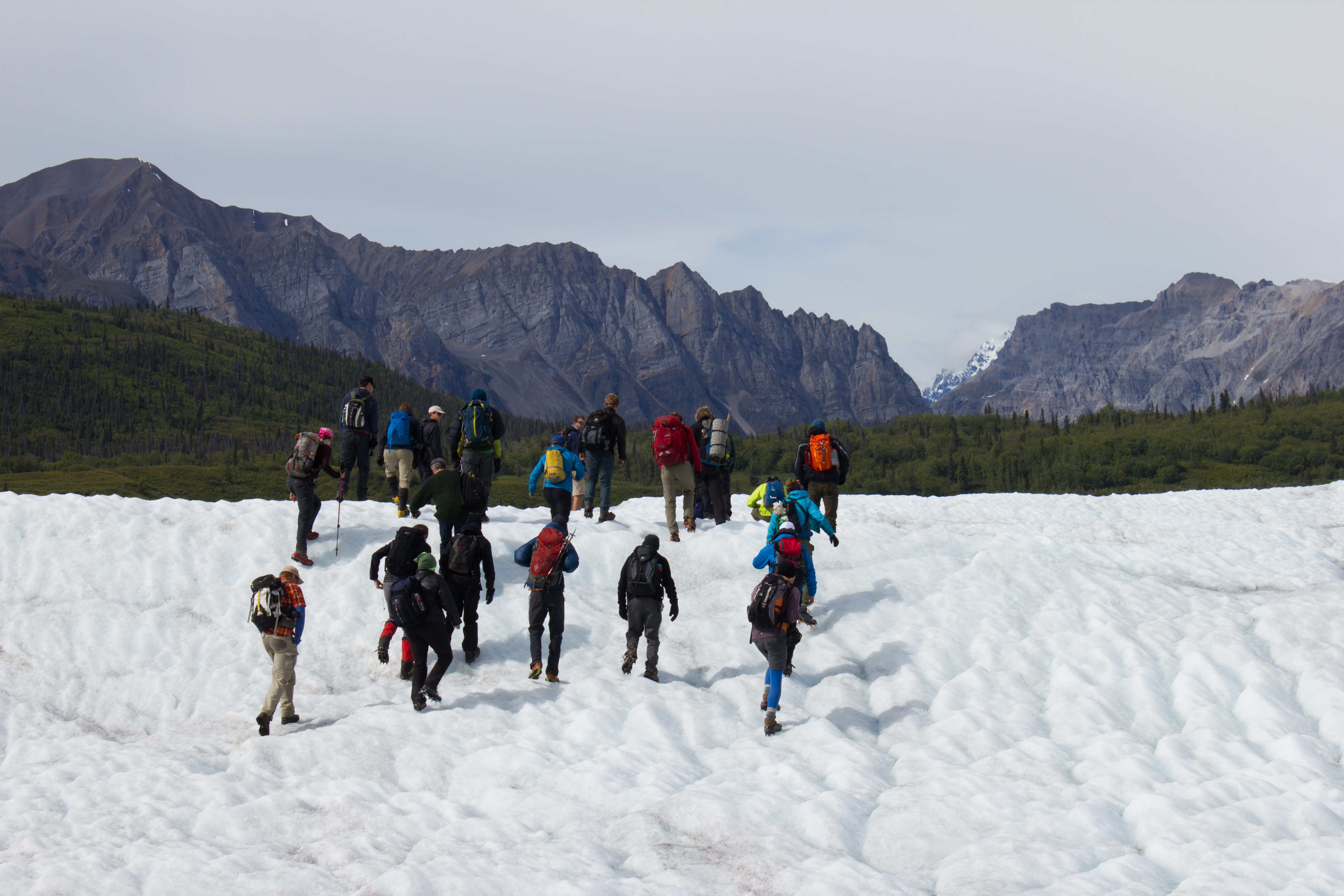
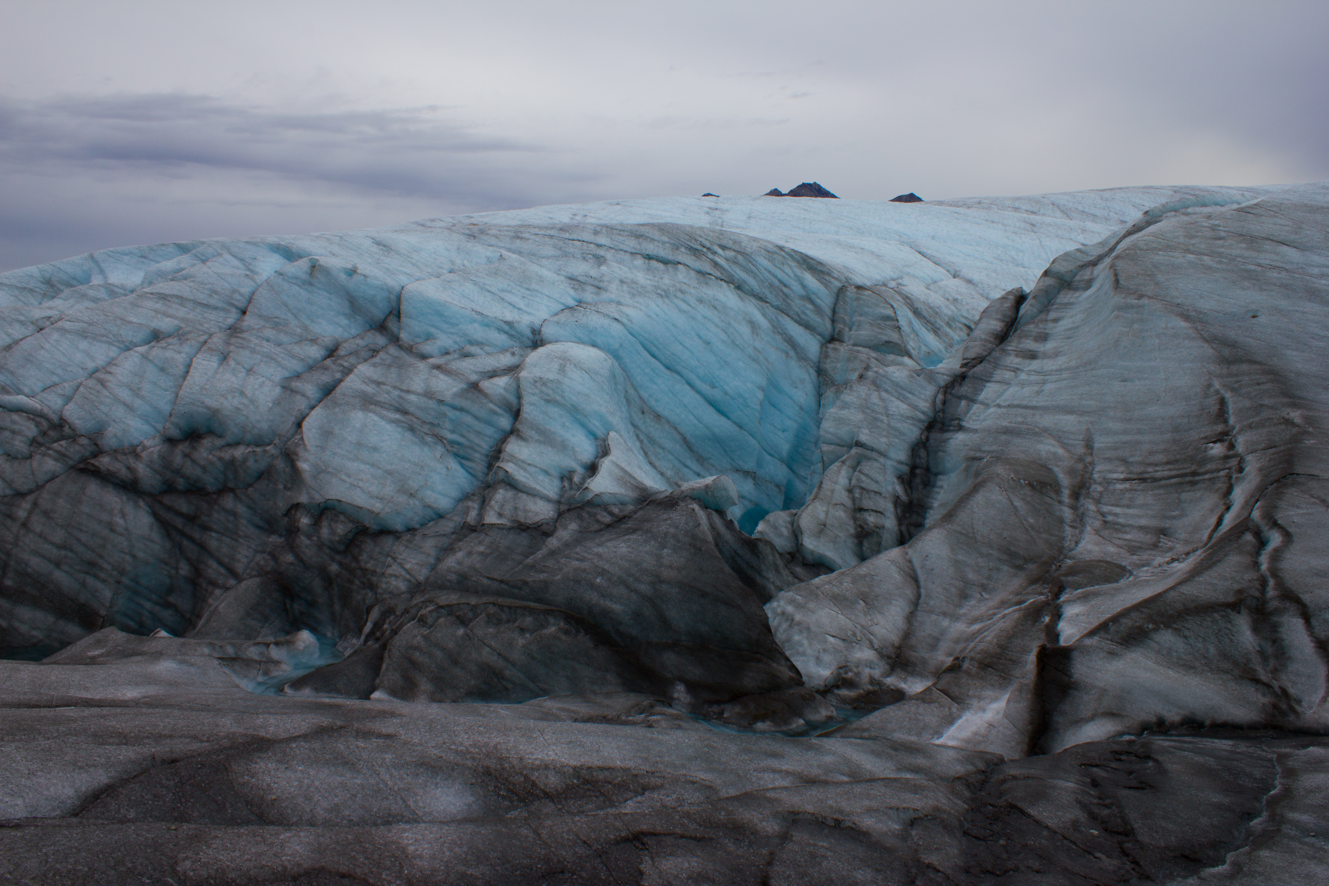
A window of clear skies two days later gave us a few hours to fly to Conrad, and set up camp. The following are some images from our time there, and of the work we were involved in.


I really enjoyed my time on Conrad. With my own project wrapped up on Nordic, I was better able to connect with the landscapes around me. This was wilderness; rock, ice, water, and weather, with little to distract from it. With night temperatures below zero, and winds that spoke of snow, it was clear that the summer was ending, and it was a beautiful location to bid it farewell for this year. The last day was an epic. We rose at 6 to piercing blue skies, and spent the morning installing the remaining stakes higher up on the glacier. We returned to break up camp, and were picked up by helicopter at 3. It was 5:30 before I was pulling out of Golden, with the drive back to Vancouver ahead of me. Arriving at the University shortly after 3am, I unloaded the equipment as quickly as possible, and was thankful that my running in and out of the building with expensive equipment did not alert the suspicions of security.
The main purpose of the field work was to obtain data. So in some ways, the work is really only beginning, and will continue throughout the winter, in the office and the lab. This summer’s campaign was just the first of several before the research questions of my PhD can, hopefully, be answered. However, a PhD can be filled with lots of missteps and wrong turns, so it’s important to recognise and appreciate when things go well. A solid first step. One down.
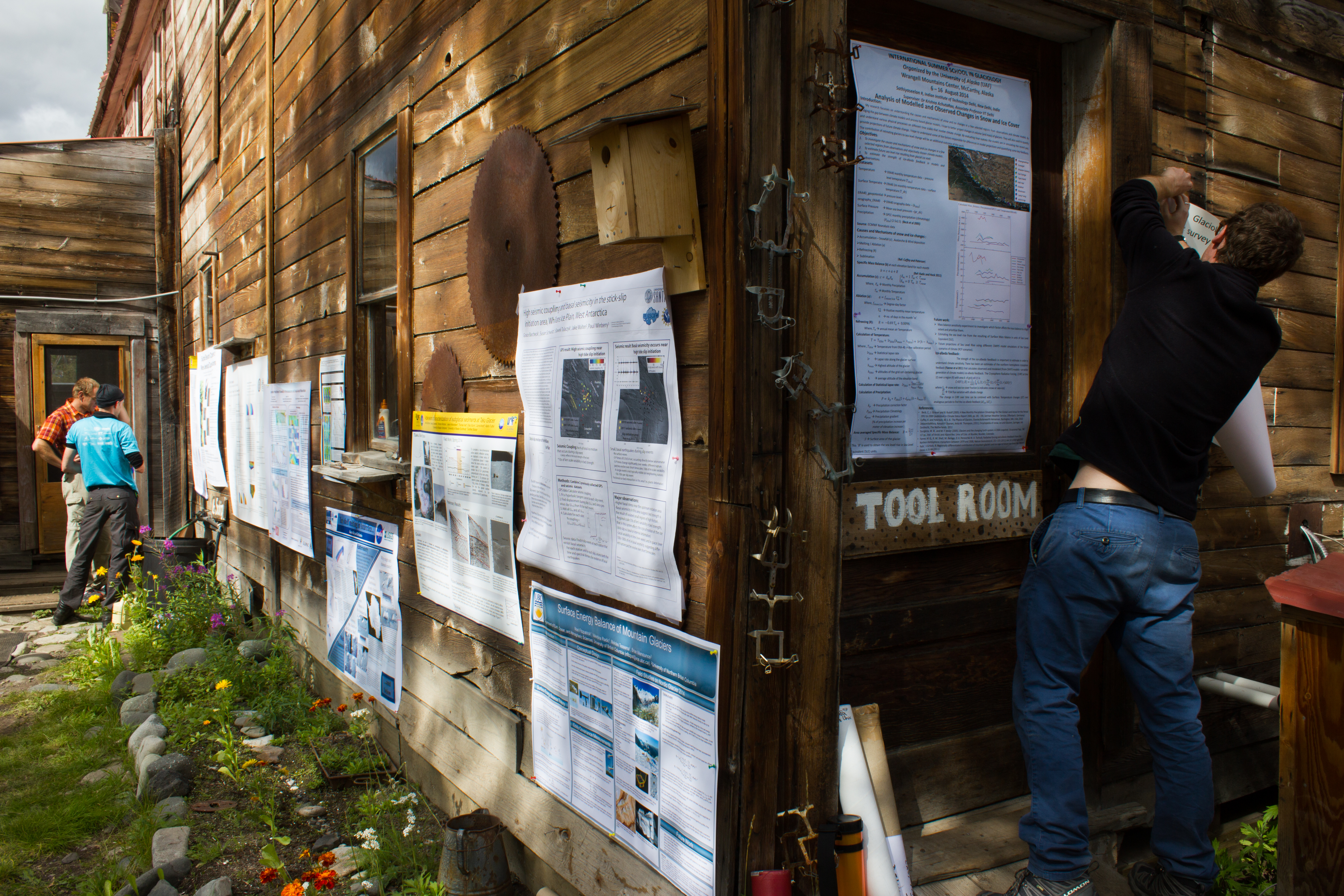
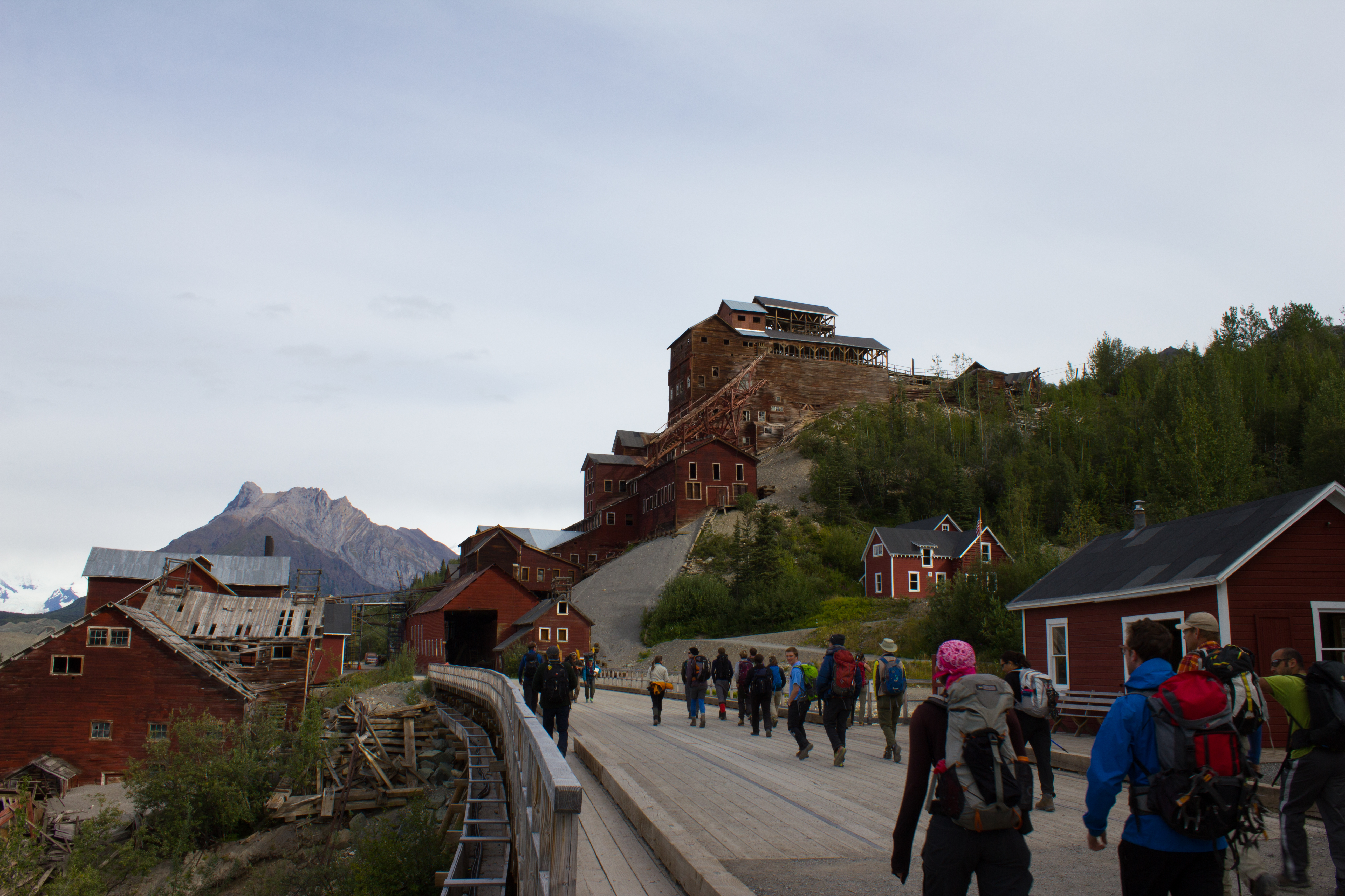
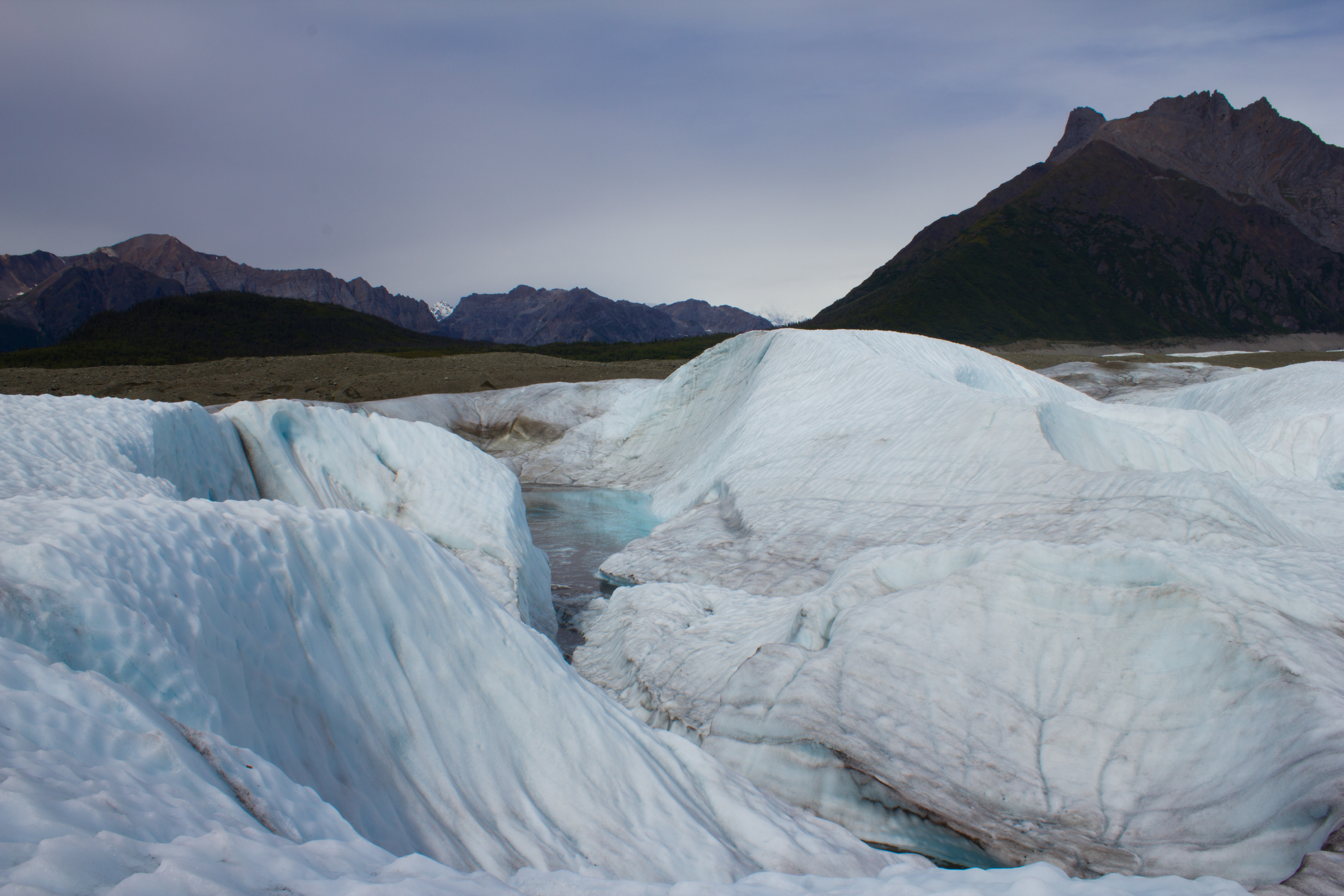
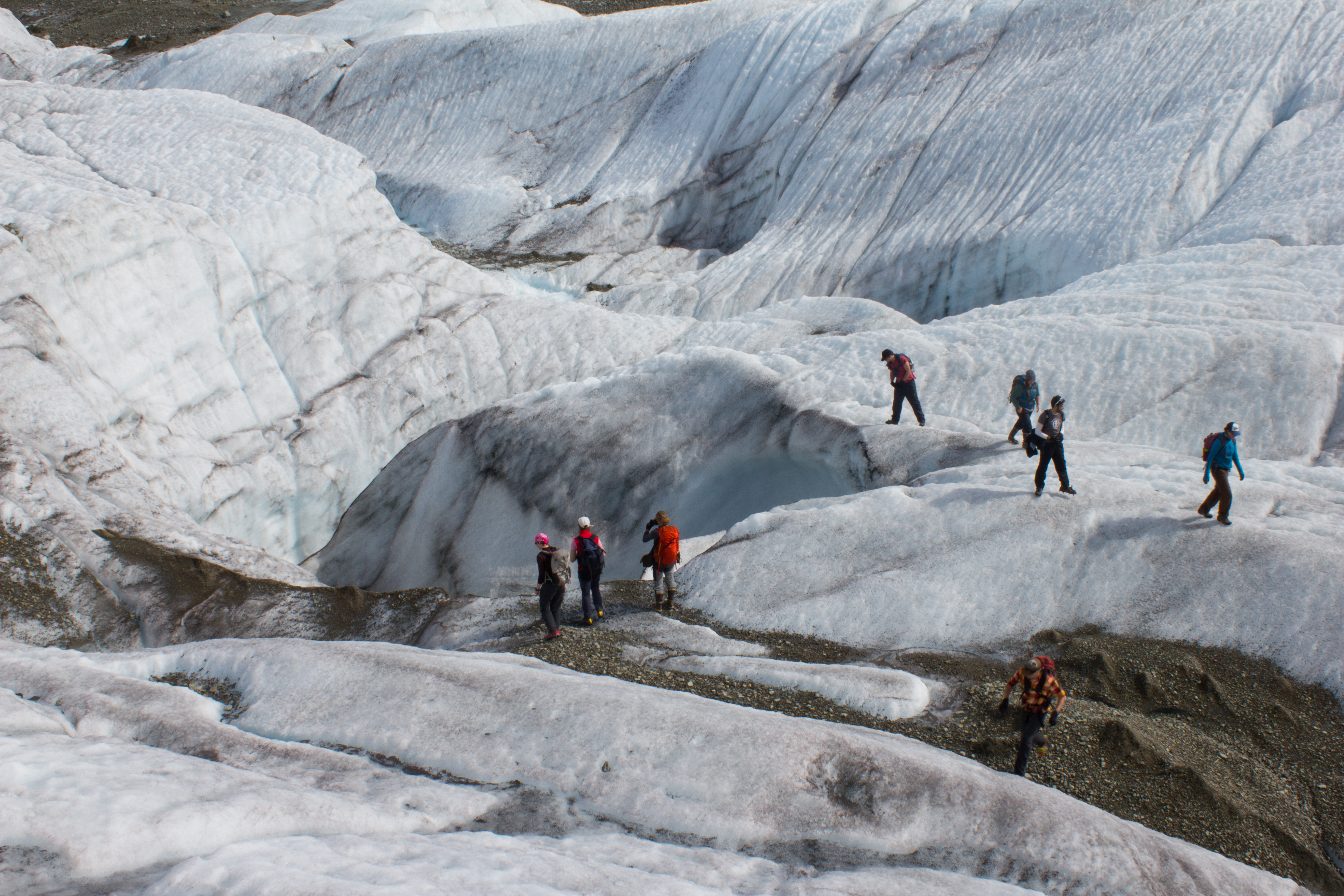
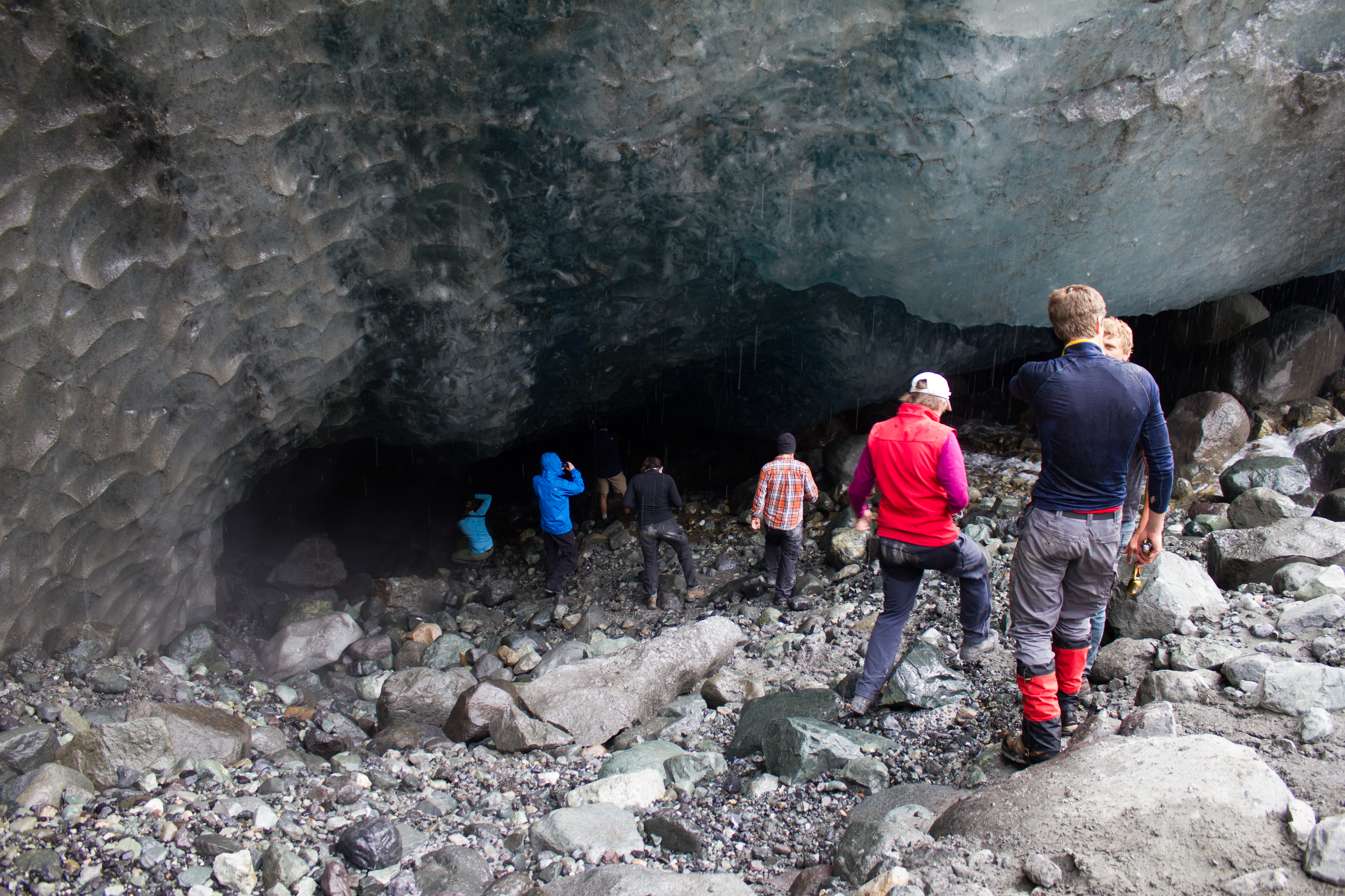
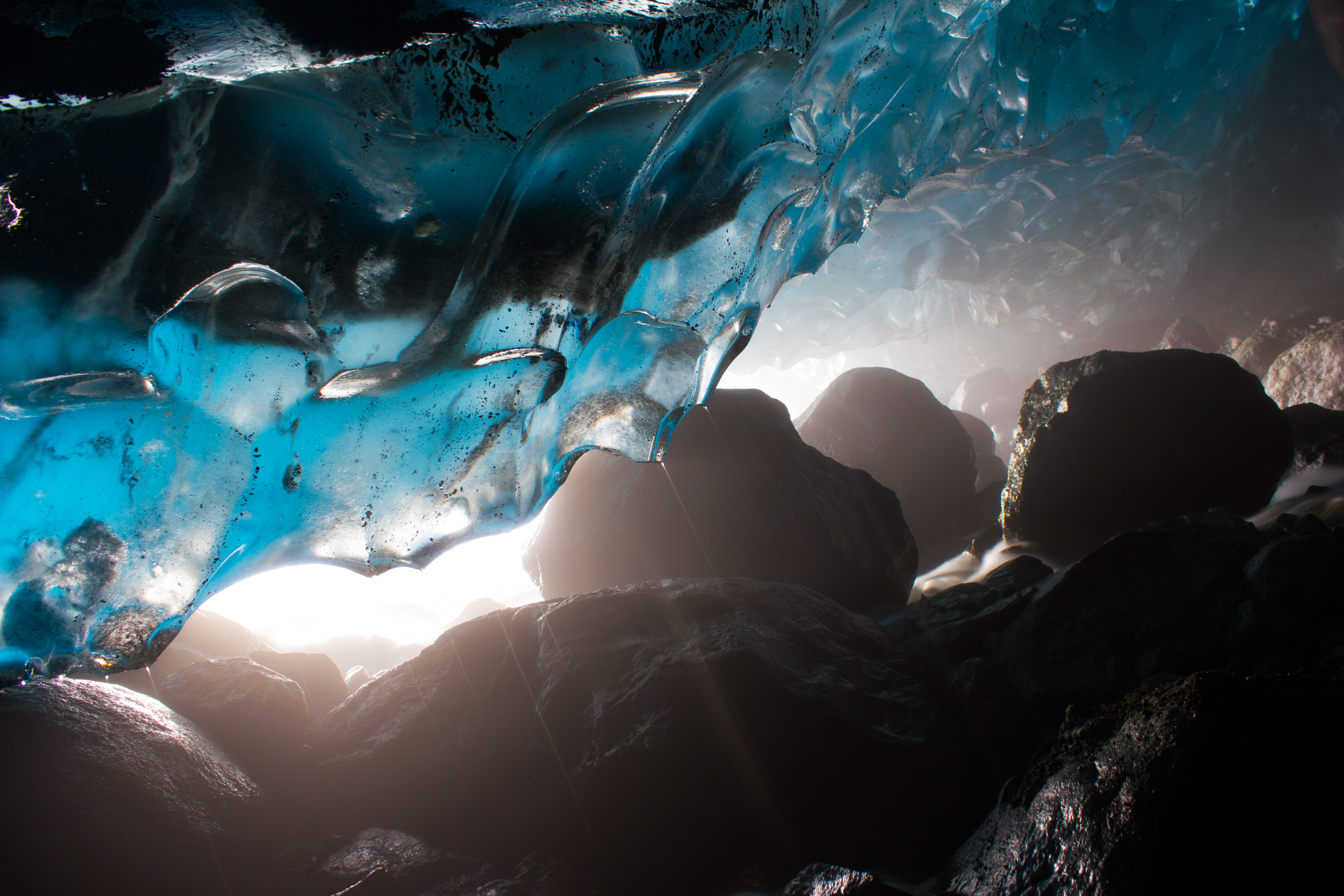
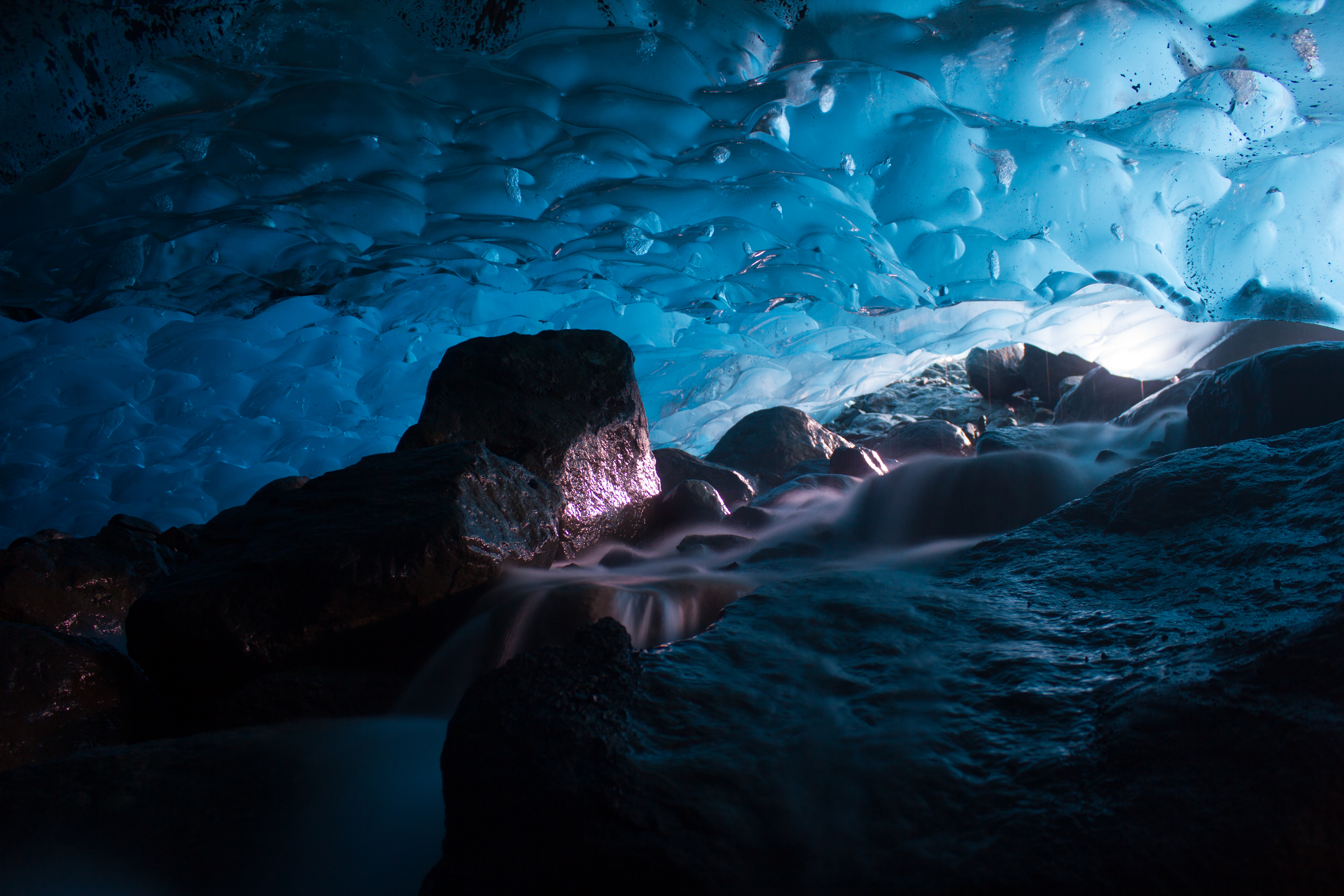
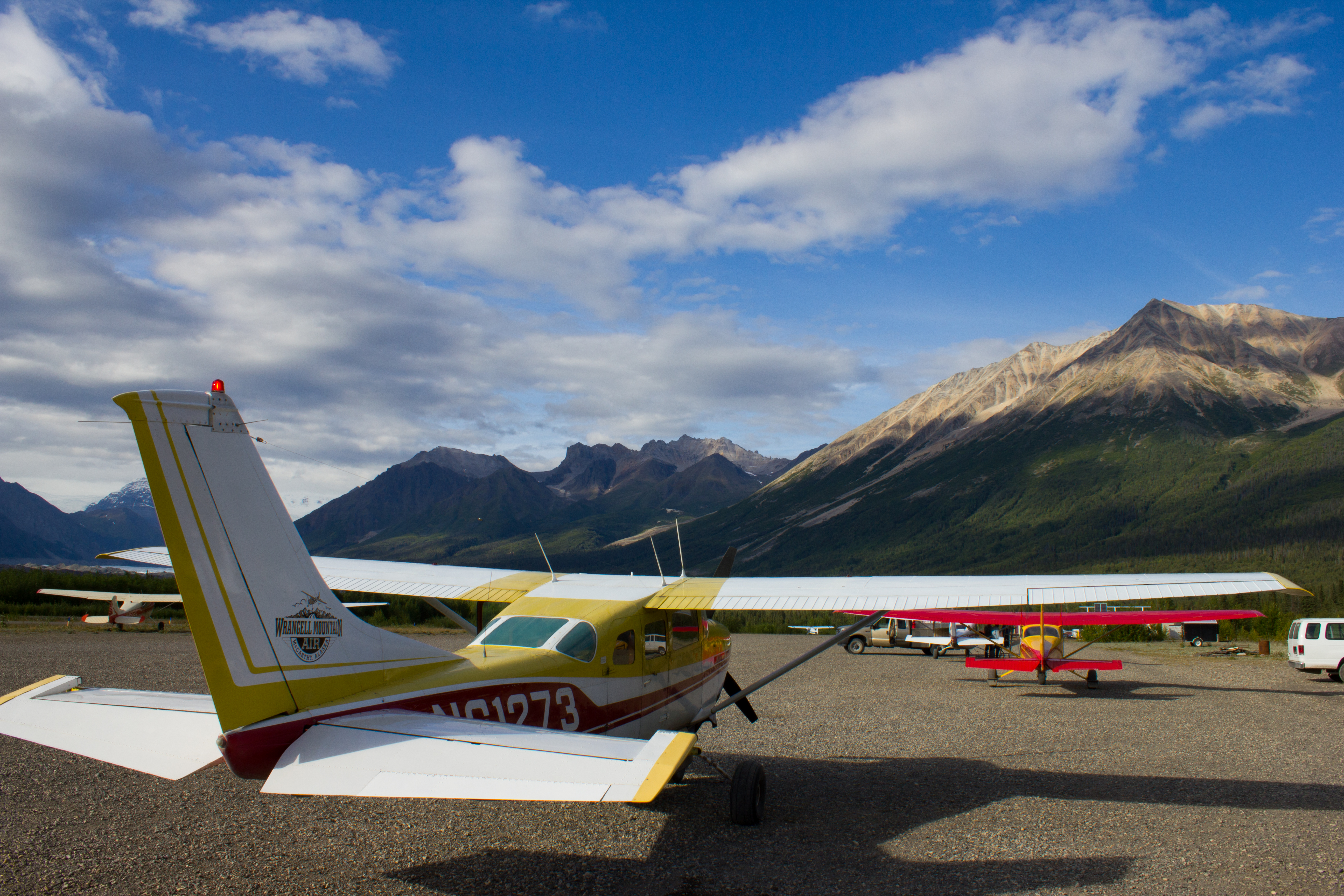
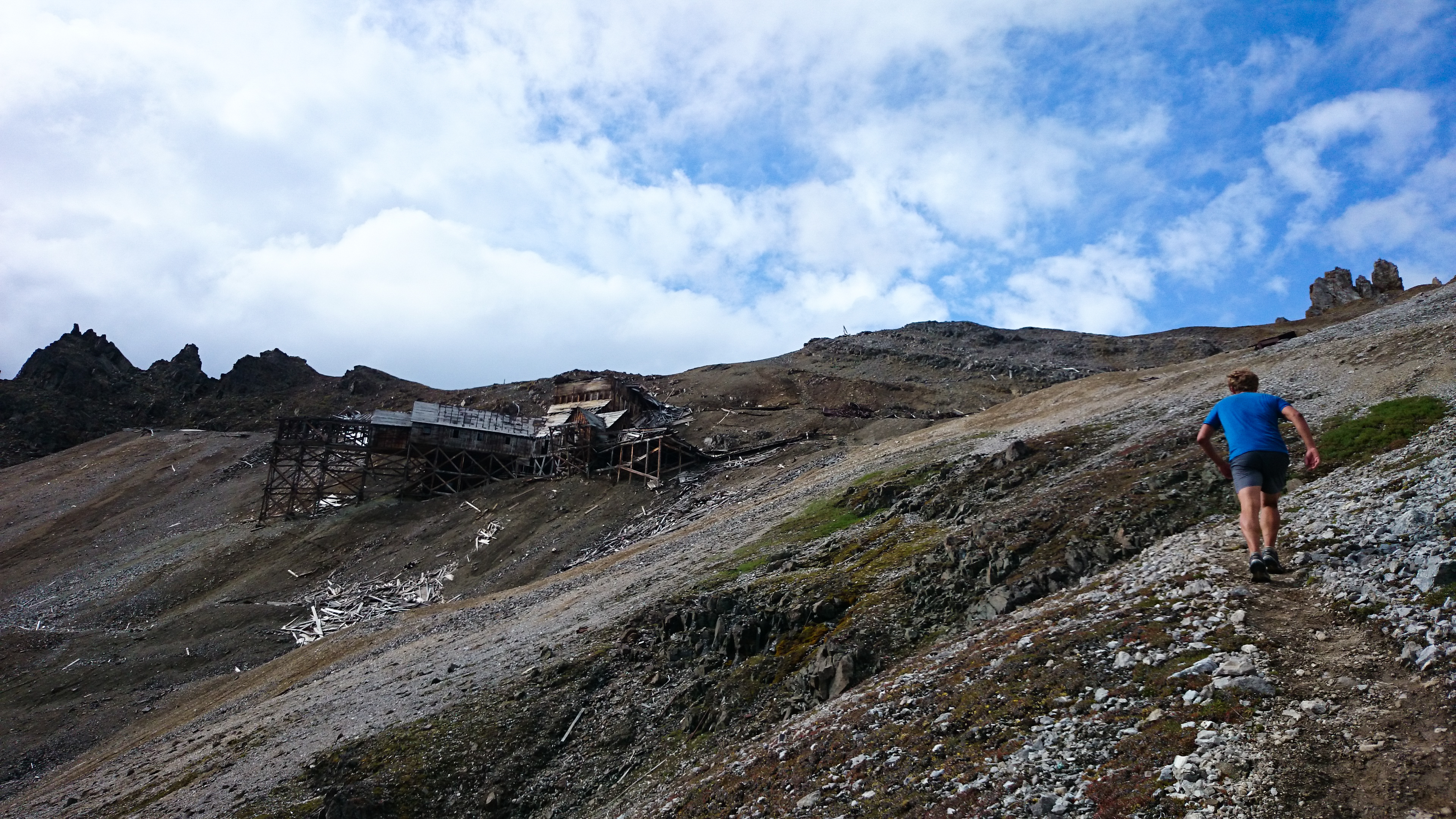
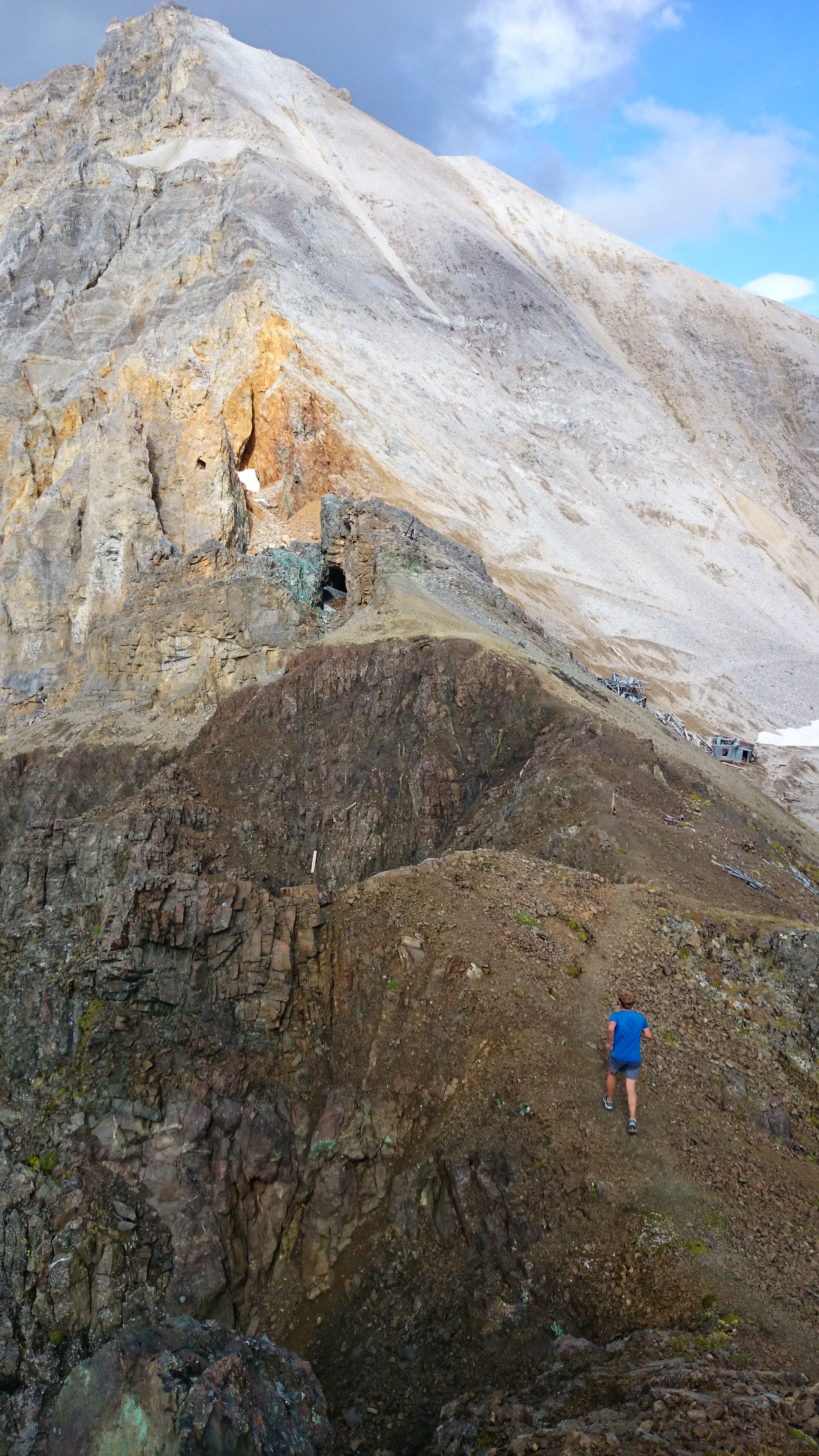
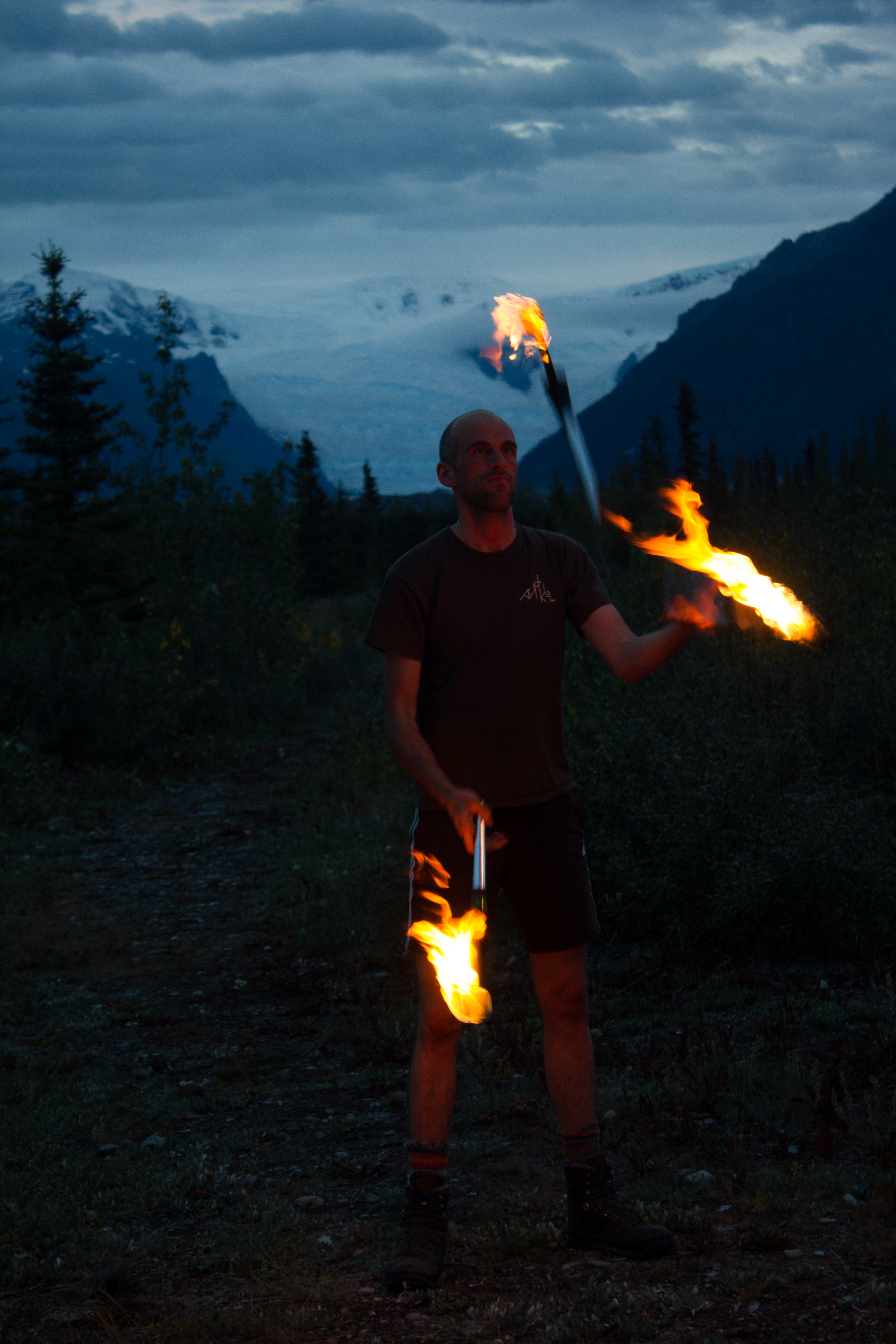
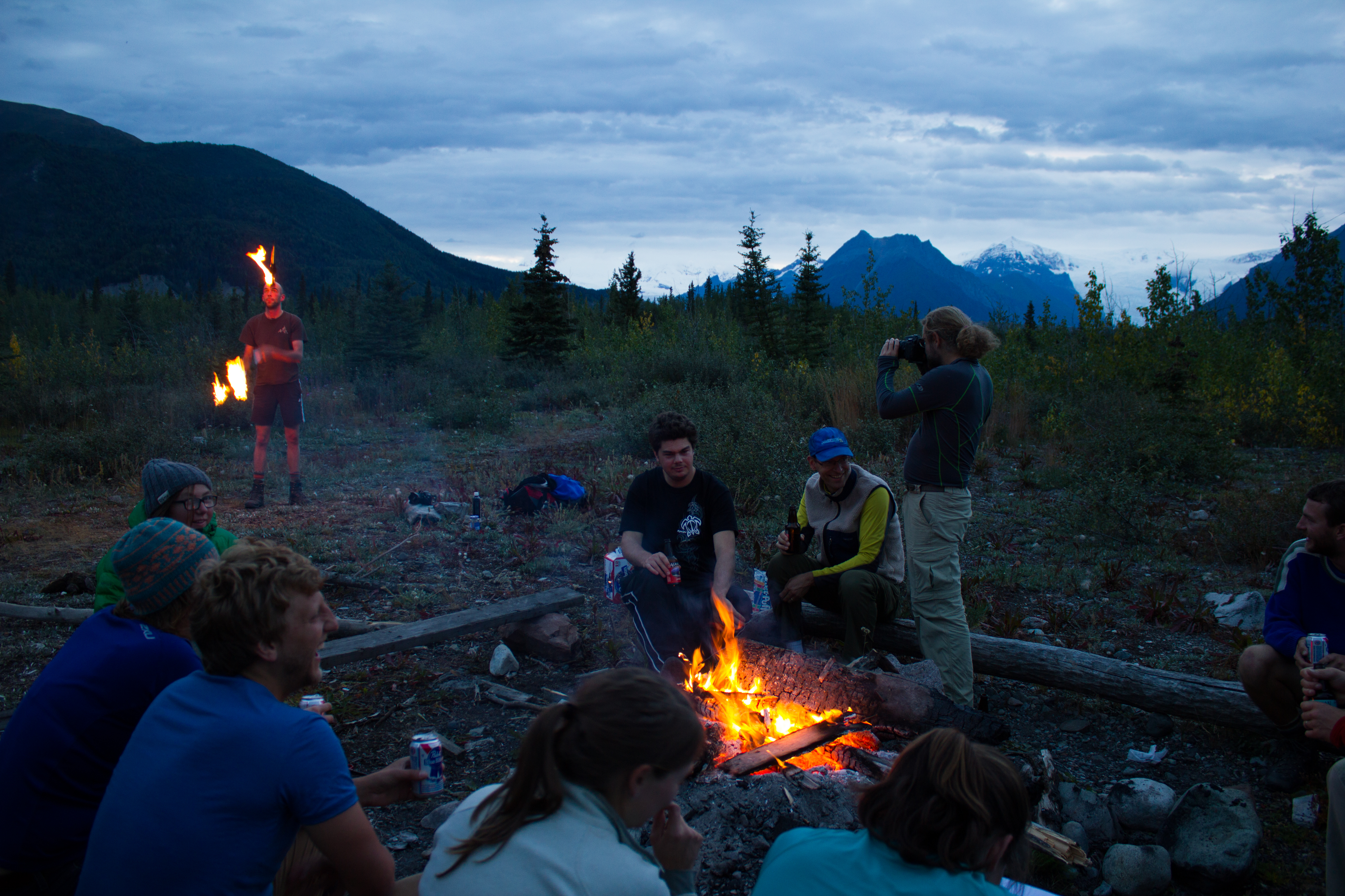
At the beginning of August, I was fortunate enough to take part in the International Glaciology Summer School, in beautiful Alaska. The school is run every two years, directed by Regine Hock of the University of Alaska Fairbanks, and brings together students and instructors from all over the world. Based in the Wrangell mountains, in the old mining village of McCarthy, the school provides an opportunity to learn from experts in a range of fields within glaciology, and perhaps more importantly, provides a platform to engage with and get to know others embarking on research in the science. The 10 days of the course were some of the most enjoyable of my academic career, and I left inspired by the enthusiasm and curiosity of my peers.
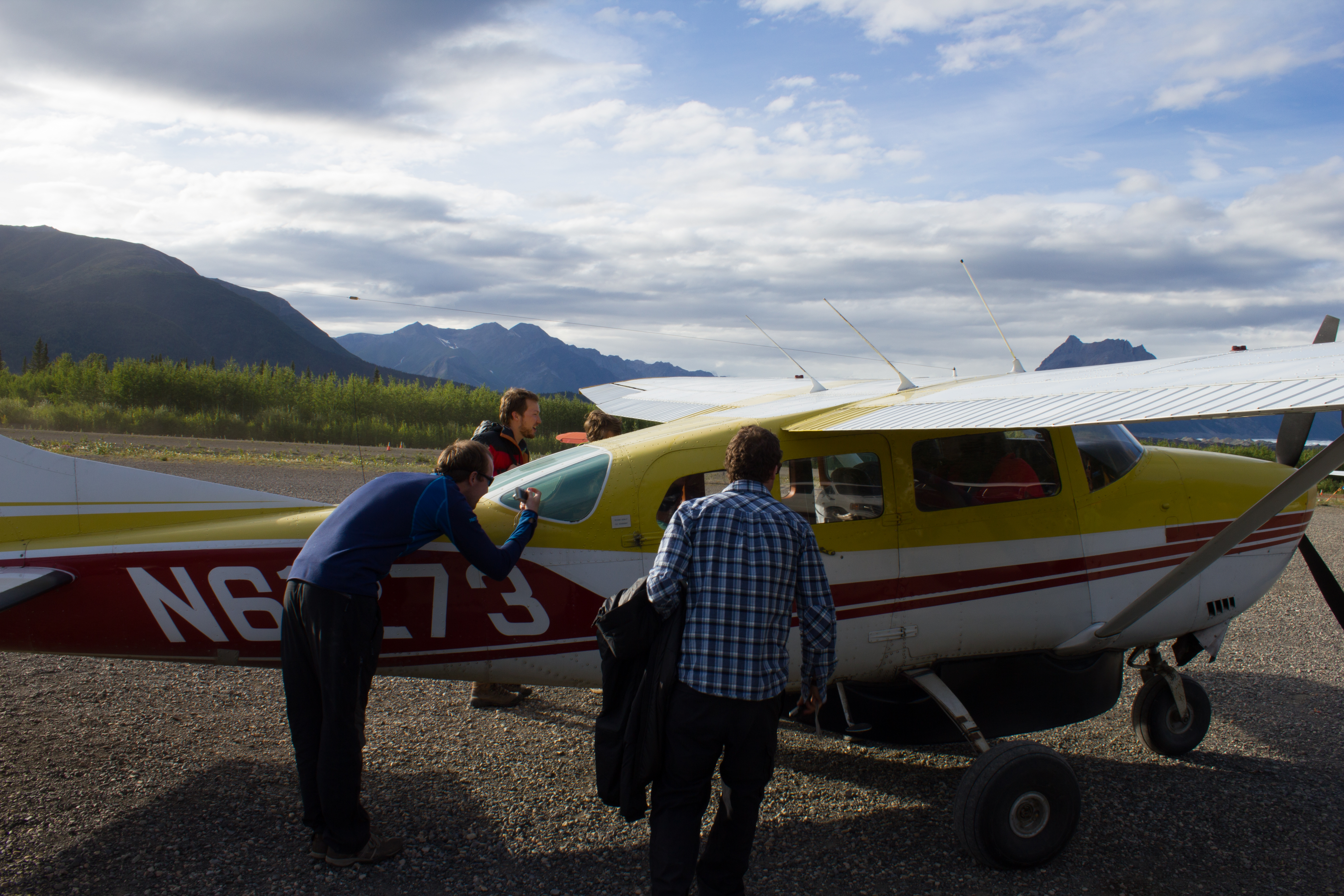
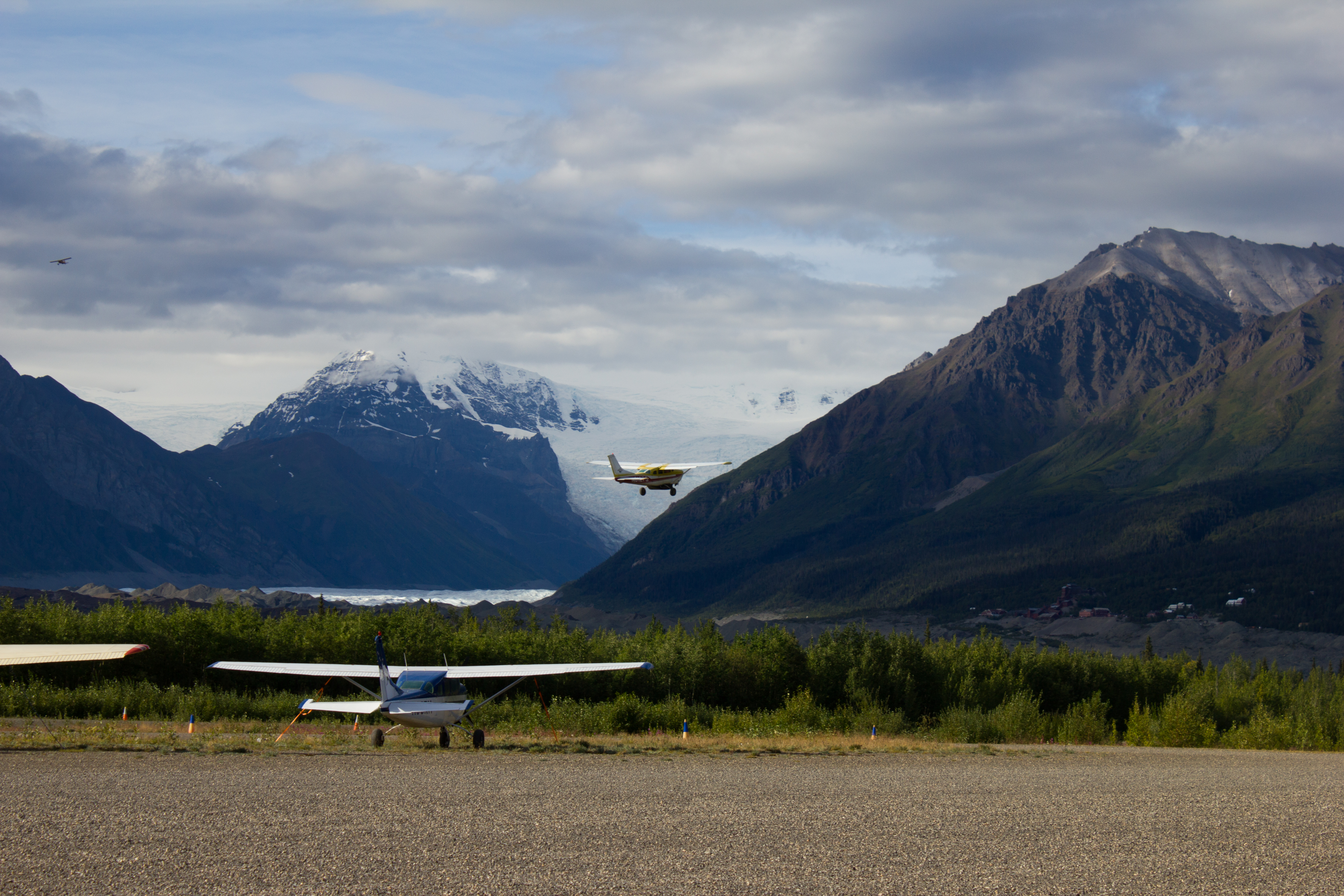
Below are images from some of the activities that took place outside of the classroom (click on images to enlarge).


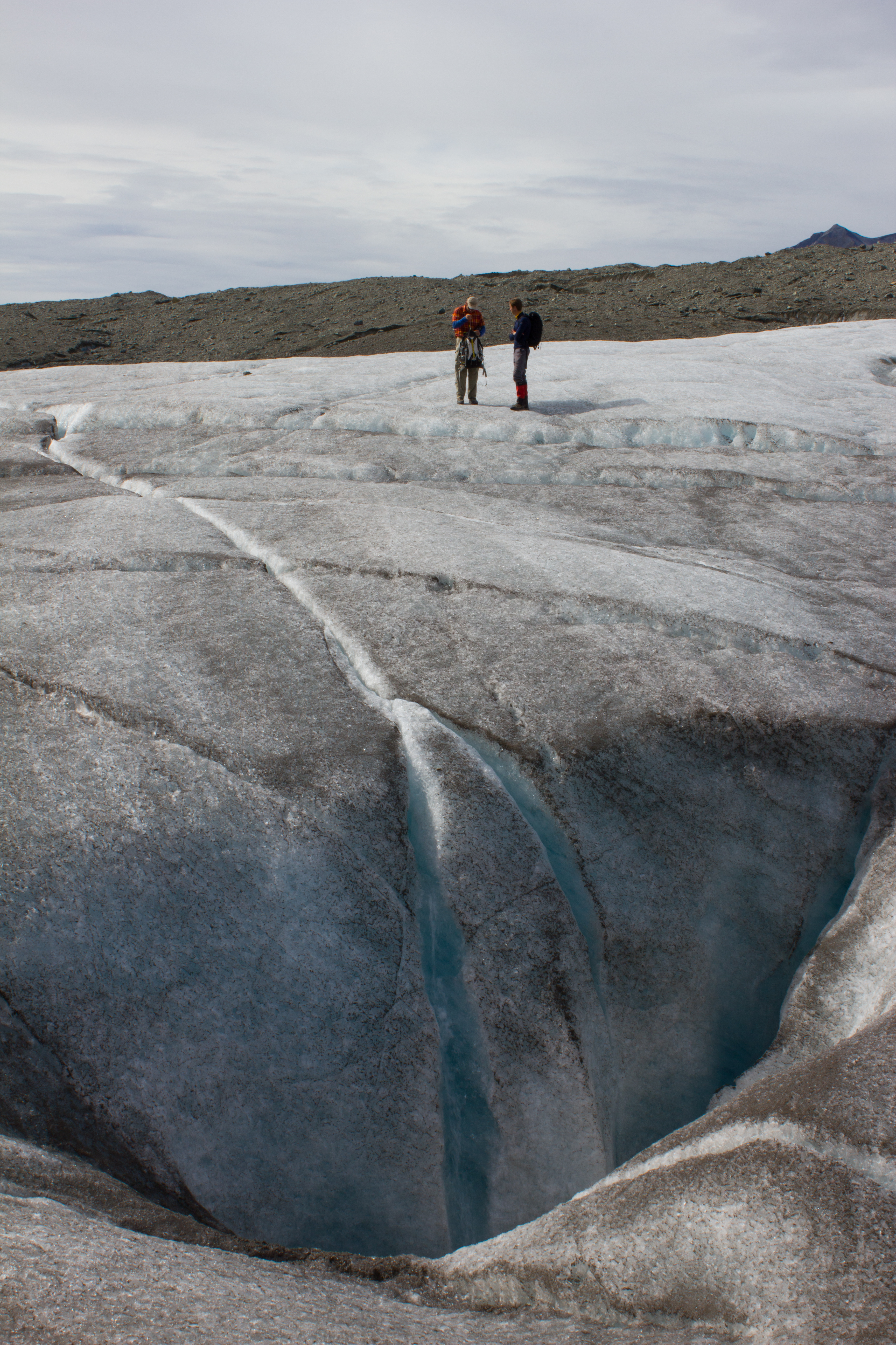
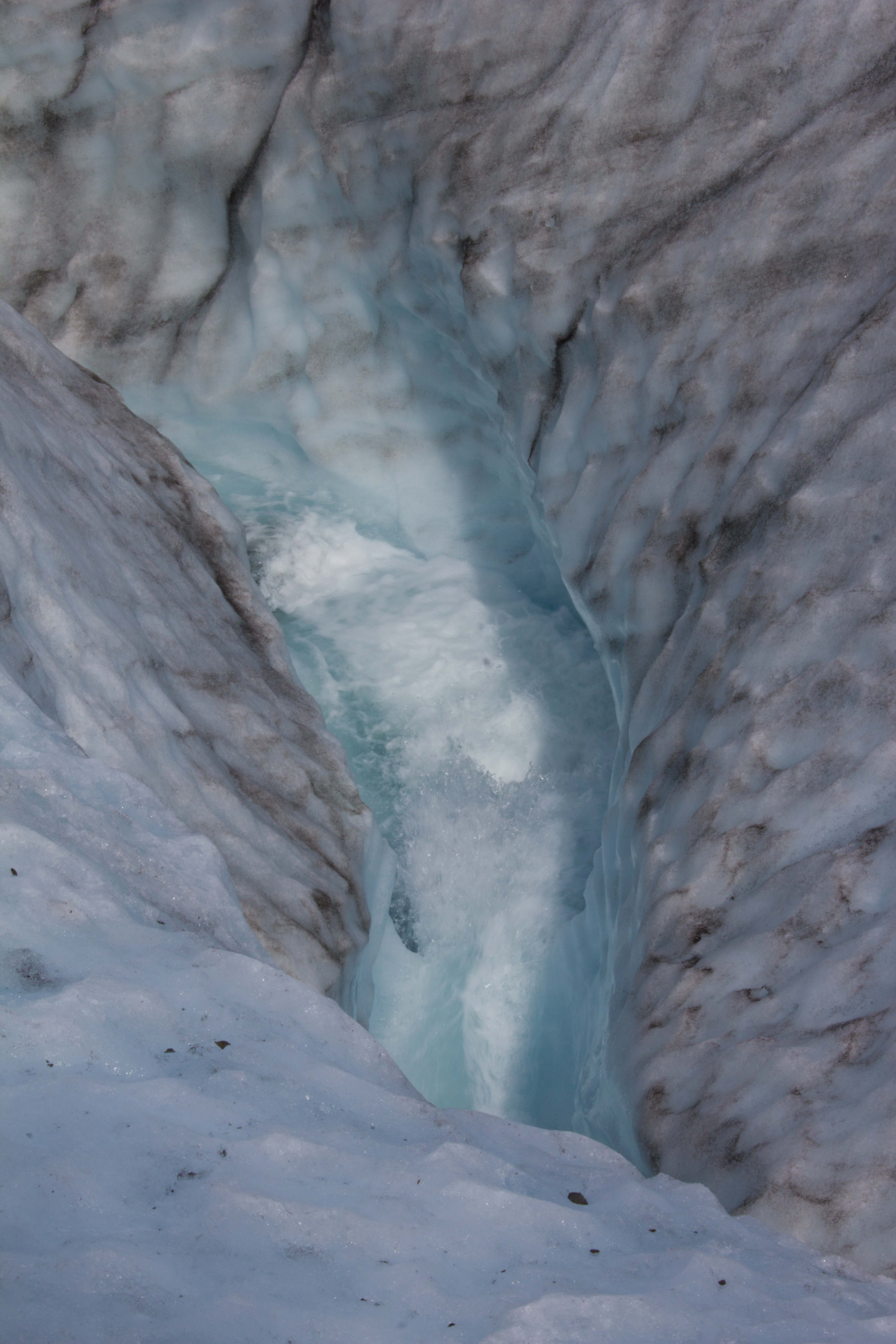
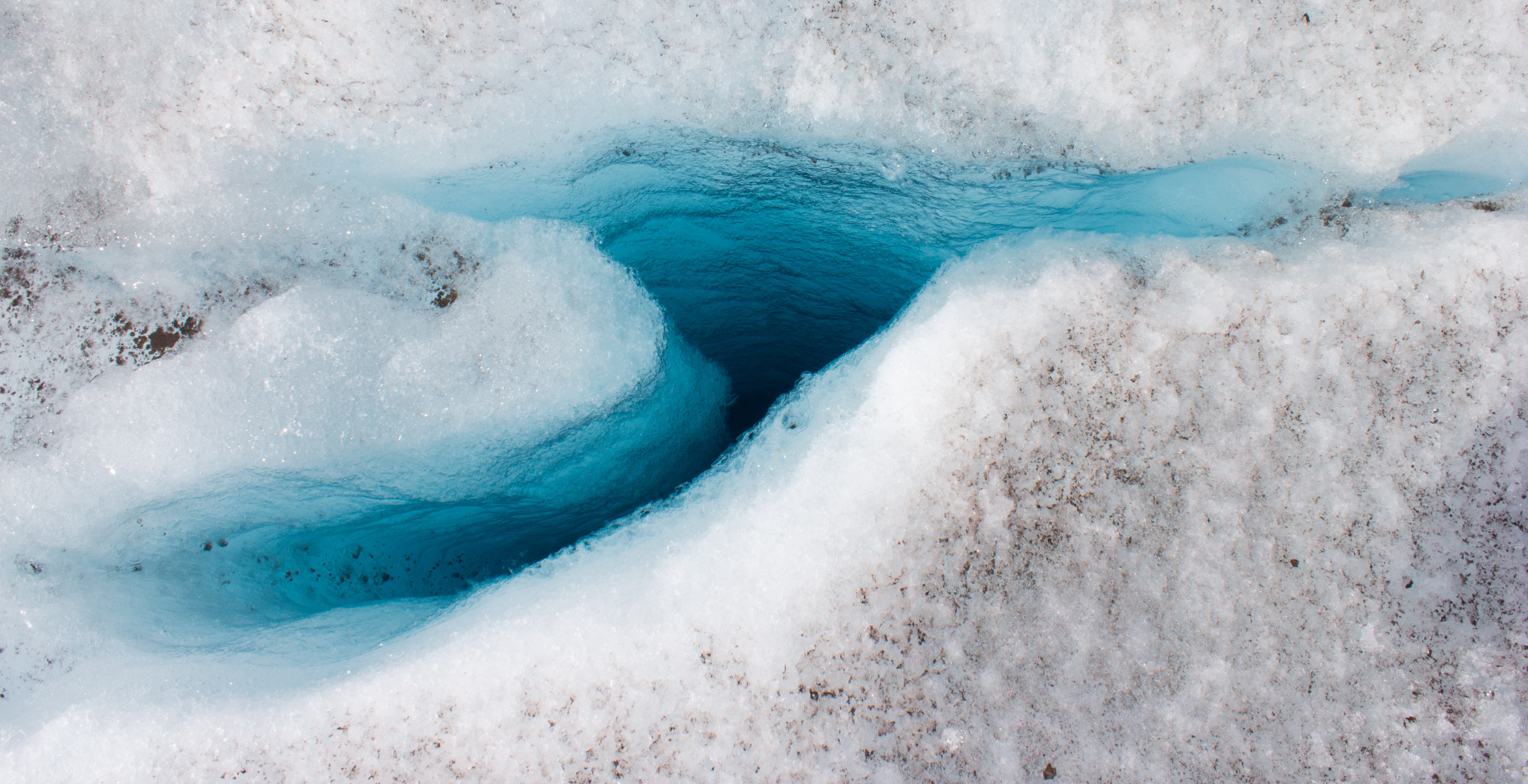
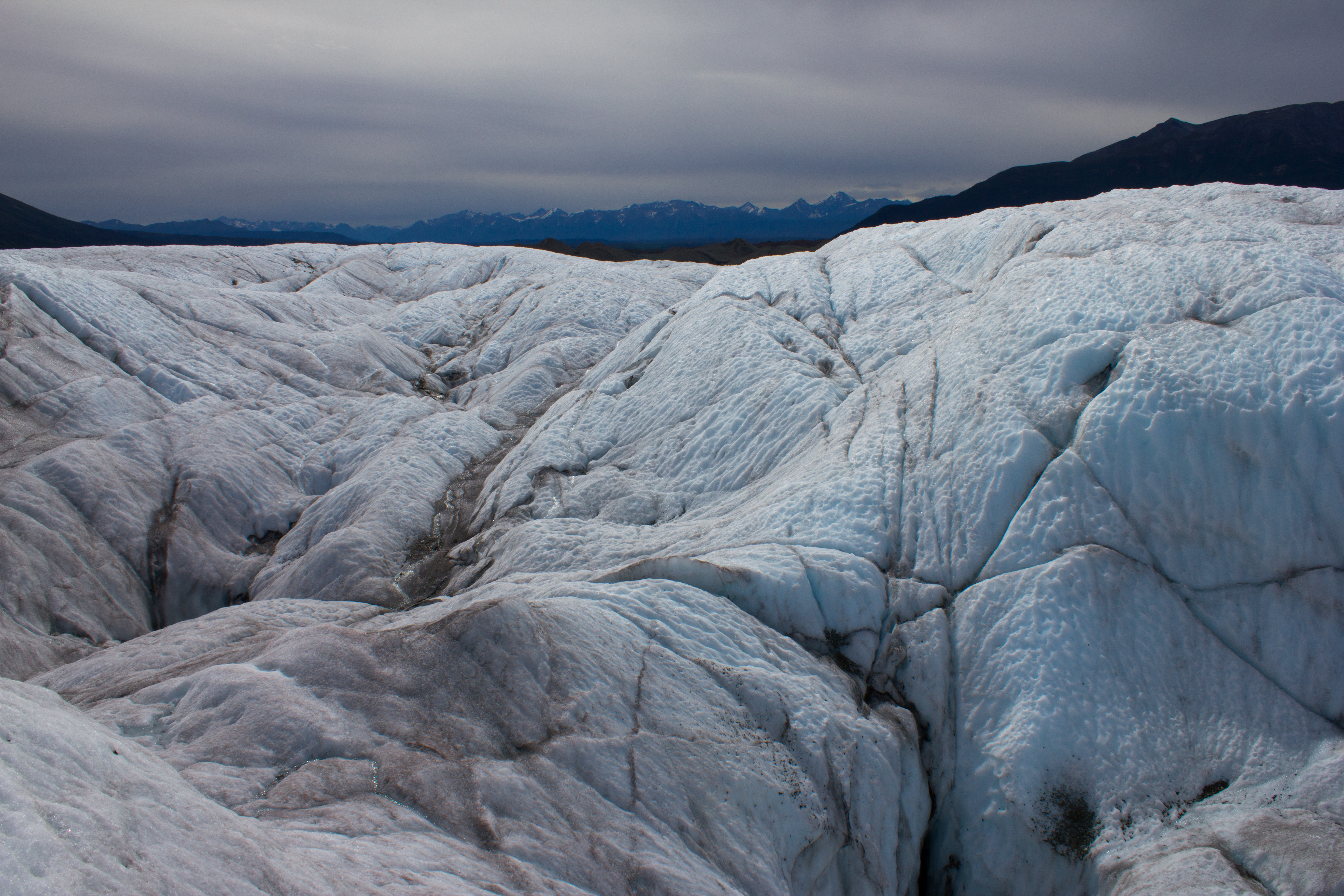

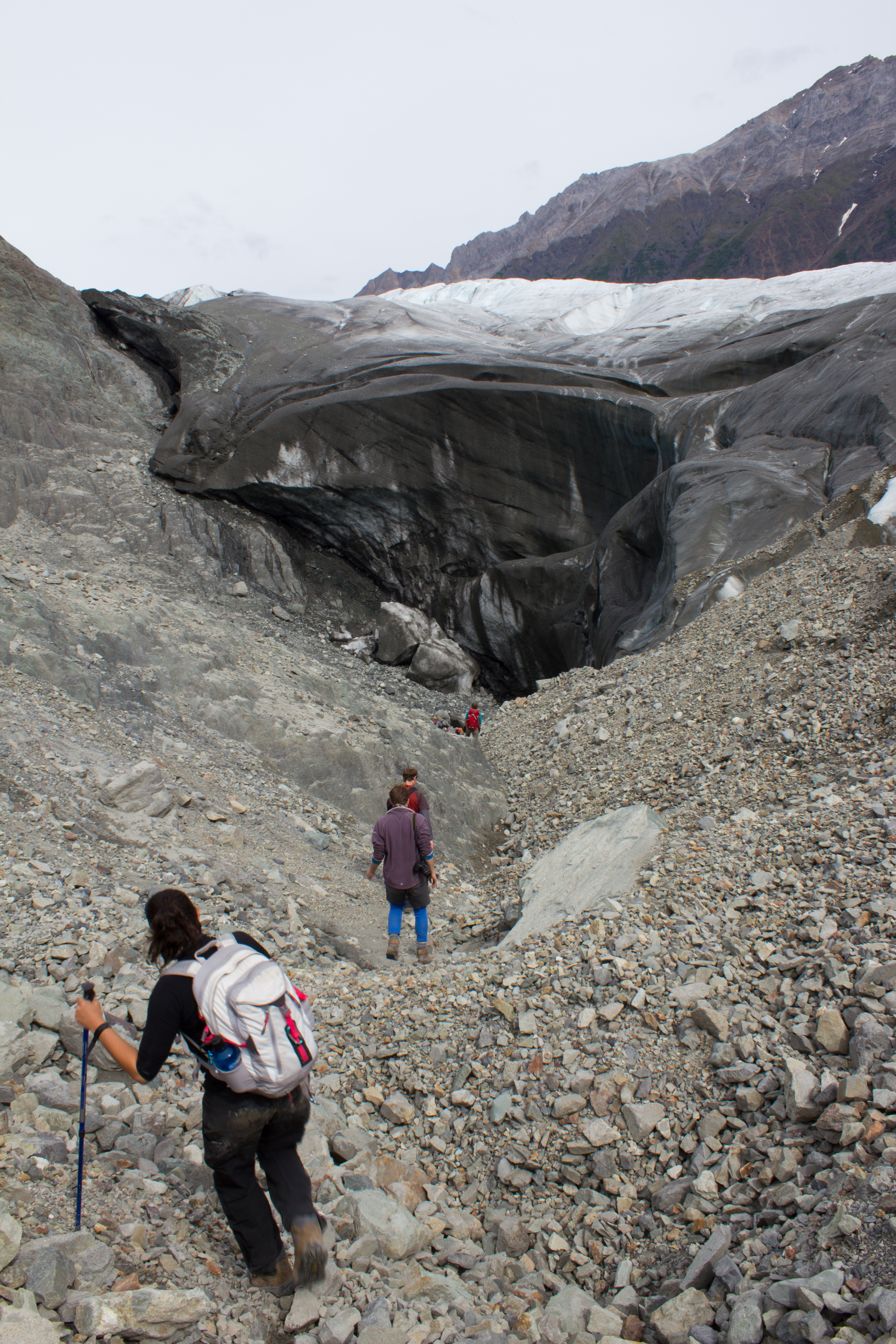
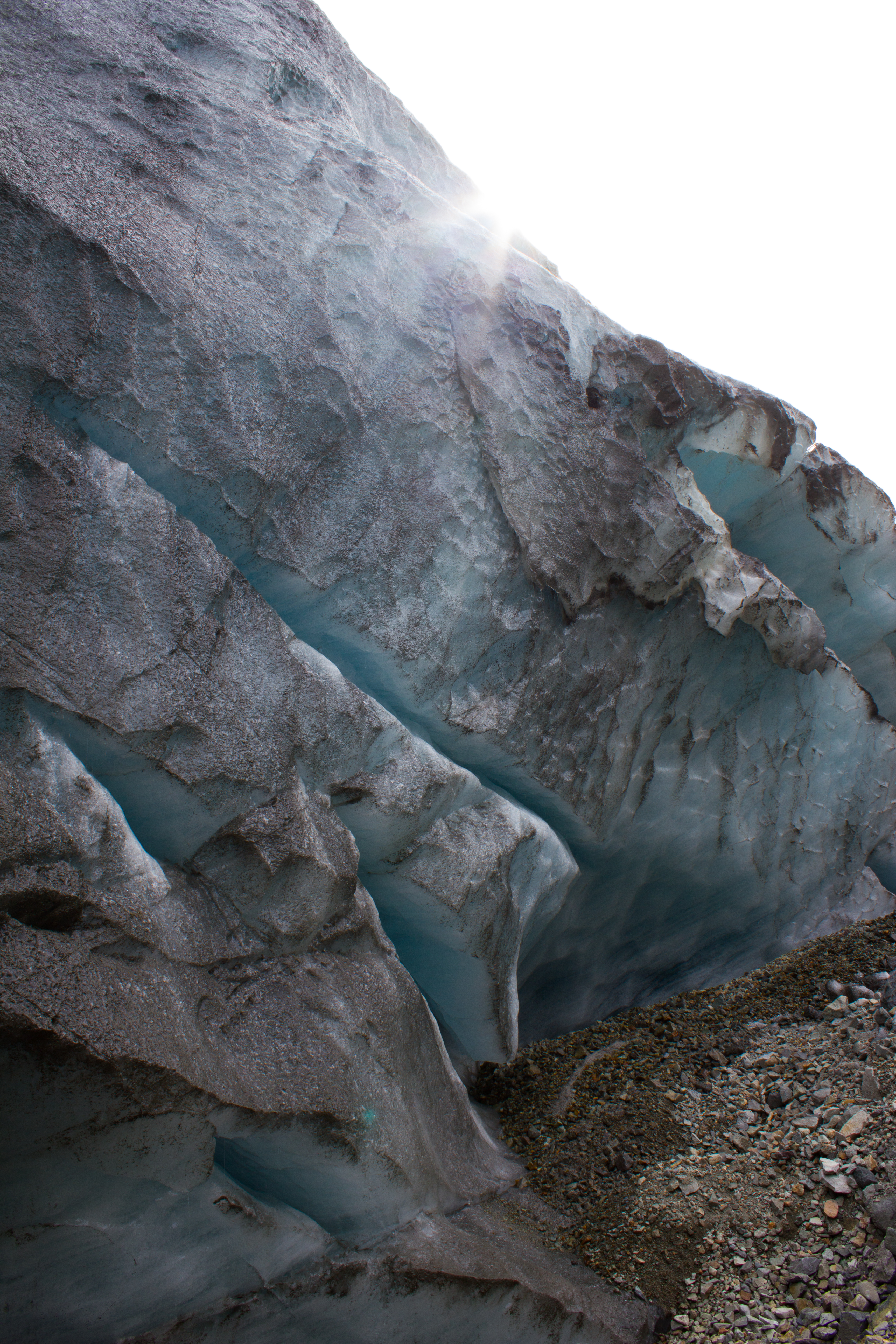
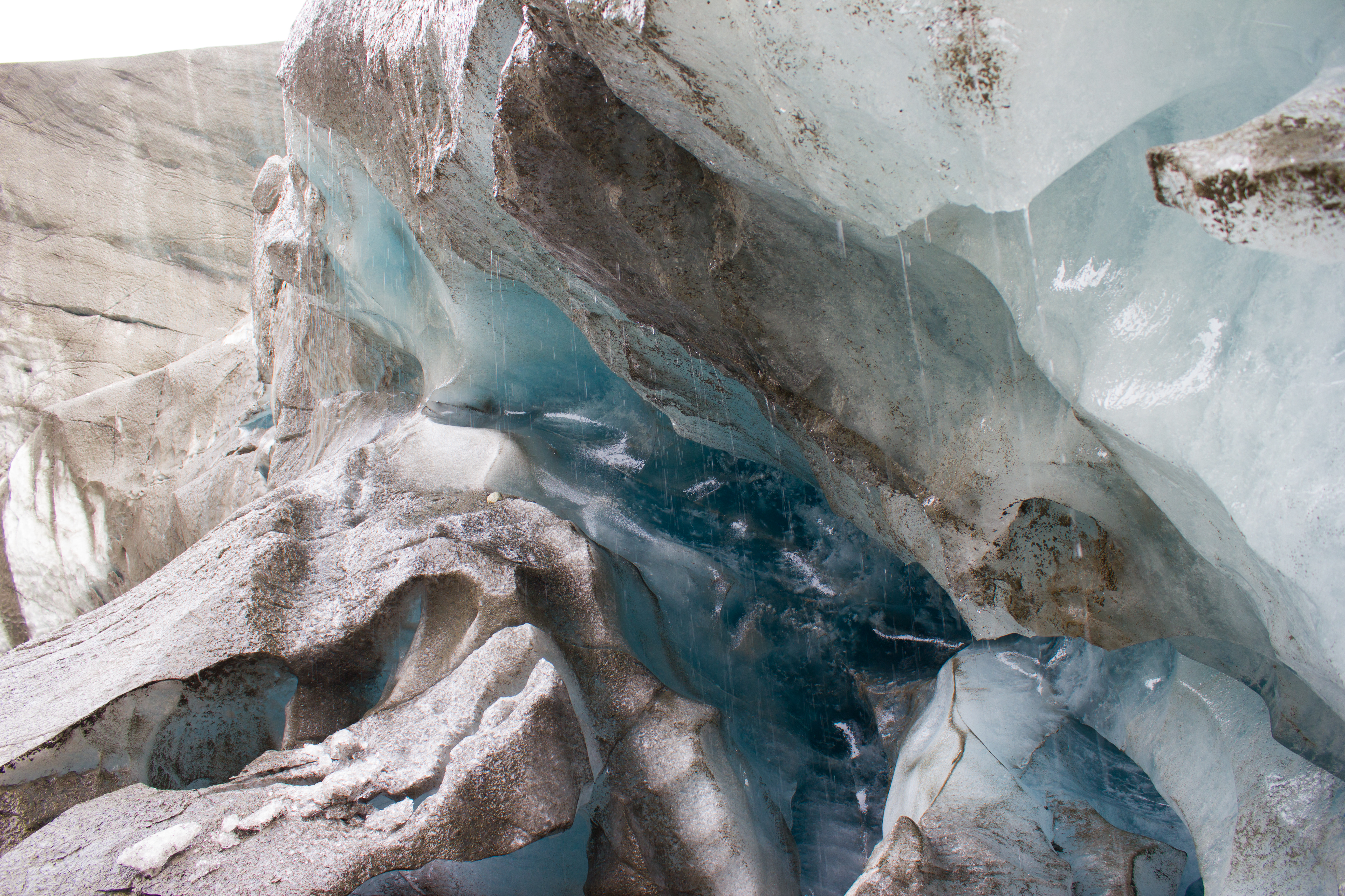
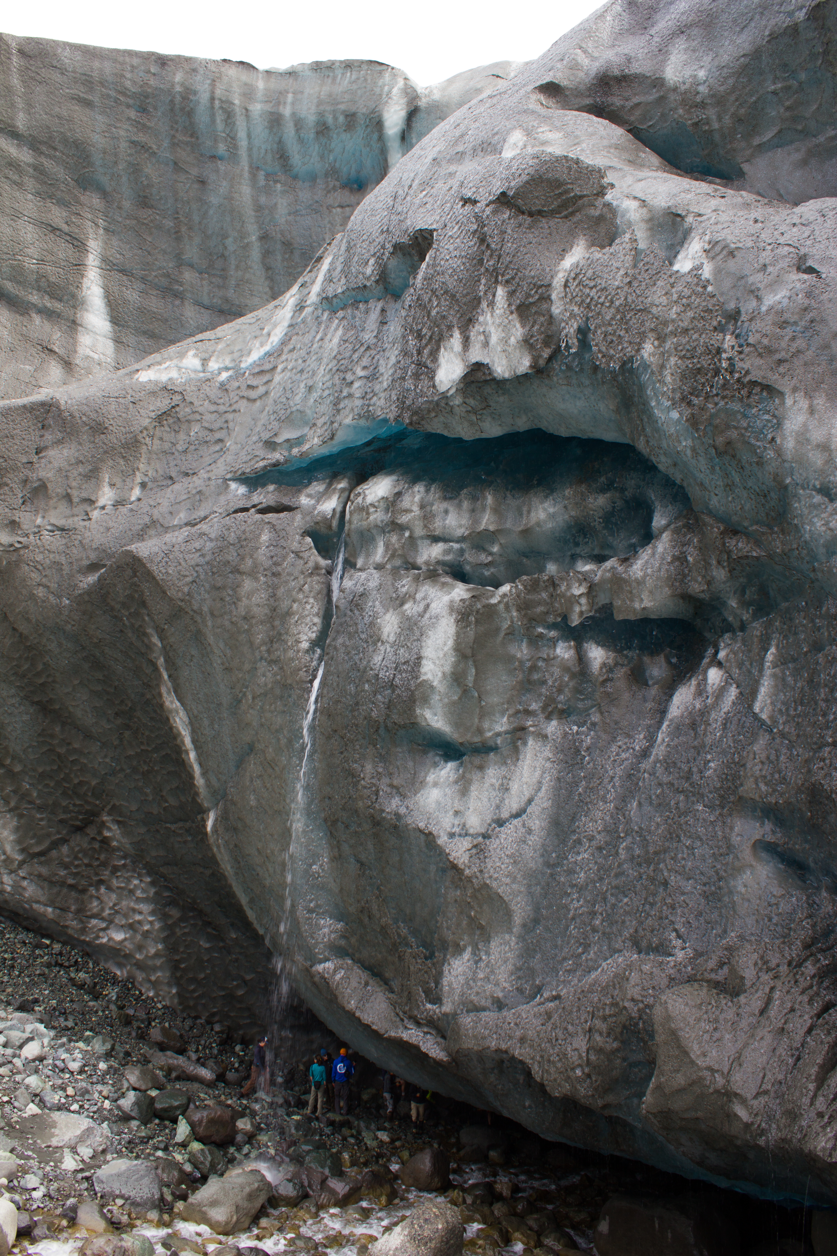
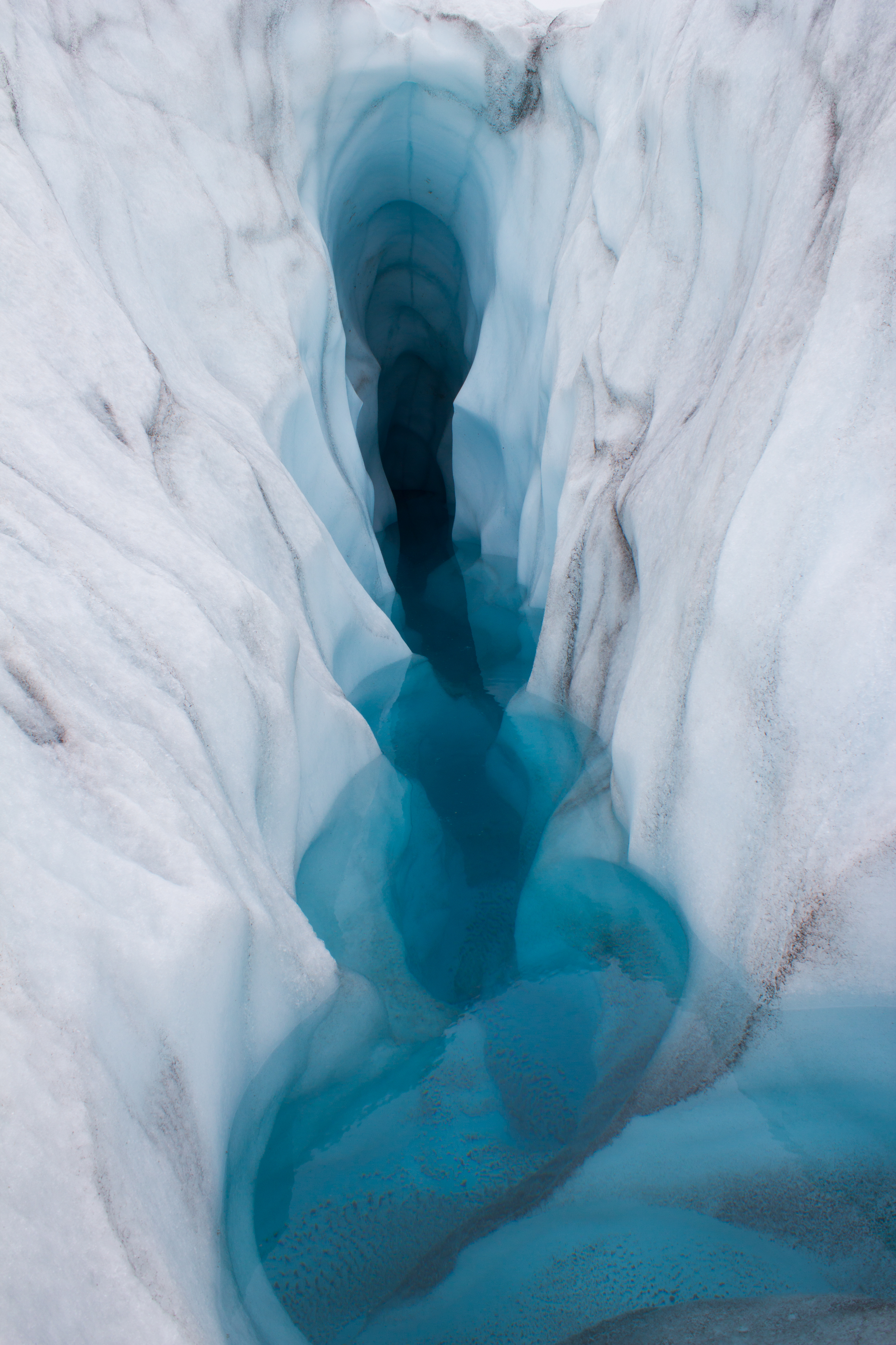
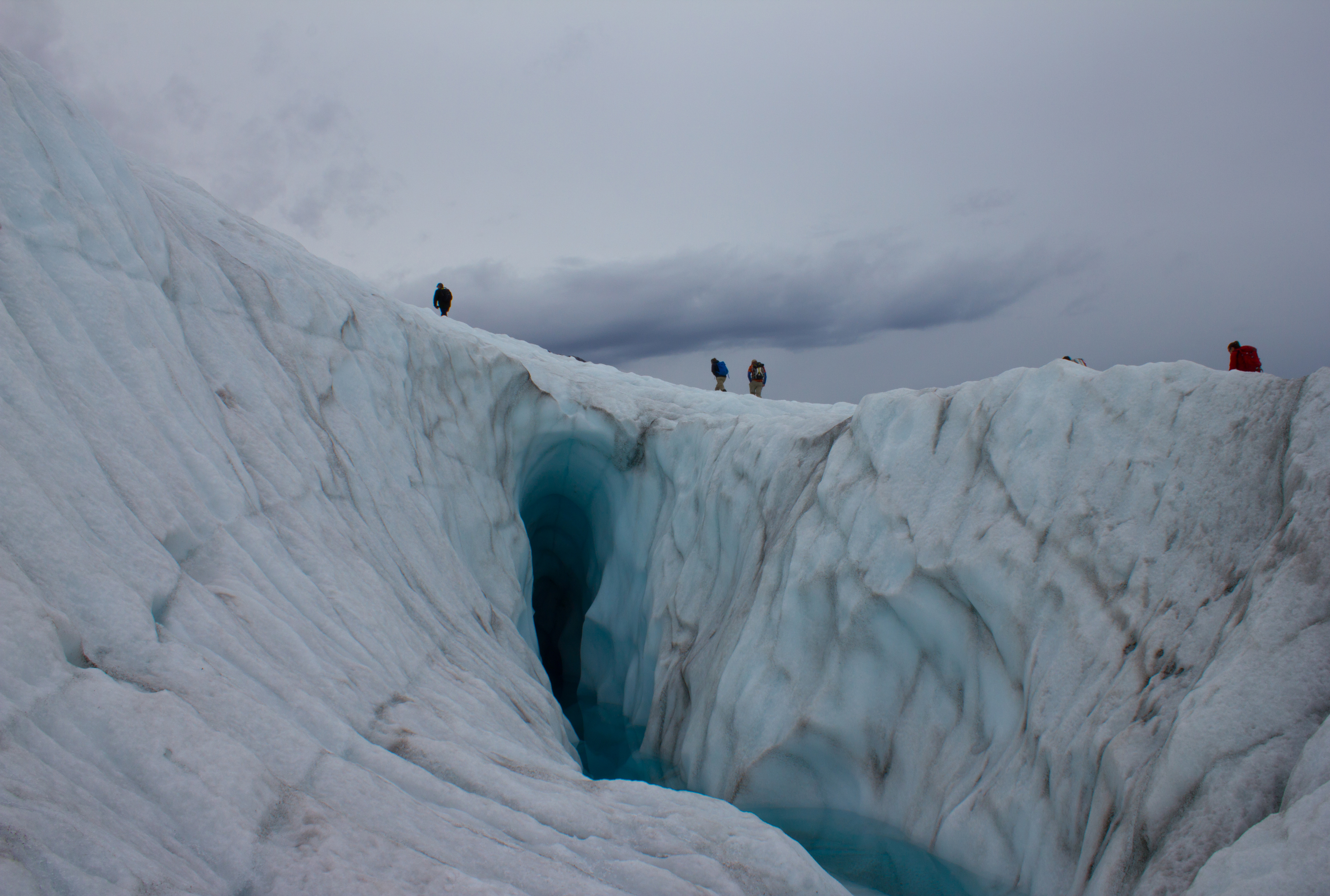
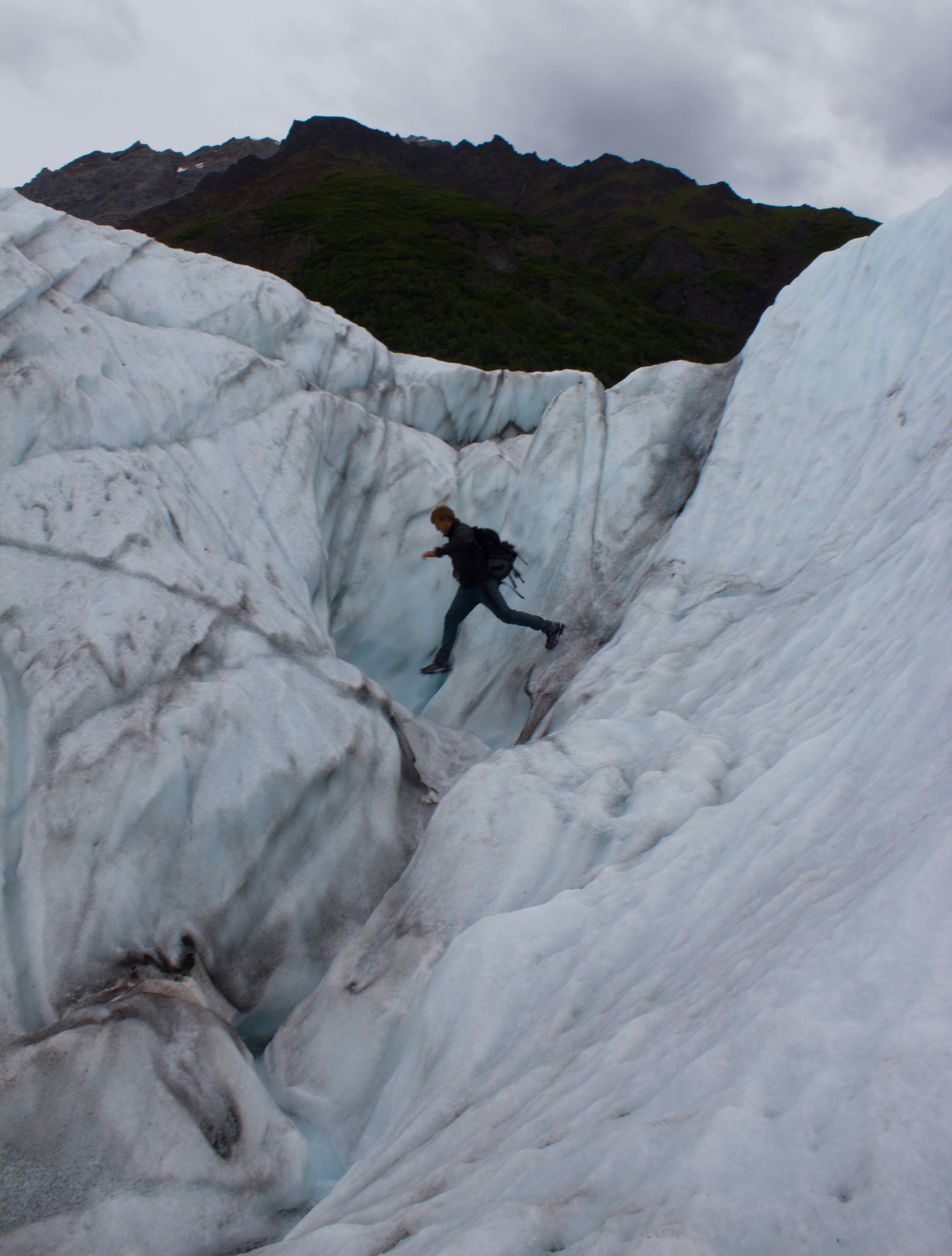
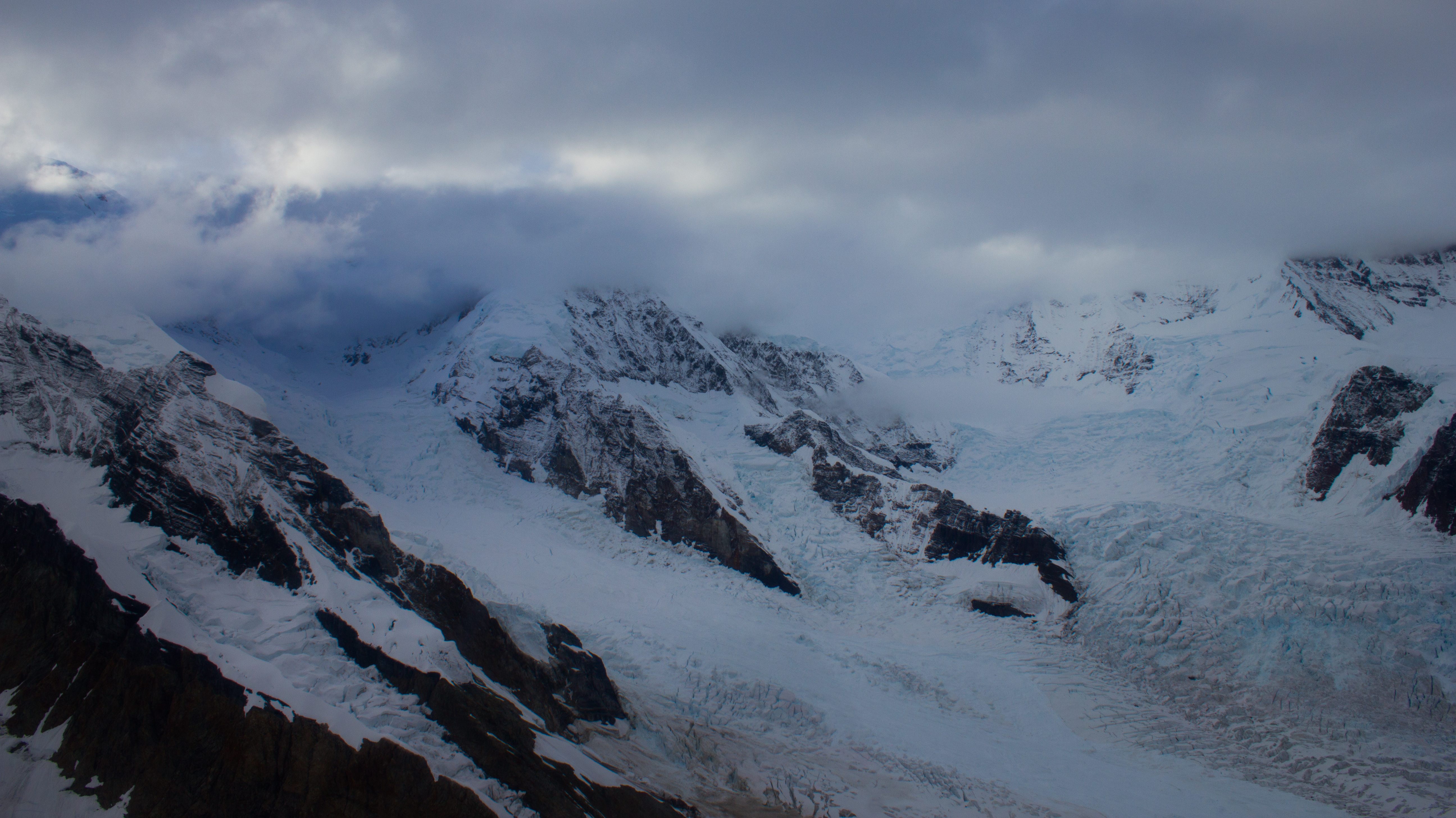
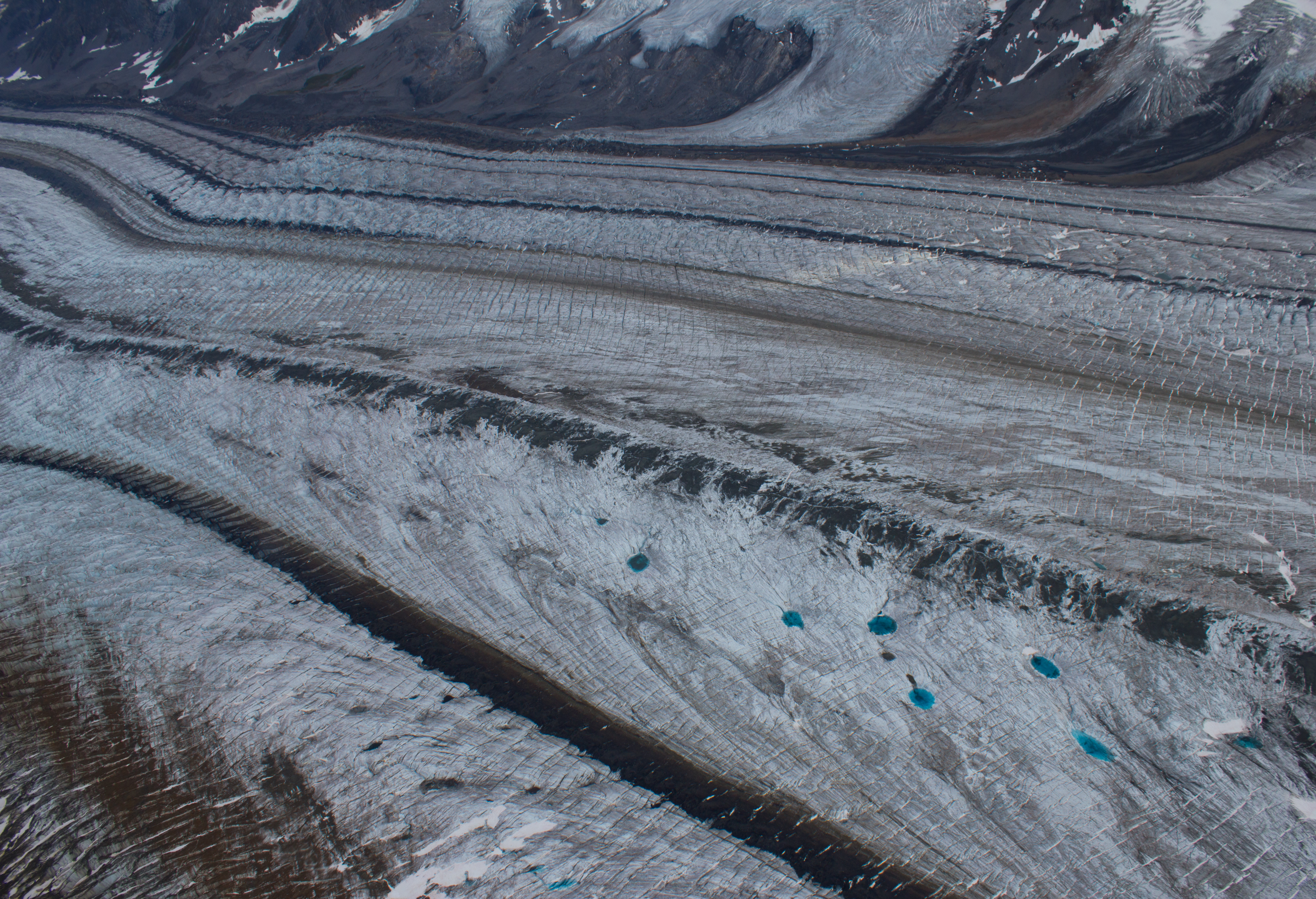

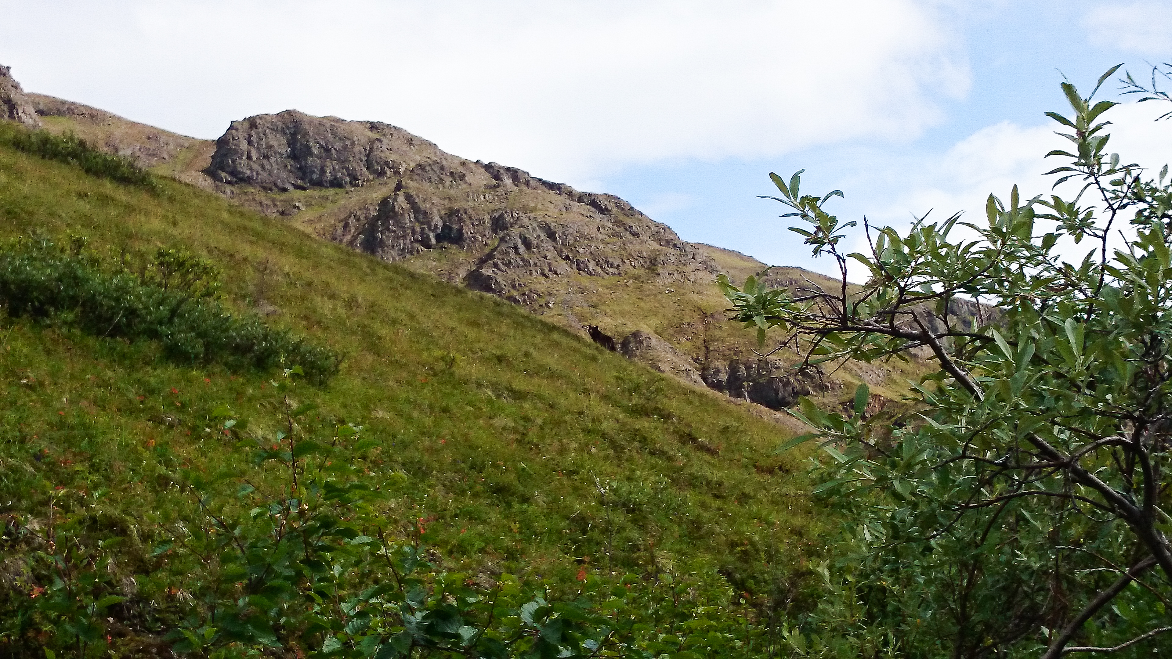
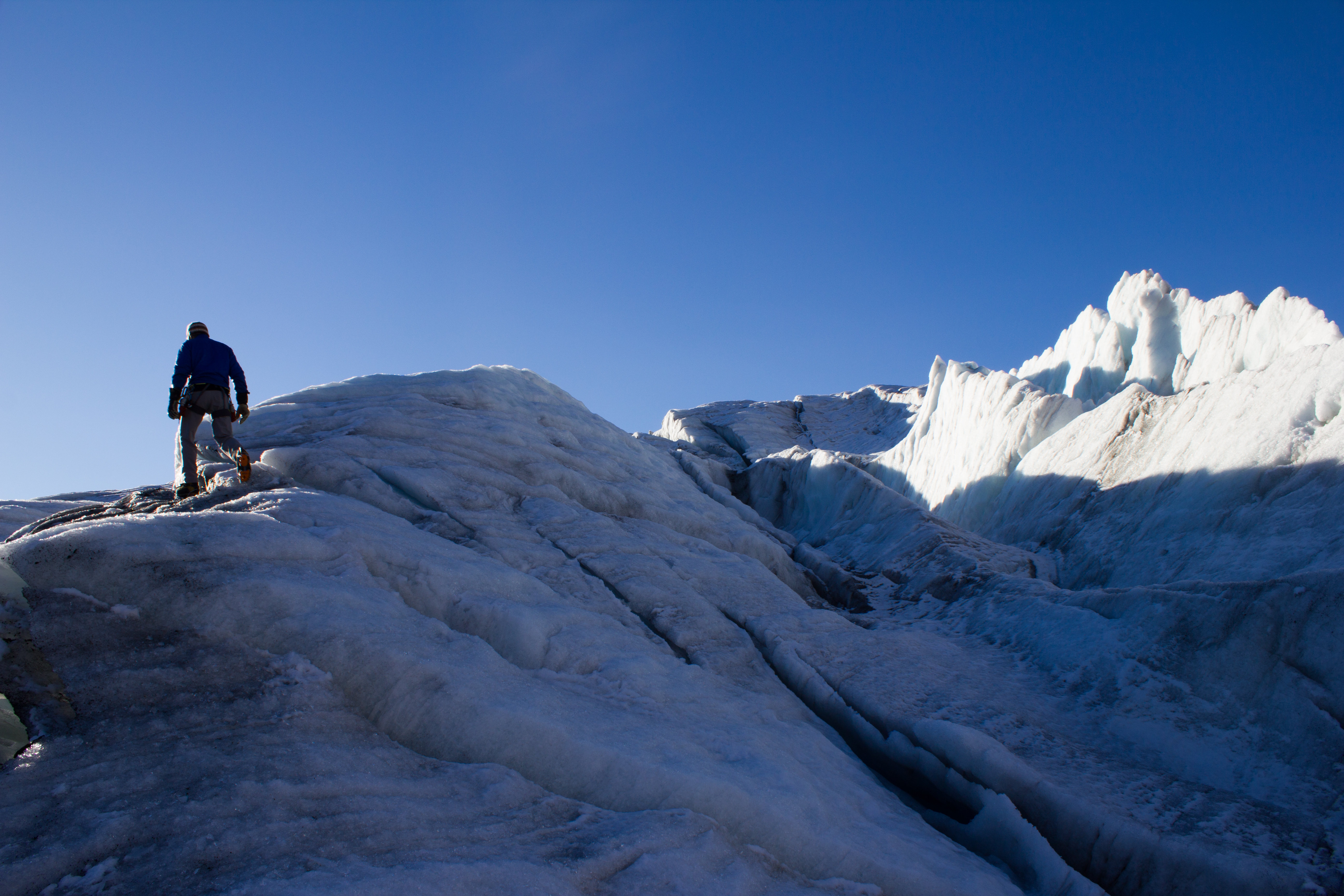
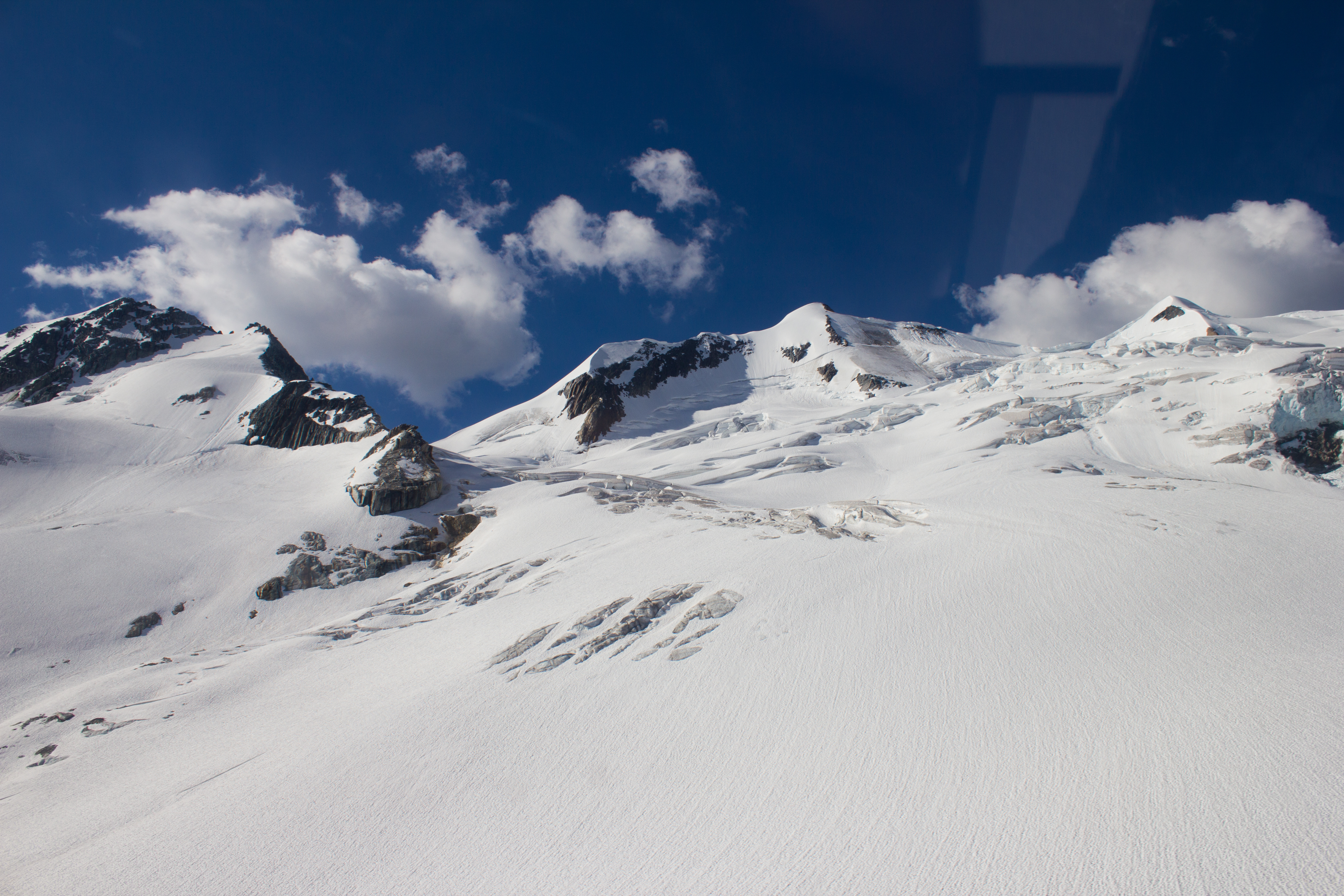
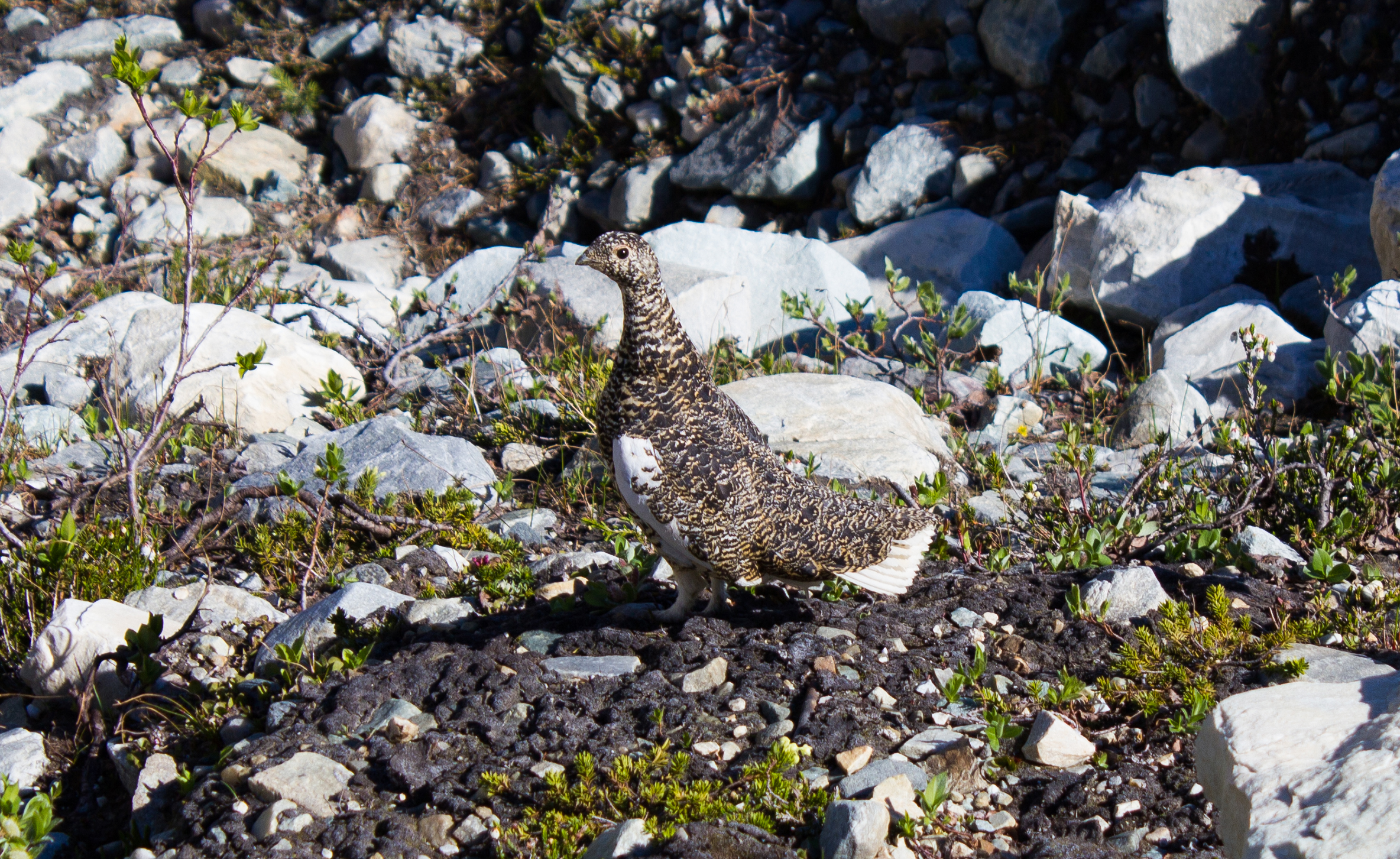
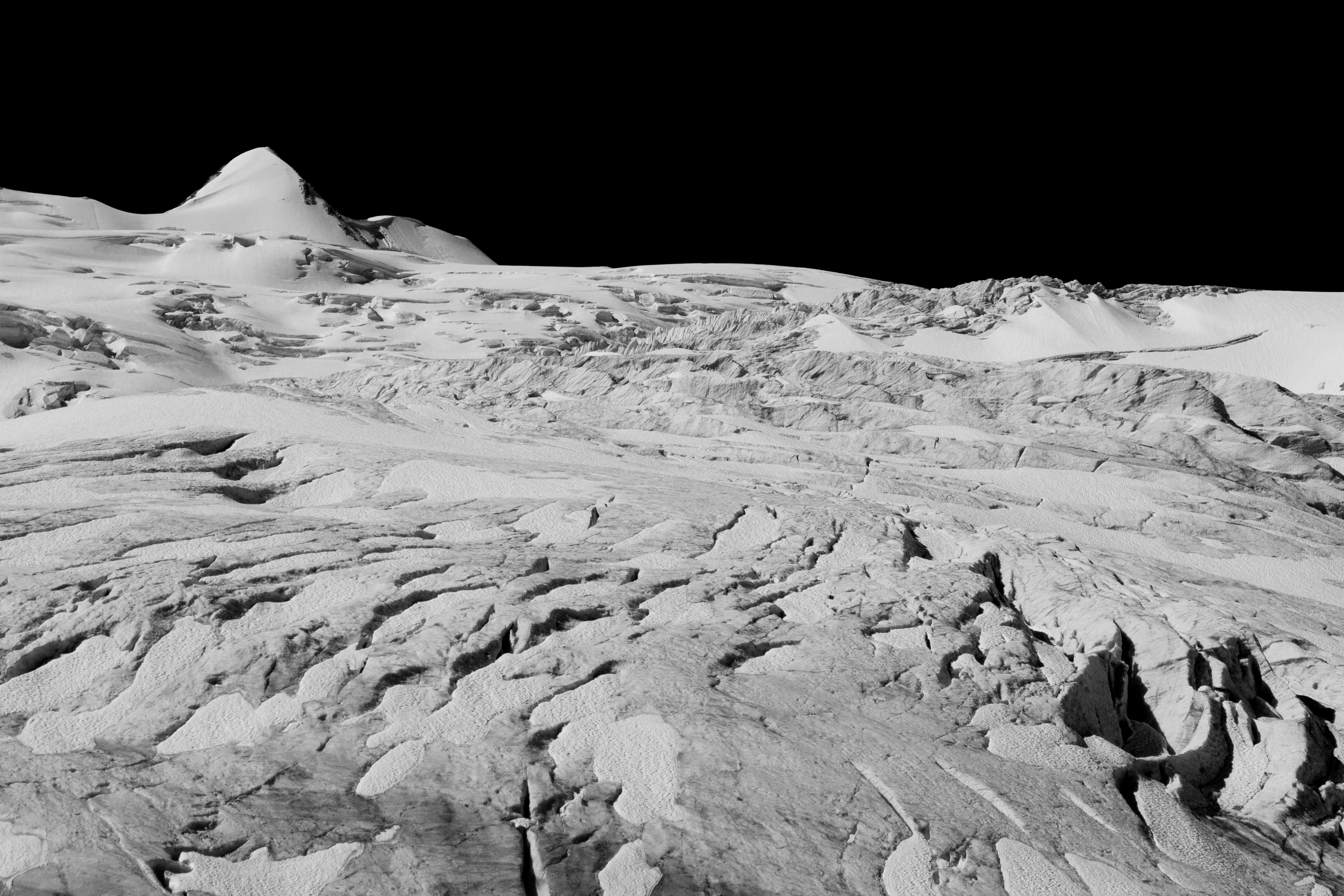
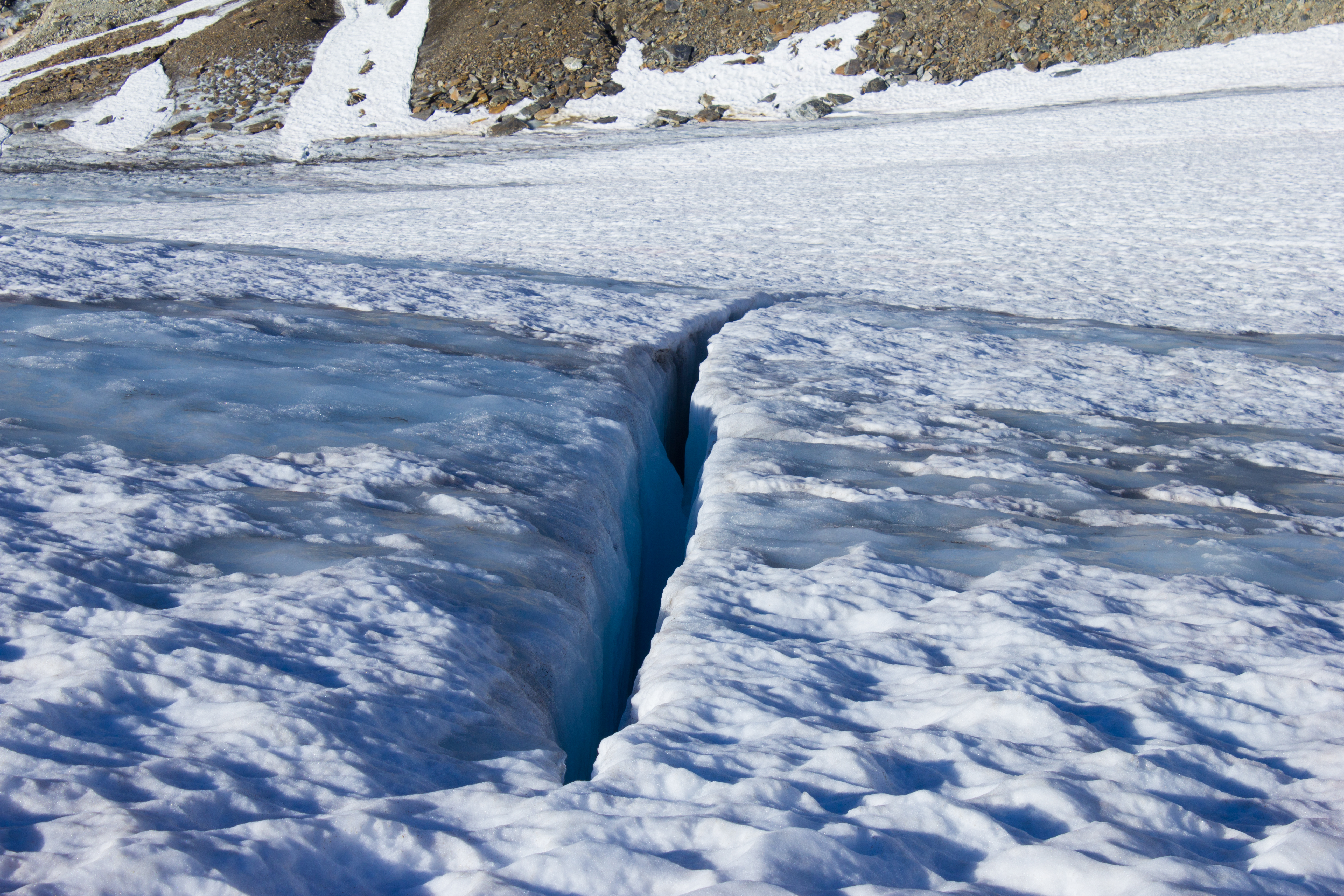
The winter snowpack was still hiding crevasses. Where it had melted, large swaths of cracked and yawning ice had been exposed, hinting at what may lie beneath the snow cover.
One day earlier, July 8th, Valentina Radic and I had left Vancouver, aiming for the town of Golden, near British Columbia’s eastern border. Our route brought us on a nine hour drive, passing from the Coastal Mountains, through the vast Interior Plateau, and into the Selkirk range near the edge of the Rockies.
Golden was to be the staging point for this summer’s field campaign. The plan was to install a weather and glacier monitoring station on Nordic Glacier. The station was to observe the melt rate of the surface of the glacier, and to record any meteorological varibles that may affect melting (see The Project).
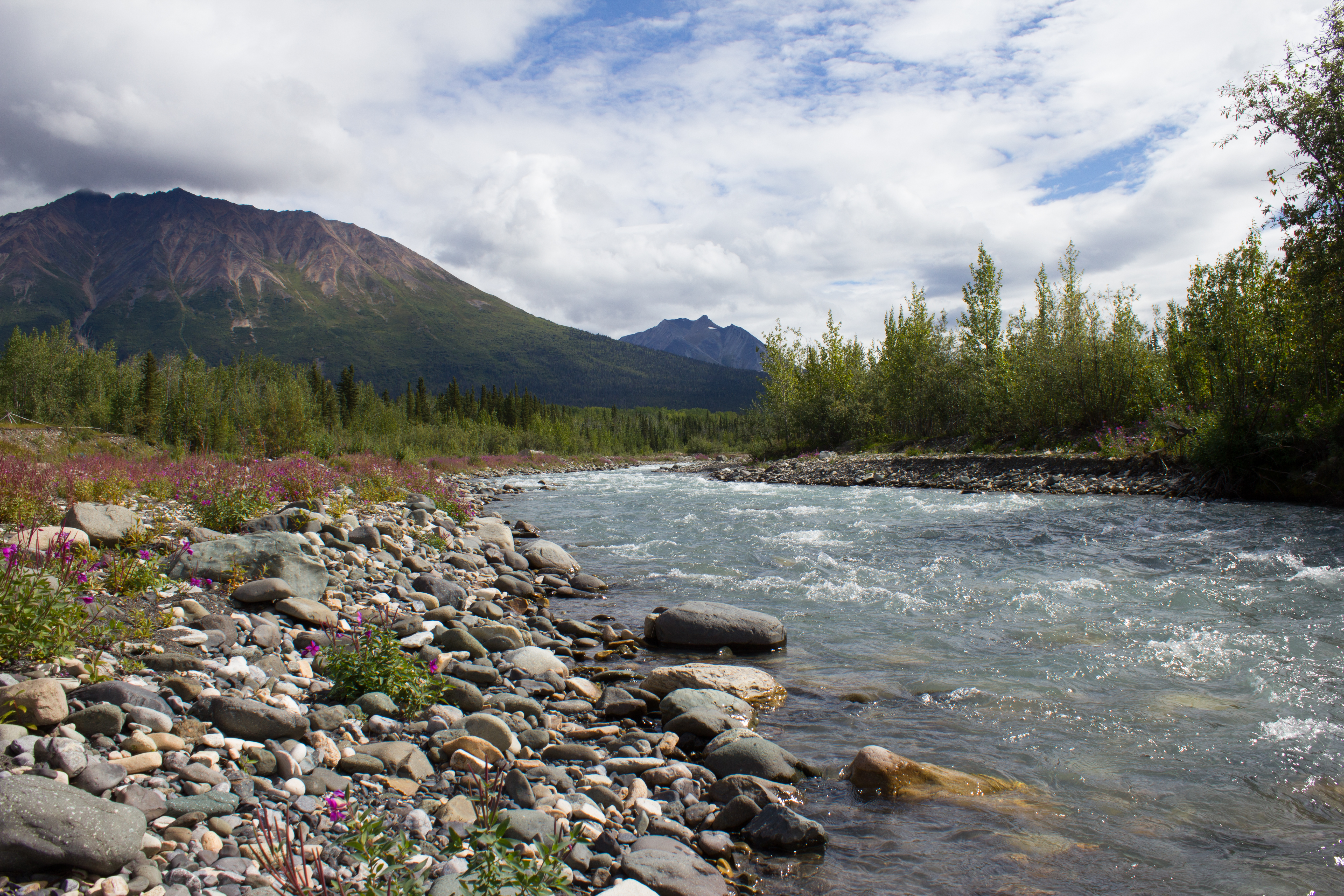
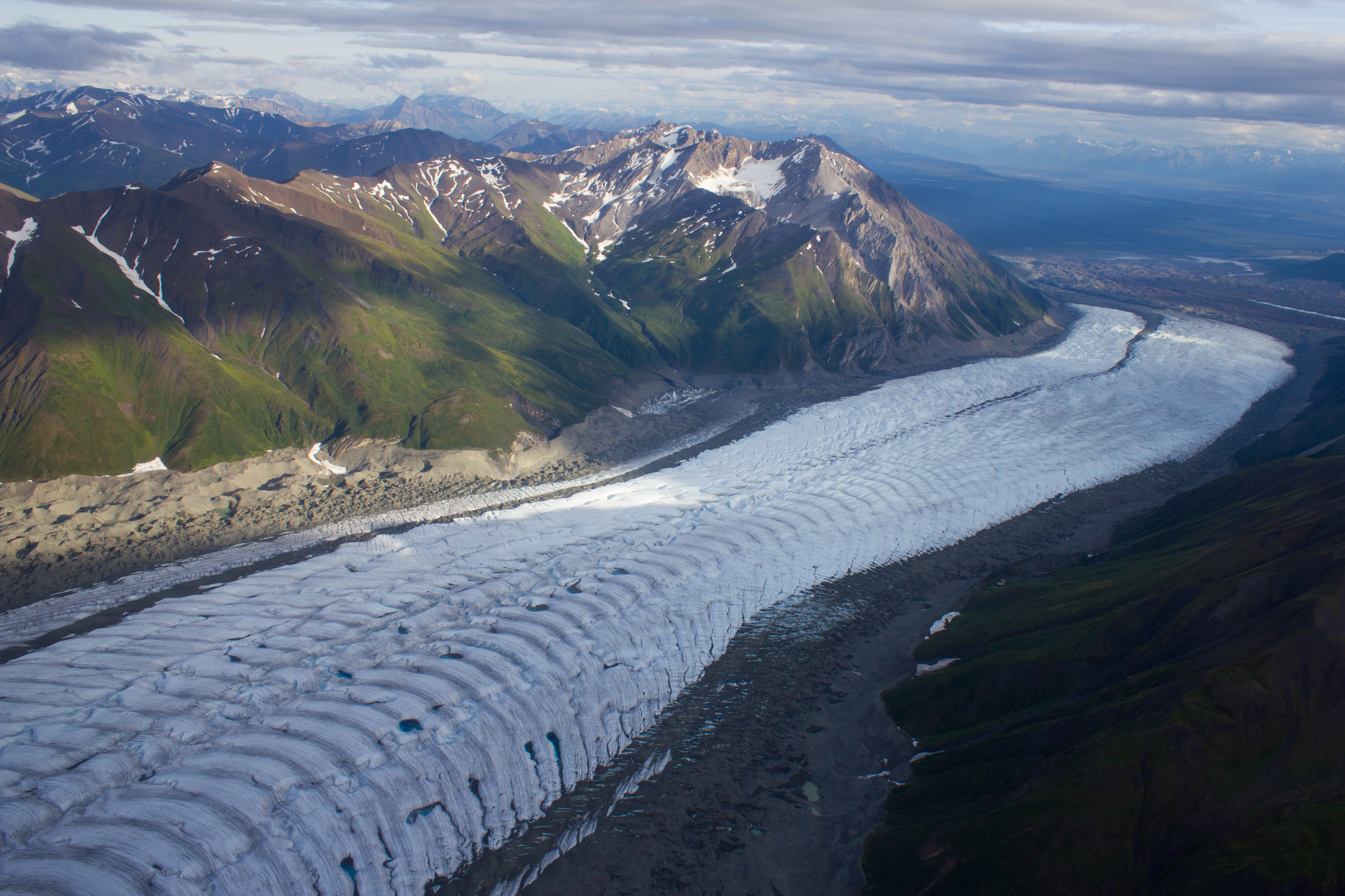
Nordic was selected as its meltwater drains into the Columbia river. This is the largest river in the the Pacific Northwest, and the forth largest in the United States. It stretches for 2,000km, through BC and seven US states, with a drainage basin the size of France. Its waters are used for irrigation and hydroelectric power production, with 14 dams on the main stem, and more on its tributaries. I had encountered the Columbia before, but much further downstream in the state of Washington, while rock climbing (see Vantage Point).
On arriving in Golden, we drove straight to the home of our hosts for the night, Tannis and Steve. When initially planning this trip, we had intended to camp once we got into the mountains, but Tannis and Steve kindly offered us the use of their backcounty ski lodge (Sorcerer Lodge) which is located in the same valley as Nordic. Operating in the area for over twenty years, they have seen firsthand the changes undergone by the glacier. It was inspiring to see the interest and enthusiasm (and knowledge) that they showed for the project, and was a reminder that this research wasn’t just an academic exercise. Joining us in Golden were Brian Menounus and Federico Ponce, two researchers from the University of Northern British Columbia. With our team of four assembled, we stocked up on some soon to be burned calories (with excellent burgers in Golden), and bedded down for an early departure.


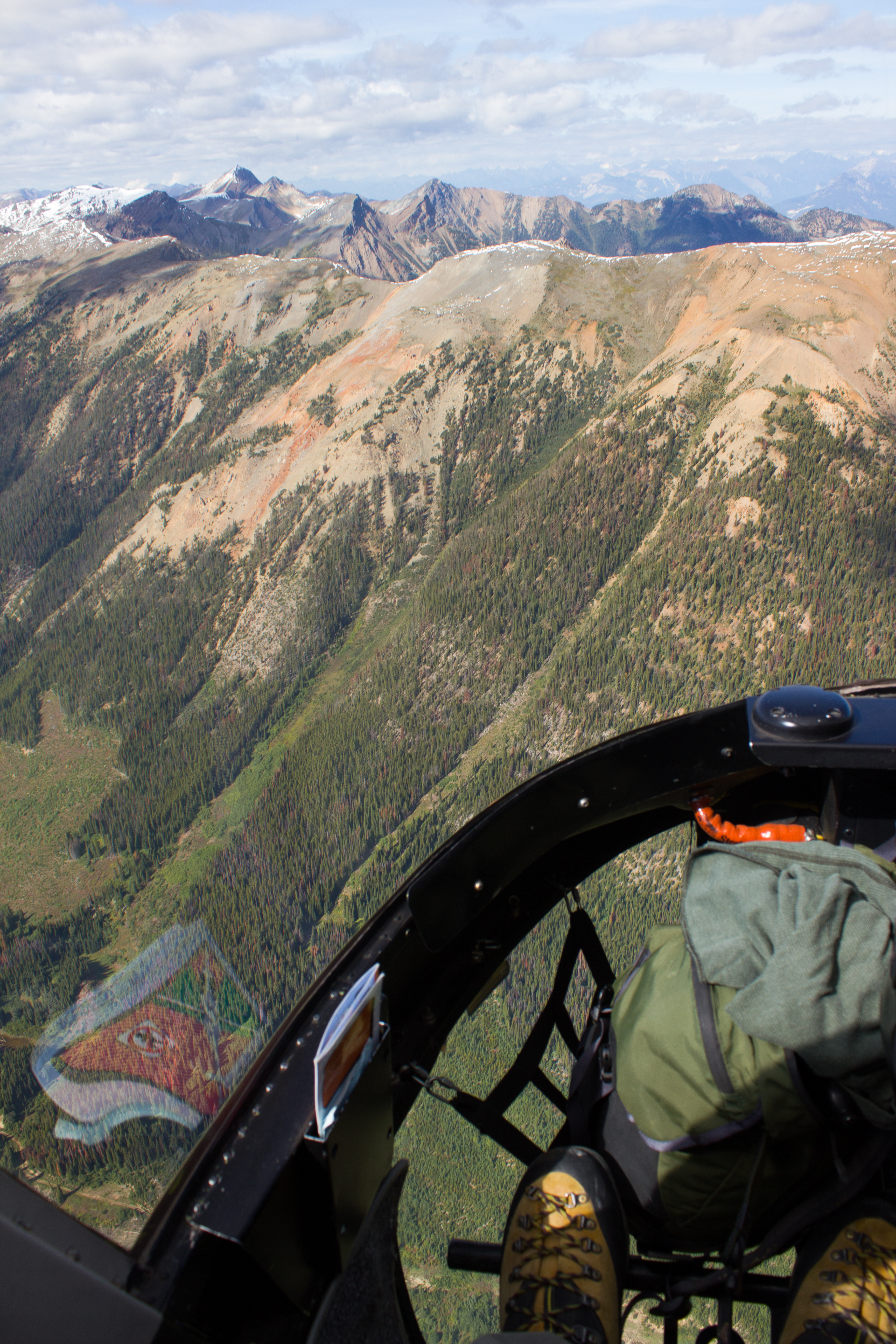
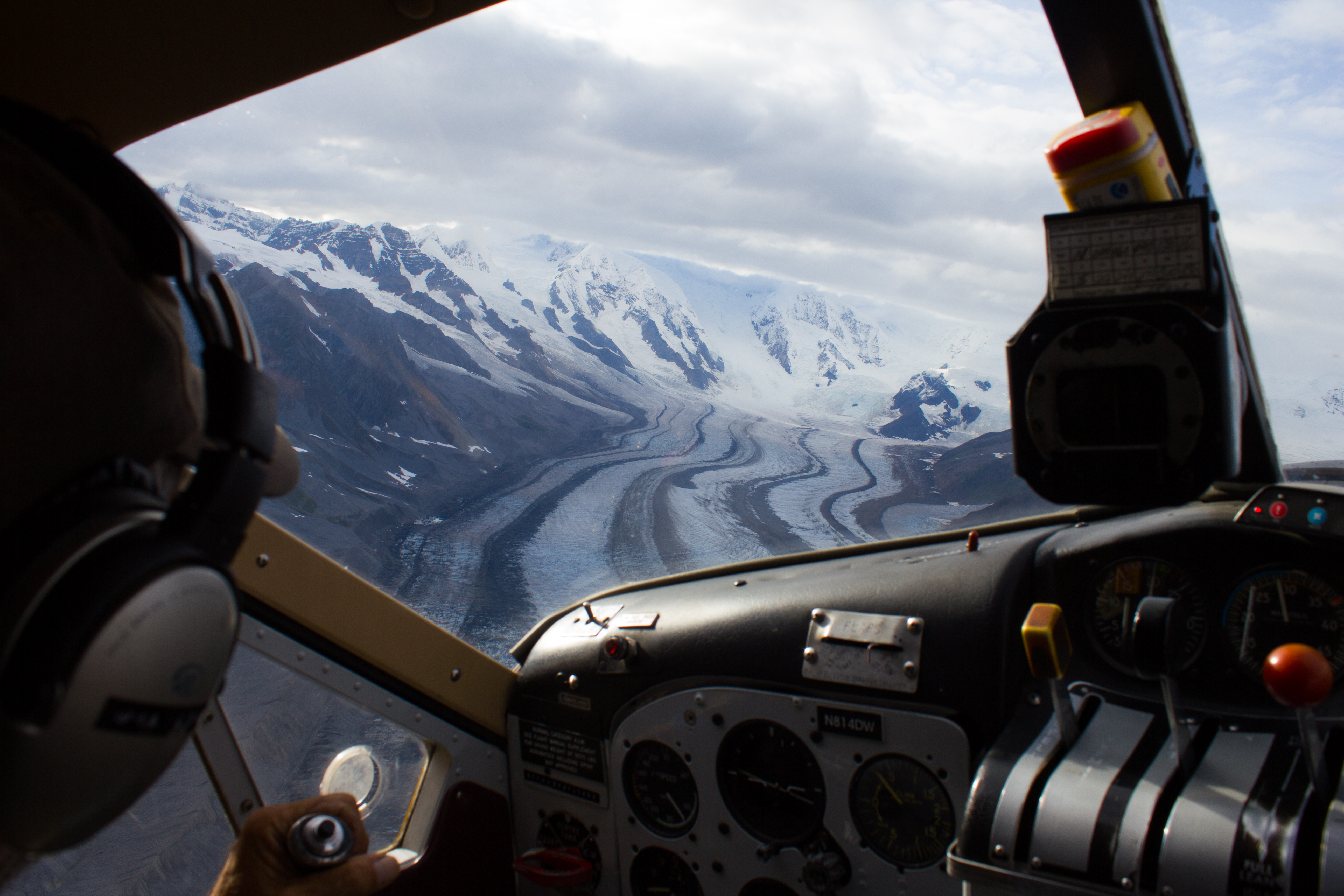
Our flight to the glacier the following morning went smoothly, with Steve lending us his experience with helicopter transports. Valentina and I went in on the first run to scan for a suitable site for the station, and to get dropped off on the glacier with the main equipment for the station. Brian and Federico were to travel in on the second run to bring equipment to the lodge.
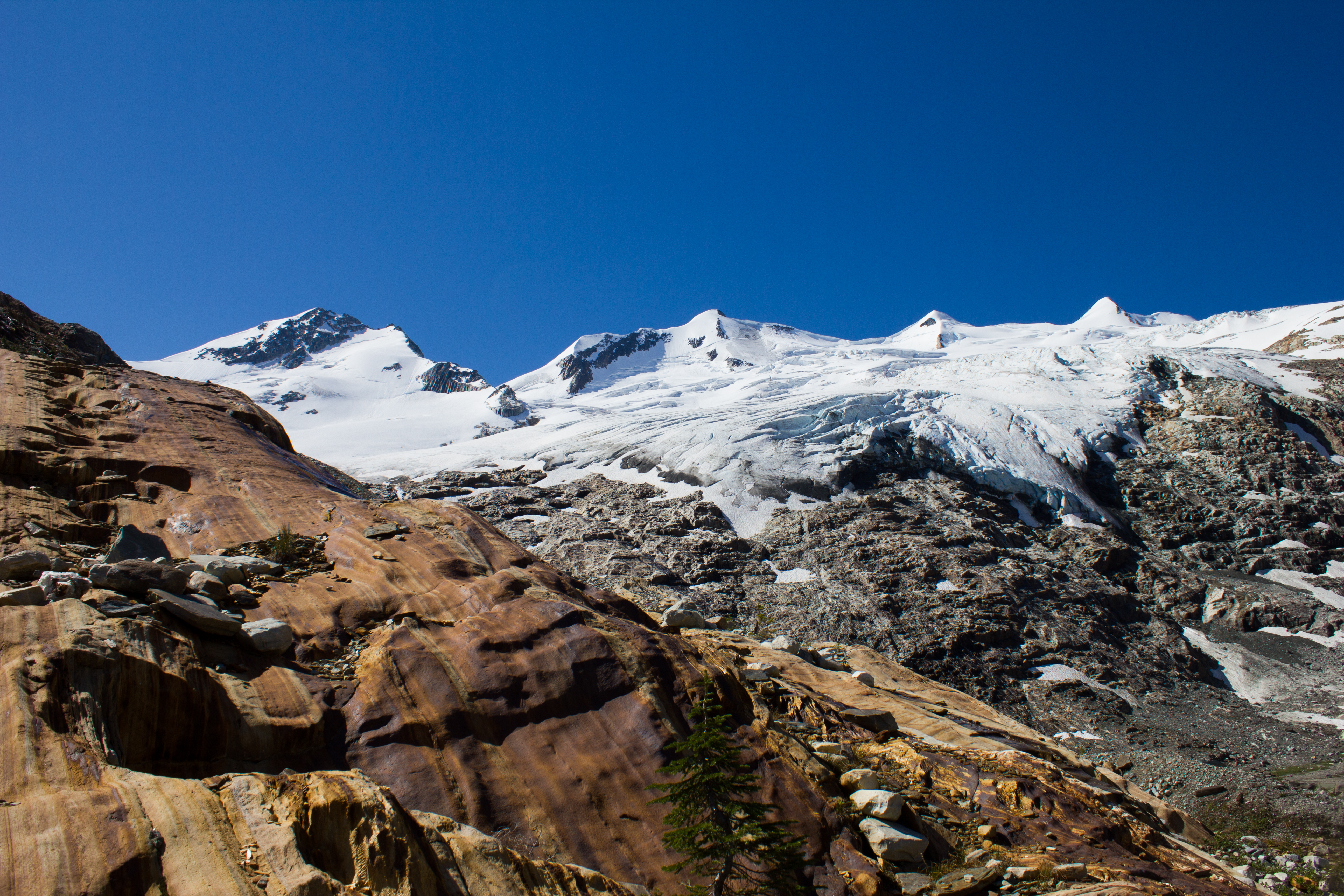
After several months of looking at Nordic in photographs and maps, seeing it grow larger through the window of the helicopter, I felt excited and nervous. As we drew closer however, I was concerned to see the extent of the snow cover in the area we had been planning to deploy. Working on a ‘dry’ section of a glacier (where there is no snow) has the major advantage of being able to see the location of the crevasses. Not only is this much safer, it allows you to move and work more efficiently, as precautions such as being roped together are not necessary. We had hoped that the winter snow pack would have melted from our site by the time we arrived, but it appeared that, for this season, we were a little early.
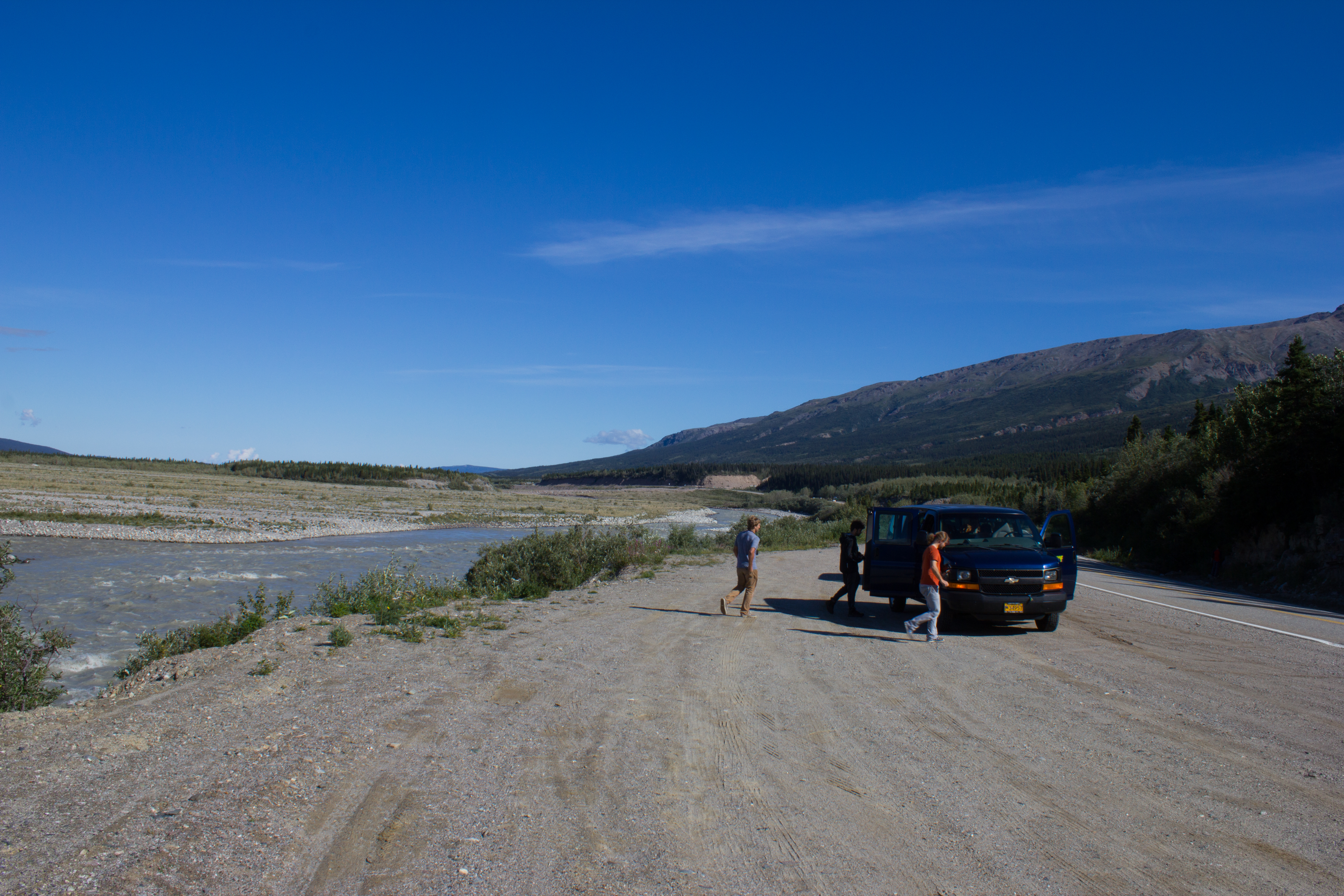
We landed on the glacier, and unloaded our equipment with the engines still running. As soon as we were clear of the downwash from the departing helicopter, we roped up and started surveying the area for the flattest spot for our station, probing the snow as we moved to check for crevasses. After the helicopter returned to deposit the larger pieces of equipment, we flew down as far as the lodge to meet with Brian and Federico. With conditions the way they were, we decided we would hike up to the glacier together, and find the safest route to the site.
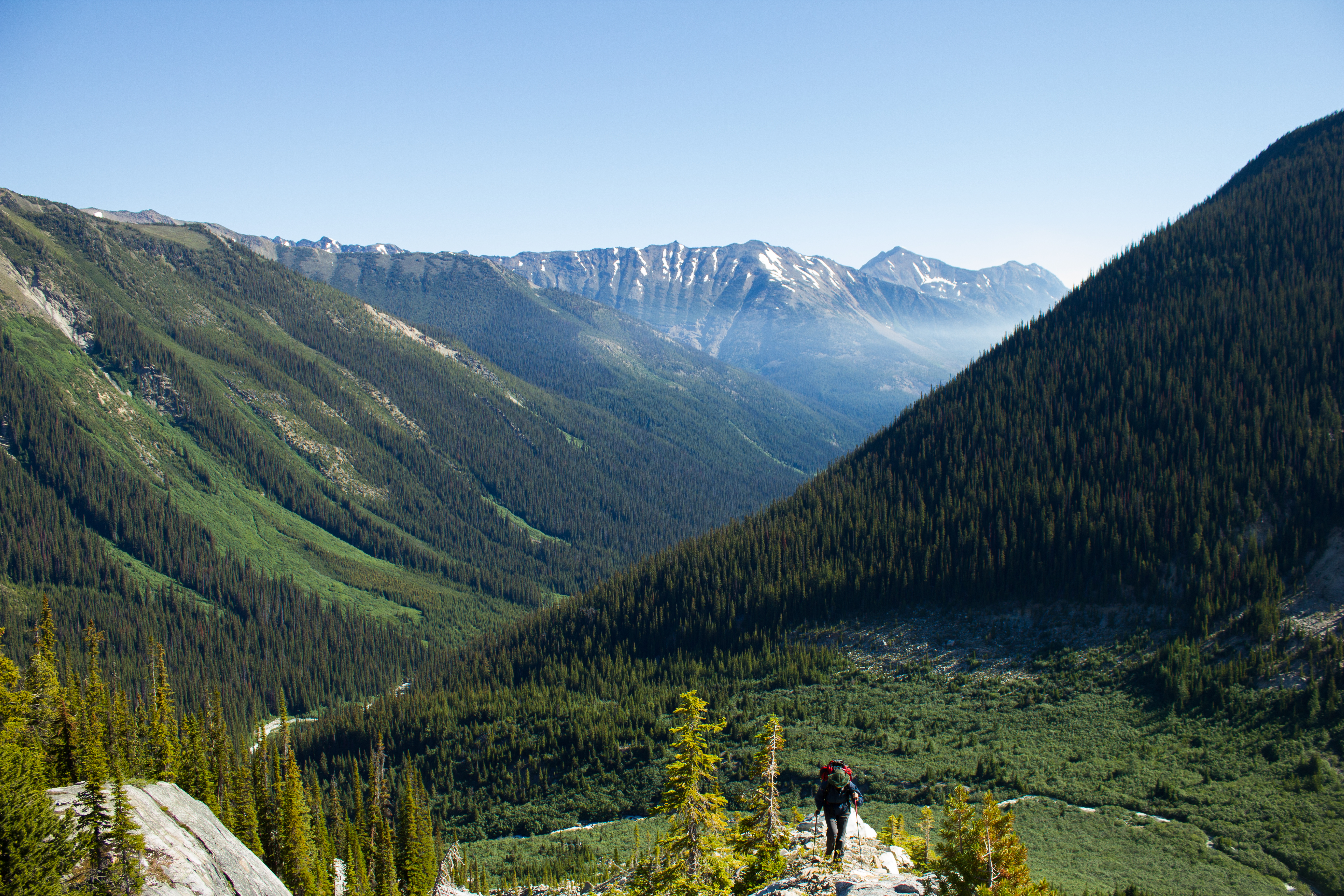
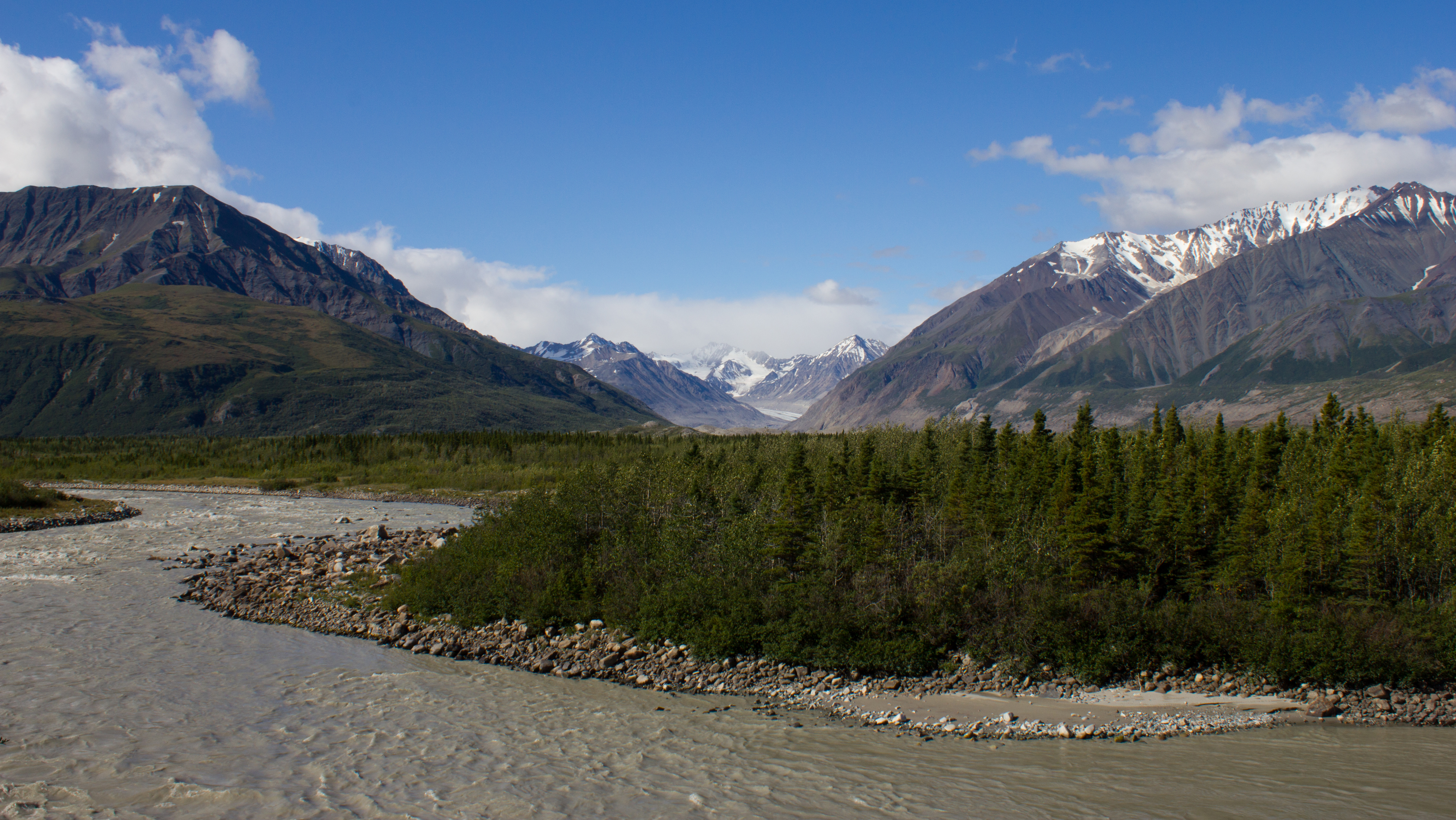
Each day, our hike to the glacier would begin with crossing the lateral moraine that separated the lodge from the main valley. From there, we would descend and traverse the valley to the other side, crossing the river to do so. The river crossing was a glacier monitoring exercise in itself. As the river’s source is the melt water draining from the glacier, there was a distinct daily pattern in the strength and level of the flow. In the morning, when there had been little melting during the colder night temperatures, the water level would be well below my knee. Returning in the evening, after a day of warm temperatures and sunshine, the flow would be much stronger, pulling at already tired legs. As you’d imagine, the water was pretty cold, and it was incredible to feel how quickly your heat could be drained away.


Installing the station came together relatively quickly. Although the glacier is a very different working environment to the lab or test field, I really felt the benefit of all the trial runs and lab assemblies. The station was constructed, wired, and operating after one, albeit long day, and it was fantastic to have the additional manpower of Brian and Federico, who obliged me with some serious ice drilling. A second day was spent testing to see how the data and power system was performing, and also securing the various components of the station in preparation for two months on the side of a mountain.


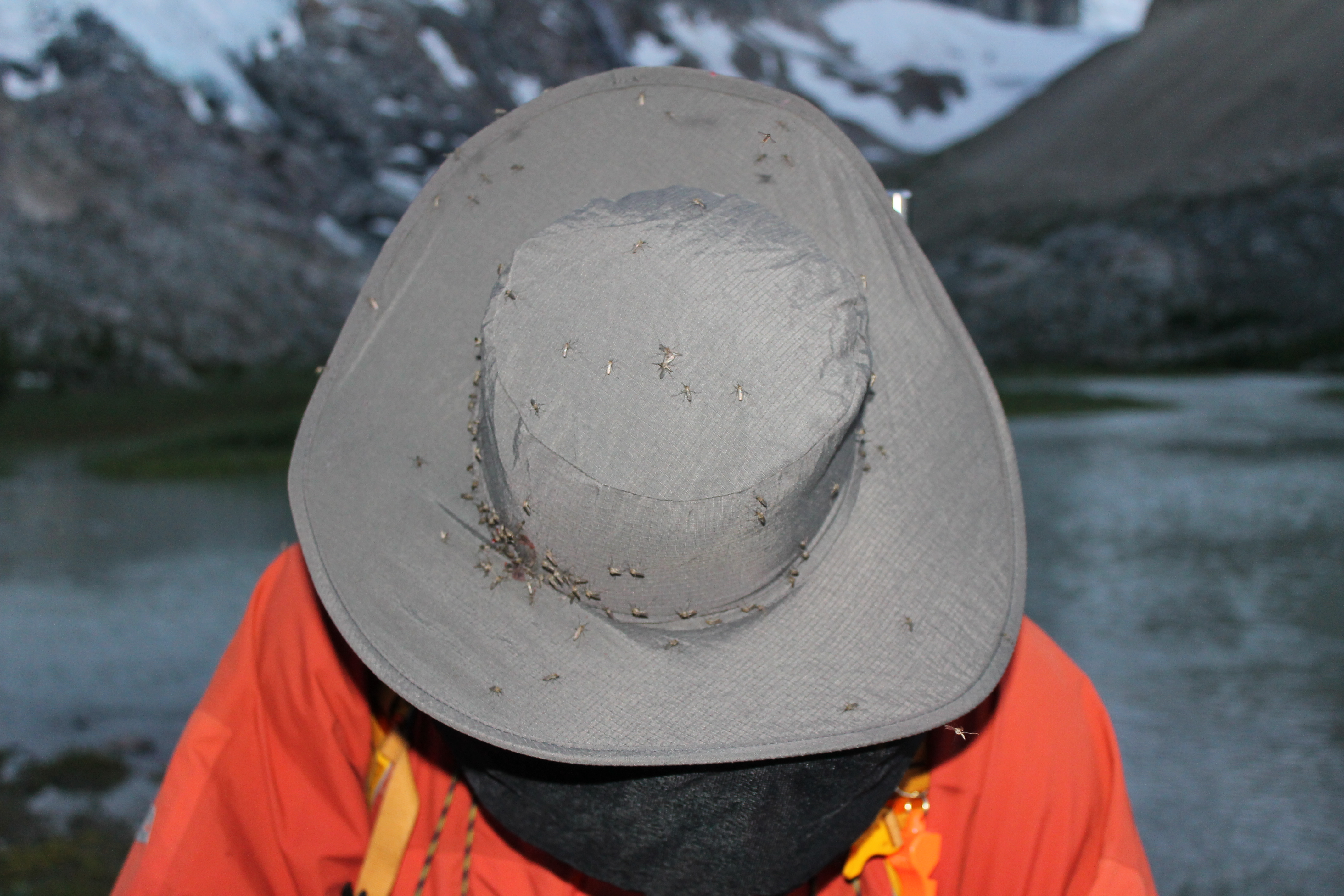
Mohammed Ali once said, ‘it isn’t the mountains ahead to climb that wear you out; it’s the pebble in your shoe.’ In this case, it was the mosquito inside your mosquito net. We carried out our field work during the buggiest few days of a particularly buggy season, and these mosquitoes couldn’t believe their luck when they saw us coming. I’ve spent time in the Amazon jungle, and this was comparable. Once on the ice however, the buzzing clouds would disappear, and we could work in peace.
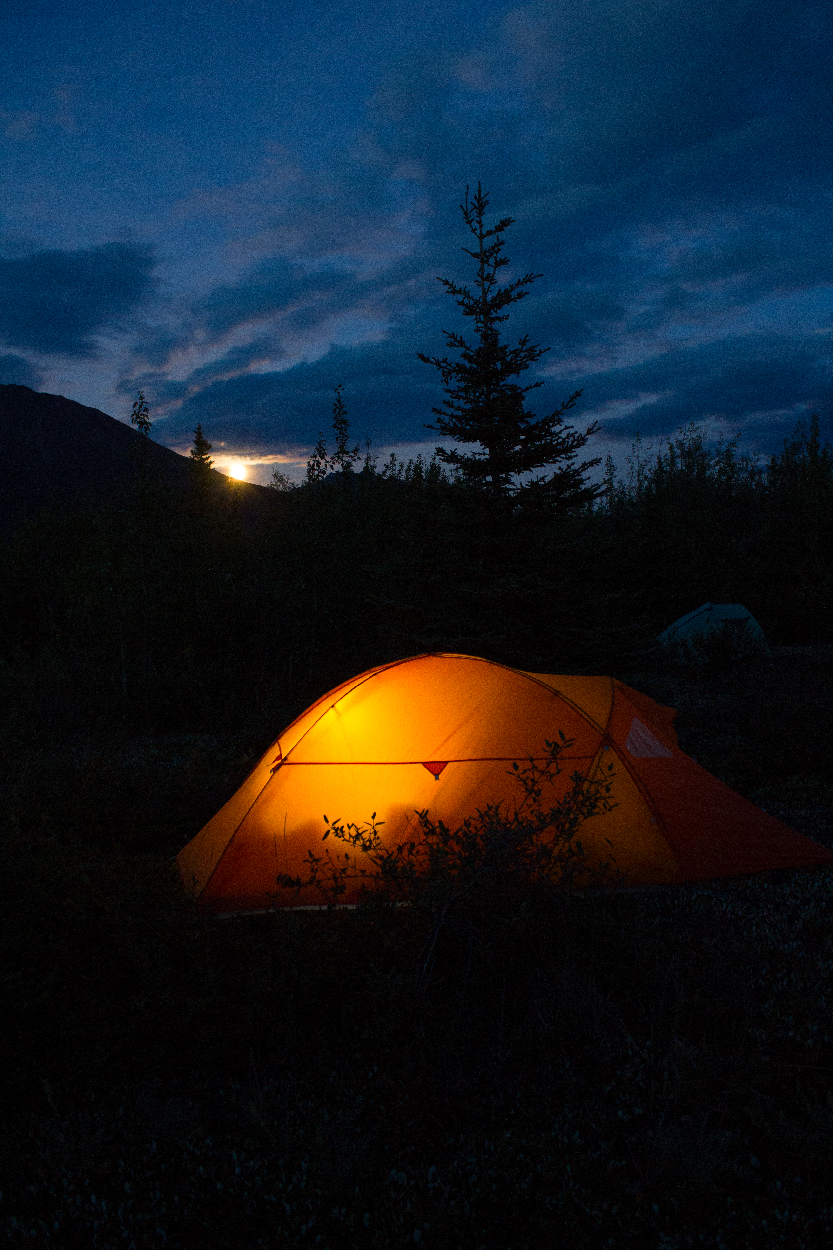
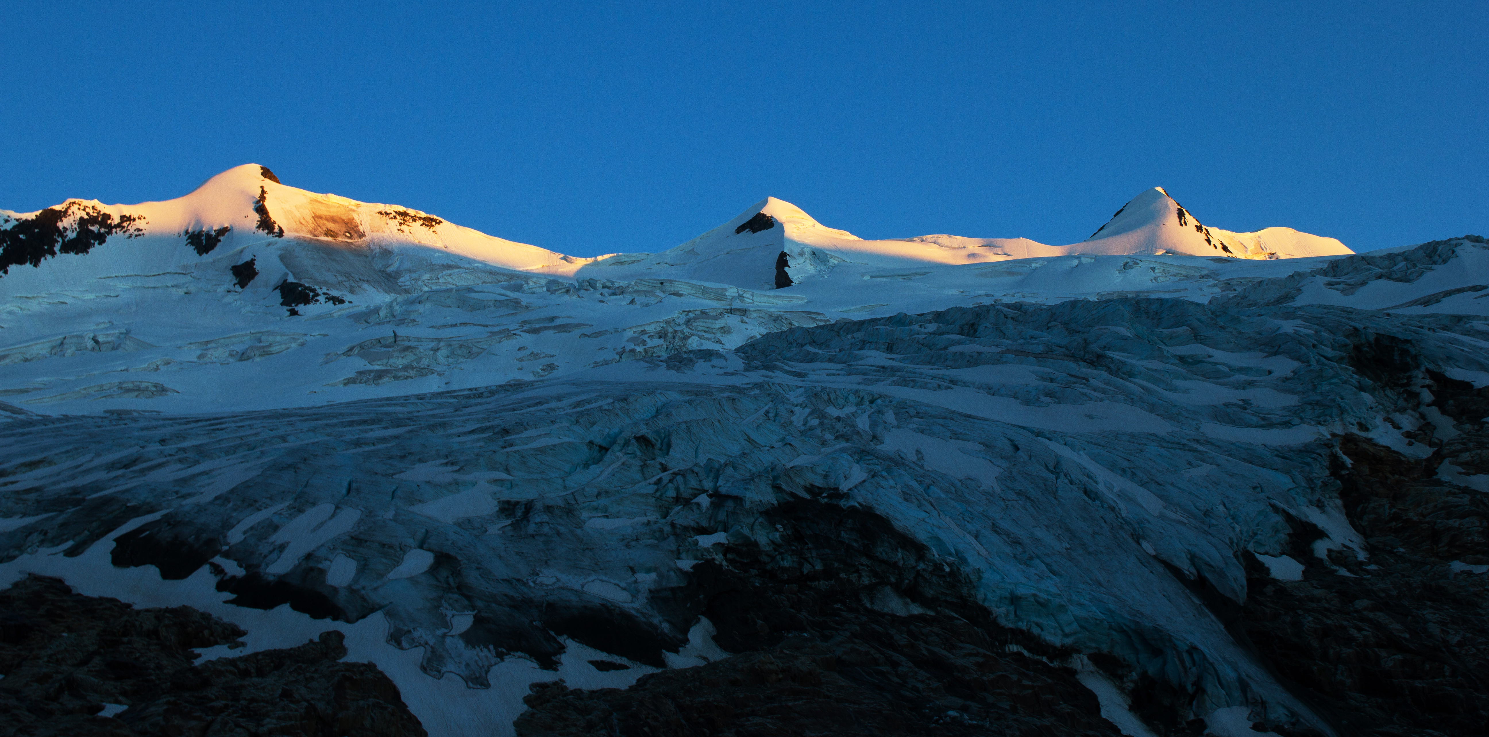
Each evening, with duties on the glacier finished, we would begin our return hike back to the lodge. Despite being tired, this was always my favourite part of the day. No longer focusing on tasks that needed to be done, I could better appreciate the surroundings, particularly in the hour around sunset when everything would be painted gold and blue. To work in such an environment is a privilege, and time needed to be taken to set aside concerns and stresses, and simply take note of where we were.
On the morning of departure, we flew over the glacier to get our last view of the station for the next two months. I will return at the beginning of September to see how well it survived, to dismantle and transport it back to Vancouver, and to start working on what its data can tell us.


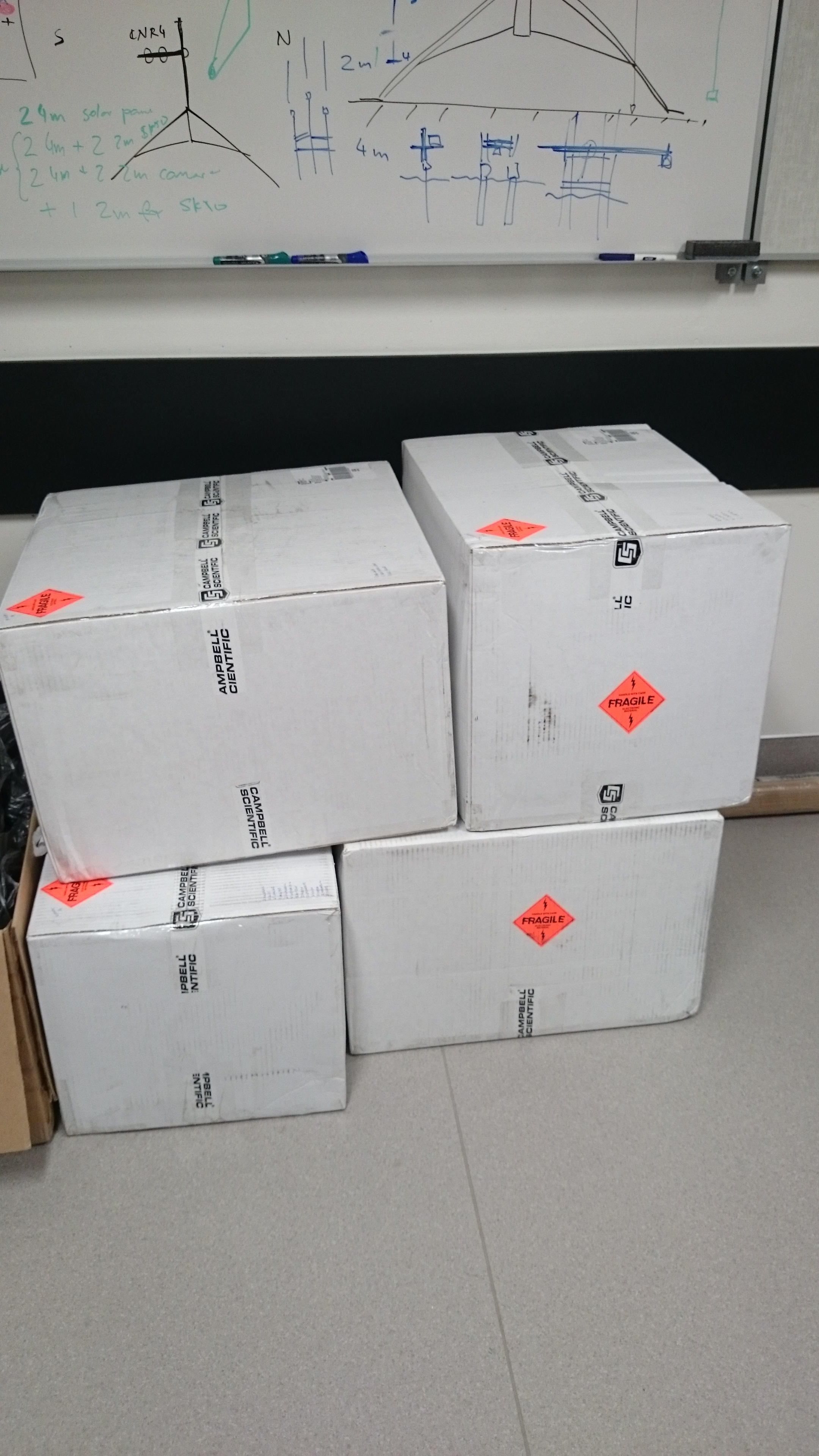
We tackled the drive back to Vancouver on the day we flew down, utilising several food/coffee/ice cream stops to keep sleep and the 35°C of the Interior Plateau at bay. Arriving back to the city, I was tired but content that the work had gone well, and looking forward to taking it easy for a few days before preparing for my next trip (Alaska). Calling into the lab to drop off a couple of items before going home, I was greeted by a delivery of 4 large boxes; the starting components for next year’s stations. It was time to get some sleep.
Up Next: I’ve just returned from a glaciology summer school in Alaska; photo-journal coming in the next couple of days.
It’s finally time to head to the hills.
Since I arrived in Canada six months ago, the majority of my focus has been geared towards the next 8 days. Early tomorrow morning, we leave Vancouver, and aim towards Nordic Mountain. We will first travel to the town of Golden, where we will stay over night, and then load up the helicopter for the flight to the glacier.
Report to follow.


As part of my upcoming glacier field work, it was decided that a camera would be a useful addition to the station, which will be installed and left unmanned for 2-3 months (see The Project) . The camera will be used to take pictures of the station and the surrounding site, so that I’ll have a record of what was happening throughout the study period. So, as an example, I can look at the pictures from a period with some interesting data and see what the weather was like, or as another example, what type of bear it was that destroyed my equipment.
The following is a DIY post on building a type of ‘nature’ camera. If anyone is actually interested in building something like this and requires more information, feel free to contact me.
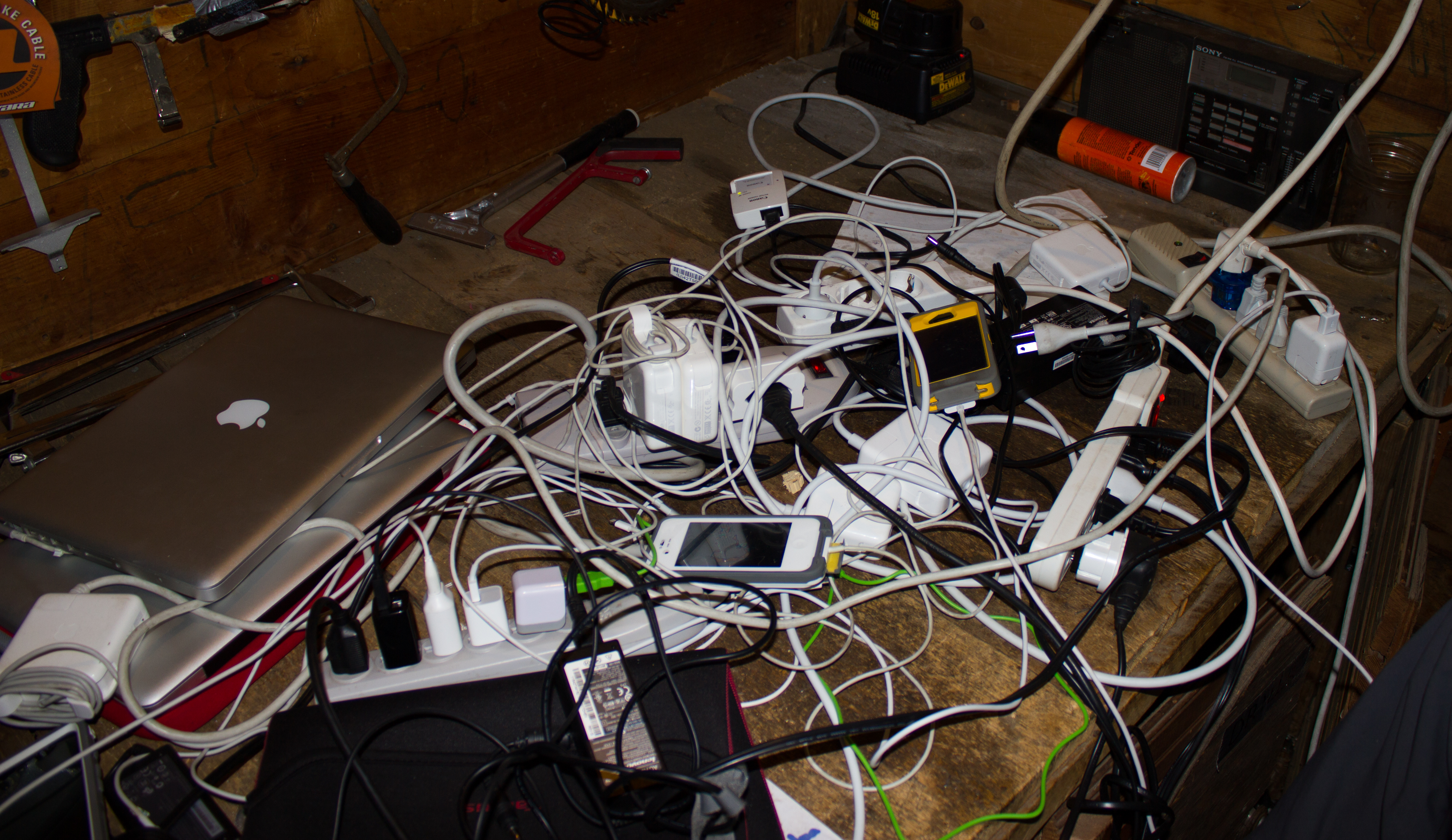
Having priced commercially available units at round $2,500, and not being overly impressed with the camera hardware being used, I decided to build my own rig. My design was strongly influenced by that of another rig built by a researcher in my department, Camilo Rada. Here is the basic outline:

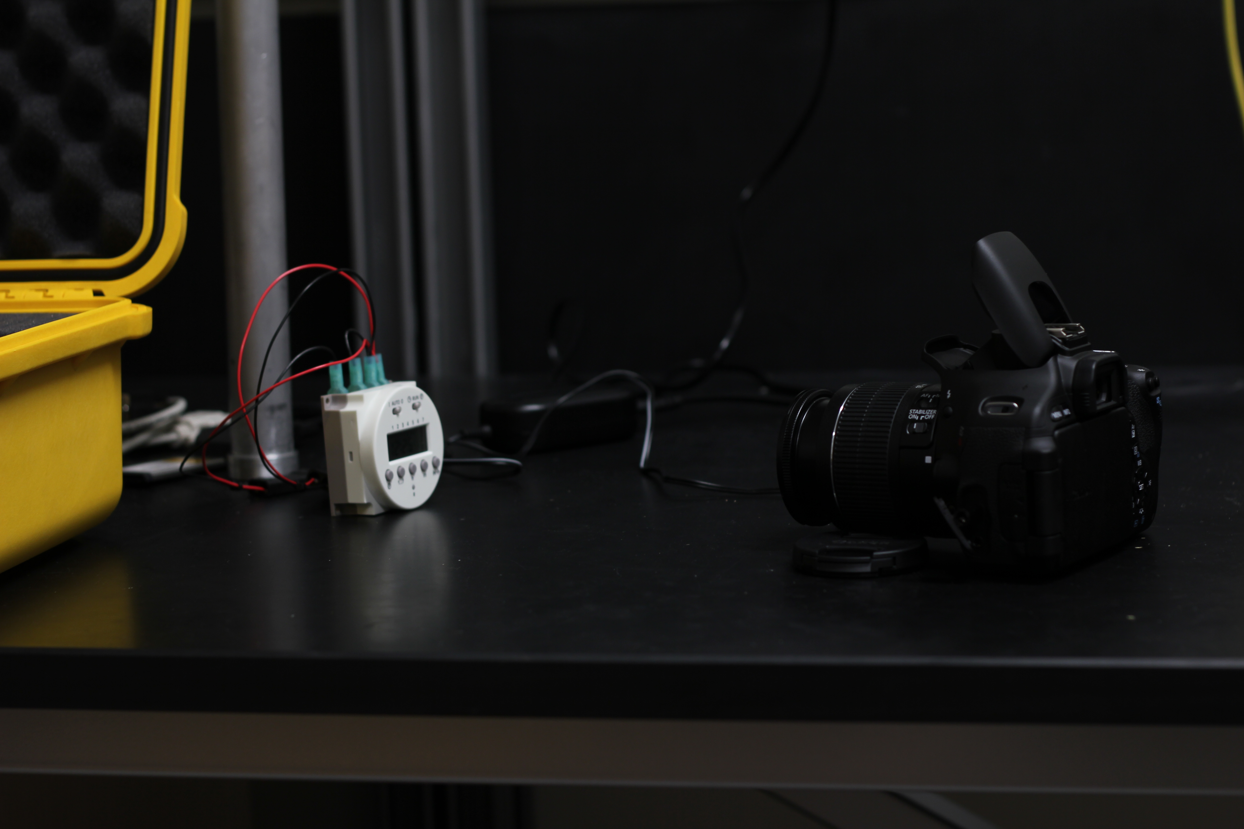
The most important component of the build is the power system. I replaced the standard camera battery with a commercially available battery adapter, which is normally used to power a camera directly from a mains socket. I wired this adapter into a DC timer, which is essentially a switch which opens and closes the power circuit at user defined times. The other end of the timer was then wired to a high capacity (10 Ah) 7.4V lithium polymer battery, originally designed for use in remote controlled aircraft.


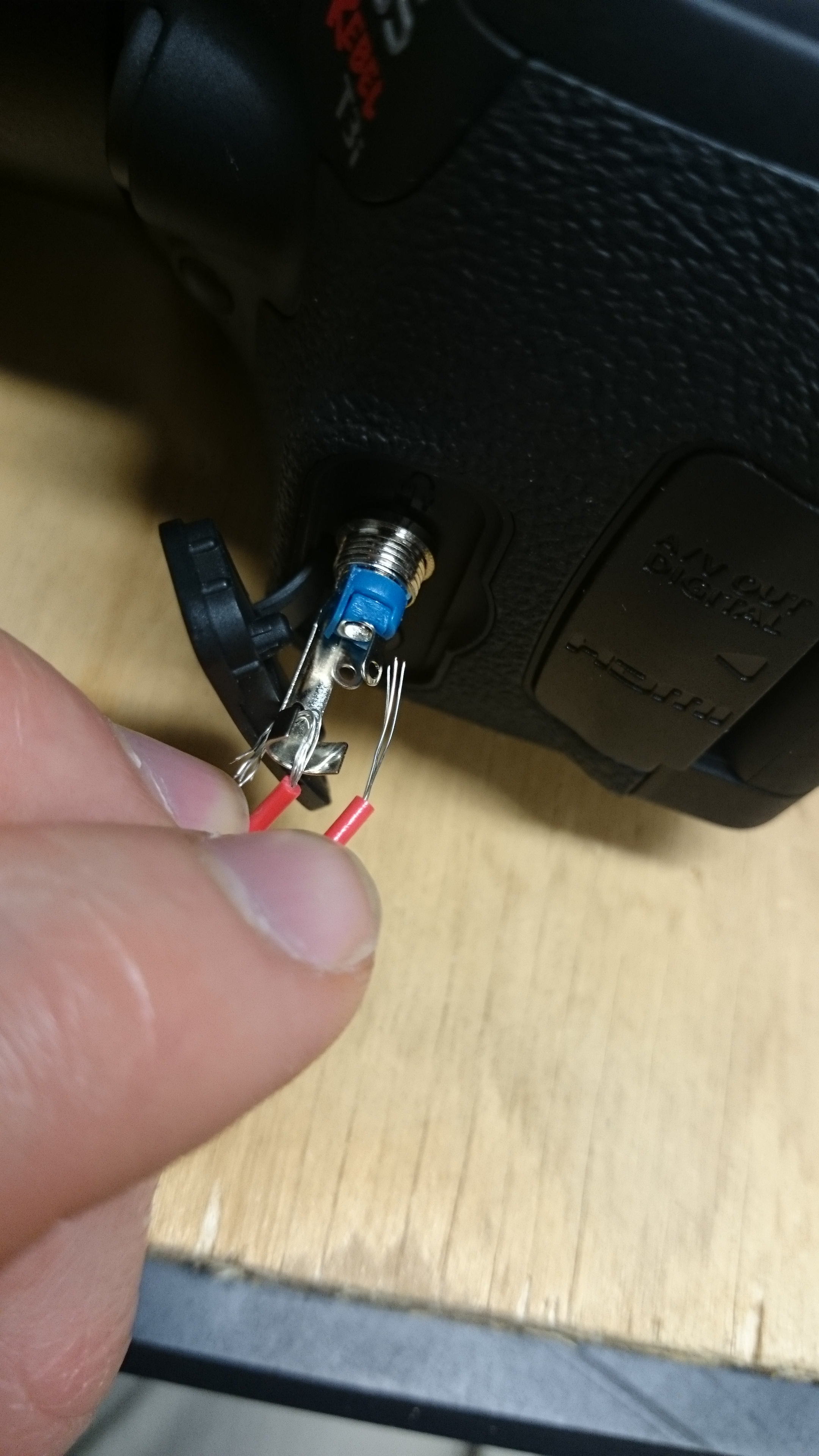
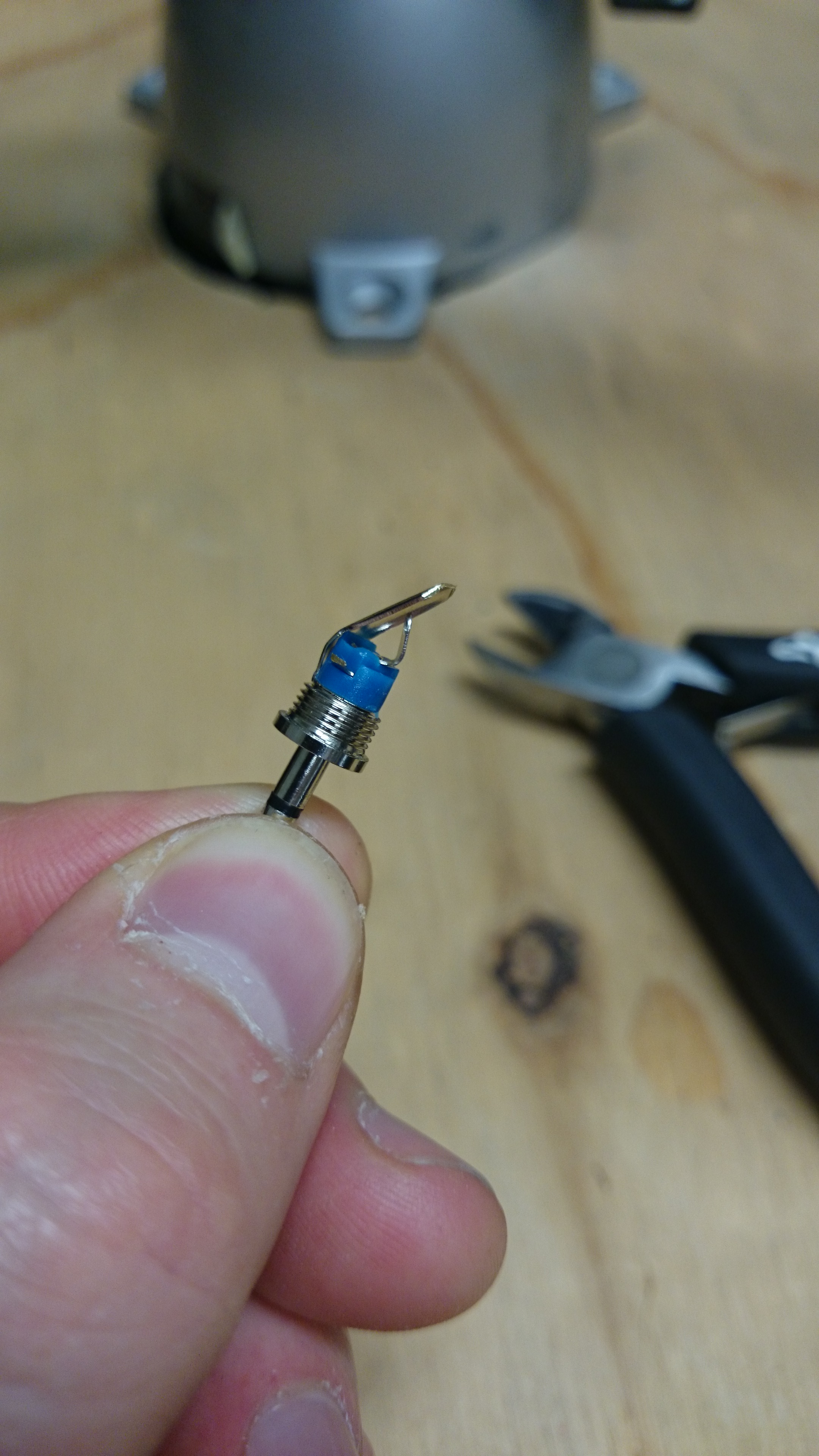
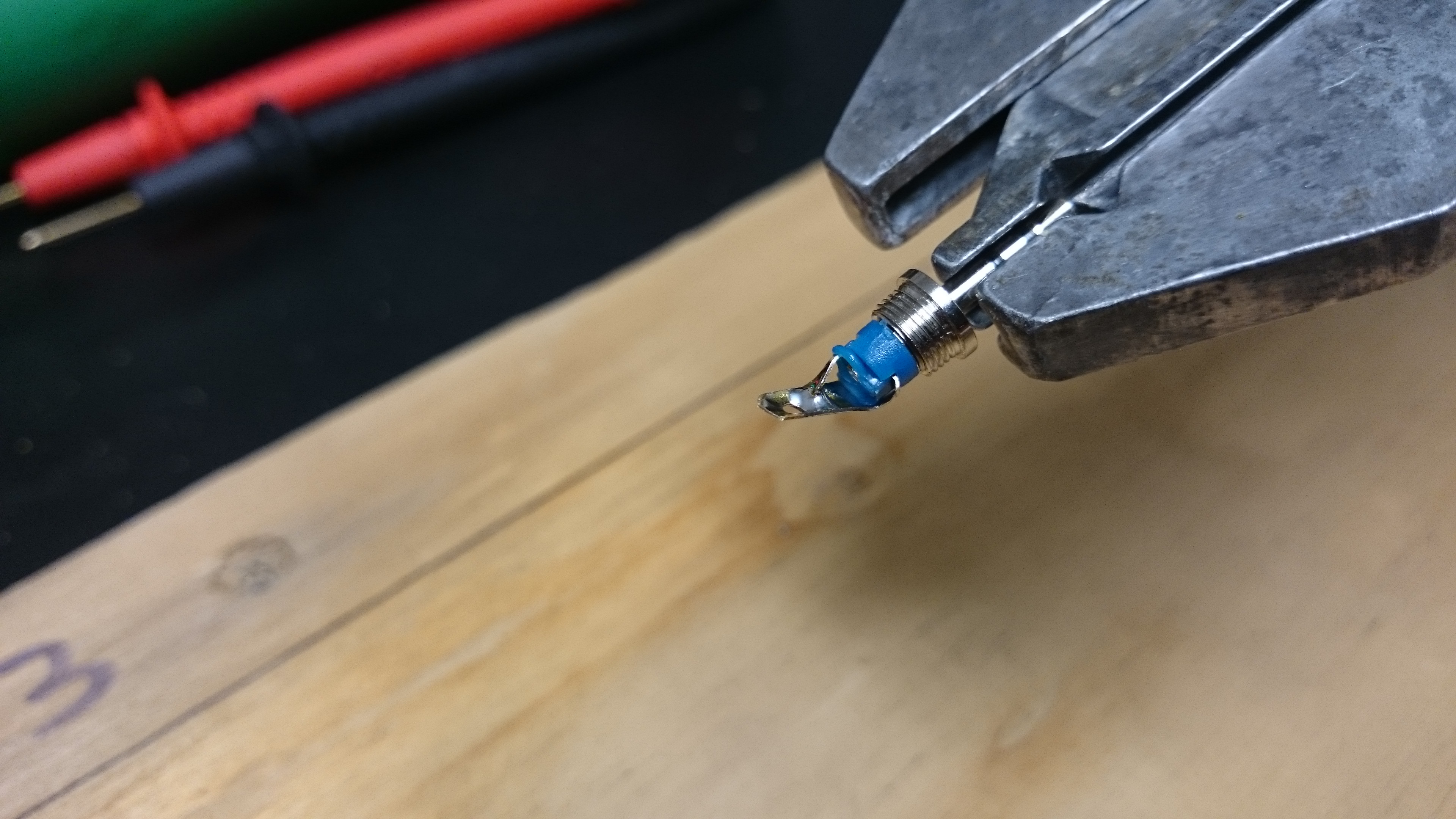
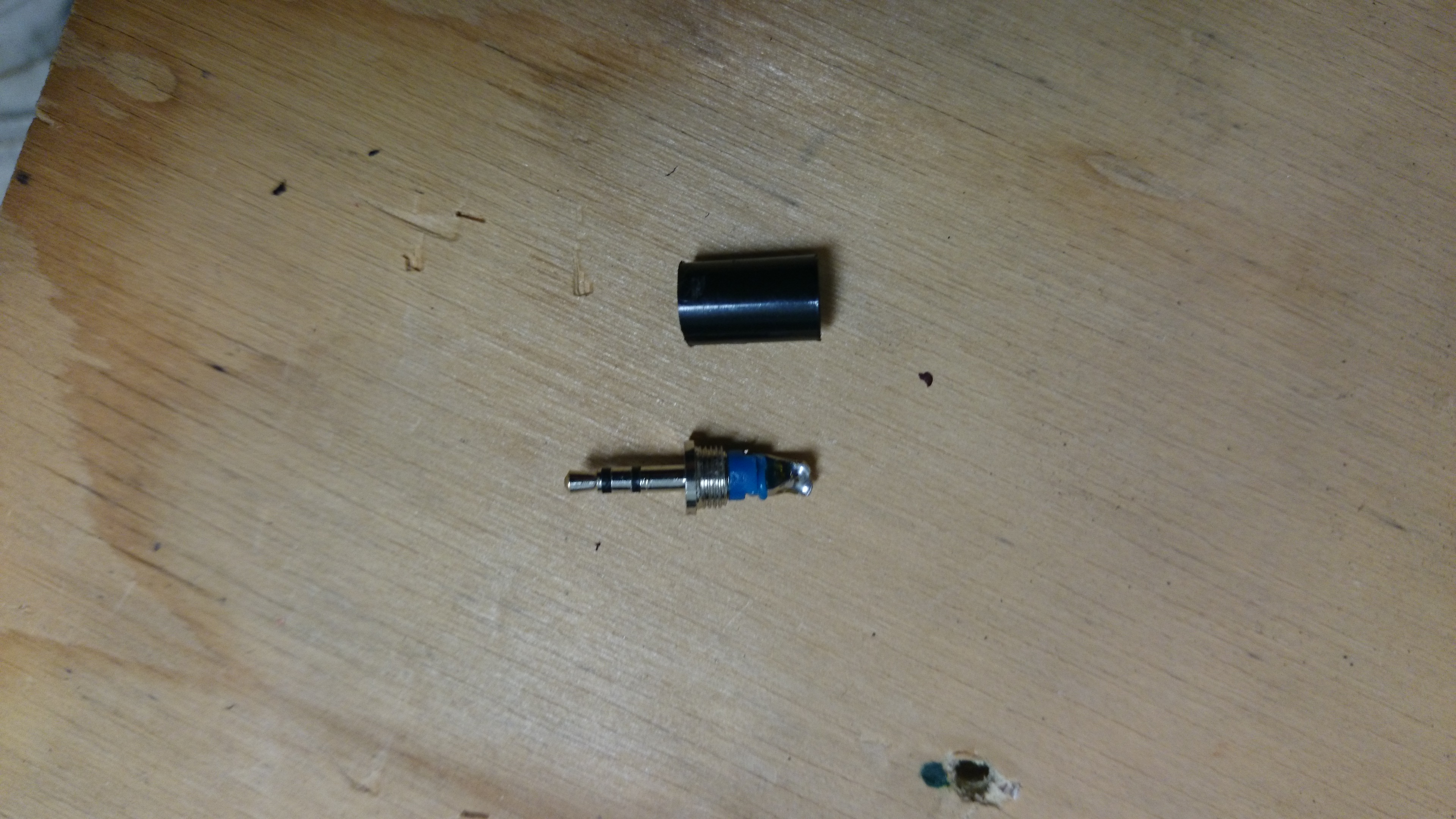
As the camera will be left to operate by itself, an automatic way of firing the shutter (taking the picture) is needed. I modified a standard 2.5mm stereo plug by shorting the outer contact (outer ring) with the inner contact (inner ring)by removing the black plastic cover and soldering the corresponding connectors together (and removing the middle connector). This plug is then inserted into the remote control port of the camera, and tells the camera that the shutter trigger is being pressed.


The timer is programmed to allow power through to the camera from the battery at set intervals, and the power switch on the camera itself is set to on. When power reaches the camera at the set times, the modified plug tells the camera that the shutter button is being pressed, and a picture is taken. After a minute, the timer shuts off power supply until the next programmed time. As for the camera settings, the mode is set to automatic (Program or P in the case of this model) so that the aperture and shutter speed will be selected automatically by the camera to suit the light conditions. The camera should be focused by the user during set up to suit the required view, and then the focus should be set to manual to prevent the camera from changing the focus during operation.


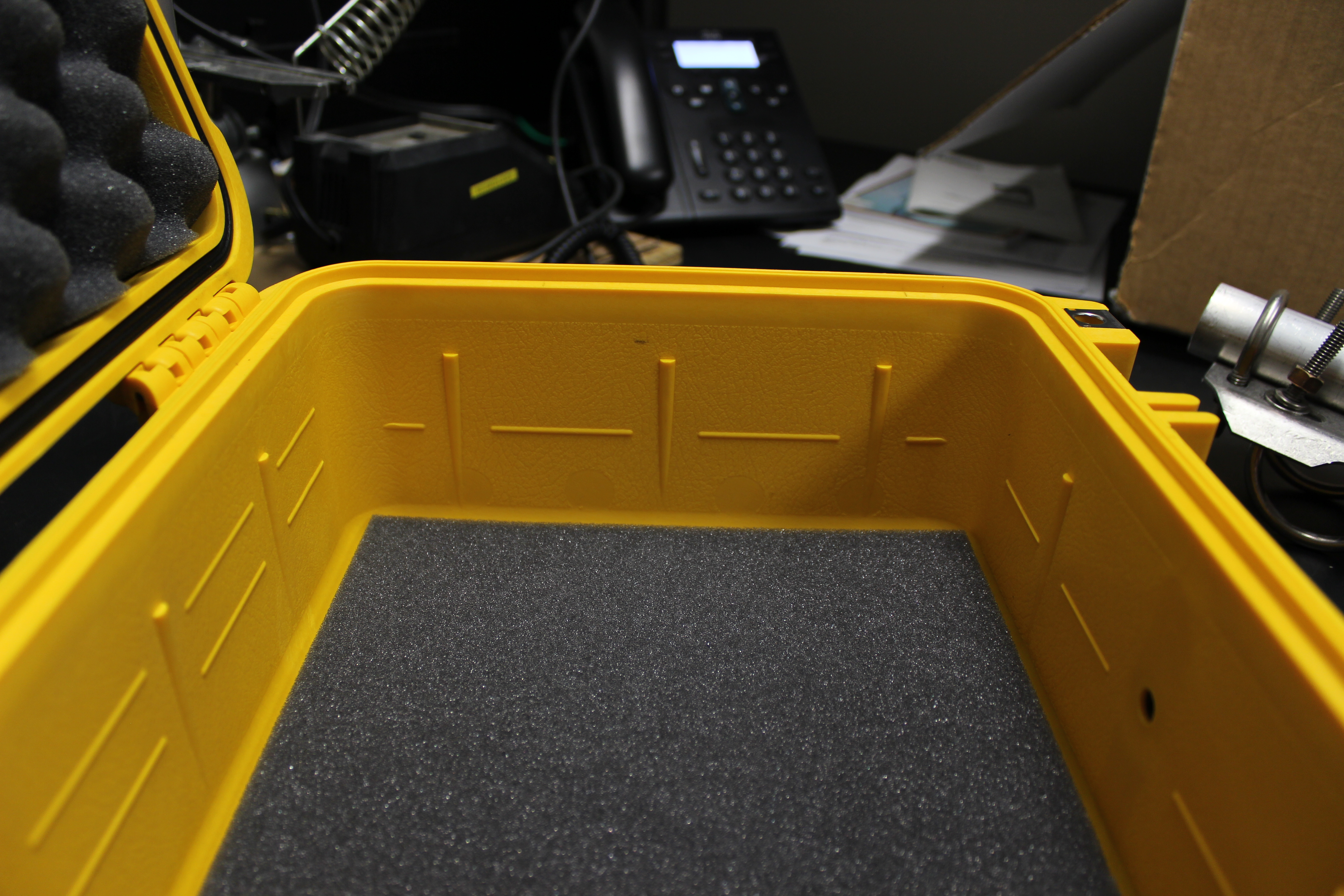
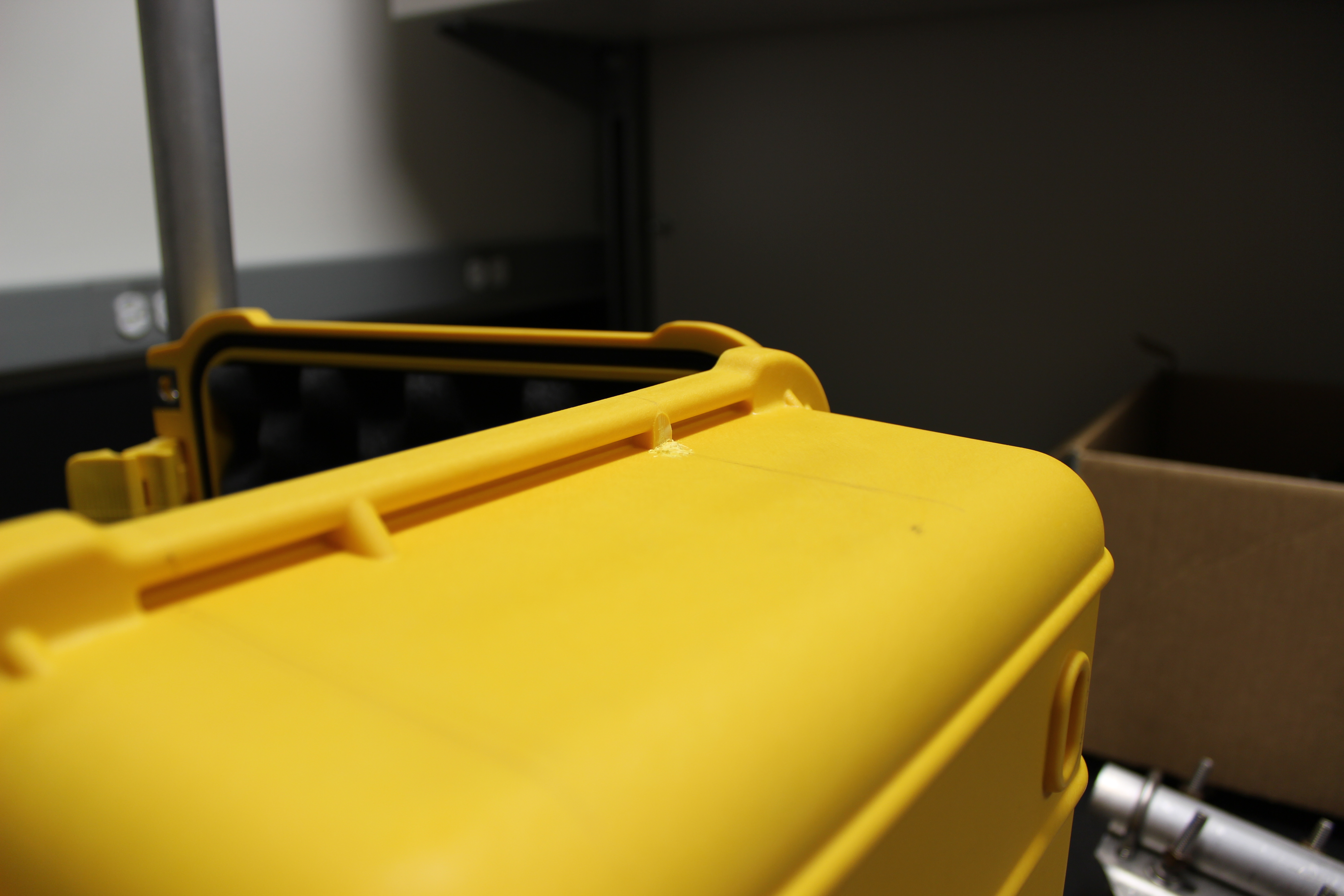
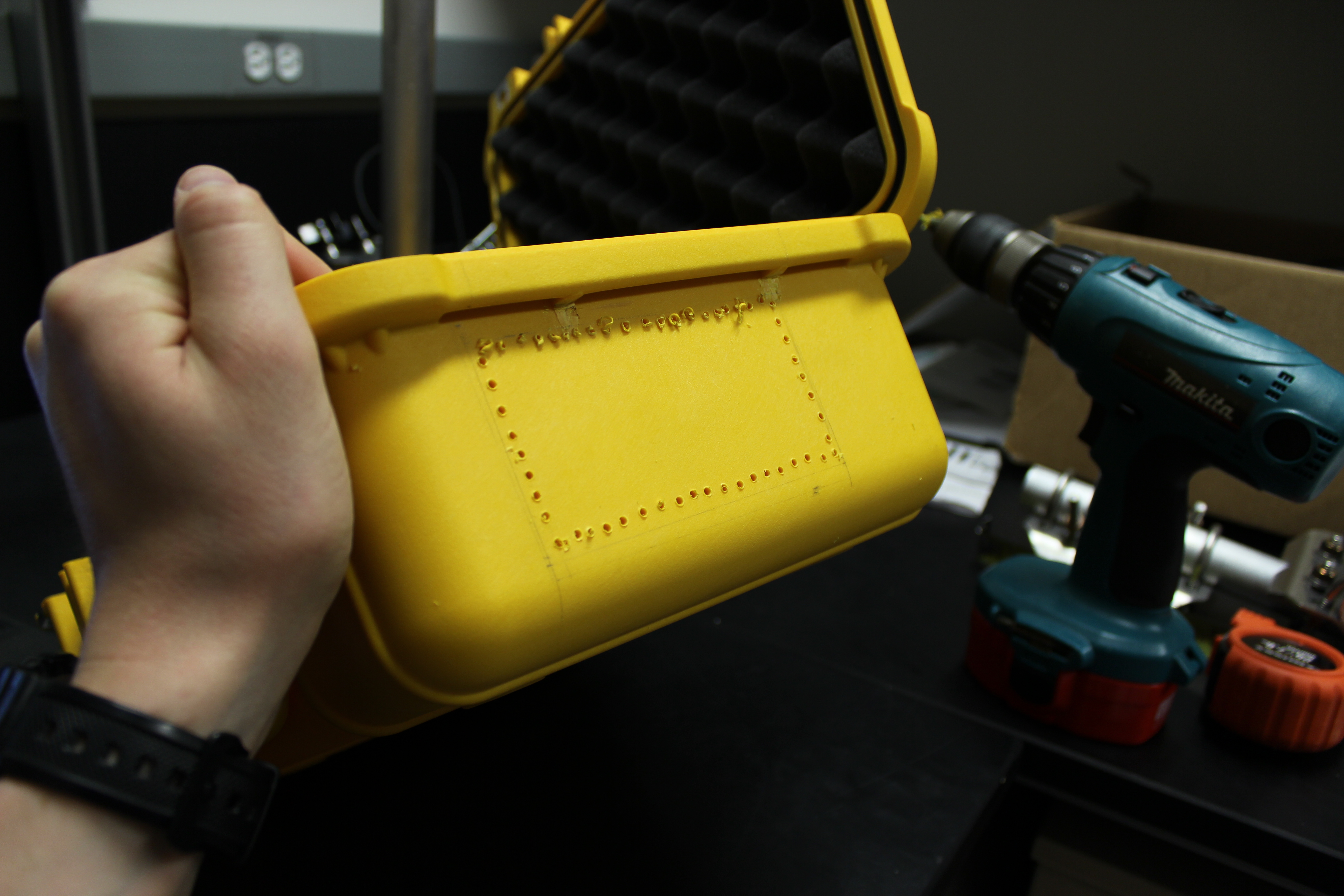
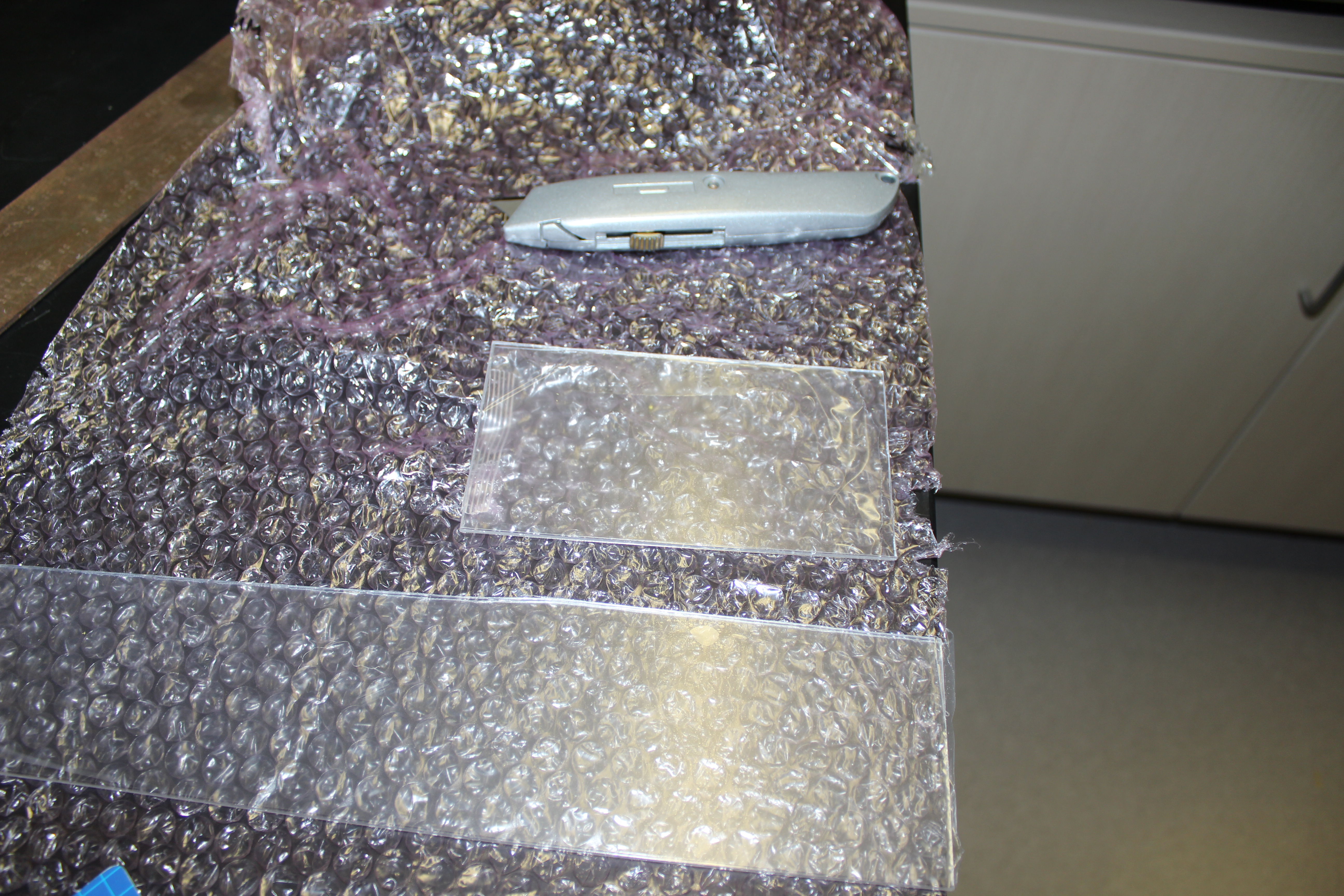
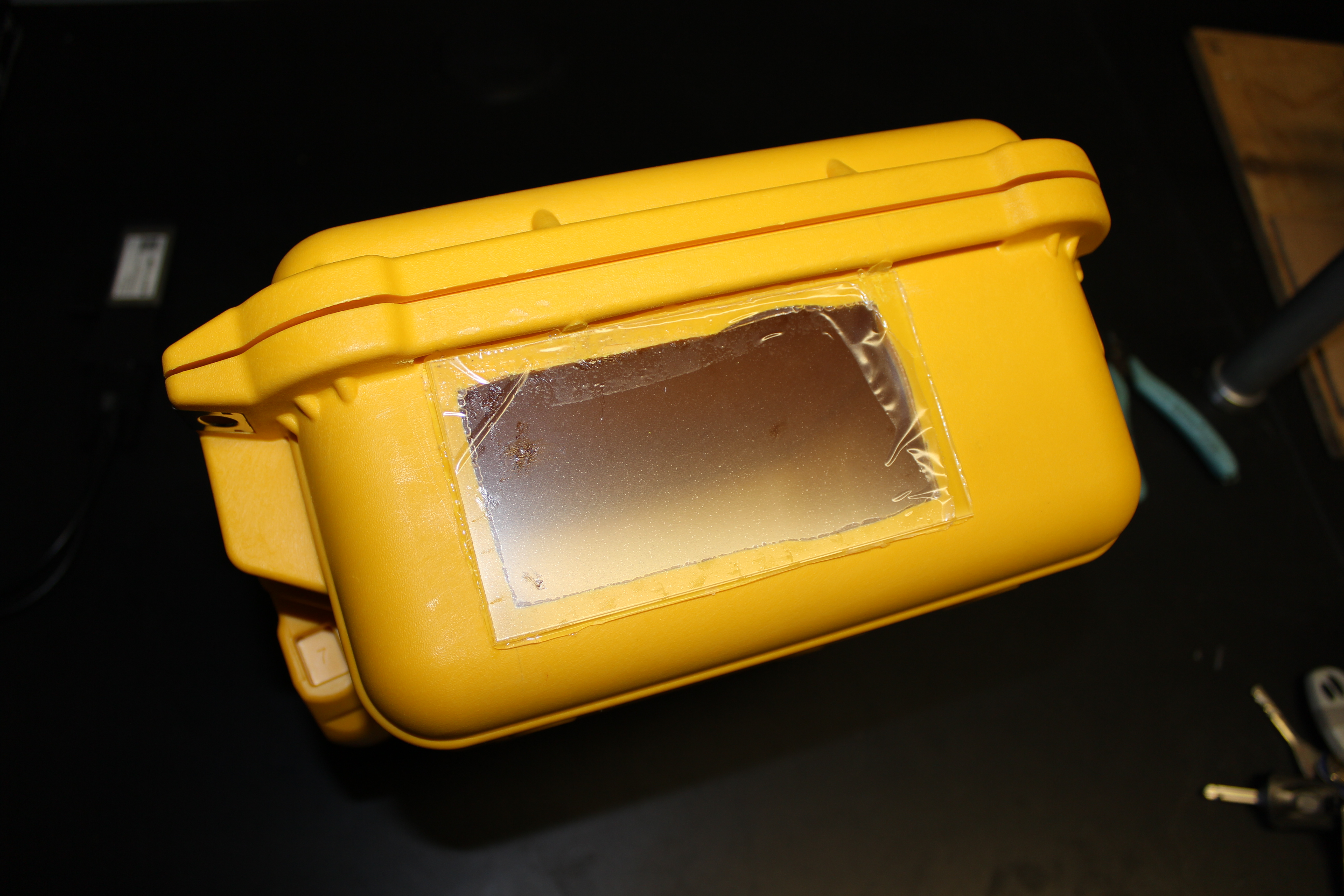
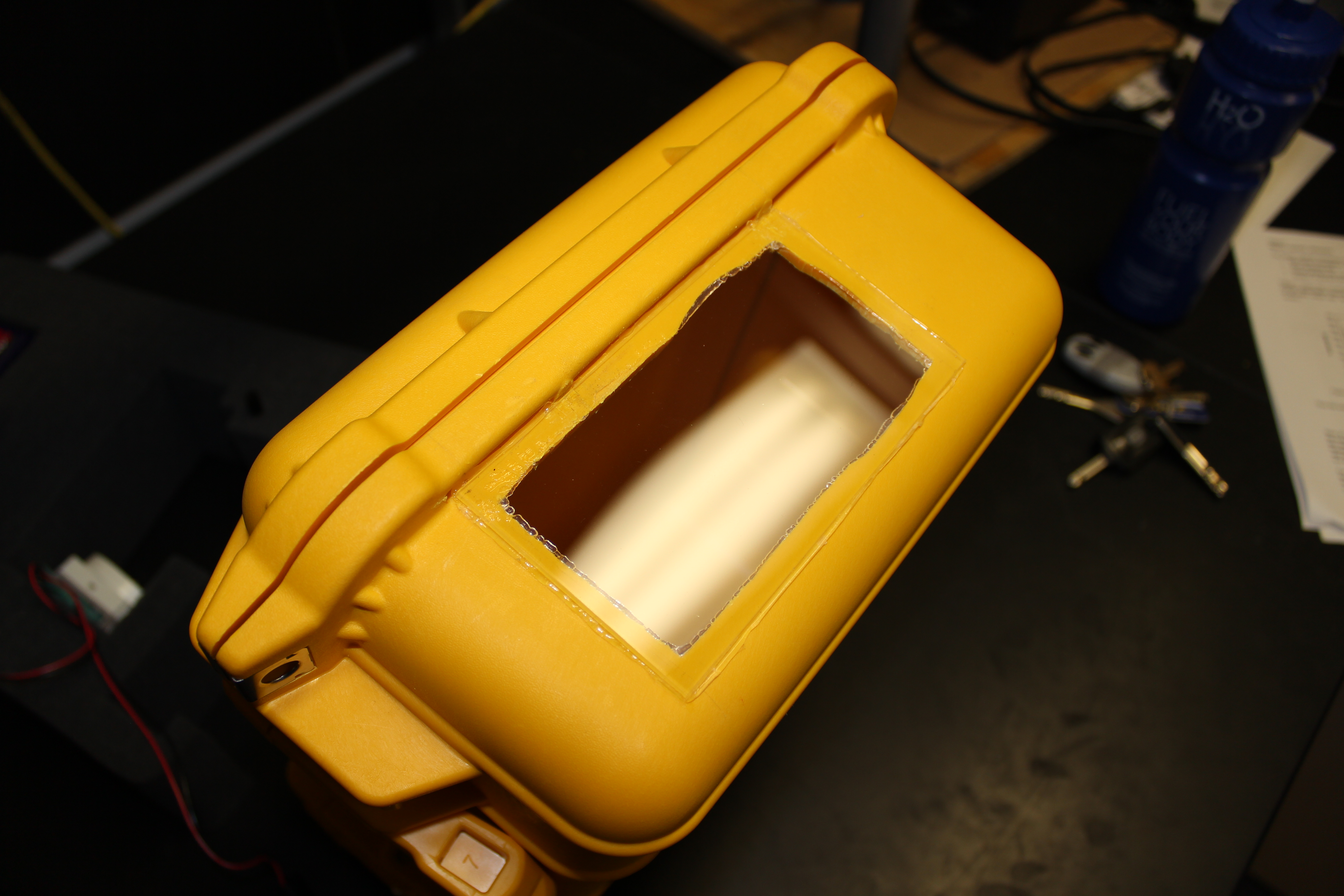
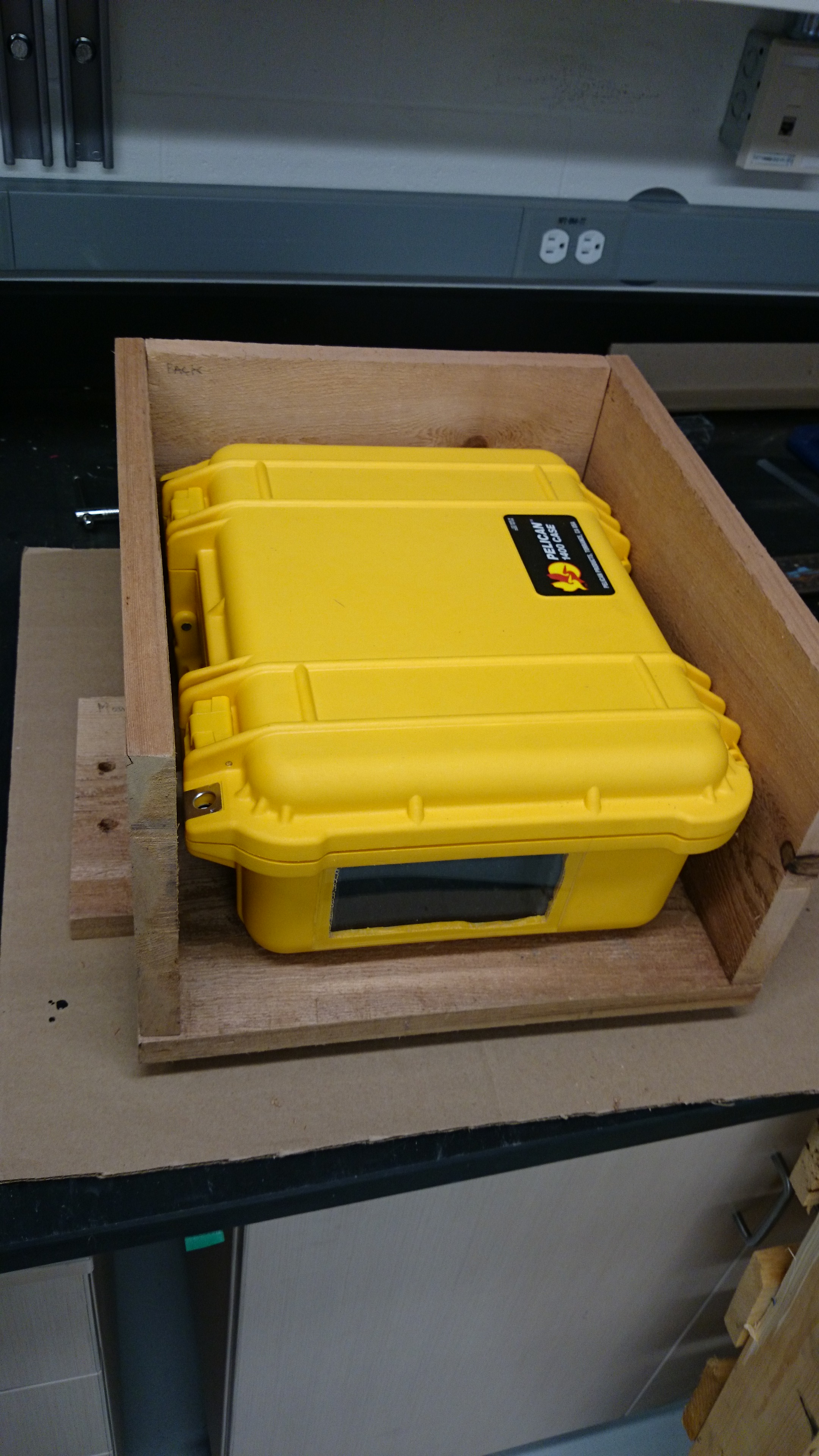
In order to weatherproof the camera rig, and keep it protected, I housed the equipment in a Pelican case. Firstly, I cut foam to fit the various components so that they are held securely in place. As a camera will not work very well in a completely opaque box, I created a window. I cut out a section of the side wall, using a drill and knife initially for the rough cut, and then a file to smooth the edges. I fitted a piece of clear acrylic for the window; I chose transparent acrylic rather than glass as it is easier to cut and is less likely to scratch or break . I bought acrylic that had a protective removable plastic covering (like cling film) which I left on until the end of building so as to avoided scratches. Basically, I treated the window like I would a lens. I used a silicone glue to attach the acrylic to the box, and left it to cure for 24 hours.


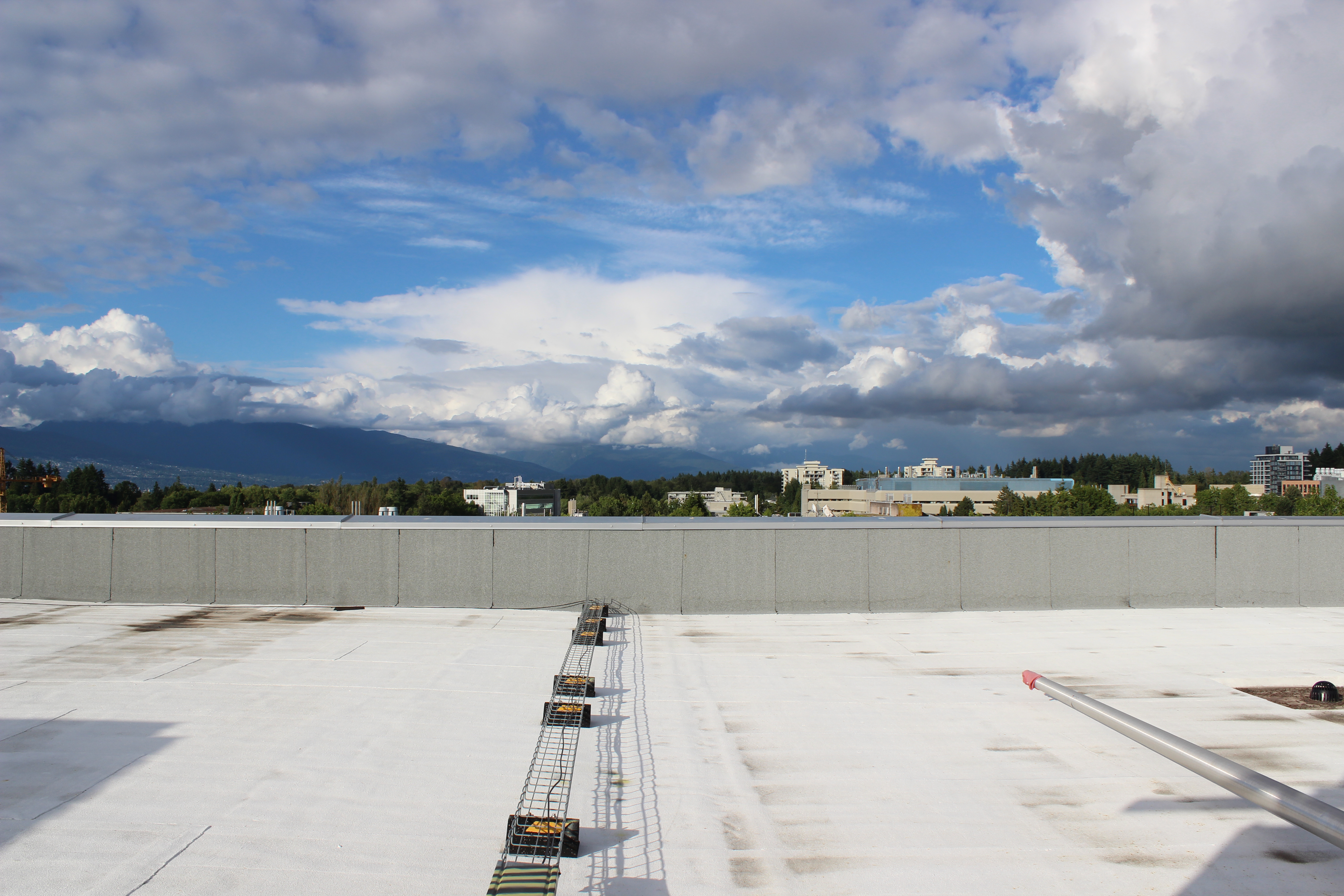
I test ran the camera on the roof of the Earth, Ocean, and Atmospheric Sciences Department here at UBC over the course of a few days, and it performed well. At the glacier, I will install the camera box in an additional wooden shelter (which I’m currently building), in order to keep it in a steady position, and to provide additional protection from anything that might damage or obscure the window. It will be set up to take images every three hours, and will hopefully provide reference and context for our data.


Update (July 4th 2014):
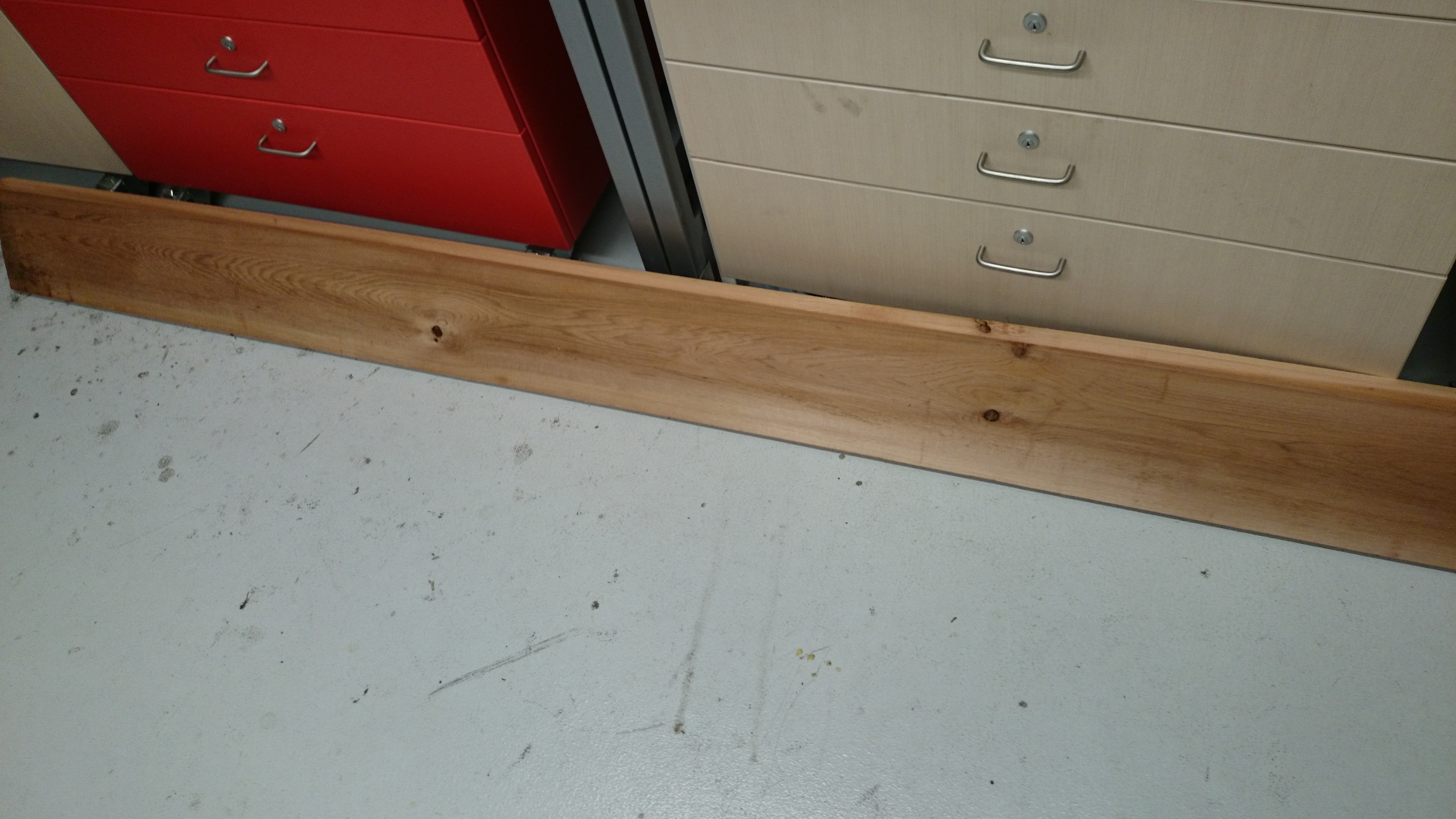
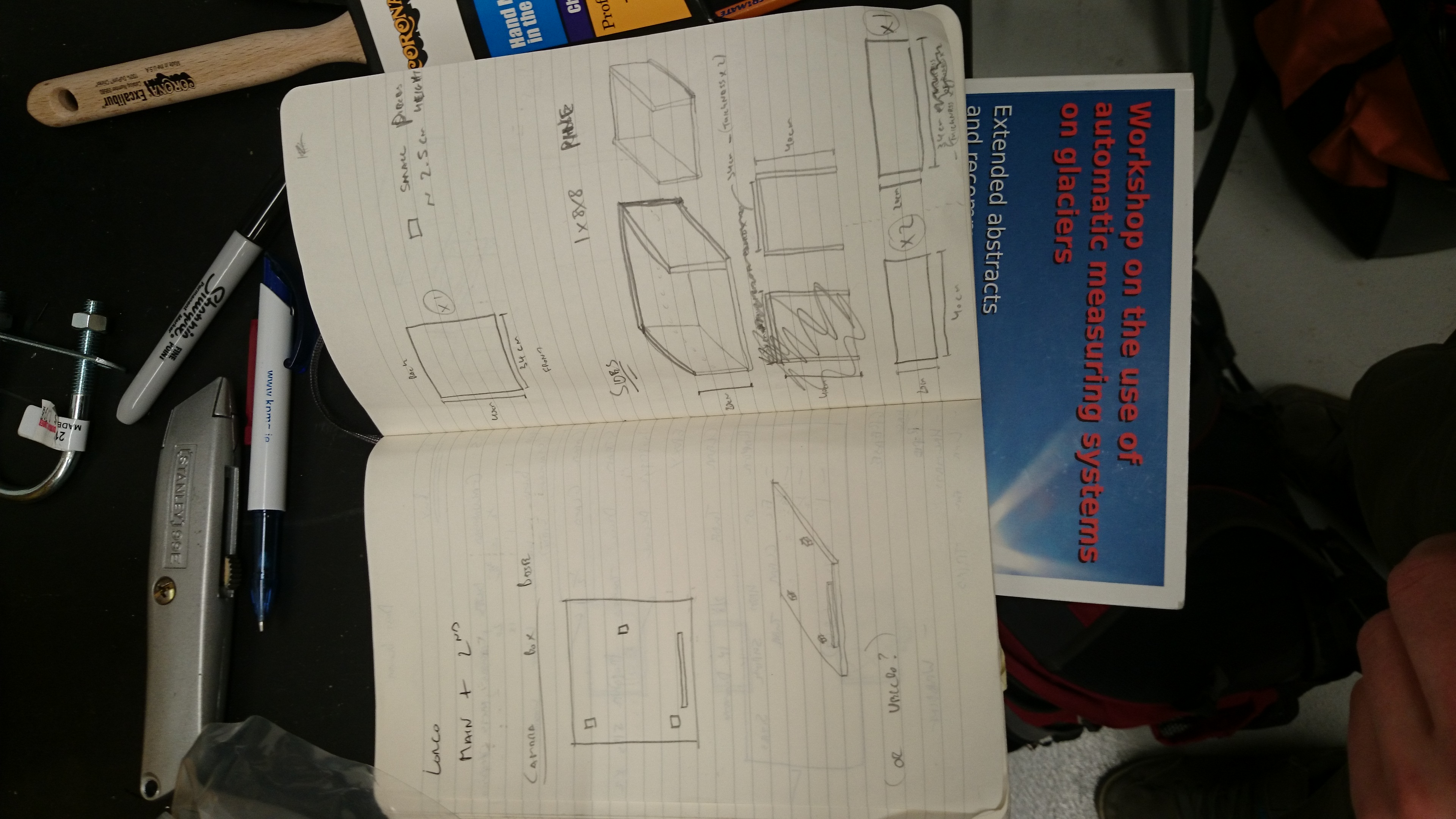
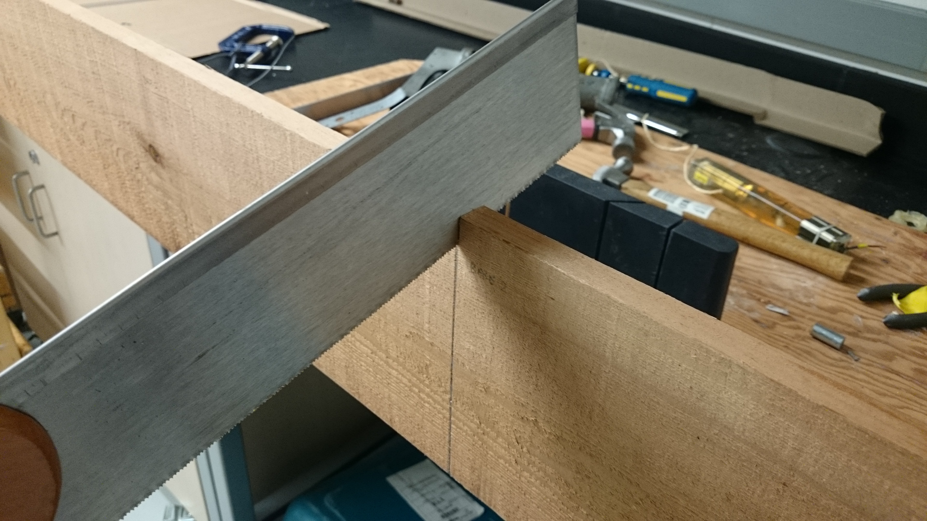
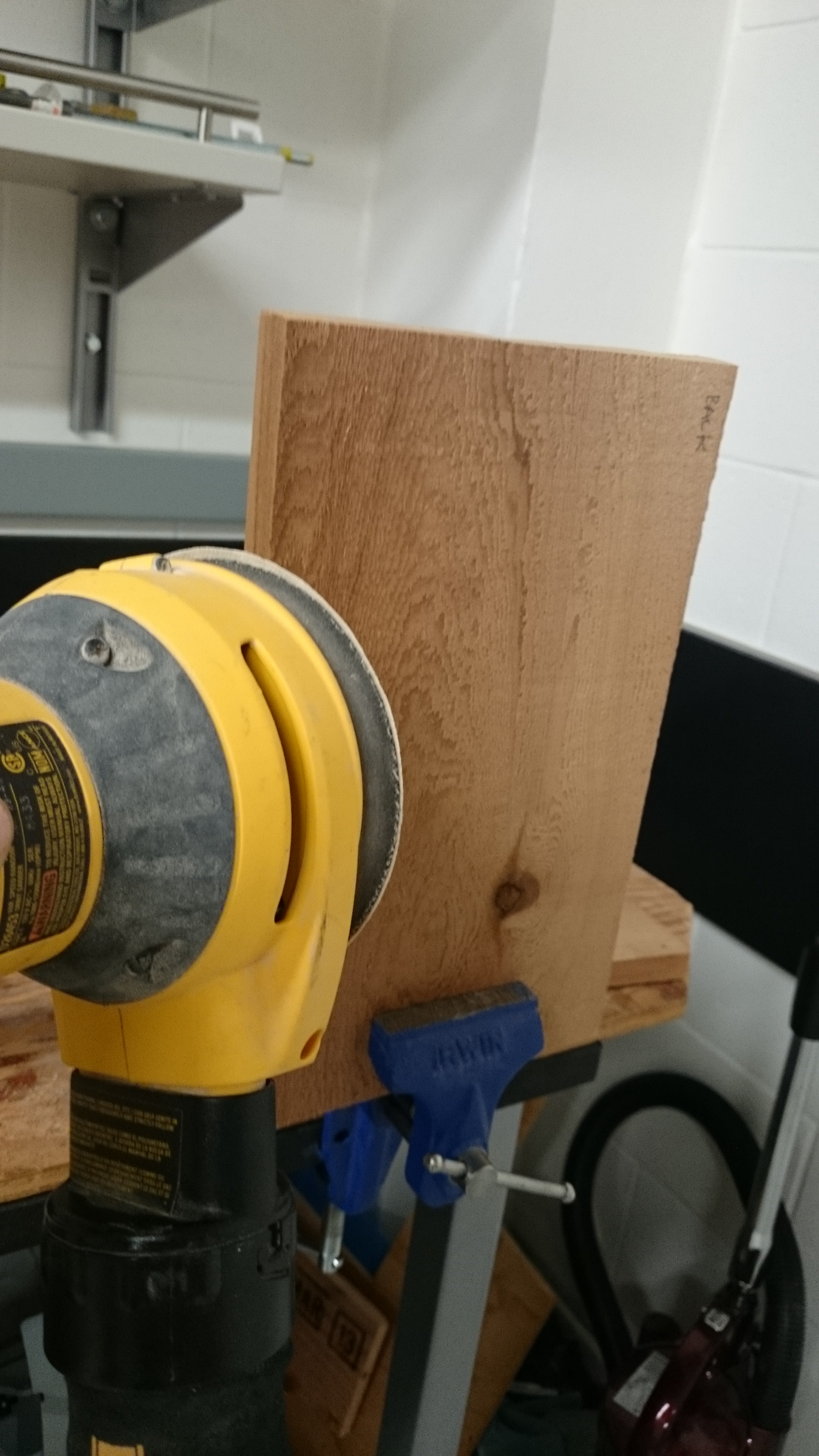
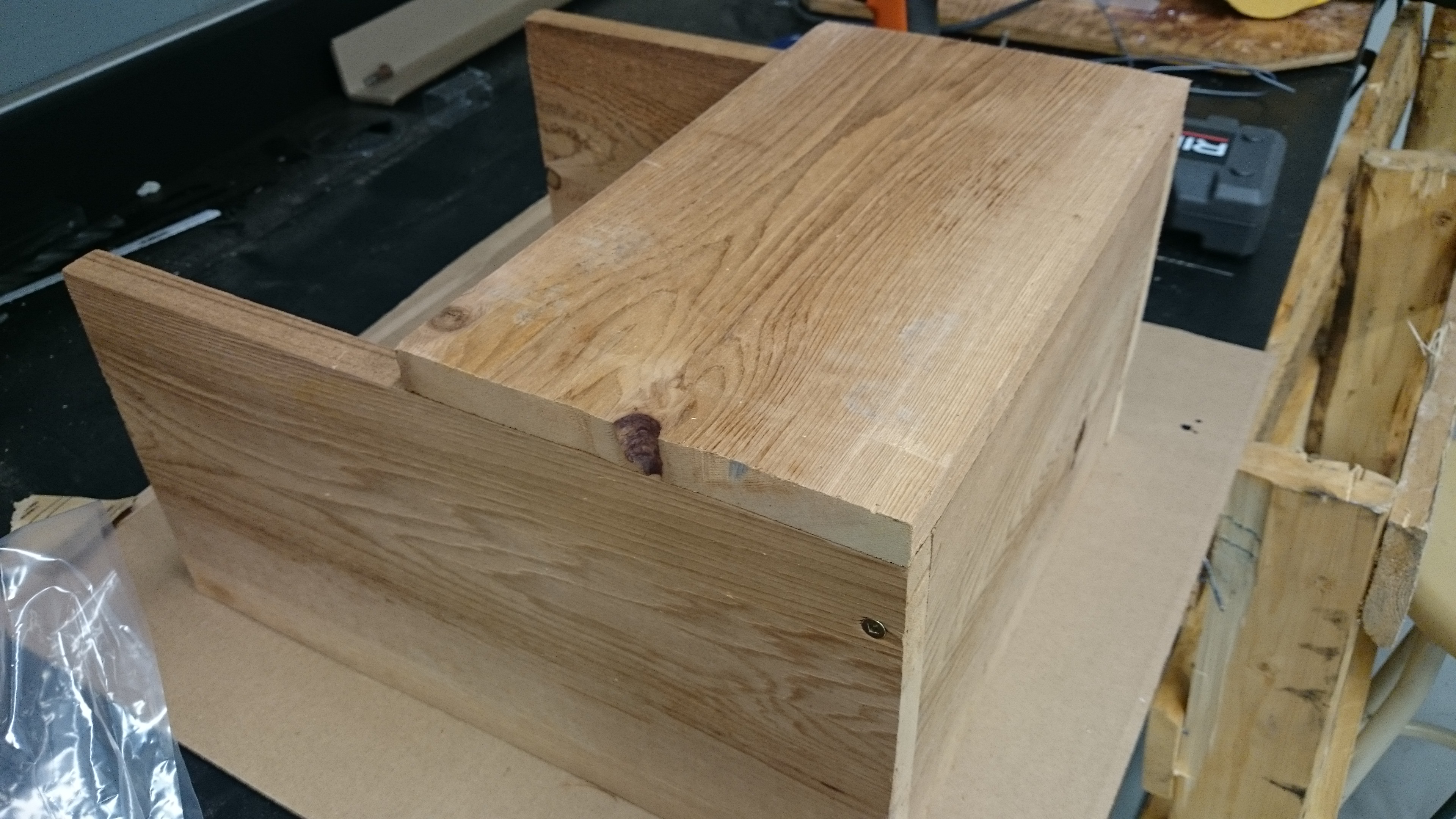
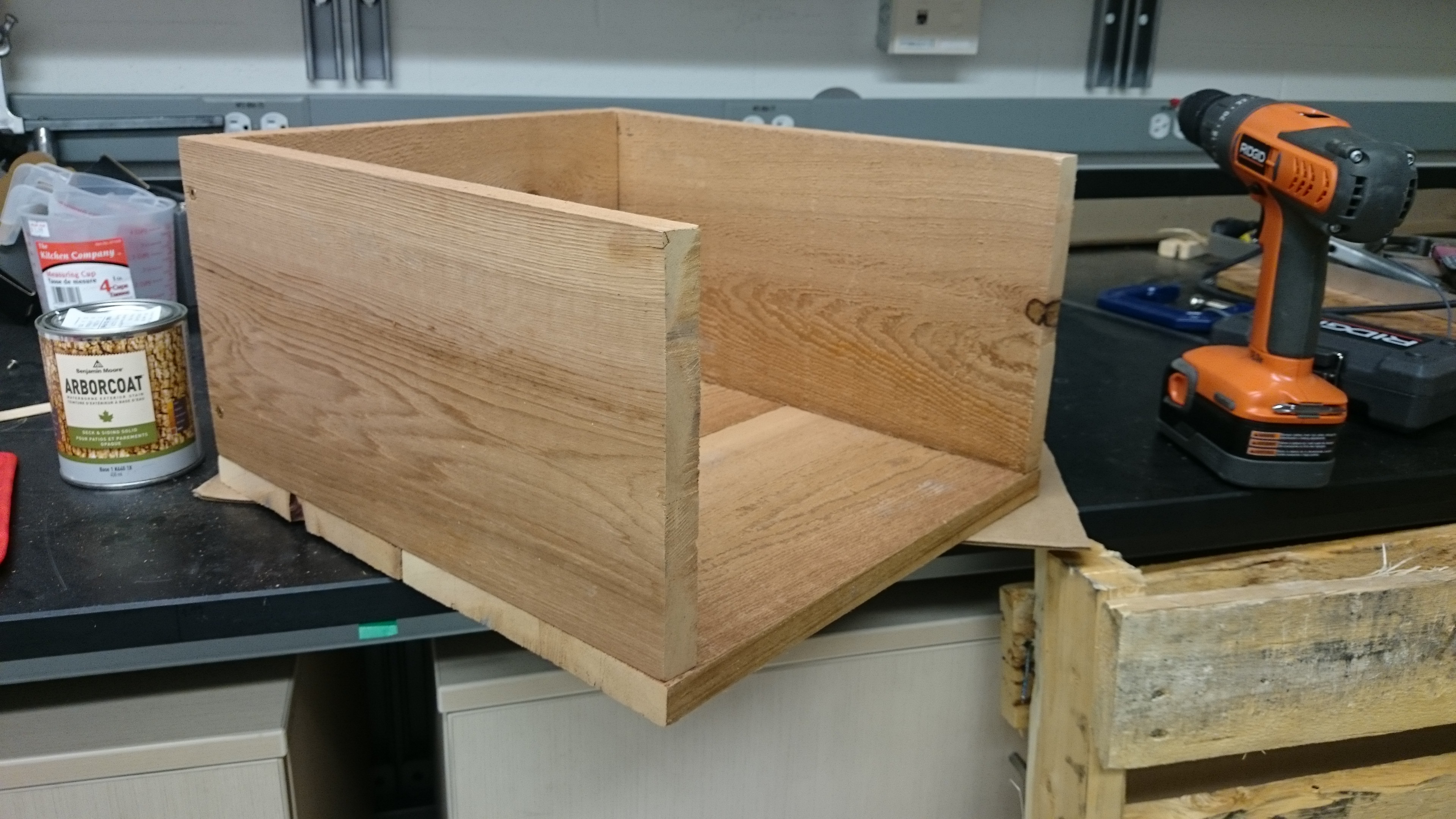
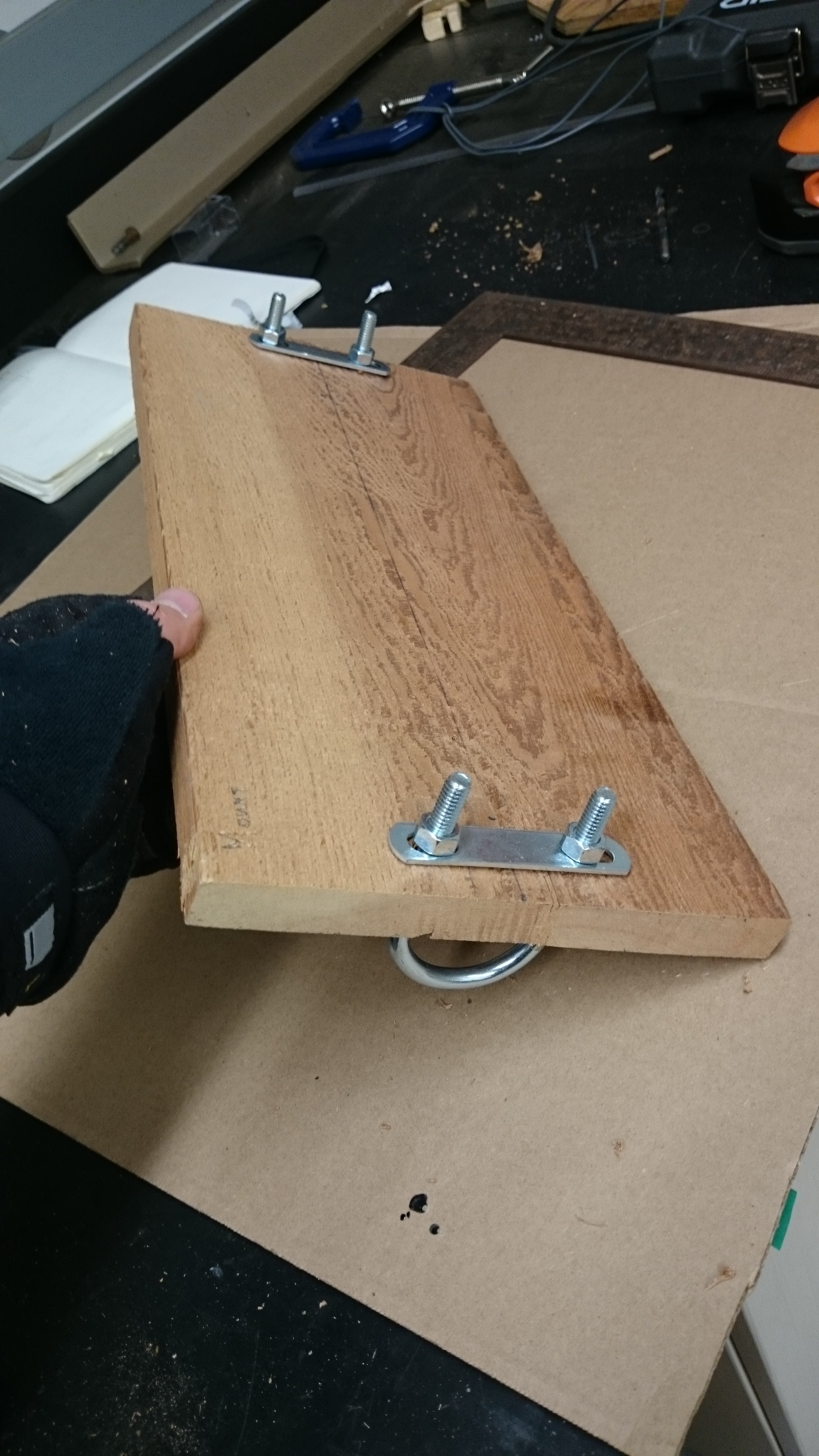
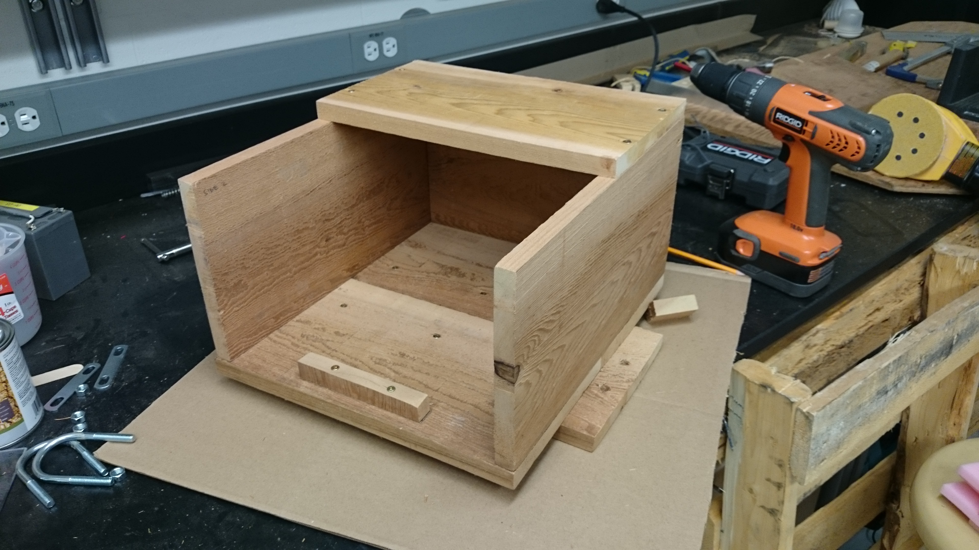
Yesterday, I built the aforementioned wooden shelter for the camera. This will act as a mount for the camera, protect the window from damage, dirt, and droplet build up, and reduce excessive heating from the sun. It was constructed using two 1″x8″x8′ pieces of cedar, some U-bolts, and assorted screws. I’m not a carpenter, and this was just a design that I thought up to solve a problem; there are probably far more elegant solutions! Below are some images from the build.


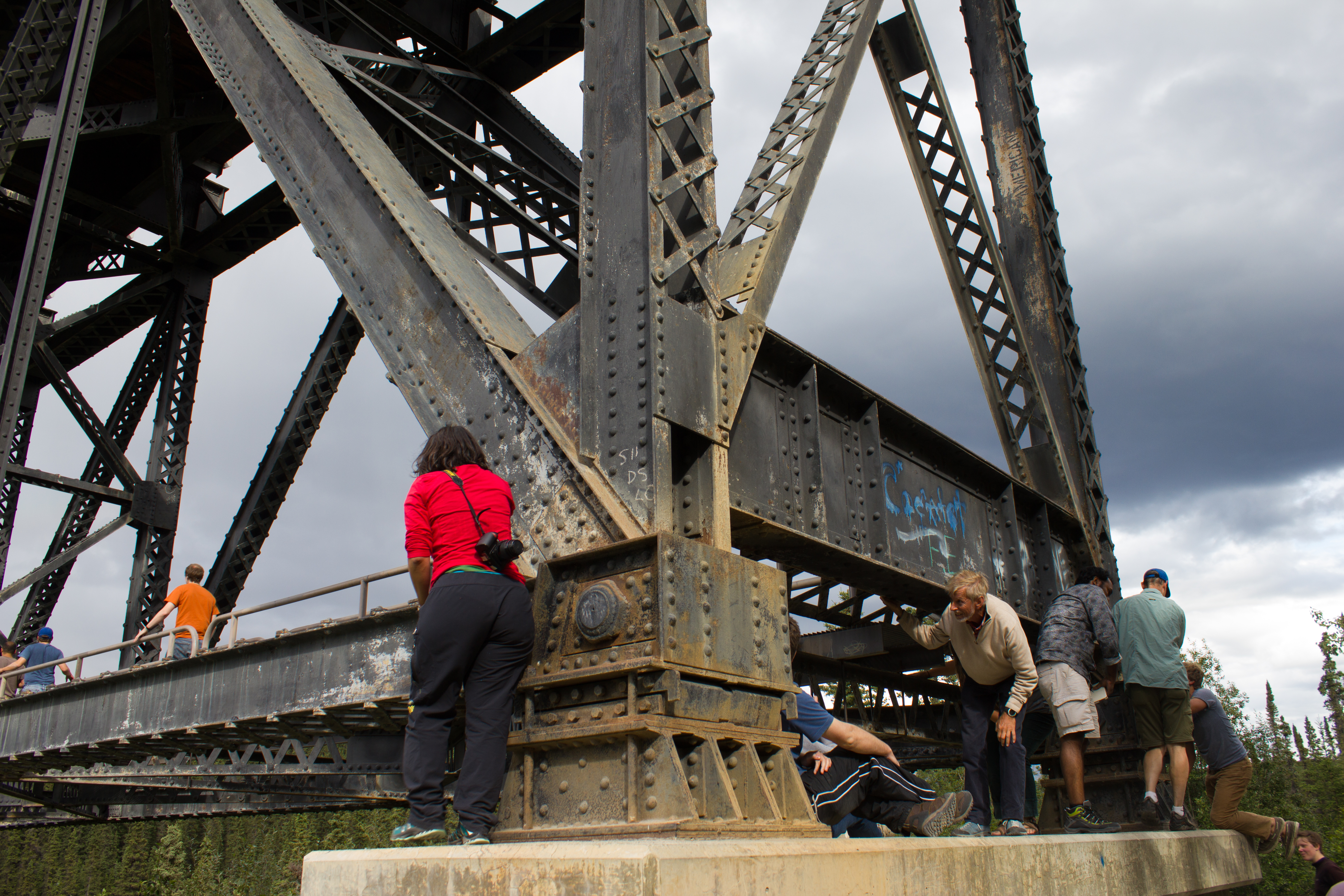
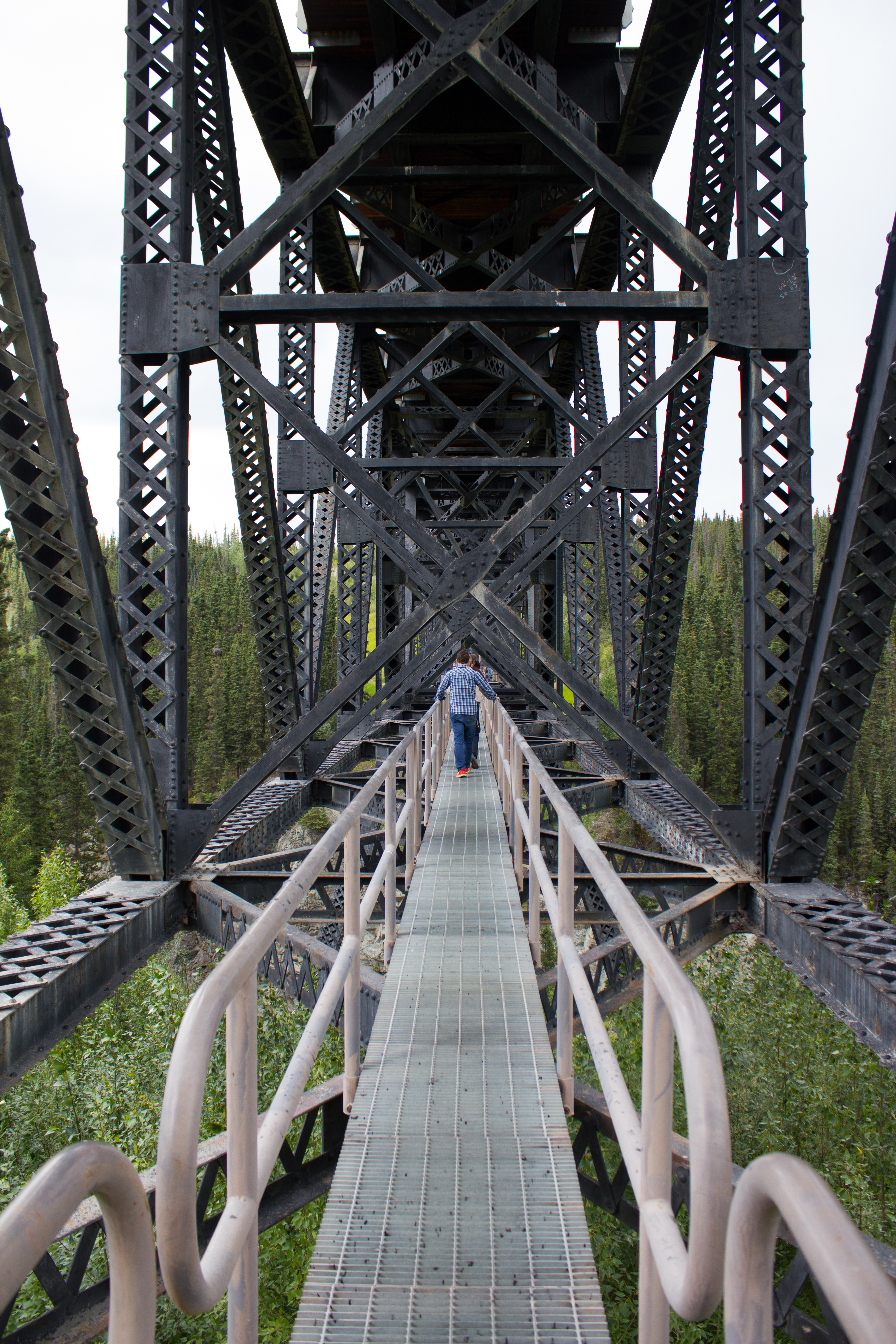
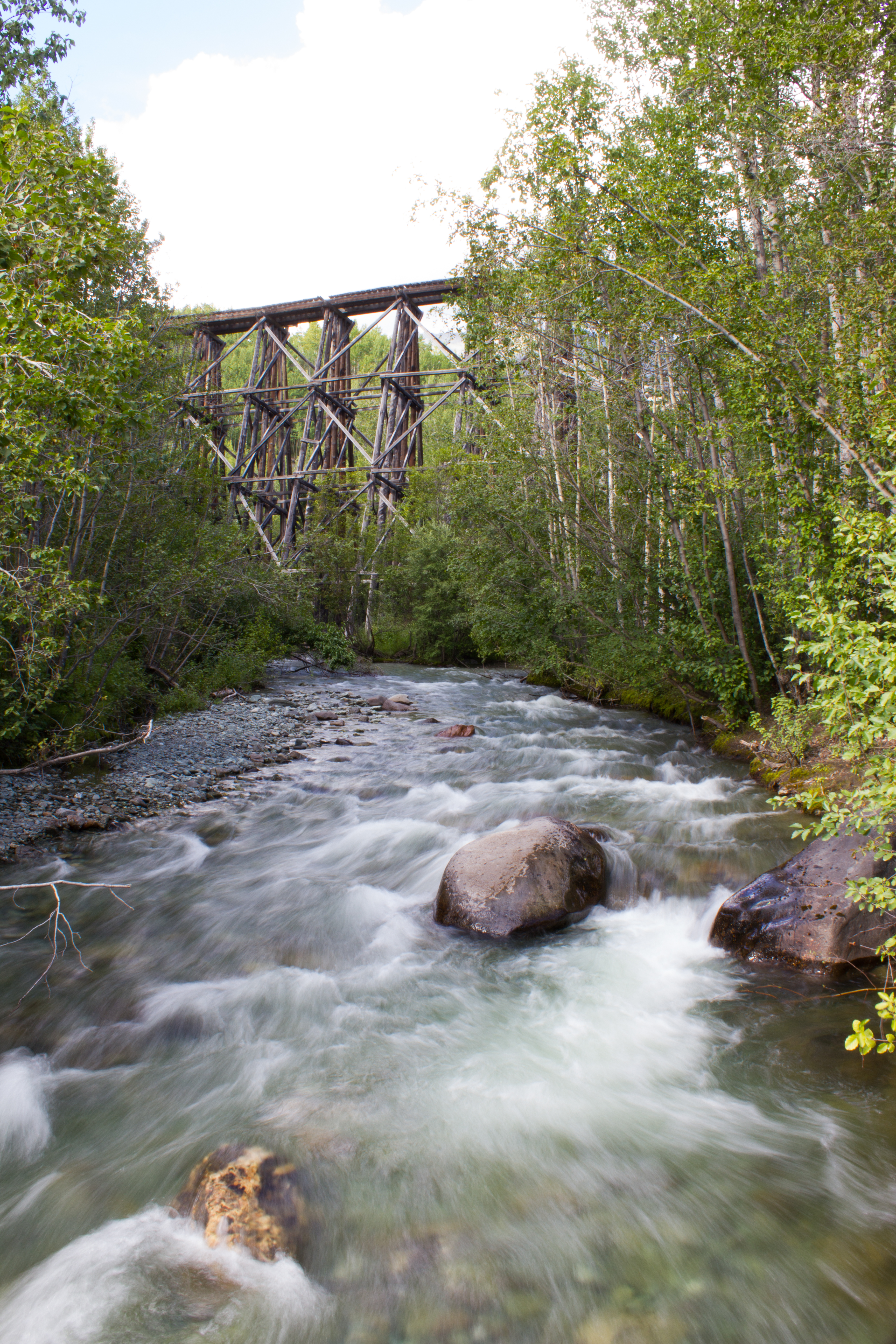
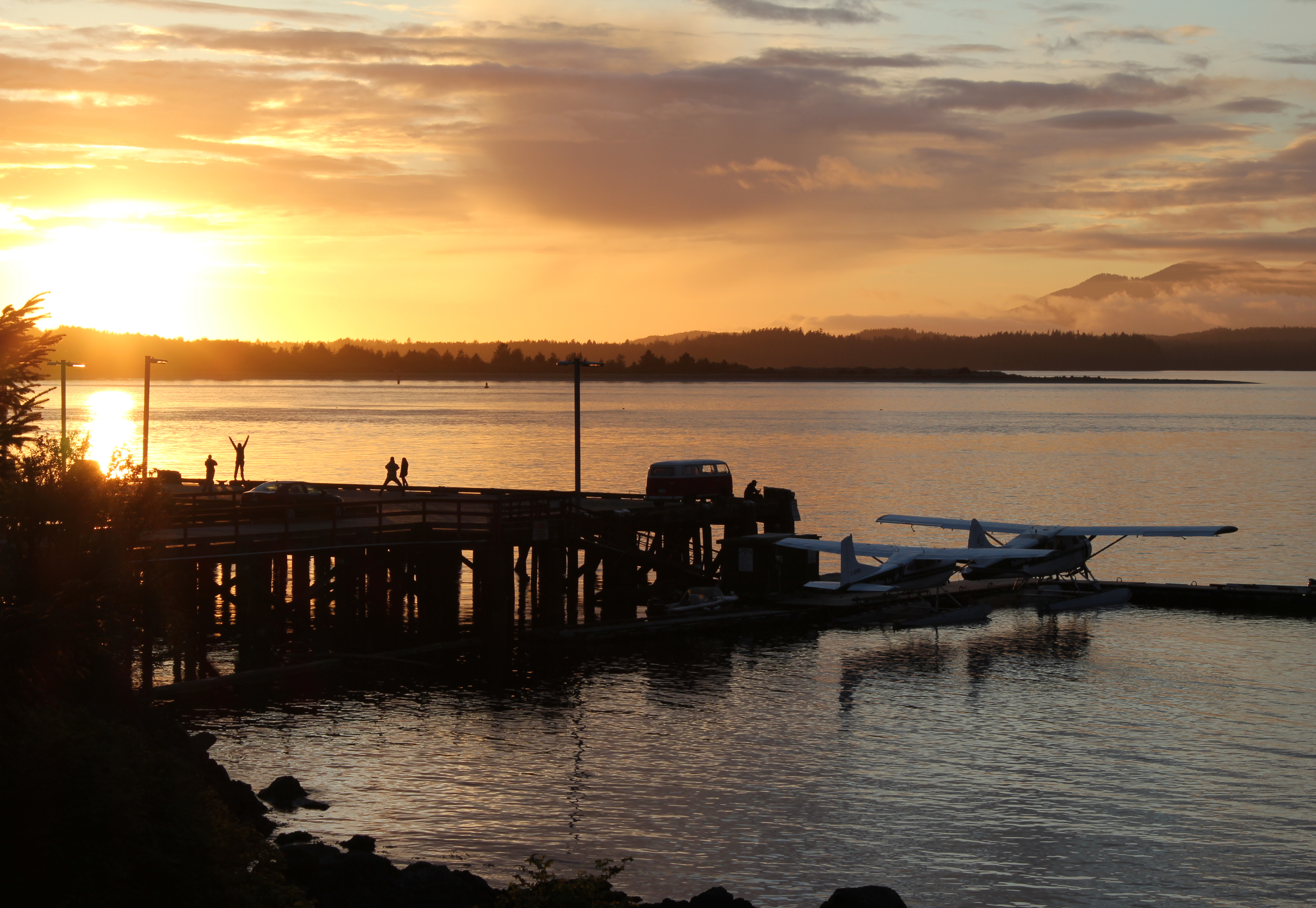
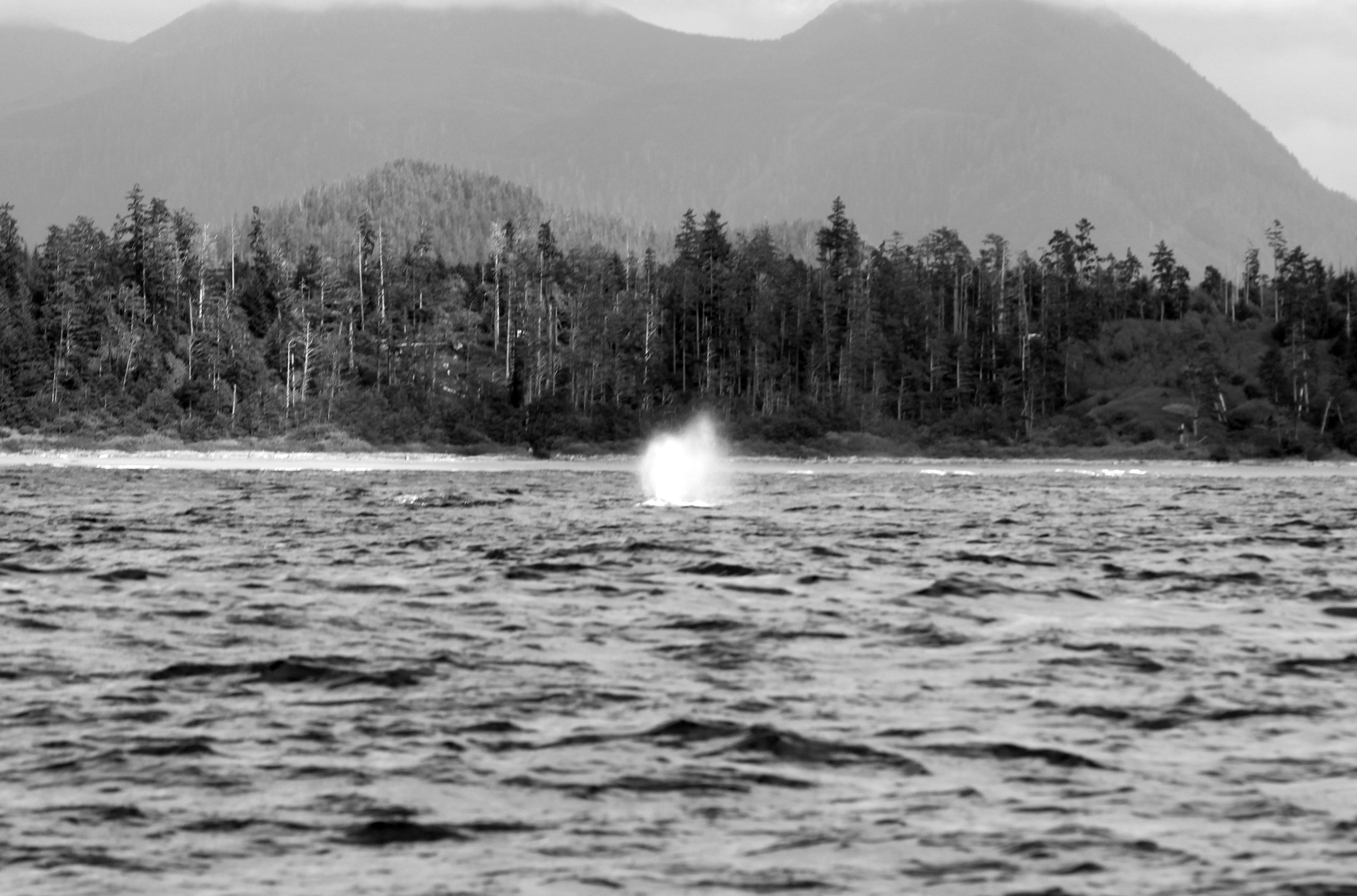
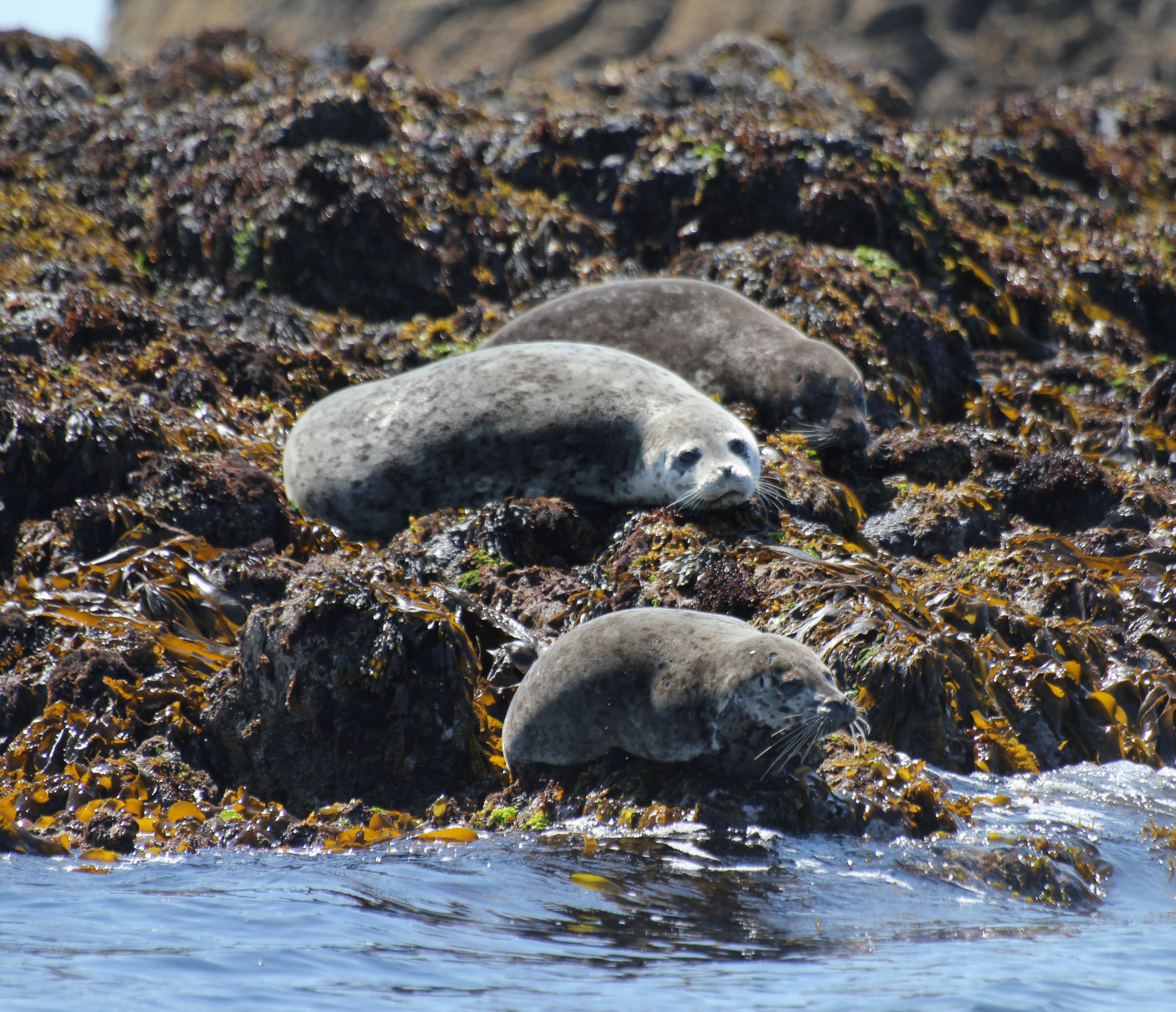
Off the southwest coast of British Columbia, like a breakwater to the Pacific ocean, lies Vancouver Island. It stretches for 480 mountainous, forest-cloaked kilometers; a perfect hideout for a (temporary) jailbreak from the city. I recently crossed the island on a short trip to the coastal village of Tofino, my route taking me westwards through its interior from the port of Nanaimo.
Transecting the island gave me a chance to get an impression of the variety of its landscape, and the wildlife within it, including bears, wolves, whales, and eagles. The images below are really just an opening glance. I had a very narrow window of time to explore, but saw enough to know that the island deserves several longer visits. I will return!


So a brief explanation as to why I’m here is required.
I’ve come to Vancouver to start a research project examining the relationships between the atmosphere and glaciers. I had been working as a research meteorologist for Met Éireann (Irish national weather service), when the opportunity arose to take up a PhD in Atmospheric Sciences at the University of British Columbia (UBC).


In a nutshell, my project aims to examine all the ways in which energy enters and exits the surface of a glacier, and how the balance between incoming and outgoing energy affects the melting or cooling of a glacier’s snow and ice. On a broader scale, my hope is to put this work towards improving our understanding of how glaciers will respond to changes in our climate. The initial plan is to install a weather station on a glacier in the Selkirk mountains in British Columbia, beginning this summer.
So, what’s required for the design?


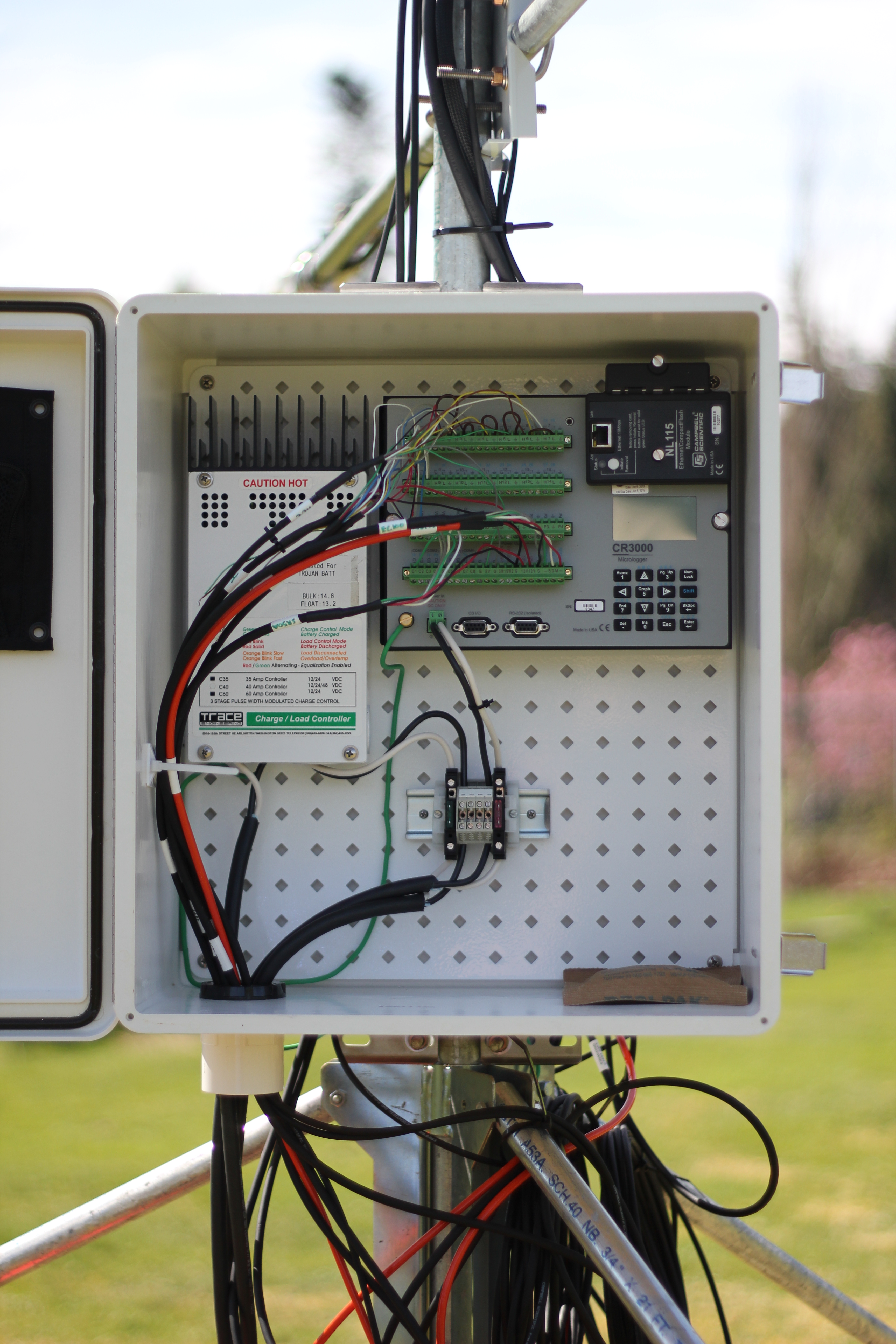
The first step was to assemble and test all of the individual components in the lab, and to set up a method to automatically record and save the measurements made by each sensor. The lab is where you want to make your mistakes, and where you want things to go wrong. The more problems that present themselves in the warm, dry lab, the fewer that will come as a surprise when you’re struggling with cold fingers on the side of a mountain, or worse, when you’re already hundreds of kilometers away, oblivious to the fact that your PhD is falling into a metaphorical or very literal crevasse.
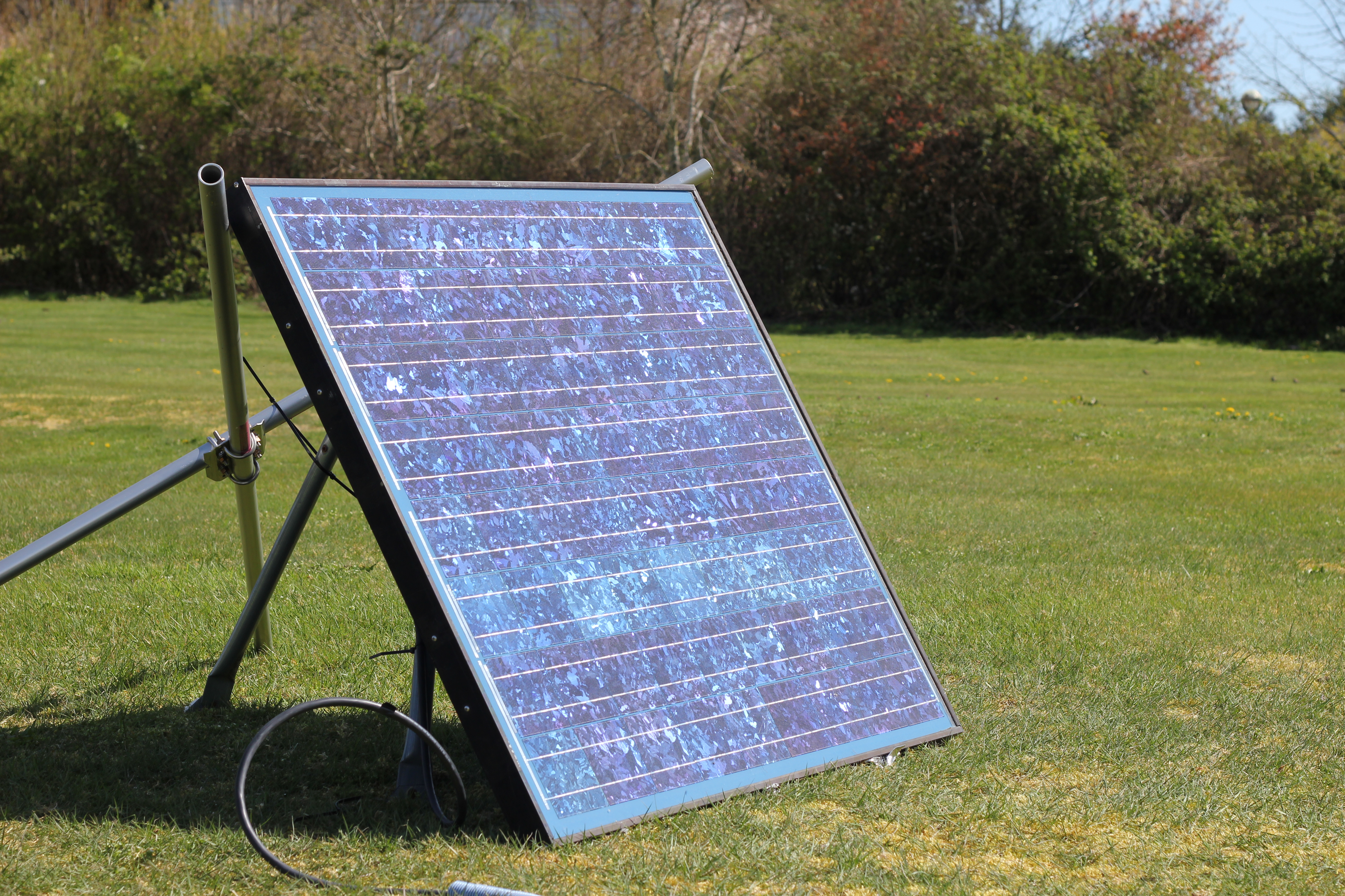
With things up and running in the lab, thoughts turned to how all the components will be brought together and mounted on the glacier, and on how to reliably power the station in such a remote setting. The plan is to rig the sensors on to a wide, stable tripod, with power provided from two marine batteries (like rugged car batteries for boats). The batteries will be recharged using a solar panel mounted nearby.

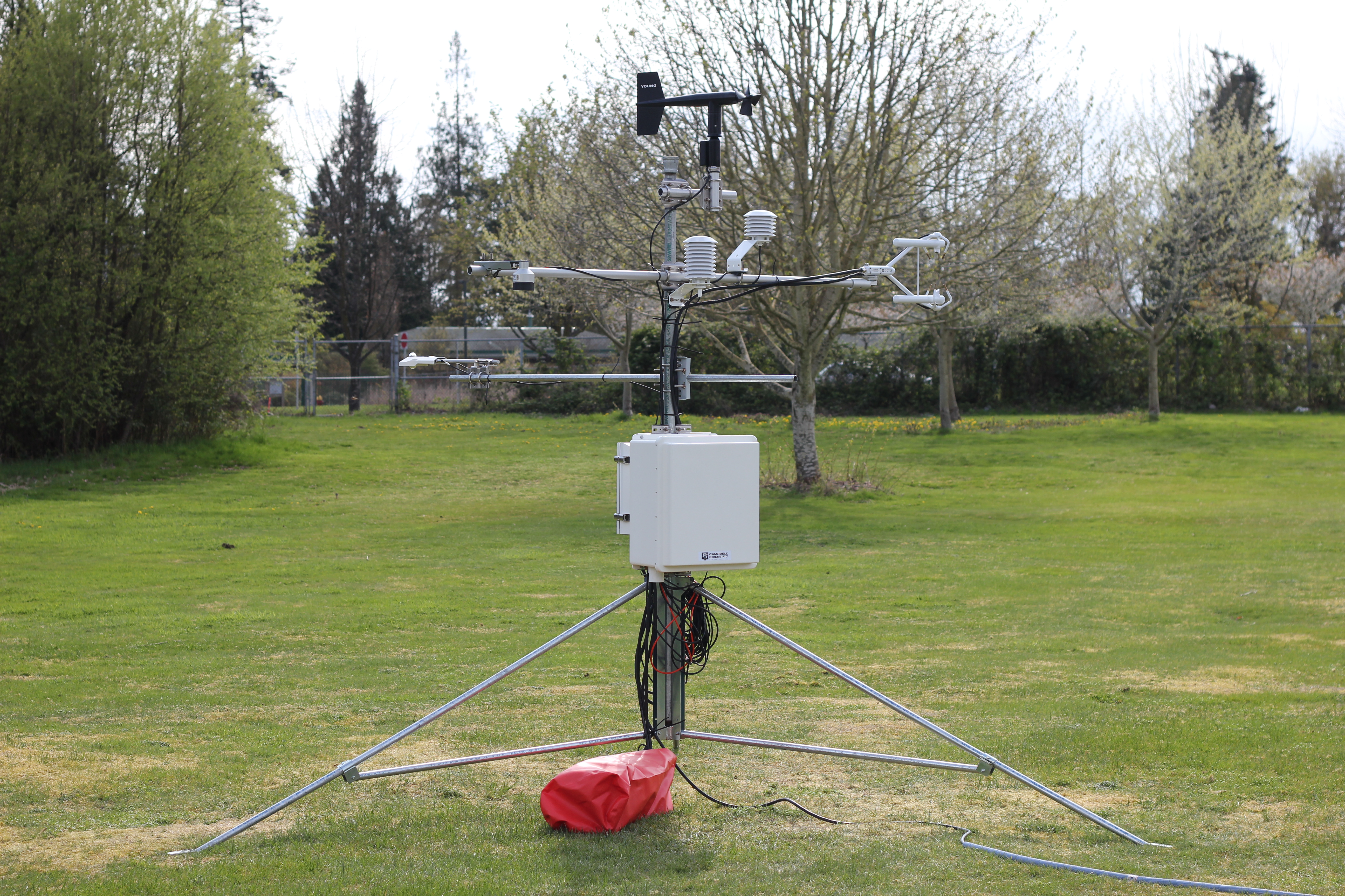
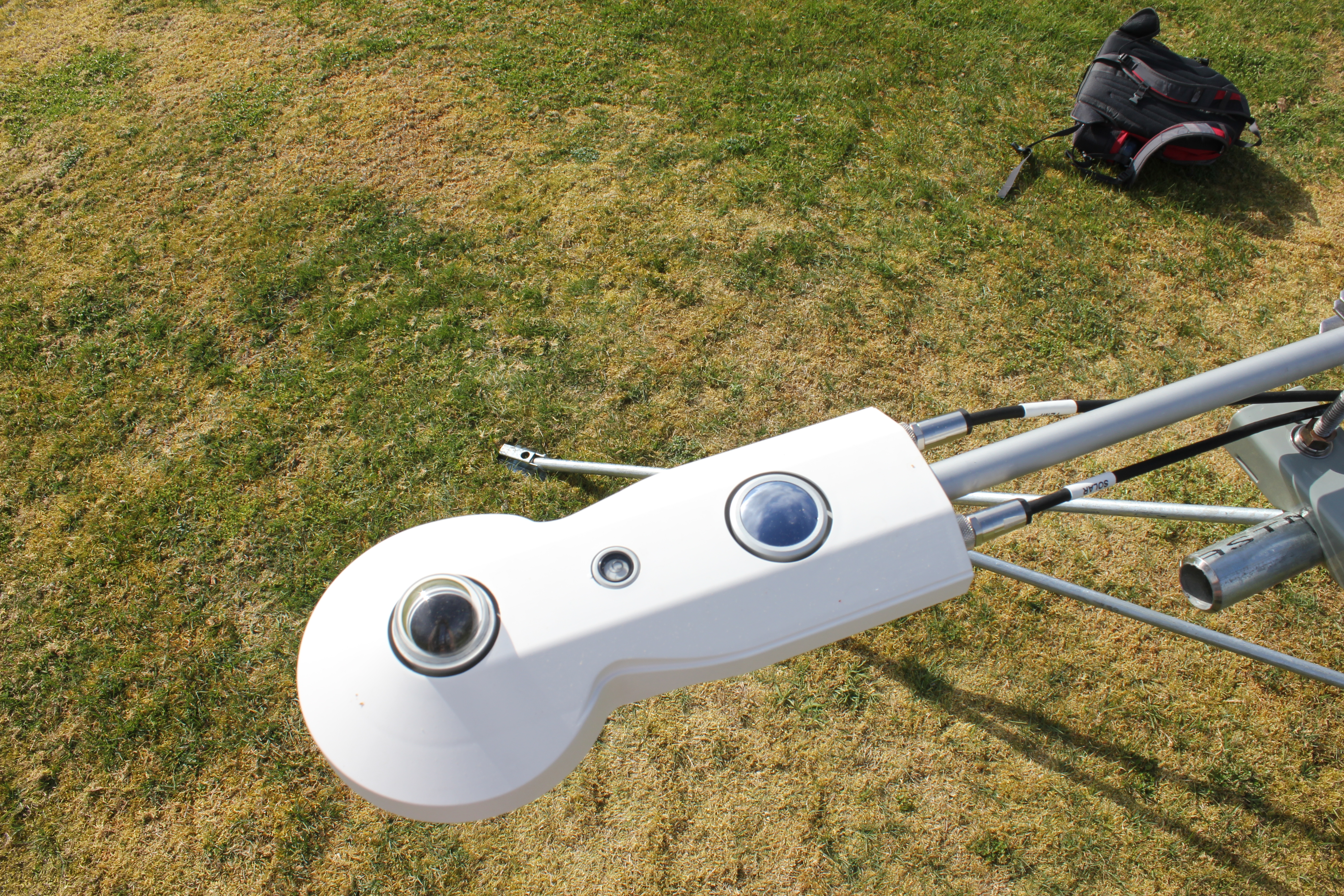
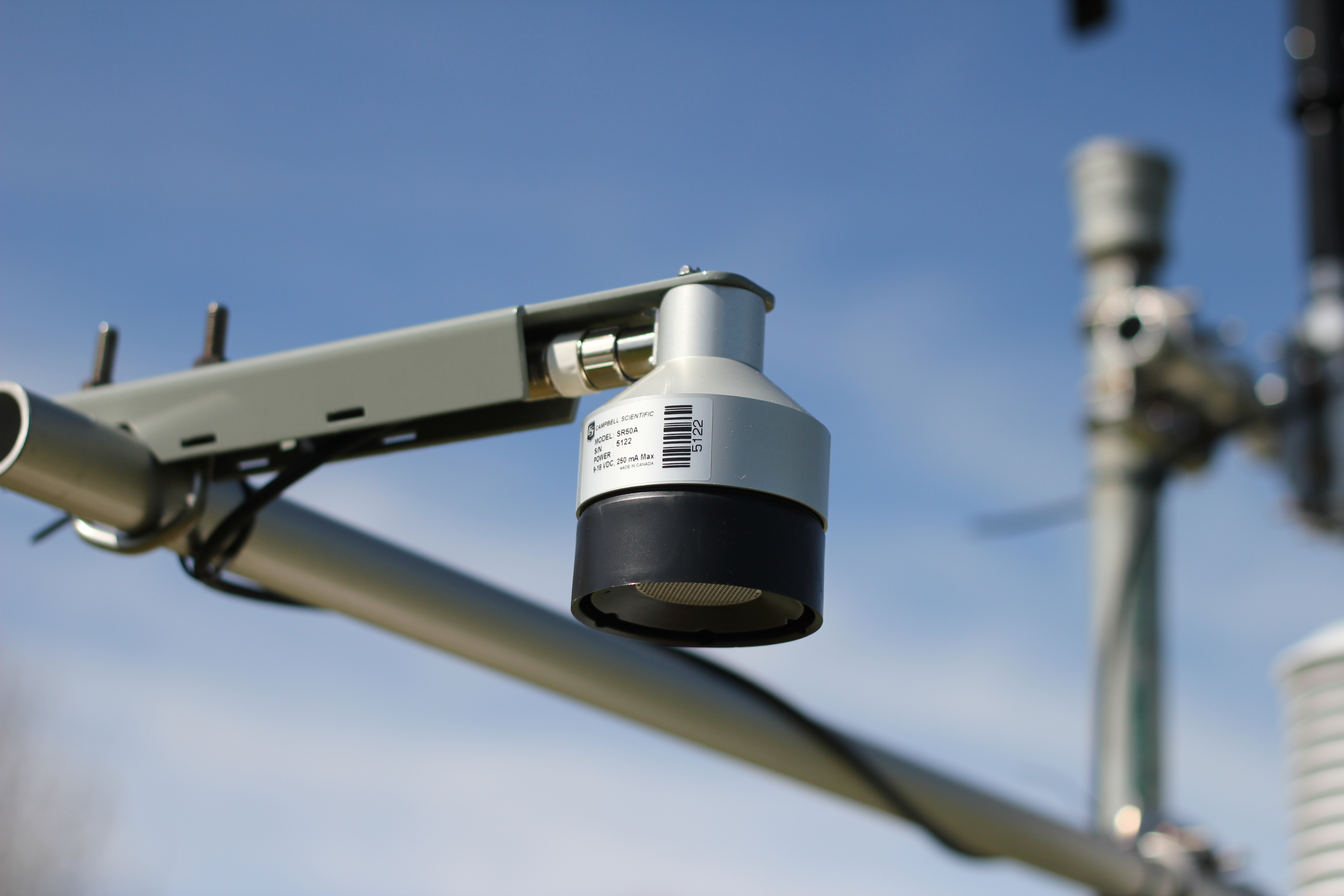
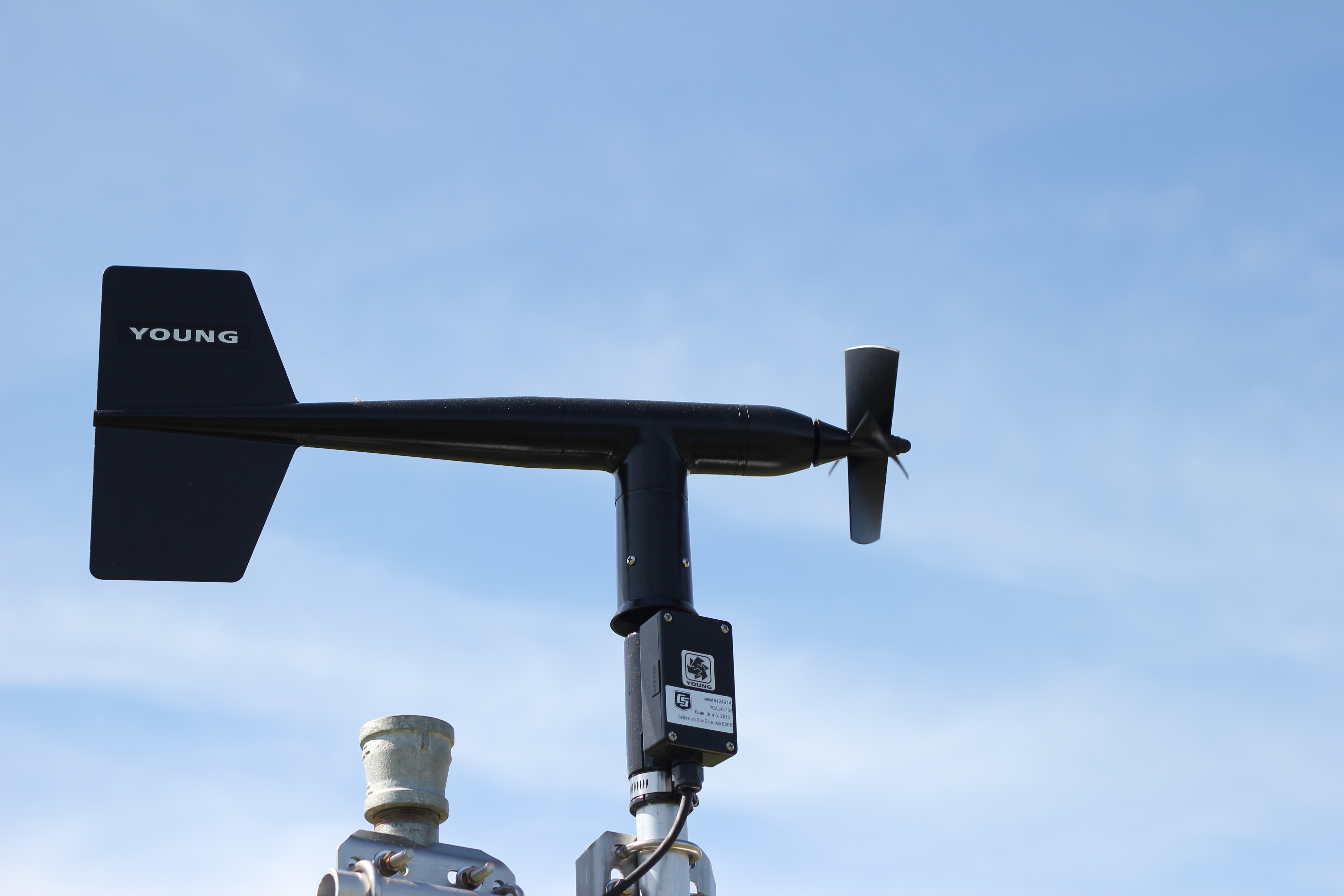
A test rig has been put together, and is now running at an outdoor site on campus. The main issues I’ll be keeping an eye on during this test include insuring the system records all the data it’s supposed to, when it’s supposed to, that the data makes sense and the sensors aren’t interfering with each other, and that a few cloudy days don’t cause my power system to flat line. Below are some images of the sensors I’m using and what they are for. For anyone interested, I intend to go into a little more detail on the science behind the project in future posts. I’m no expert though, so it should all be fairly readable!


All going to plan, we will travel to the glacier and install the weather station this July. There will be some modifications and additions leading up to this, including a new custom made 4 legged ‘tripod’ (quadpod?), and a timelapse camera system which I will be building in the meantime. Many more hours in the lab and office will be required to get everything ready, but from this campus, reminders for why we are doing this are never far away.
We drove through the snow to get to the desert.
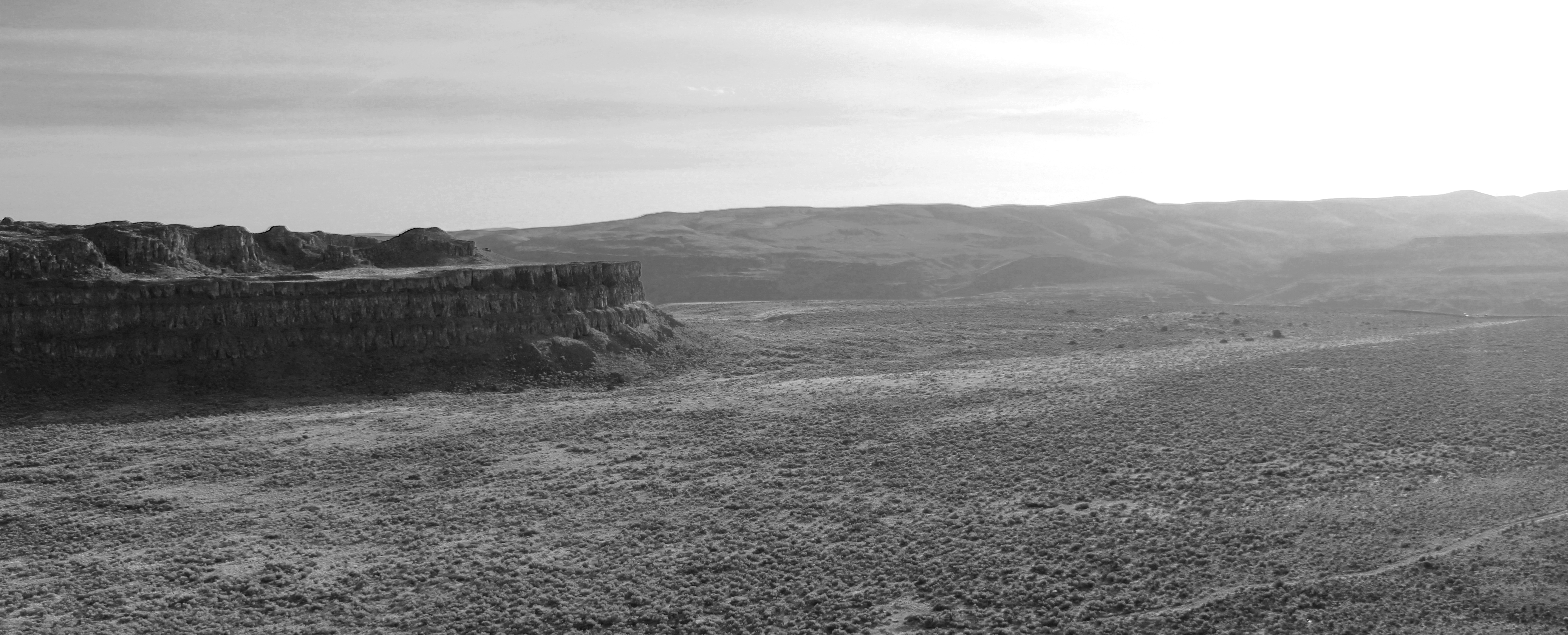
Our destination was south of the 49th parallel, to the home of some of Washington state’s finest rock climbing, Vantage. The drive east from Seattle is a compressed lesson in geography. Leaving behind the moist, cloud catching city on the Pacific coast, the road quickly rises to thread the barrier of the Cascade mountain range. Snow drifts, and white peaks signal the temperature drop as our altitude increases. Descending on the eastern side of the range, the snow vanishes as quickly as it appeared, replaced by a dry, rocky expanse, shielded from the moisture to the west by its lofty neighbours.
We were a party of climbers from the University of British Columbia’s Varsity Outdoor Club (UBC VOC), with a plan to escape the inclement weather in Vancouver for a weekend. Having only decided to go the day before, approaching the US border, I had images of paperwork problems, and forcing my Canadian co-passengers to turn around and drop me at the nearest bus route back to Vancouver. In reality, the crossing was seamless; the benefit of an Irish passport. With the 450km drive complete, including a supply stop at the vast wilderness that is the American supermarket, we arrived just before midnight on Friday. Tents up. Bags down. Bed.
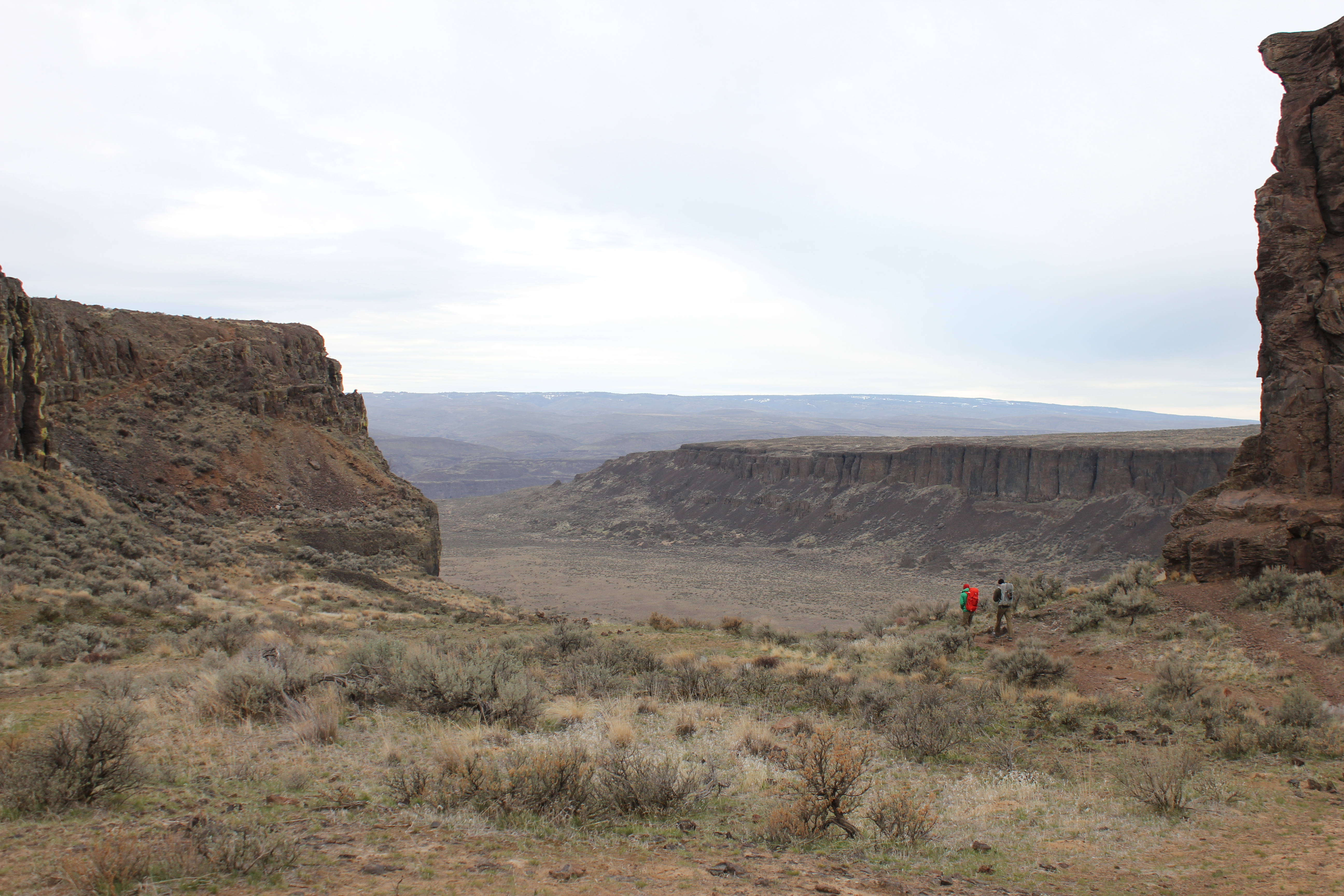


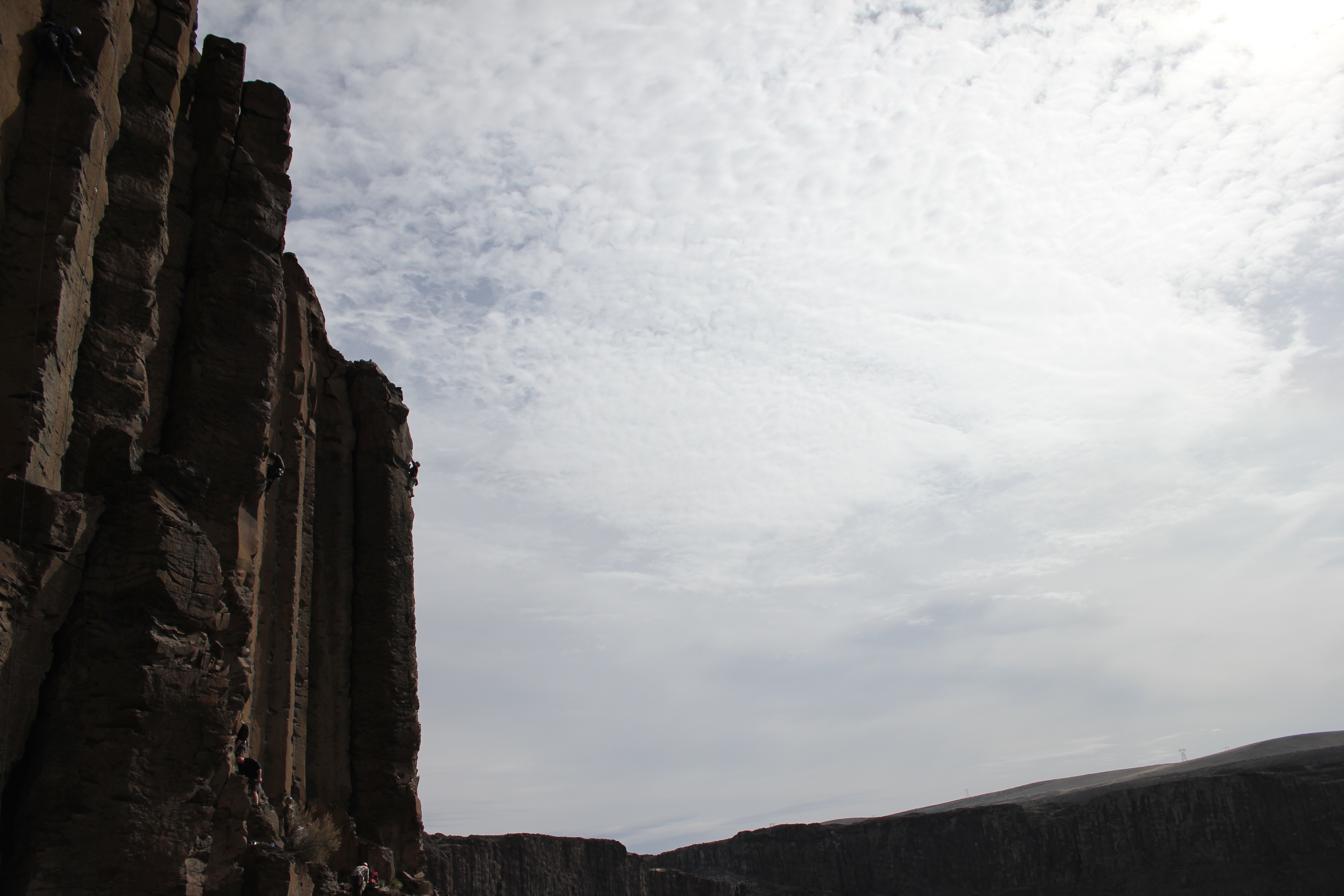
The climbing in Vantage is predominately located on the basalt columns that make up the cliff faces, giving a huge selection of arête and crack routes, with some good rock faces in between. On Saturday, we focused our efforts on Sunshine Wall, ticking off a few of the classic single pitch routes, and one very enjoyable multi pitch route with an amazing view.

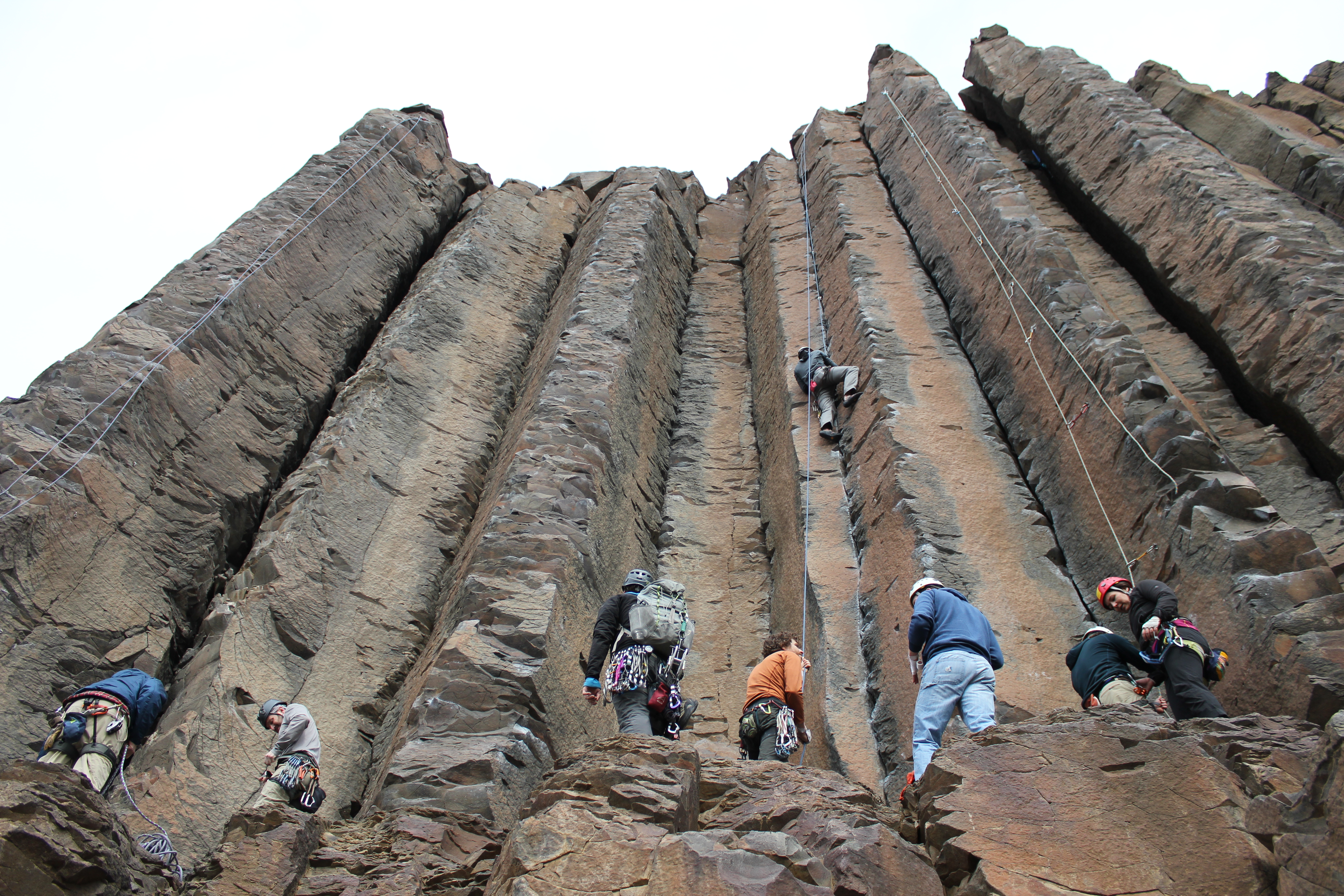


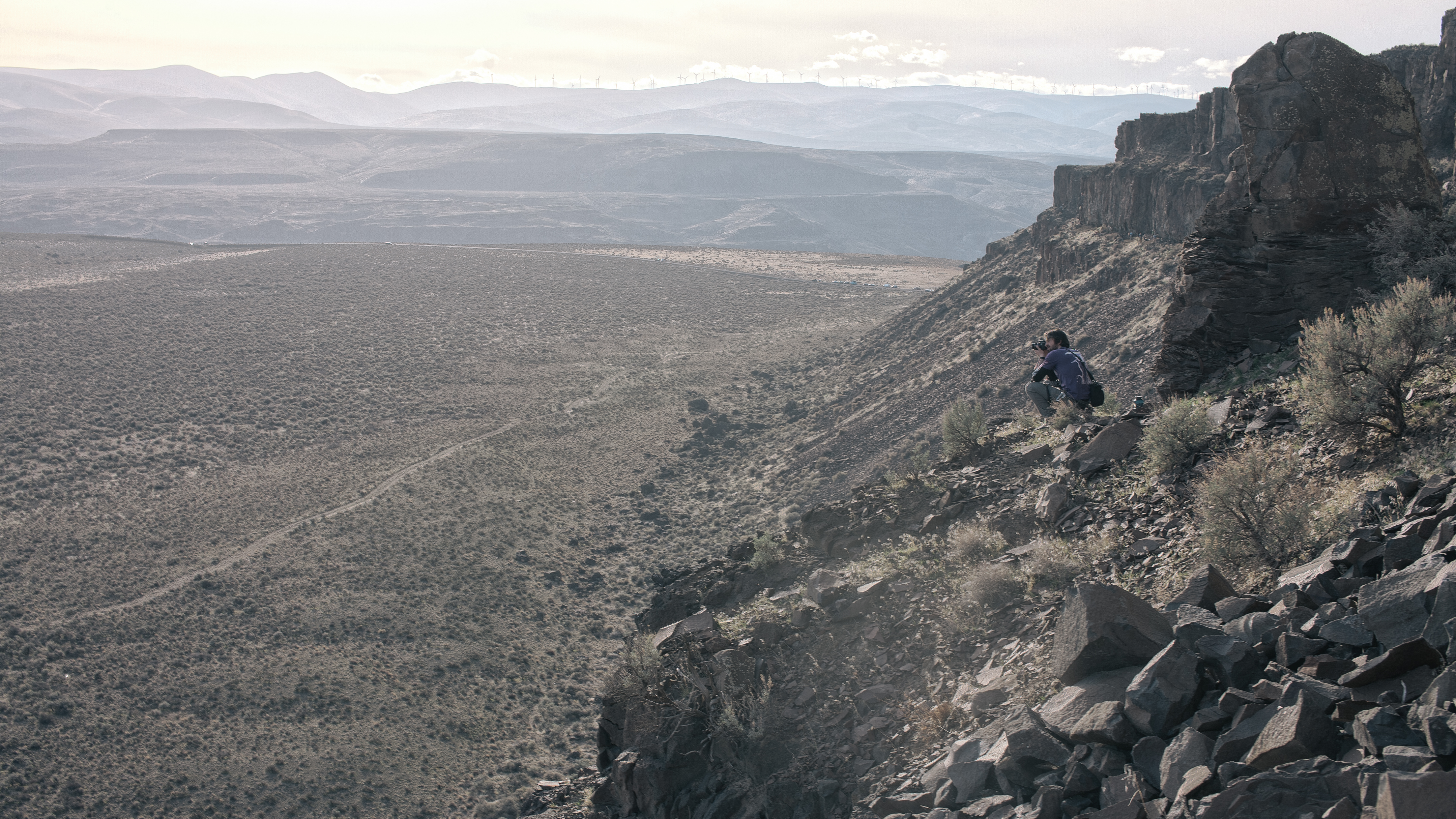
Climbing, like many things, had been put on the back burner while I was getting ready to move to Canada, and this was my first day on the rock since last summer. I am far from a good climber, but climbing can reward all equally. Once the underlying nerves and fear can be controlled, climbing gifts you with the opportunity to focus solely on the action at hand, remove distractions, and to reset from the loops that your mind can get stuck in during day to day life. And when all the swearing and scraping is done, it feels pretty epic to get to the top too.
The day ended like all good camping days should, with a big feed, a social fire, and a warm sleeping bag.

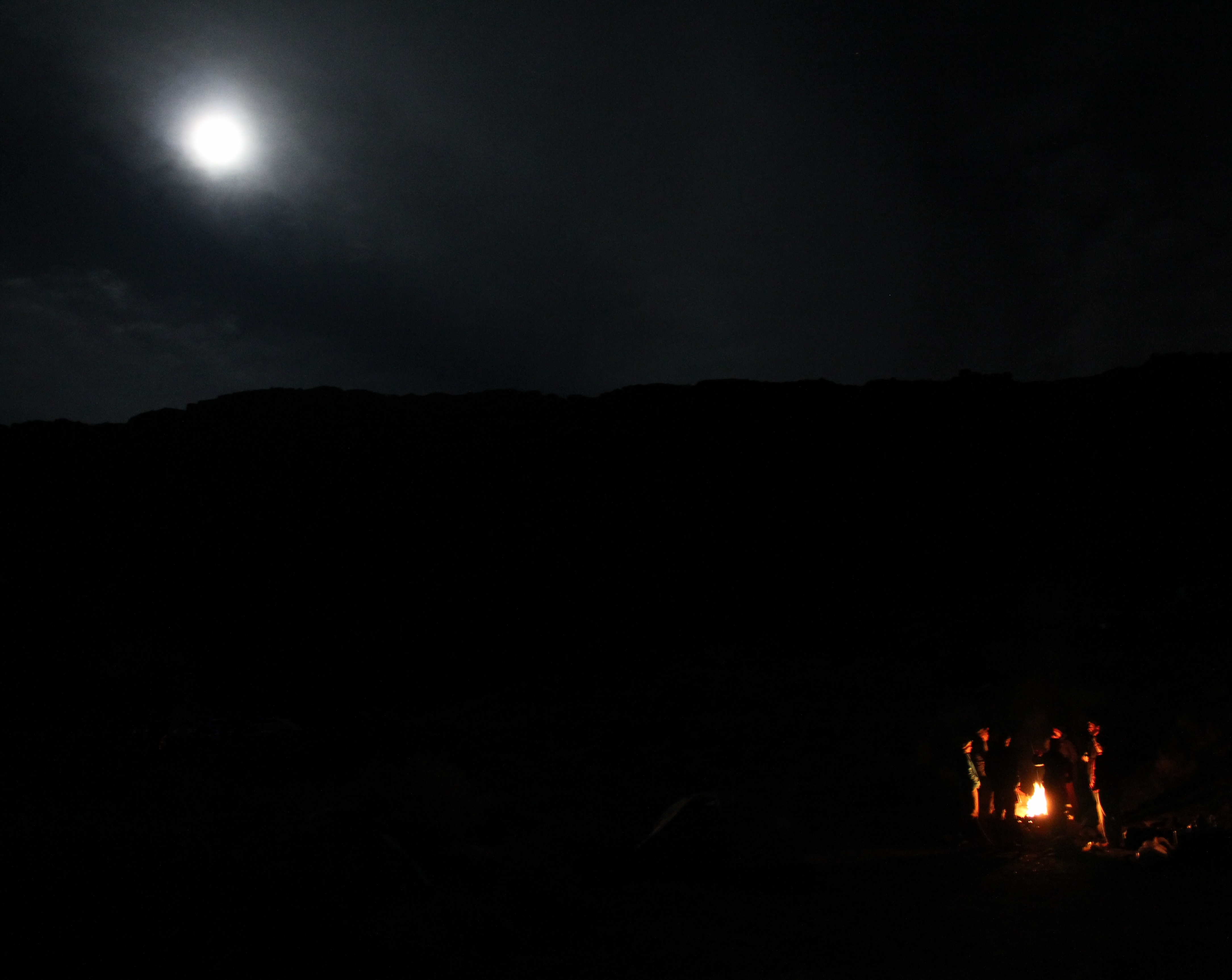

Saturday night was not without incident, the stillness punctuated with occasional distant but powerful booms, which we learned later were from artillery testing taking place in the region. We had our own pyrotechnics closer to hand, with what appeared to be a very sizeable gas canister explosion in another group’s camp. After a pause, the sound of hysterical drunken laughter drifting through the smoke assured us that all was well.
Sunday morning started as Saturday finished, with beautiful sunshine. Stocking up on vitamin D, and with a plan to hit the road at noon, we headed out early to a rock section overlooking our camp, known as the Feathers. In the more laid back atmosphere of a Sunday morning, we worked our way through three or four short but technical routes, and soaked up as much of the desert ambience as we could before we had to load up, and head out.


This trip was my first to the United States (apart from flight stopovers). A combination of striking surroundings, friendly locals, and some exciting climbing, made it memorable, and left me with a positive impression, despite the reminders coming from the sounds in the distance. More importantly, it achieved the goal I hope for the most when I travel. I felt like I was somewhere completely different.